VIDEO: Winds Of Change On The Doorstep…
You must be logged in to view this content. Click Here to become a member of IndyWX.com for full access. Already a member of IndyWx.com All-Access? Log-in here.
You must be logged in to view this content. Click Here to become a member of IndyWX.com for full access. Already a member of IndyWx.com All-Access? Log-in here.
You must be logged in to view this content. Click Here to become a member of IndyWX.com for full access. Already a member of IndyWx.com All-Access? Log-in here.
Forecast Period: 09.30.19 through 10.06.19
7-Day Precipitation: Below average precipitation is expected through the period.
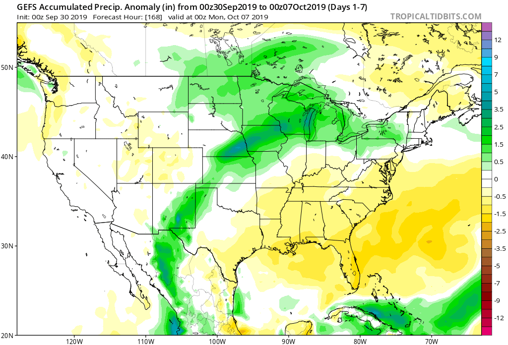
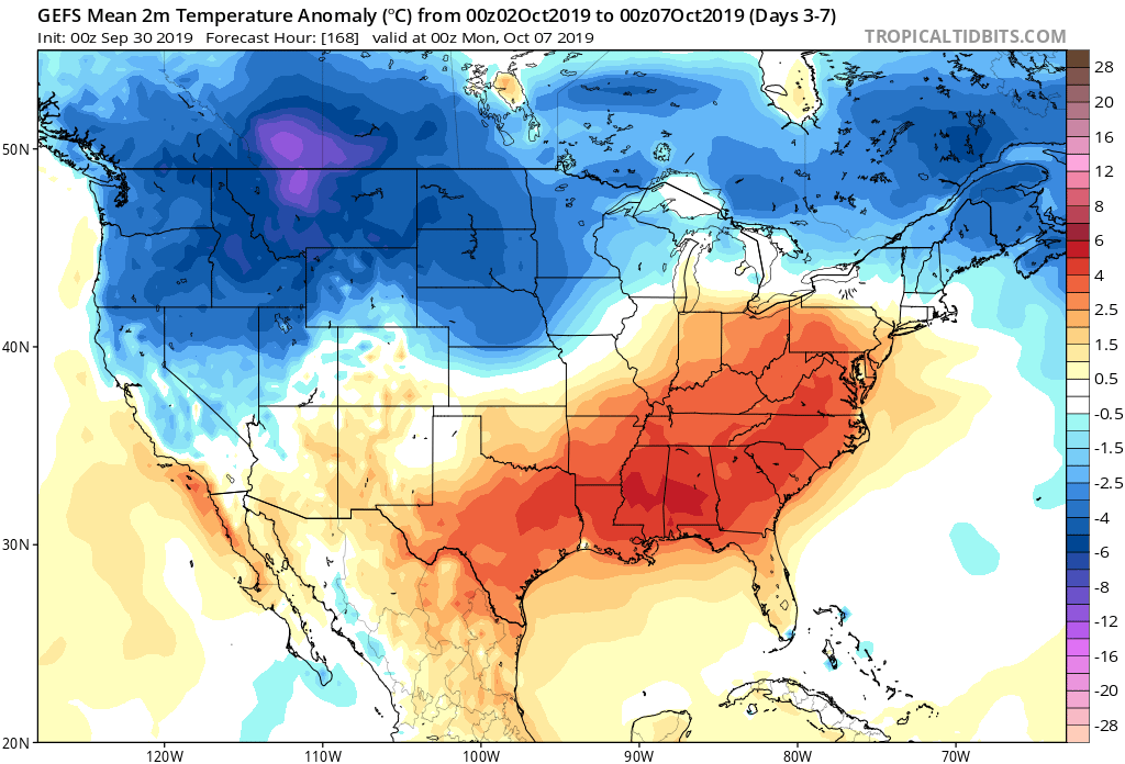
7-Day Temperatures: Though significant cooling will take place later this week and weekend, overall, the period will run above average in the temperature department with the near record heat to open the period.
Severe Weather: Organized severe weather isn’t expected during the forecast period.
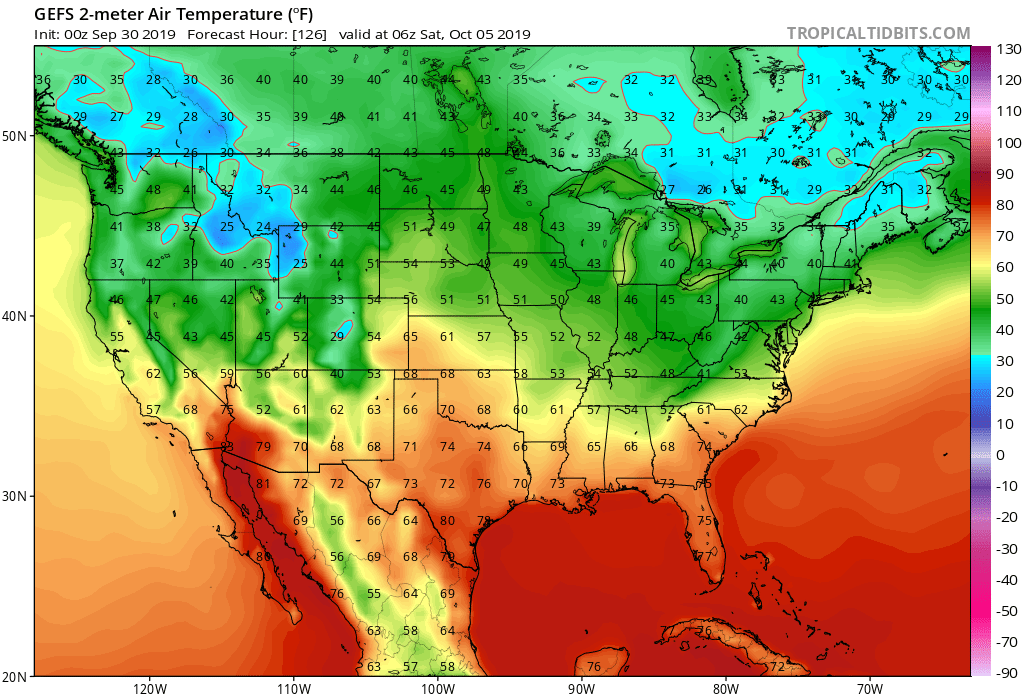
Frost/ Freeze: In addition to the Rockies, the upper Mid West, northern Great Lakes region, and interior Northeast will likely receive their first frost or freeze of the season Friday and/ or Saturday morning.

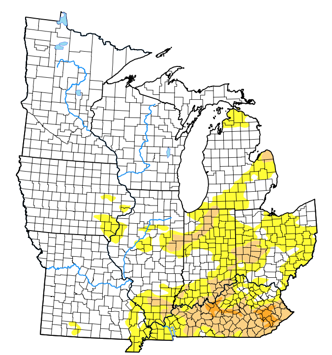
Drought Monitor: Widespread dry to droughty conditions exist across the lower Ohio Valley into the central Ohio Valley and lower Michigan. Portions of northern IL into northern IN and lower MI cashed in on excessive rainfall late last week and show greatly improved conditions from a drought perspective with this week’s update. Unfortunately, the cold front that’s set to deliver the much cooler air later this week won’t have much moisture to work with and an overall dry time of things should continue for the better part of the region.
Summary: A strong southwesterly air flow will promote anomalous heat as we traverse the first half of the work week. In some cases, records will fall across the Ohio Valley region. Looking ahead, a stout cold front will sink south in the Wednesday evening-Thursday time frame. A few showers are likely ahead of the front, but significant or widespread rainfall isn’t anticipated. The much bigger deal will be the significantly cooler air that arrives Thursday evening into the weekend. We’ll go from temperatures around 20 degrees above normal to open the work week to temperatures 5-10 degrees below normal by late week.
The next best shot of organized beneficial rainfall will arrive late Sunday into early Monday of next week…
You must be logged in to view this content. Click Here to become a member of IndyWX.com for full access. Already a member of IndyWx.com All-Access? Log-in here.
You must be logged in to view this content. Click Here to become a member of IndyWX.com for full access. Already a member of IndyWx.com All-Access? Log-in here.