VIDEO: Tracking 2 Cold Fronts That Will Pave The Way To A Phenomenal Weekend…
You must be logged in to view this content. Click Here to become a member of IndyWX.com for full access. Already a member of IndyWx.com All-Access? Log-in here.
You must be logged in to view this content. Click Here to become a member of IndyWX.com for full access. Already a member of IndyWx.com All-Access? Log-in here.
High pressure will remain in control of our weather to open the new work week, keeping most of the area dry. We do note the latest high resolution guidance pops a few showers later this afternoon, but these should remain isolated at best (not even worth changing that “partly cloudy” icon on the 7-day ;-)).
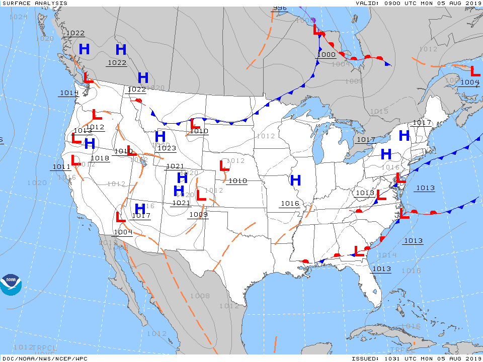
That will begin to change tomorrow as the first of a series of frontal systems begins to impact our weather. We anticipate showers and thunderstorms to become scattered-to-numerous Tuesday afternoon and evening.
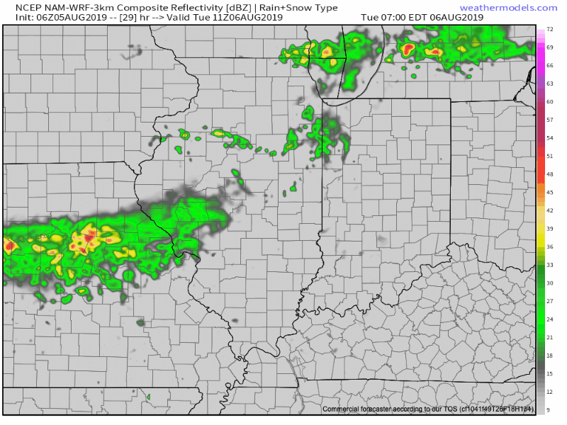
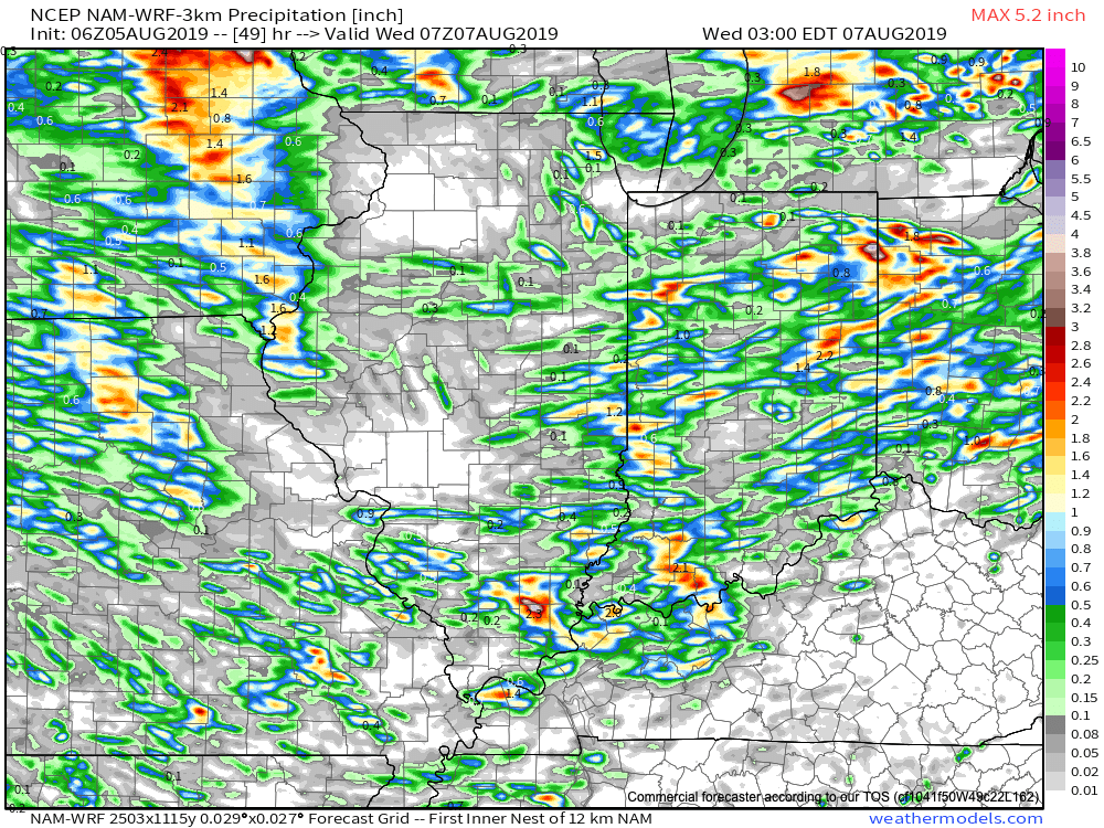
Rainfall amounts won’t be “uniform,” but there will be some locally heavy downpours scattered about the region.
A second front will blow through the state Thursday afternoon with additional chances of scattered showers and thunderstorms.

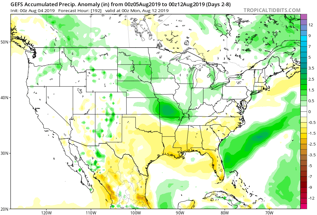
While it certainly won’t rain the entire time over the upcoming few days, areas that need moisture will be in luck with a good shot of picking up between 0.40″ to 0.80″ on a widespread basis. There will be locally heavier amounts in excess of 1″.
Once Thursday’s front pushes south, high pressure will arrive in time for the weekend and will supply another beautiful stretch of weather by mid-August standards.

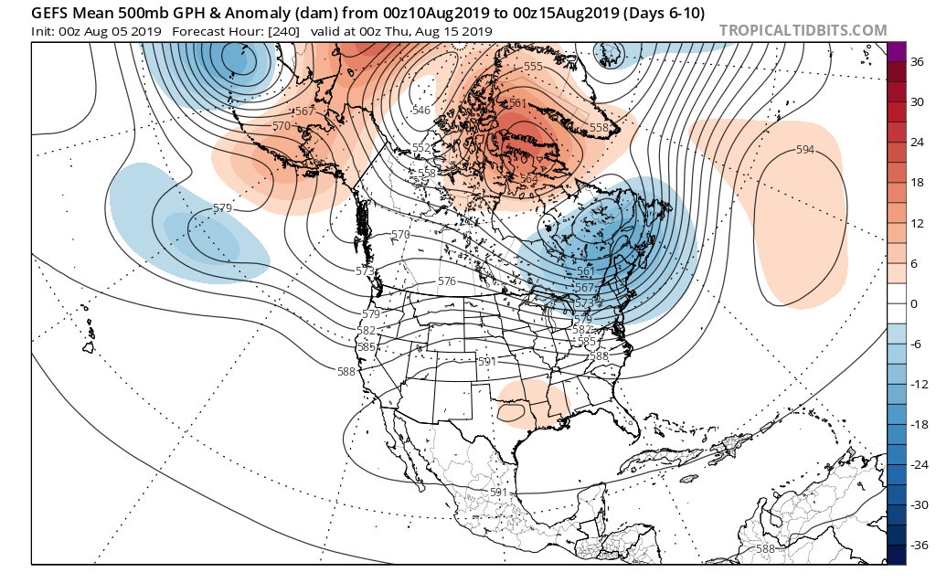
Looking further ahead, the more active pattern will continue into next week with the potential of a fairly strong system impacting the Midwest, Ohio Valley, and Great Lakes early to mid next week. This would be the system referred to last week as the one that could really serve as a reminder Fall is just around the corner (rain and storms followed by a gusty northwest wind and September-like air). We’ll continue to keep an eye on things!
You must be logged in to view this content. Click Here to become a member of IndyWX.com for full access. Already a member of IndyWx.com All-Access? Log-in here.
Forecast period: 08.04.19 through 08.11.19
7-Day Precipitation: Rainfall is expected to run near average through the forecast period.
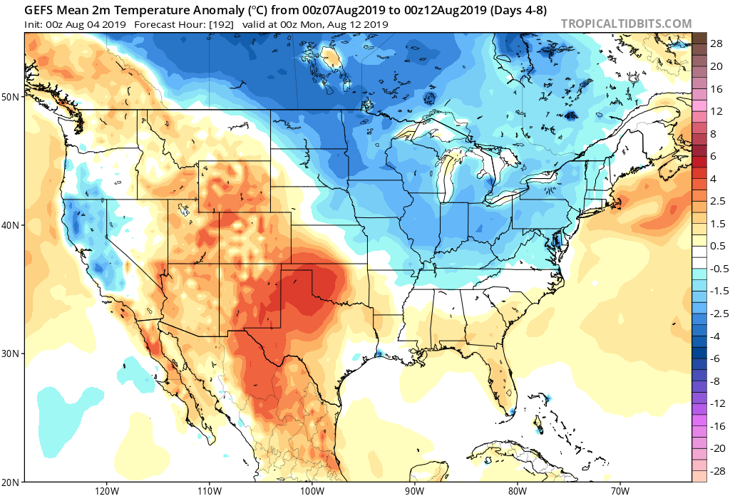
7-Day Temperature Outlook: Temperatures are expected to run near average before turning cooler than normal late in the period.
Severe Outlook: Organized severe weather isn’t anticipated through the forecast period.
Summary: The forecast period will start off on a quiet note, but that will begin to change by the middle of the work week. The first of a series of cold fronts will approach the region Tuesday with an increase in shower and thunderstorm activity that will continue into Wednesday with the frontal passage itself. On the heels of that FROPA, a second front will sweep into the area Thursday, continuing scattered showers and thunderstorms. High pressure is then expected to build over the Ohio Valley heading into the weekend, resulting in drier conditions.
As you’d imagine, temperatures will trend cooler behind these frontal systems late week and into the weekend. As for rainfall, widespread amounts should average between 0.40″ and 0.80″ during the Tuesday-Thursday time frame with locally heavier amounts where stronger storms track.
More a bit later with the issuance of our afternoon video package! Make it a great Sunday, friends!
While the weekend will remain quiet and very pleasant by early-August standards, there are significant changes on the horizon that will help drive a cooler and increasingly active pattern as we rumble into next week and beyond.
With that said, high pressure will dominate our weekend weather- supplying plentiful sunshine, warm temperatures, and low humidity.

This morning’s video link has the details on the changes that loom: