VIDEO: Heavy Snow Returns This Afternoon; Intense Banding Expected…
You must be logged in to view this content. Click Here to become a member of IndyWX.com for full access. Already a member of IndyWx.com All-Access? Log-in here.
You must be logged in to view this content. Click Here to become a member of IndyWX.com for full access. Already a member of IndyWx.com All-Access? Log-in here.
High resolution guidance started to show the snowier solutions earlier this evening and that trend has continued this evening. The consistency is great to see, but we also notice a couple of interesting elements “upstream” that will likely ultimately end up producing a memorable mid-December snow storm across central Indiana by the time all is said and done.
Before we talk specifics, here’s our updated snowfall forecast. Please note, this is expected total snowfall by daybreak Tuesday morning. We wouldn’t be shocked to hear of localized one foot amounts along the I-70 corridor.
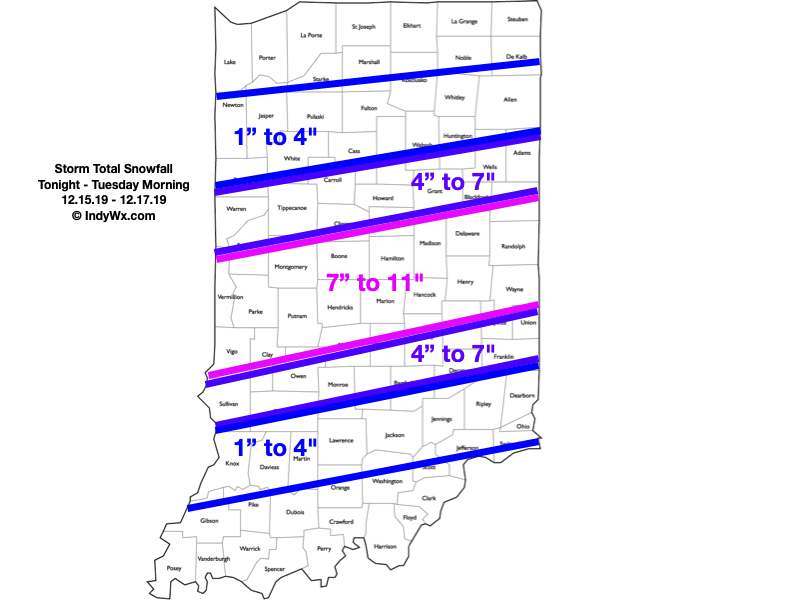
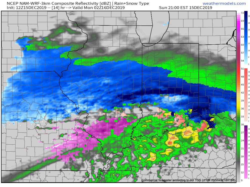
Periods of heavy snow will come to an end during the overnight. We think by 3a to 4a, most of the snow from “round 1″ will be to our east and we’ll be left with clean up duties before a Monday morning rush that will likely still be heavily impacted. By the time the 1st round is finished, most of the I-70 corridor will be shoveling and plowing away 4″ to 6” of wet snow.
We’ll then get into the expected lull in the action through a good chunk of the daytime Monday. That said, curious eyes will be focused in on south-central MO mid-to-late morning as precipitation blossoms in response to a strengthening surface wave that will move northeast out of the Ark-la-tex and into the TN Valley tomorrow night.
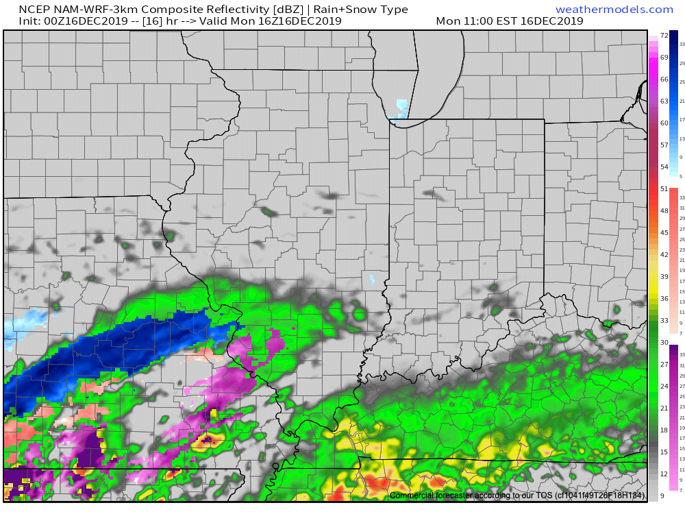
This will promote an expanding shield of moderate to heavy precipitation moving northeast and overspreading central Indiana by mid afternoon Monday. For us here across central Indiana, this will fall as snow.

If you don’t have to travel tomorrow, we’d recommend staying home and off the roads. While conditions will improve late morning into early afternoon, travel conditions will go downhill in significant fashion by 3p to 4p Monday across central Indiana- including the metro.
Periods of snow, heavy at times, will continue into the overnight before pushing off to the east before sunrise Tuesday. By that time, the heart of central Indiana will be cleaning up from a double digit and most memorable mid-December snow storm.
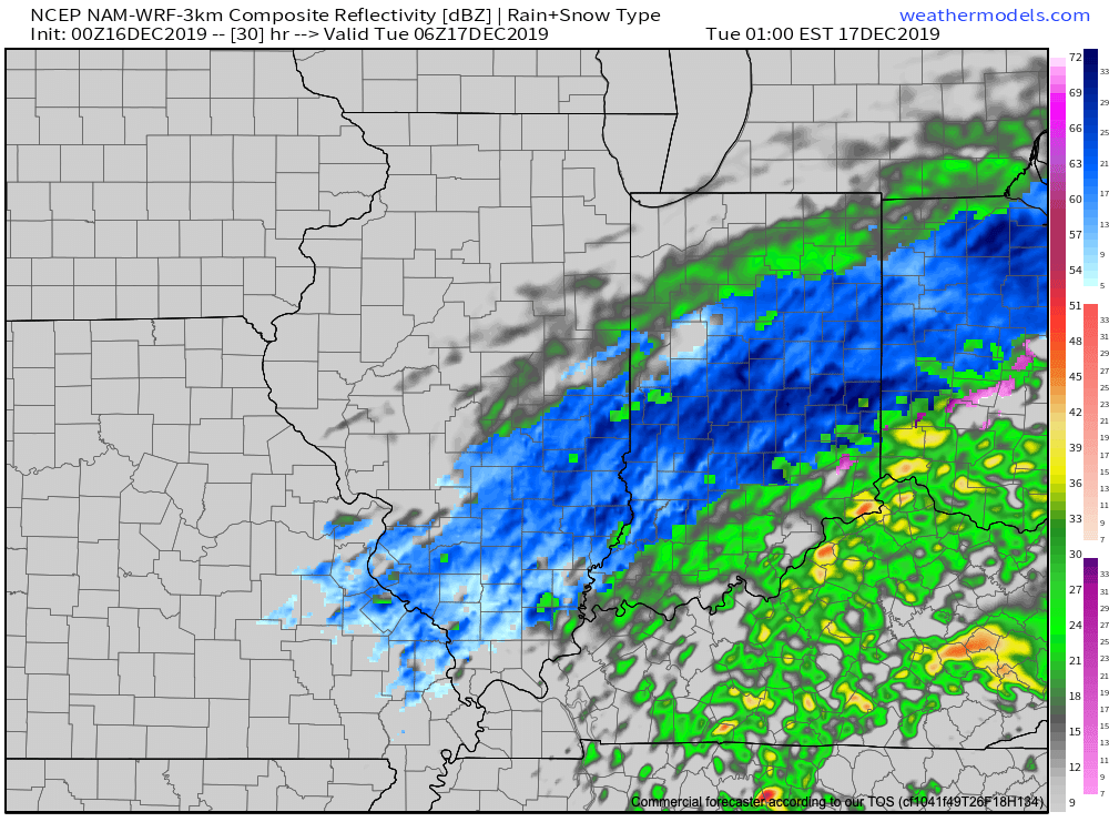
We’ll be left with colder, but generally dry conditions Tuesday. Temperatures will remain below freezing through the day, but the majority of the region won’t be dealing with any additional snowfall after sunrise…
Gas up that snowblower! Next update will come early in the AM.
You must be logged in to view this content. Click Here to become a member of IndyWX.com for full access. Already a member of IndyWx.com All-Access? Log-in here.
Type: Impactful Wintry Weather
What: Accumulating snow; mixed wintry precipitation
When: This evening and Monday afternoon – Tuesday morning
Temperatures: Lower to middle 30s, falling into the middle 20s Tuesday morning
Wind: East northeast 10 to 15 MPH, shifting to the northwest Monday night with gusts to 25 MPH
Blowing/ Drifting: Minimal
Pavement Impacts: Plowing and salting will be required.

Right out of the gate, let’s talk accumulation: While we don’t need to make significant changes to the snowfall forecast, we did “tighten” the 3″ to 6″ band up a bit and scaled the 1″ to 3″ zones closer into central Indiana on both the north and south sides. This continues to be a central Indiana event- at least as far as heaviest snowfall totals go.
This event will still come in 2 waves, but it now appears as if the initial surge of moisture this evening and tonight will feature the heaviest snowfall rates. Snow will overspread the region this evening (arriving into Indianapolis, itself, between 6p and 7p) and come down heavily at times through the overnight hours. Part 1 will end before daybreak, but the damage will have been done by that point and the morning commute will be significantly impacted as central Indiana digs out from 3″ to 5″ of wet snow.
We’ll get a break through the bulk of the daytime Monday, but precipitation will once again overspread the region from southwest to northeast Monday evening, continuing into the predawn hours Tuesday. This will take the form of snow across central Indiana with a wintry mix and/ or a cold rain across southern and southeastern Indiana. An additional coating to 1″ of snow is possible with this 2nd wave of moisture.
Finally, winds will shift to the northwest and drive colder air into the state Monday night behind the departing storm. Everyone (including southeastern Indiana) will be below freezing Tuesday morning with additional travel impacts likely.
Confidence: High
Next Update: This evening
You must be logged in to view this content. Click Here to become a member of IndyWX.com for full access. Already a member of IndyWx.com All-Access? Log-in here.