You must be logged in to view this content. Click Here to become a member of IndyWX.com for full access. Already a member of IndyWx.com All-Access? Log-in here.
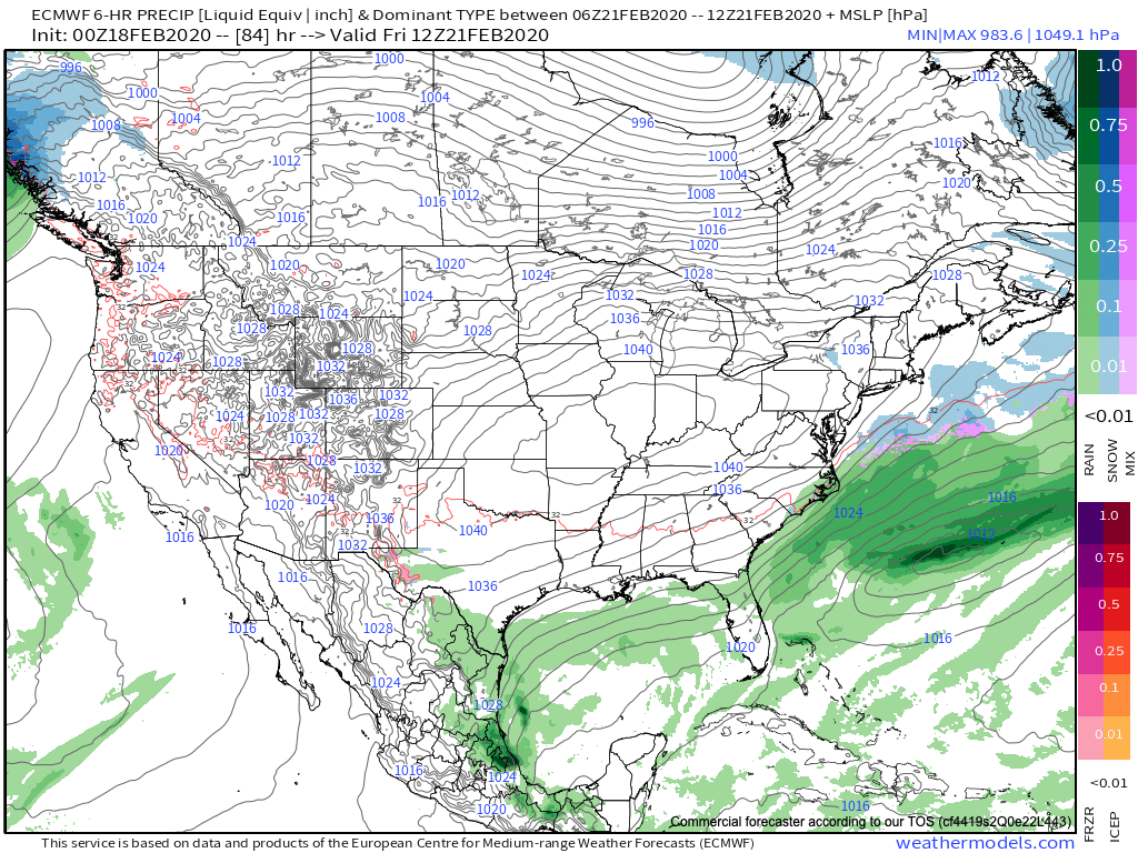
A much colder air mass will push into the Ohio Valley region today, taking up residence into the latter part of the work week. The good news? After we get rid of the clouds today, plentiful sunshine is expected through the remainder of the week and into the weekend as sprawling high pressure dominates.
High pressure will support a quiet, sunny stretch of weather this week.
This week’s quiet weather will quickly shift to a return of a stormy regime as we push into next week. From this distance, there’s really (2) camps the majority of modeling falls into. The European paints a pattern will undercutting storms beneath a developing block across Ontario and Quebec. This would present multiple opportunities for wintry weather next week across not only central Indiana, but a large chunk of the Ohio Valley. Meanwhile the GFS says the primary storm track will be northwest of our area, allowing a milder southwesterly flow to take hold and primarily rain.
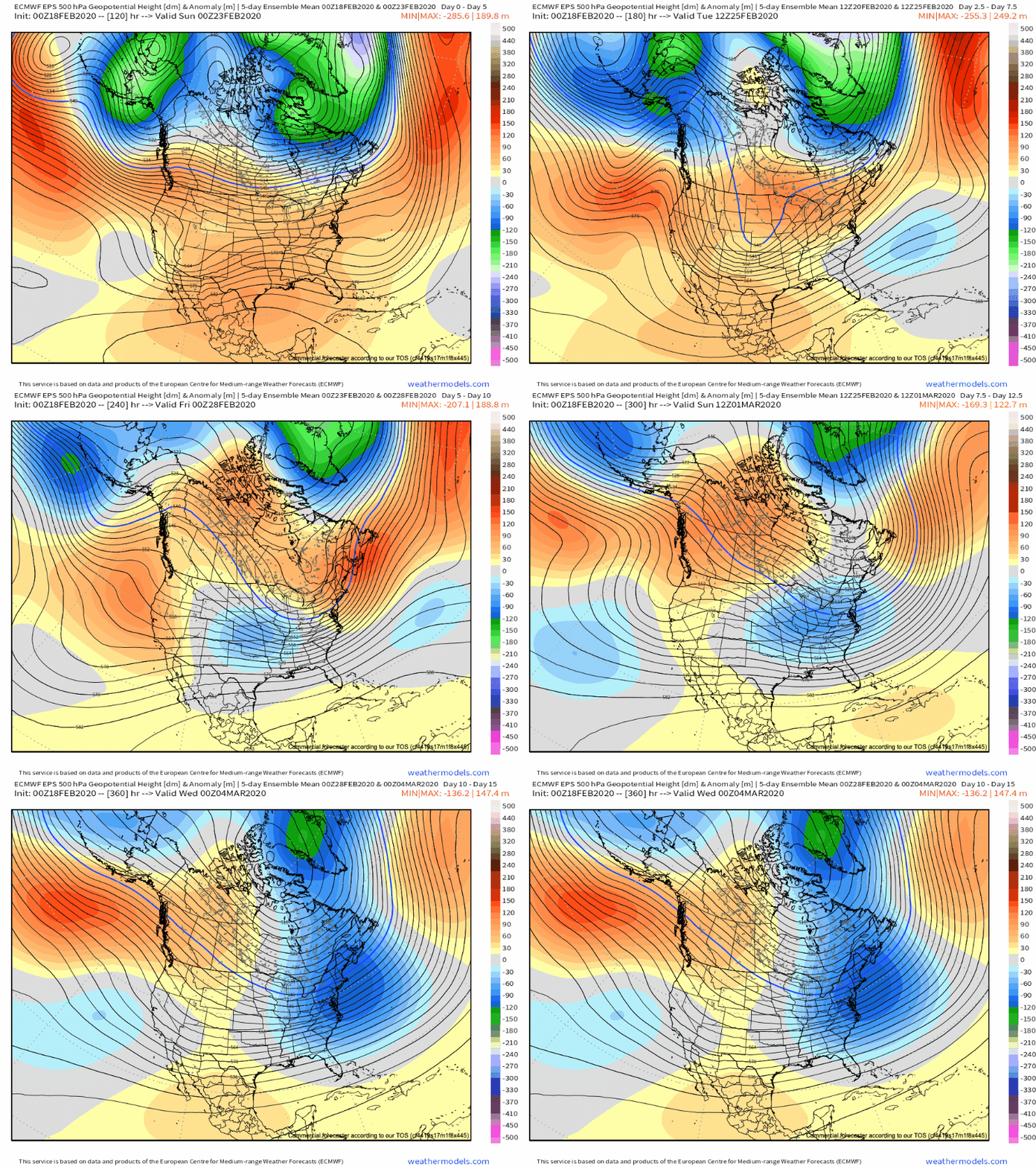
So what’s more likely to happen? We’re leaning more towards the European solution with an evolving cold pattern (that begins stormy) as we close February and open March. Note the blocking next week across Quebec and Ontario eventually give way towards more of a wholesale eastern North America trough as we welcome in meteorological spring. This continues to raise our confidence on March opening much colder than normal.
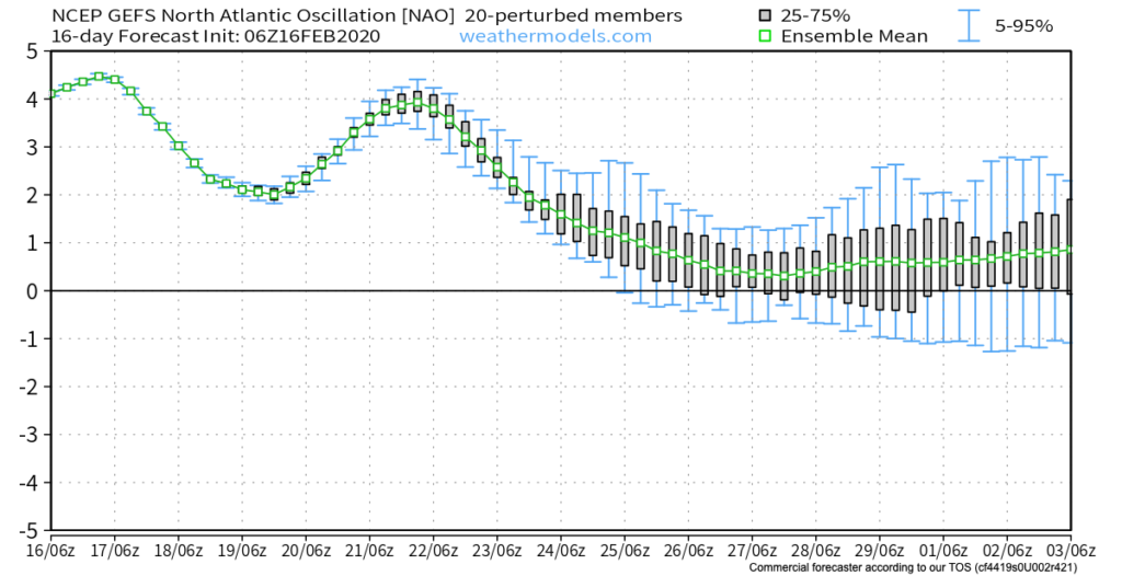
The GFS ensemble also sees this colder pattern evolving to close February and open March.
Stay tuned as we get set for another active stretch of weather around these parts next week.
As for the shift back to cold, the longevity of said cold pattern lies solely on the progression of the MJO and EPO. More to come on that with our long range Thursday update.
You must be logged in to view this content. Click Here to become a member of IndyWX.com for full access. Already a member of IndyWx.com All-Access? Log-in here.
With the exception of a rain maker blowing through the region Monday evening into Tuesday, we’re heading into a relatively quiet weather pattern for the upcoming 7-8 days. A couple of days of well below average temperatures will follow Tuesday’s cold front before weekend moderation takes place. With the shift in the pattern (albeit likely only for a brief period of time), we thought we’d look ahead to what may loom to close February and head into March.
As we’ve discussed in the past, the EPO and MJO are the keys to the pattern, and will continue to be through March. Some of the recent trends with both features would suggest cold is going to fight back as we head into late Feb and early March (spike positive in the EPO also boosts our confidence the pattern will warm over the weekend and into early parts of Week 2). This would likely be met with a return of an active storm track through our neck of the woods.
Both the GEFS and EPS paint a developing negative EPO as we close the month and welcome March. Secondly, the MJO is looking more and more like it’ll move out of the traditional winter warm phases and towards a much colder Phase 8. Collectively, these features should give pause to anyone thinking the kick-off to meteorological spring will be met with dry, warm weather. In reality, the opposite would more than likely result- stormy with colder than normal weather.
This is also the time we begin leaning more heavily on the influence a negative NAO can have on the pattern. Should this teleconnection get into the negative territory in March, then we’d be talking about a potential colder pattern lasting for 10-14 days towards one that would reload to result in colder, wintry conditions lasting into April. While not there yet, it’s certainly worth keeping an eye on in the coming days and weeks.
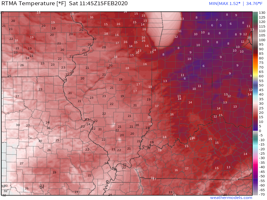
It’s another frigid start to the day with widespread lower to middle 10s across central Indiana. Even colder air resides across the eastern Ohio Valley with single digits over the fresh snowpack.
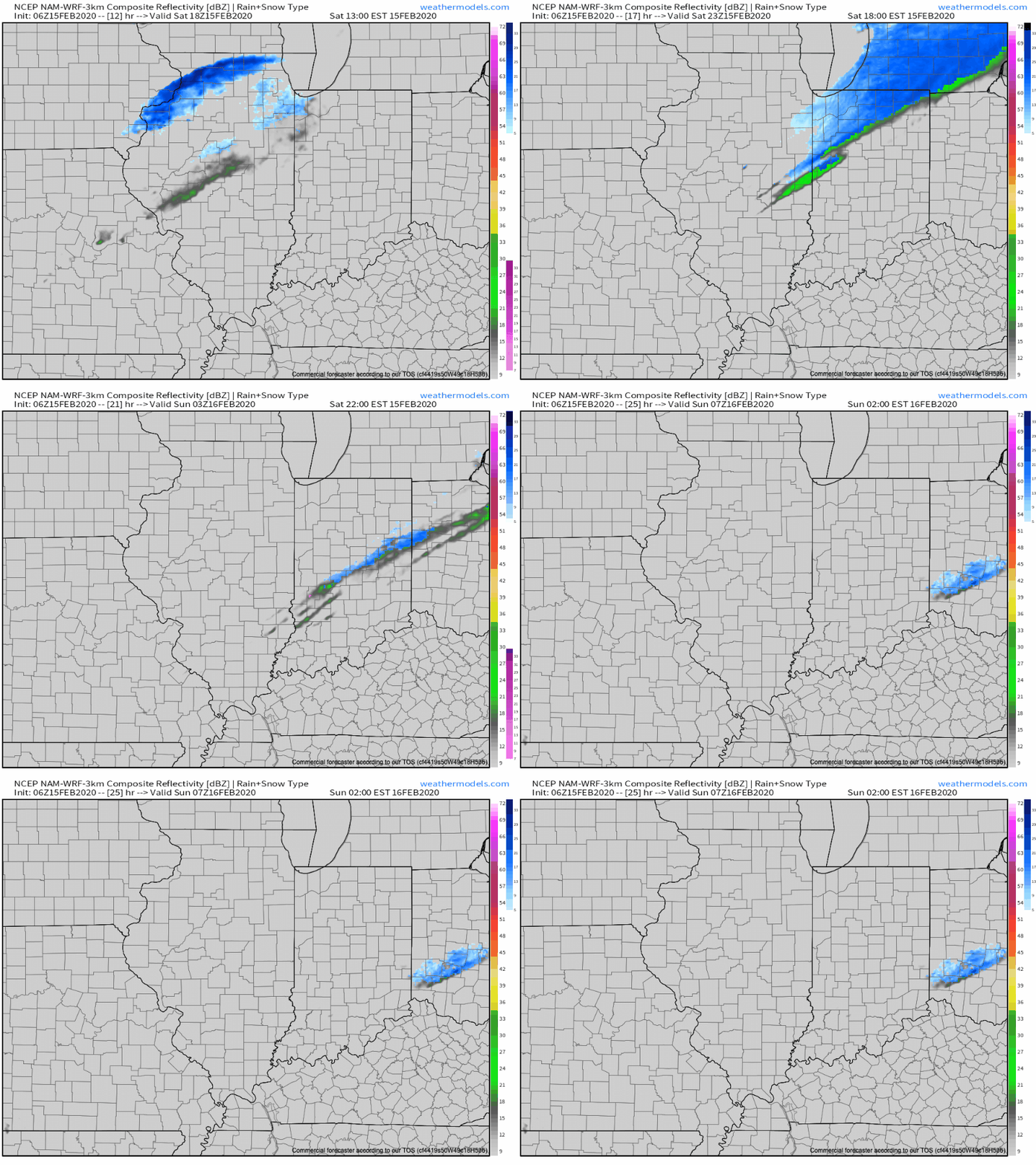
Today will feature quiet weather until later this evening when a weak clipper-like system slides southeast. This feature will help increase our cloud cover and result in a few light snow showers across the northern half of the state. Those snow showers may make it as far south as the I-70 corridor by evening before dissipating. Not expecting much, if any accumulation, locally, across central Indiana.
Quiet conditions will return as we open up the new week, but a fast moving storm system will result in increasing cloudiness through the day Monday and rain returning Monday evening into Tuesday.
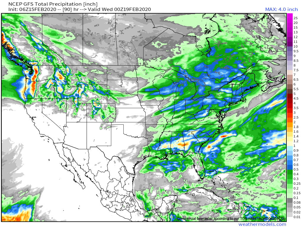
In general, we anticipate this system to deposit somewhere between 0.50″ and 0.75″ Monday night into Tuesday morning.
Much colder air will follow the cold frontal passage for midweek, including a stretch of highs in the upper 20s and 30s and lows in the 10s.
The 2nd half of the week will feature well below average temperatures.
High pressure will supply dry and sunny weather as we get set to close the work week, and as we look ahead, it doesn’t appear as if our next storm system will impact the region until the 2nd half of next weekend.