VIDEO: Drier Air Arrives For The Weekend; Targeting (2) Cold Fronts Next Week…
You must be logged in to view this content. Click Here to become a member of IndyWX.com for full access. Already a member of IndyWx.com All-Access? Log-in here.
You must be logged in to view this content. Click Here to become a member of IndyWX.com for full access. Already a member of IndyWx.com All-Access? Log-in here.
You must be logged in to view this content. Click Here to become a member of IndyWX.com for full access. Already a member of IndyWx.com All-Access? Log-in here.
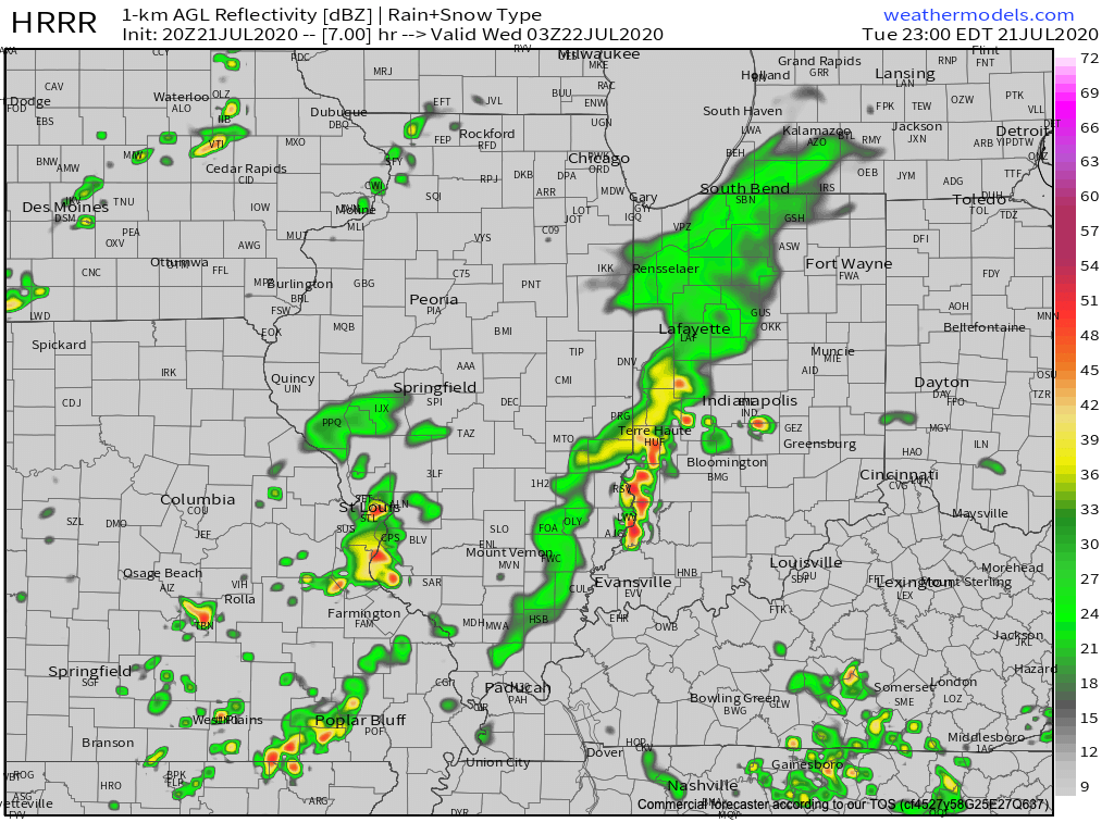
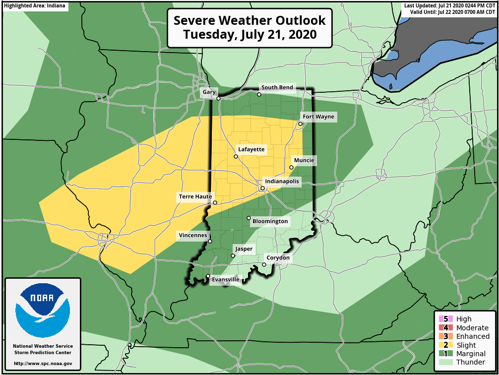
I. A round of strong (and locally severe) storms blew through north-central parts of the state earlier this afternoon and as we write this, yet another batch of storms is erupting across IL. These storms should hold together into central IN late evening (targeting a 8p-11p arrival west to east) and a few could become severe. Ingredients in place favor strong, damaging wind gusts with the stronger cells, but there’s also the opportunity for a quick spin-up tornado. Torrential downpours can be expected with any and all storms. It’ll be wise to keep tabs on the local radar this evening.
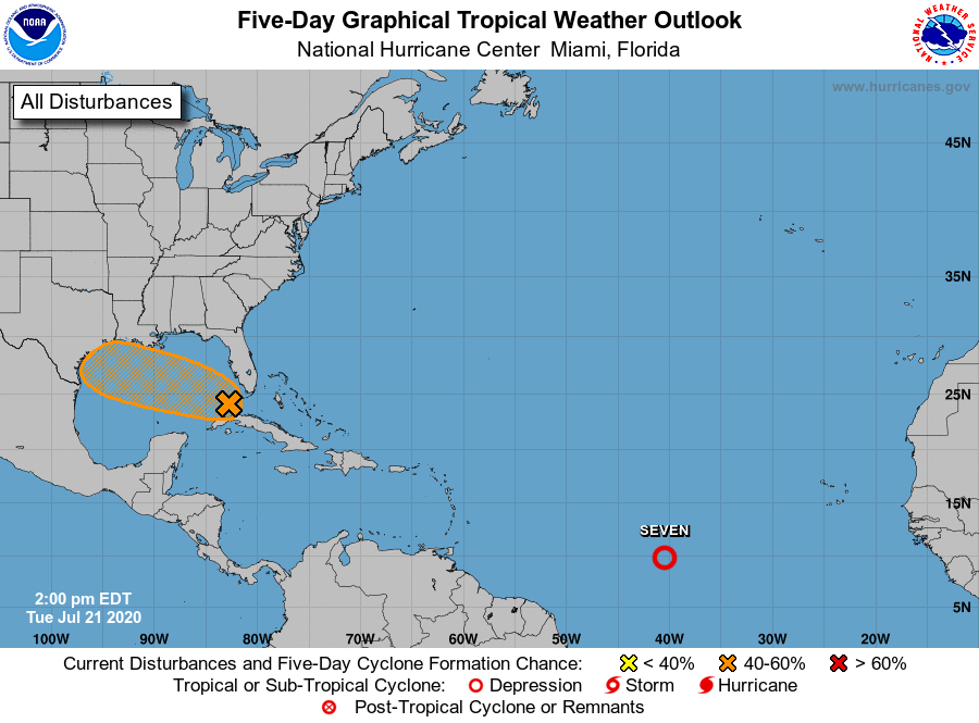
II. As can be expected the deeper into summer we go, the tropics become more active. That’s certainly been the case over the past couple days and all indications continue to point towards a particularly “robust” season as late summer gives way to fall. Interests to the Gulf Coast beaches and Carolina coast should pay close attention to the tropical outlooks in the coming weeks and months. Unfortunately, conditions seem ripe for the opportunity of a few major hurricanes this season, especially when you combine the SST profile with the tendency for the MJO to spend time in Phases 2-3.

In the shorter term, the National Hurricane Center (NHC) is keeping close tabs on the Gulf as well as newly formed TD 7.
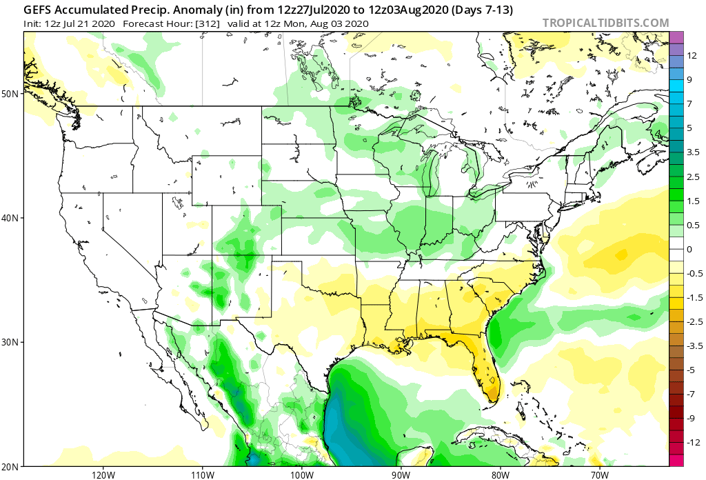
III. Overall upper pattern strongly suggests we can expect a very active close to July and open to August. Between next week and the first few days of August, we’re tracking 3 cold fronts that will help to beat back the heat and serve up above normal rainfall through the period (not to mention threat of additional strong to severe storms).
You must be logged in to view this content. Click Here to become a member of IndyWX.com for full access. Already a member of IndyWx.com All-Access? Log-in here.
You must be logged in to view this content. Click Here to become a member of IndyWX.com for full access. Already a member of IndyWx.com All-Access? Log-in here.