You must be logged in to view this content. Click Here to become a member of IndyWX.com for full access. Already a member of IndyWx.com All-Access? Log-in here.
You must be logged in to view this content. Click Here to become a member of IndyWX.com for full access. Already a member of IndyWx.com All-Access? Log-in here.
You must be logged in to view this content. Click Here to become a member of IndyWX.com for full access. Already a member of IndyWx.com All-Access? Log-in here.
After a chilly open to October, the past several days have provided a rebound in the temperature department. Officially, through the first 11 days of the month, Indianapolis is 1.3° above average.
Month-to-date temperature anomalies through 10.9.20
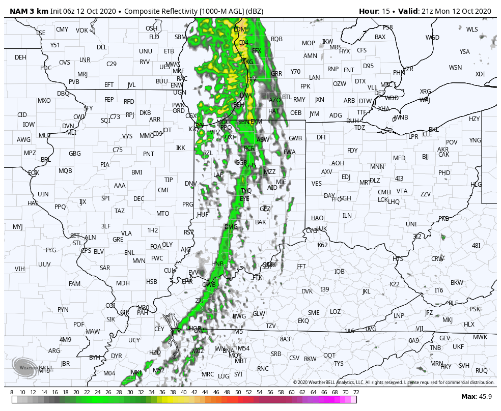
This week will feature (2) cold fronts sweeping through the region. The first front is on our doorstep now and will pass through the area this evening.
Expect a brief shower and gusty winds between 4p and 6p this evening from west to east across central Indiana. Winds will likely gust to around 40 MPH as the front moves through.
Forecast radar at 5p Monday.
Forecast wind gusts at 6p Monday.
Cooler and less humid air will pour into the region tonight and set the stage for a pleasant midweek period.
A secondary cold front will push into the state Thursday and this frontal system will pack a colder punch just in time for the weekend.
Another shot of light rain and gusty winds will accompany the 2nd cold front, but the bigger story will be the sharply colder air. Highs this weekend will likely only top out in the lower to middle 50s with overnight lows into the 30s.
A weak wave of low pressure will be monitored this week for the possibility of spreading a chilly rain (GFS has even hinted at wet snow mixing in at times, but we’re not buying that as of now) across the Ohio Valley Sunday into next Monday. If this system develops, we’d likely be talking about highs not making it out of the 40s during these days. More on this and what the lead up to Halloween has in store later this evening in our video update.
Delta– the remnants of one time powerful Hurricane Delta will curl northeast into the TN Valley today and cross the southern Appalachians Sunday. Central Indiana will miss out on any…
You must be logged in to view this content. Click Here to become a member of IndyWX.com for full access. Already a member of IndyWx.com All-Access? Log-in here.