
You must be logged in to view this content. Click Here to become a member of IndyWX.com for full access. Already a member of IndyWx.com All-Access? Log-in here.
Category: Client
Permanent link to this article: https://indywx.com/video-detailed-short-term-analysis-of-storm-threats-discussing-the-long-range-pattern-into-the-1st-half-of-june/
May 24
VIDEO: Hot, Humid Start To Memorial Day Weekend; Unsettled Into Next Week…
You must be logged in to view this content. Click Here to become a member of IndyWX.com for full access. Already a member of IndyWx.com All-Access? Log-in here.
Permanent link to this article: https://indywx.com/video-hot-humid-start-to-memorial-day-weekend-unsettled-into-next-week/
May 23
VIDEO: Short-Term Update; Timing Storms Out Into Next Week…
You must be logged in to view this content. Click Here to become a member of IndyWX.com for full access. Already a member of IndyWx.com All-Access? Log-in here.
Permanent link to this article: https://indywx.com/video-short-term-update-timing-storms-out-into-next-week/
May 23
Strong Storms Rumble In Later This Morning…
It’s quiet on the home front just after midnight, but that will begin to change in a significant manner as we push through the predawn hours. Strong and severe thunderstorms are ongoing to our west early this morning and the environment should support these storms to remain rather potent pushing into central Indiana between 3a and 5a.
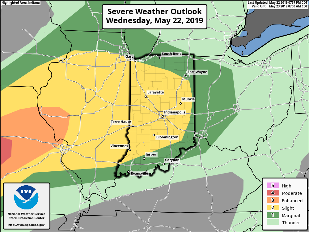
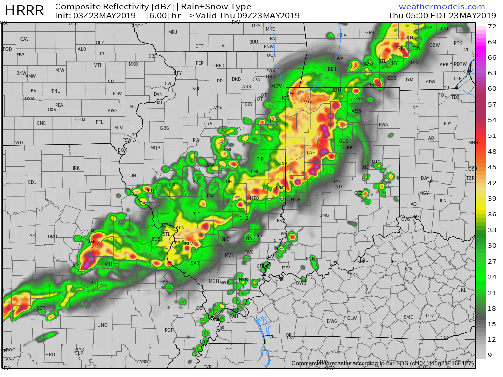
The primary concern with these storms will be damaging winds and localized torrential downpours. Some neighborhoods could very well pick up a quick 1” in less than an hour. Vivid lightning can also be expected. Most of the storms should push south and east of the city after the morning rush.
We’ll have a fresh video update in a few hours.
Permanent link to this article: https://indywx.com/strong-storms-rumble-in-later-this-morning/
May 22
Prolonged Unsettled Stretch Of Weather…
Yesterday was only the beginning of a renewed prolonged stretch of unsettled and stormy weather. A series of fronts will make a move towards the OHV only to stall out and lift north back as a warm front over the upcoming 7-day period. The end result? An extended stretch of wet, stormy conditions.
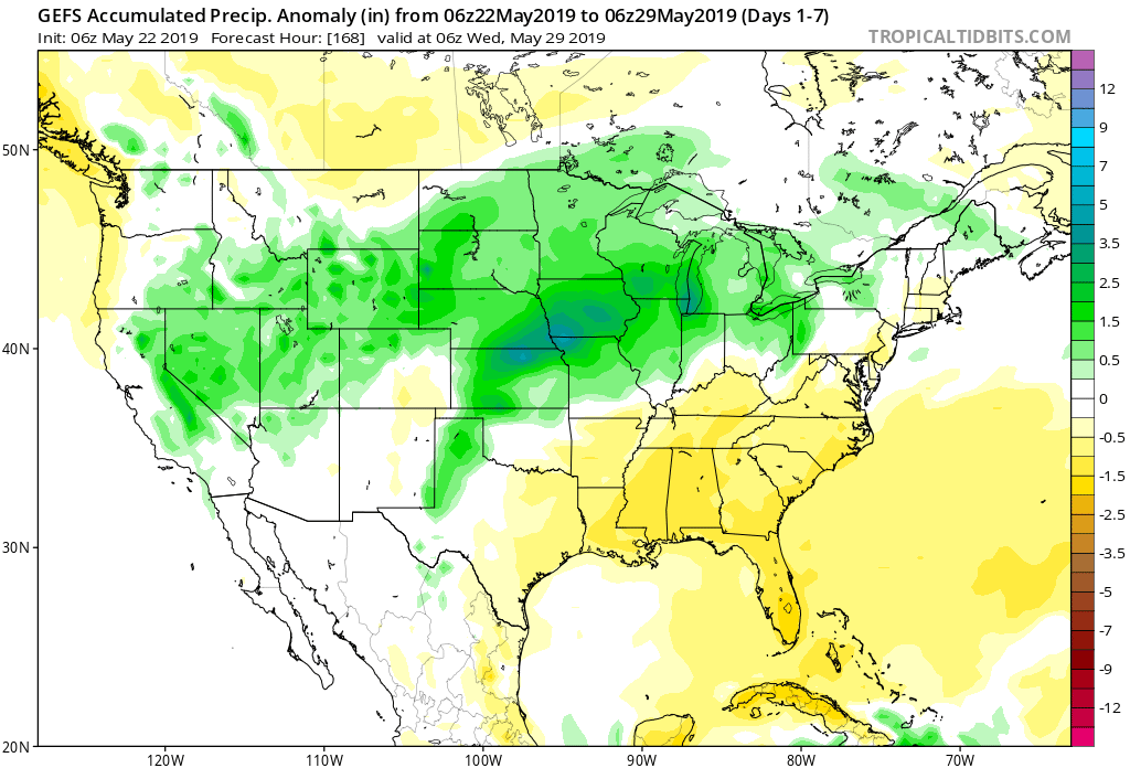
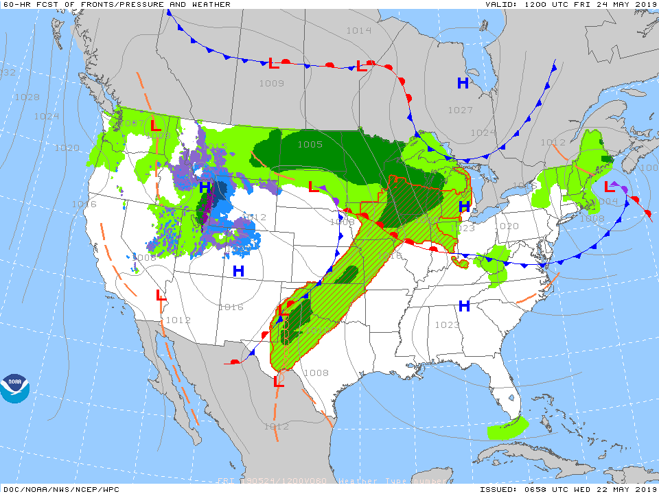
Get used to the setup above with a stalled front nearby and waves of low pressure moving along the associated boundaries from time to time. As these ripples of energy scoot along the front, more enhanced showers and thunderstorms can be expected.
It’s still tough from this distance to say with certainty which day(s) will offer up the most widespread shower and thunderstorm coverage in this pattern, but we continue to lean towards Saturday into Sunday. Stay tuned.
Models agree on widespread 1.5″ to 2.5″ rainfall totals over the upcoming week with locally heavier amounts.
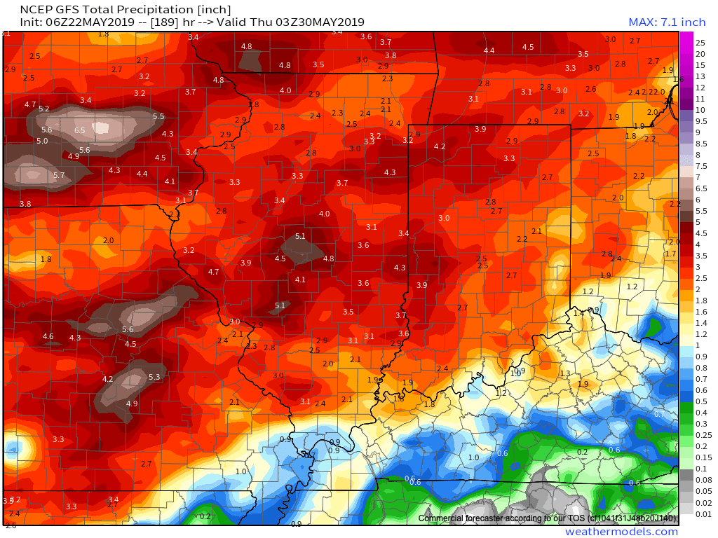
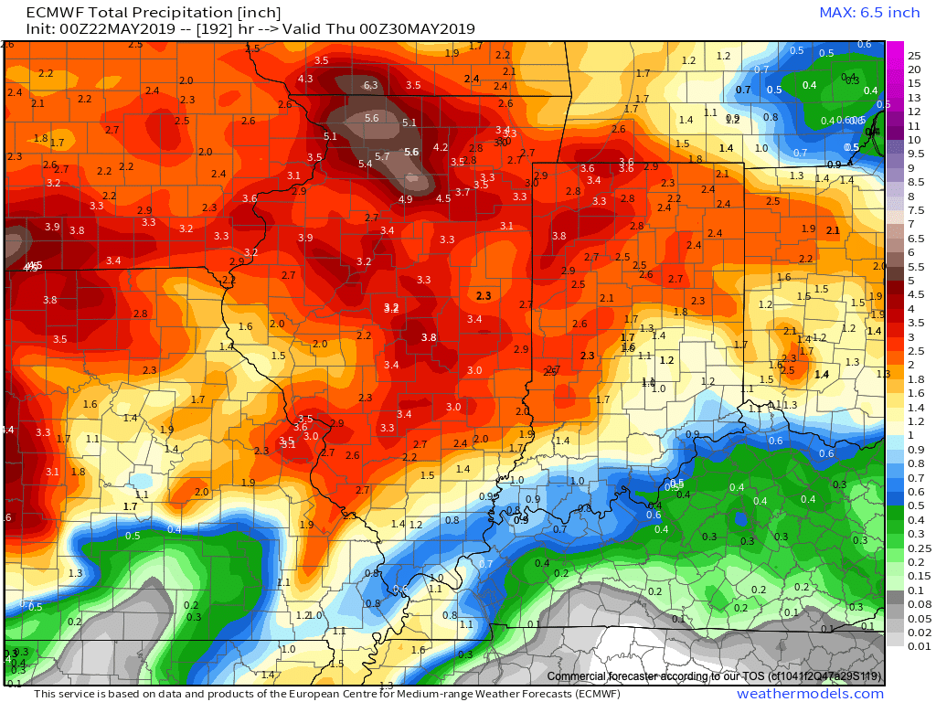
Conditions will also return to a warmer than normal theme into the middle of next week. At times, conditions will become oppressive (depending on which side of the front you find yourself on). If heading to the track, ensure you have means to remain cool and pack the rain gear just to be safe!
More later tonight on the long range, including a video recap of our Summer Outlook.
Permanent link to this article: https://indywx.com/prolonged-unsettled-stretch-of-weather/