Category: Client

Gusty Storms Blow Into Town Saturday PM…

The Storm Prediction Center has pulled the “Slight” Risk area more into Indiana with their most recent update for Saturday and we believe this may encompass more of the immediate area with subsequent updates.

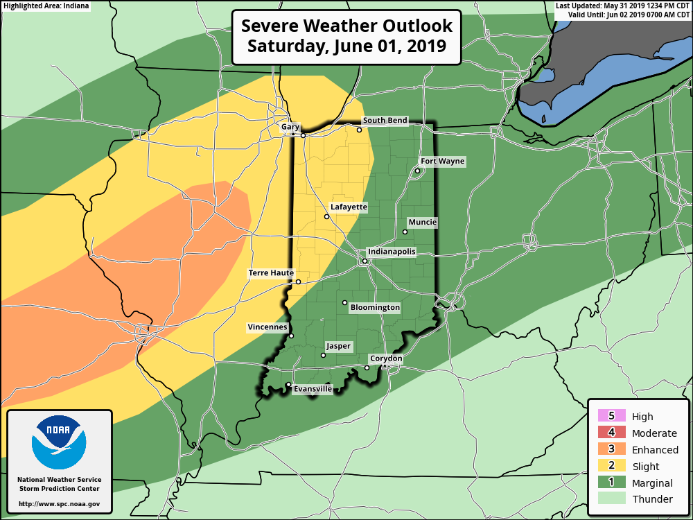
The biggest concern has to do with straight line wind potential with one, or multiple lines of storms that will rumble through the state Saturday afternoon and evening.

The day will dawn bright and sunny with pleasant temperatures, but as the morning gives way to afternoon, conditions will destabilize and we’ll have our eyes focused to the northwest for thunderstorm initiation early afternoon across northern Indiana and Illinois. We then anticipate these individual storms to morph into a couple of lines of storms and push south into central Indiana during the mid and late afternoon/ early evening hours.

If you have outdoor plans tomorrow, please plan to have a means of receiving the latest information around potential severe thunderstorm watch/ warning information that may be required.

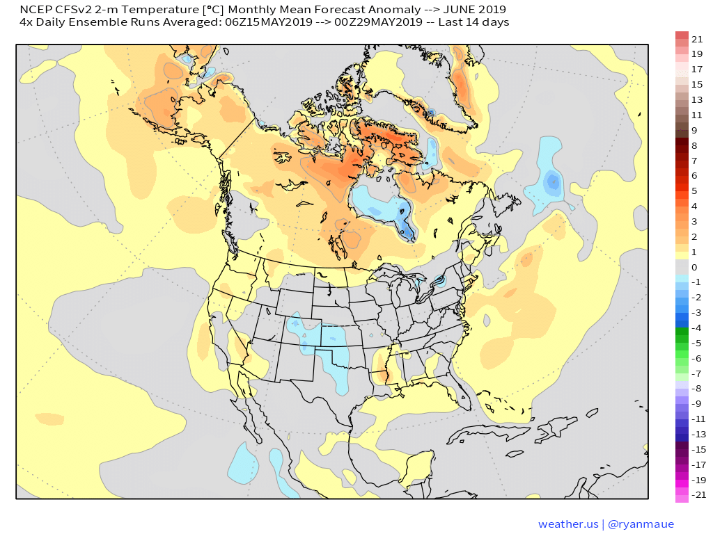
The 2nd half of the weekend will include fantastic weather (drier, less humid, and cooler) that will carry us into the first couple of days of the work week!

Permanent link to this article: https://indywx.com/gusty-storms-blow-into-town-saturday-pm/

VIDEO: Gusty Saturday Storms; Wet Pattern Returns Next Week After 3-Day Break…

You must be logged in to view this content. Click Here to become a member of IndyWX.com for full access.  Already a member of IndyWx.com All-Access?  Log-in here.

Permanent link to this article: https://indywx.com/video-gusty-saturday-storms-wet-pattern-returns-next-week-after-3-day-break/

Short-Term Video Update: How Long Do Storms Last Tonight? Strong Storms Saturday PM?

You must be logged in to view this content. Click Here to become a member of IndyWX.com for full access.  Already a member of IndyWx.com All-Access?  Log-in here.

Permanent link to this article: https://indywx.com/short-term-video-update-how-long-do-storms-last-tonight-strong-storms-saturday-pm/

VIDEO: Scattered Storms This Evening; Cooler Pattern To Open June…

You must be logged in to view this content. Click Here to become a member of IndyWX.com for full access.  Already a member of IndyWx.com All-Access?  Log-in here.

Permanent link to this article: https://indywx.com/video-scattered-storms-this-evening-cooler-pattern-to-open-june/

June Outlook: Does The Wet Pattern Continue?

Averages for June are as follows:

  • Average Low: 62.1 (f)
  • Avearge High: 81.9 (f)
  • Average Rain: 4.25″
  • Average Snow: 0.00″

As we head to the 50-yard line of 2019 (already?!), we’re of the belief we’re looking at a cooler than normal month of June with close to average rainfall. Before we get into our reasoning of such, let’s look at a few snap shots of the latest data:

CFSv2

JMA

NMME

Though we can’t show it, the longer range European model paints a cool, wet picture from the south-central into the Plains and portions of the Northeast.

Given the analogs we’ve looked over with weak El Ninos along with similar MJO pulses, we’ve built a generally wet and cool June forecast nationally:

Ridging should support warmer than average conditions across the Southeast and Pacific Northwest, along with a rather widespread cooler than normal regime through the south-central Plains into the Great Lakes and New England. Unfortunately, we think wetter than normal conditions remain from the Delta into the central Plains. With that said, conditions seem more favorable for planting through a large portion of the OHV region.

Permanent link to this article: https://indywx.com/june-outlook-does-the-wet-pattern-continue/