You must be logged in to view this content. Click Here to become a member of IndyWX.com for full access. Already a member of IndyWx.com All-Access? Log-in here.
Category: Client
Permanent link to this article: https://indywx.com/video-detailed-look-at-the-pattern-and-associated-heavy-rain-timing-into-early-next-week/
Jun 03
VIDEO: Unsettled Weather Returns After A Pleasant Open To The Work Week…
You must be logged in to view this content. Click Here to become a member of IndyWX.com for full access. Already a member of IndyWx.com All-Access? Log-in here.
Permanent link to this article: https://indywx.com/video-unsettled-weather-returns-after-a-pleasant-open-to-the-work-week/
Jun 02
Weekly #AGwx And Severe Weather Outlook…
Forecast Period: 06.02.19 through 06.09.19
7-Day Precipitation: Rainfall is expected to run above average through the period.

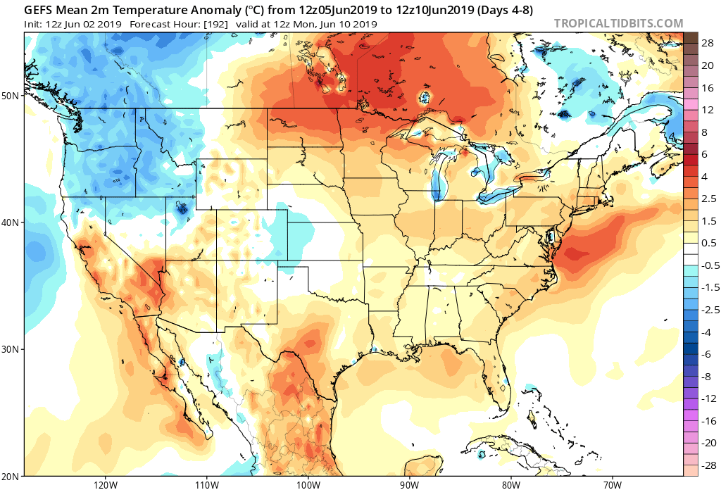
7-Day Temperatures: Above normal temperatures are expected through the period, mostly thanks to warmer than average overnight lows.

Severe Weather: We’ll remain quiet through early week before things begin to turn more active by midweek. The Storm Prediction Center is including the southern half of the region in a risk of severe weather by Wednesday (noted in the Day 4 Outlook below).

Summary: After a pleasant and quiet open to the period (today and Monday), thinks will begin to turn more active thereafter. Initially, it’ll take some time to “moisten” things up on Tuesday, but at the very least, light to moderate rain should work across central Indiana late Tuesday morning into the afternoon. Things will be fully saturated by Wednesday and periods of more concentrated rain, occasionally heavy, can be expected into the weekend. Unfortunately, guidance is in rather remarkable agreement of widespread 1.5″ to 2.5″ with locally heavier totals over the upcoming 7-day period.
Permanent link to this article: https://indywx.com/weekly-agwx-and-severe-weather-outlook/
Jun 02
Needed 48 Hour Break From The Rain; Unfortunately, Heavy Rain Returns Later This Week…
You must be logged in to view this content. Click Here to become a member of IndyWX.com for full access. Already a member of IndyWx.com All-Access? Log-in here.
Permanent link to this article: https://indywx.com/needed-48-hour-break-from-the-rain-unfortunately-heavy-rain-returns-later-this-week/
Jun 01
VIDEO: Severe Weather Potential Later Today; Discussing The June Pattern…
You must be logged in to view this content. Click Here to become a member of IndyWX.com for full access. Already a member of IndyWx.com All-Access? Log-in here.
Permanent link to this article: https://indywx.com/video-severe-weather-potential-later-today-discussing-the-june-pattern/
