You must be logged in to view this content. Click Here to become a member of IndyWX.com for full access. Already a member of IndyWx.com All-Access? Log-in here.
Category: Client
Permanent link to this article: https://indywx.com/video-hot-humid-weather-rolls-on-for-now-backing-up-our-mid-july-thoughts/
Jul 01
VIDEO: Hot Now, But A Significant Pattern Change Awaits…
You must be logged in to view this content. Click Here to become a member of IndyWX.com for full access. Already a member of IndyWx.com All-Access? Log-in here.
Permanent link to this article: https://indywx.com/video-hot-now-but-a-significant-pattern-change-awaits/
Jul 01
Weekly #AGwx And Severe Weather Outlook…
Forecast period: 07.01.19 through 07.08.19
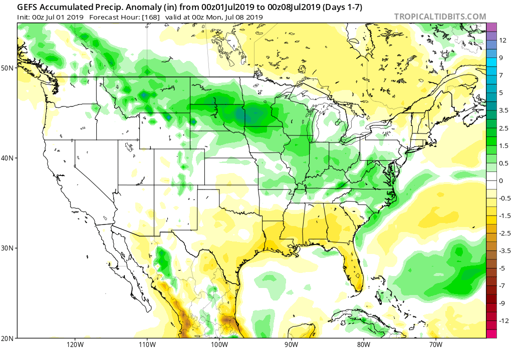
7-Day Precipitation: Rainfall is expected to run above average through the period.

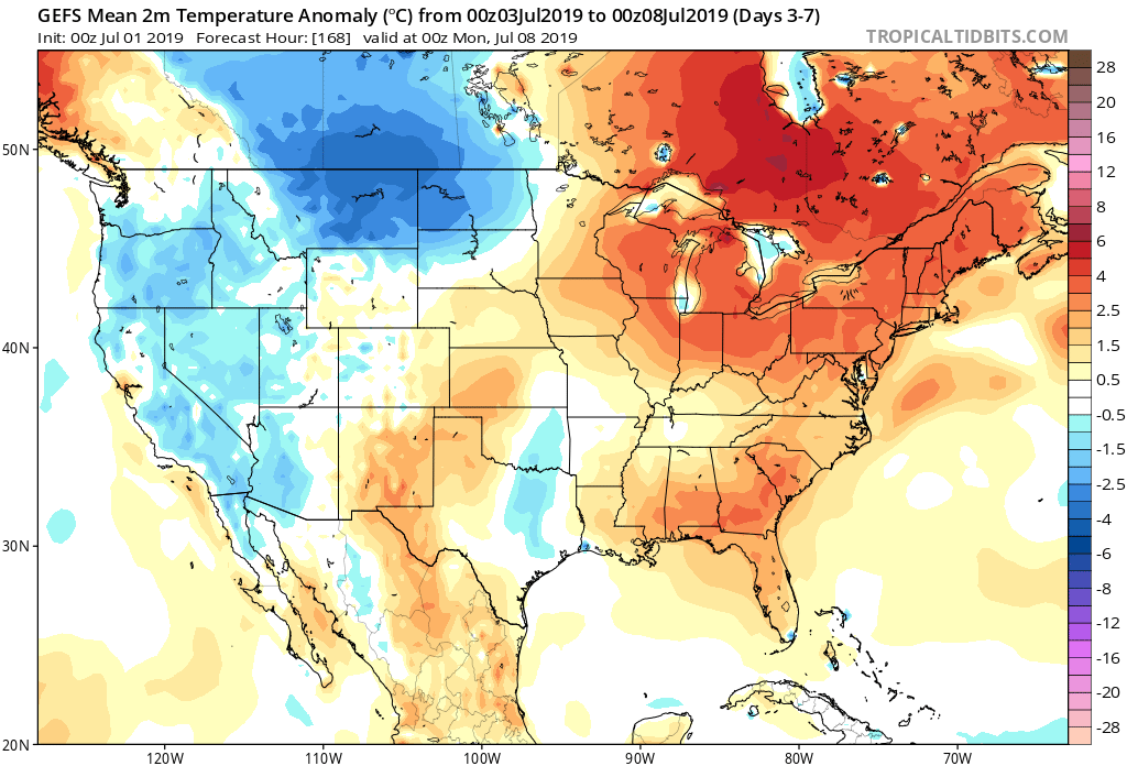
7-Day Temperature Outlook: Temperatures are expected to run above average through the period.

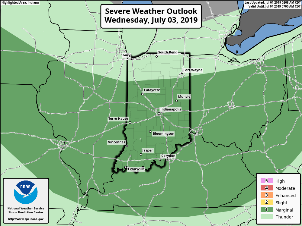
Severe Outlook: A ‘Marginal’ risk of severe weather is hoisted from the Storm Prediction Center for Wednesday, July 3rd. Otherwise, widespread organized severe weather isn’t anticipated.

Summary: A “rinse and repeat” pattern will spell daily chances of showers and thunderstorms along with an overall continuation of our hot and humid pattern from last week. Coverage of thunderstorms will likely be greatest Tuesday afternoon and evening, Wednesday afternoon and evening, and Friday evening into Saturday morning. Widespread rainfall amounts through the period should top out between 1″ and 1.5″, but there will be locally heavier amounts where stronger storms track. (A wholesale pattern change back to much cooler conditions is still on deck just past this forecast period).
Permanent link to this article: https://indywx.com/weekly-agwx-and-severe-weather-outlook-5/
Jun 30
VIDEO: “Rinse And Repeat” Through The Short-Term; Updated Long Range Thoughts…
You must be logged in to view this content. Click Here to become a member of IndyWX.com for full access. Already a member of IndyWx.com All-Access? Log-in here.
Permanent link to this article: https://indywx.com/video-rinse-and-repeat-through-the-short-term-updated-long-range-thoughts/
Jun 29
VIDEO: Weekend Discussion And Looking Ahead To Wetter, Cooler Times…
You must be logged in to view this content. Click Here to become a member of IndyWX.com for full access. Already a member of IndyWx.com All-Access? Log-in here.
Permanent link to this article: https://indywx.com/video-weekend-discussion-and-looking-ahead-to-wetter-cooler-times/
