
You must be logged in to view this content. Click Here to become a member of IndyWX.com for full access. Already a member of IndyWx.com All-Access? Log-in here.
Category: Client
Permanent link to this article: https://indywx.com/video-strong-storm-threat-nw-tomorrow-where-will-soon-to-be-barrys-remnants-track-next-week/
Jul 09
Tuesday Morning Rambles: Potential Tropical Impacts Down The Road And Renewed Heatwave Claim Headlines…
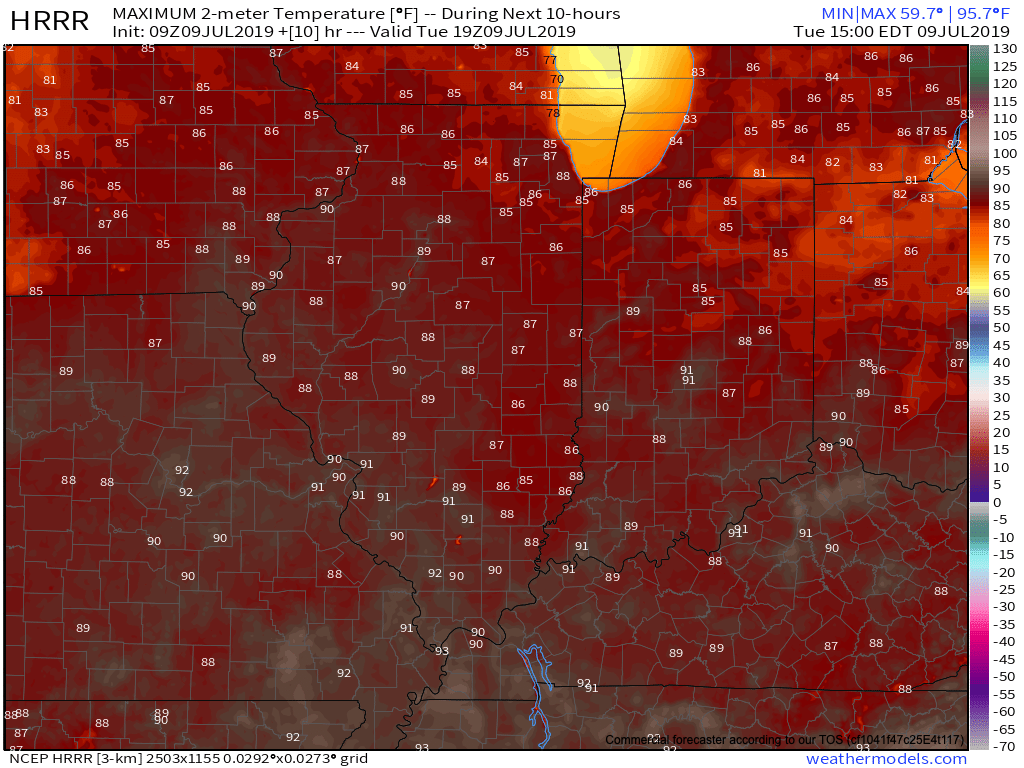
I. Another quiet, pleasant mid-summer day is on tap thanks to high pressure. Though very warm, humidity will remain low today. We should add another 90 degree day to the books later this afternoon.
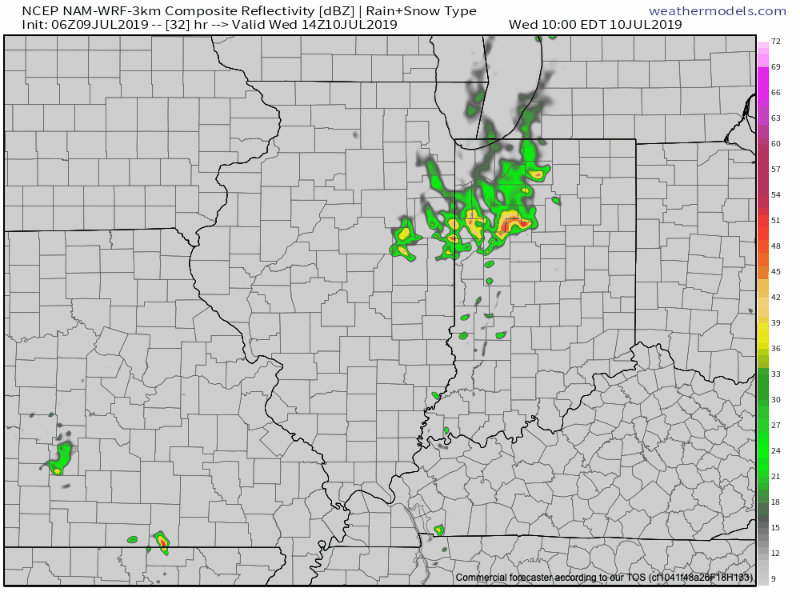
II. A cold front will move into the Ohio Valley Wednesday and we expect a couple of lines of thunderstorms to move across central Indiana during the day. The first line will likely be in a weakening state as it approaches central Indiana around lunchtime tomorrow, however, we expect a second line of showers and t-storms to move through the heart of the state tomorrow evening.
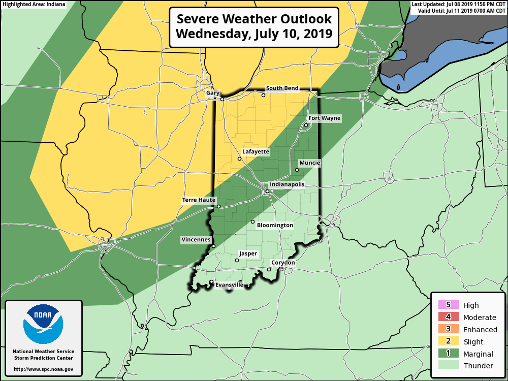
The Storm Prediction Center includes northwest IN in a ‘Slight’ risk of severe weather Wednesday.
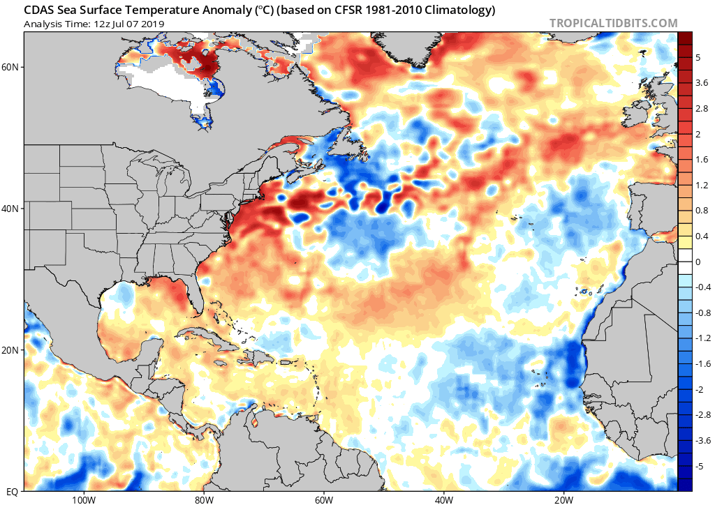
III. While dry conditions (and cooler temperatures) will return here for late week and into the first half of the weekend, all eyes by this time will be centered on soon-to-be Barry. Conditions still seem favorable (sea surface temperatures and upper level wind environment) for a disturbance currently over SW GA to strengthen into a named tropical system over the northern Gulf over the next 24-48 hours.
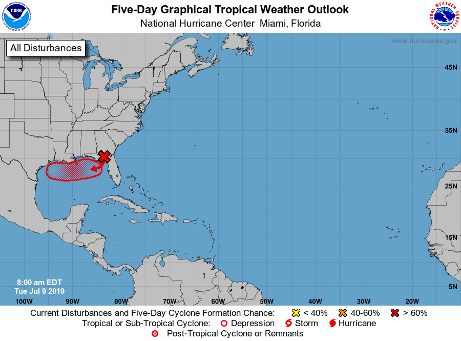
While confidence remains low concerning potential inland impacts from the eventual remnants of Barry (always the case with tropical systems), there seems to be an opportunity for two paths as of now.
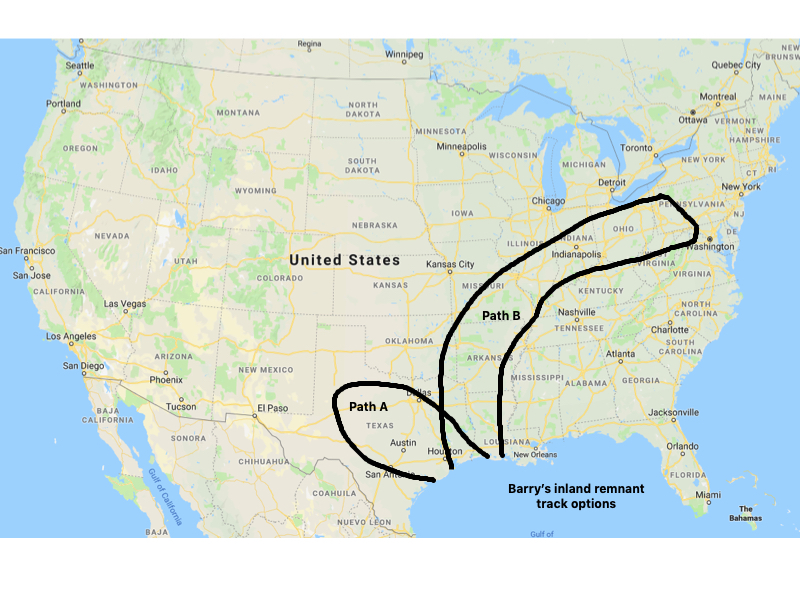
“Path A” would essentially be a scenario where Barry gets trapped under an upper level ridge to the north, resulting in raining himself out over Texas next week. “Path B” would curl Barry north and northeast into the OHV, spreading a swath of heavy tropical rains well inland. Stay tuned.
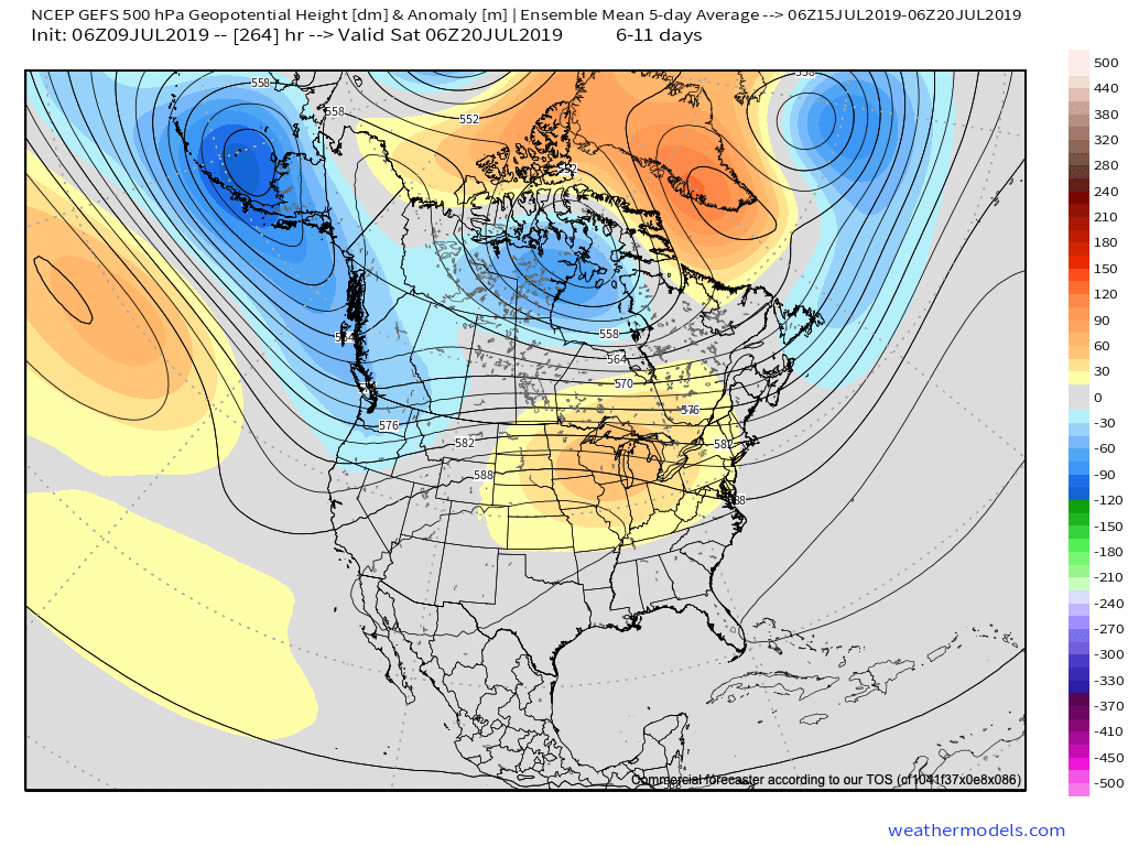
IV. The other headliner will be a return of significant heat next week. While Barry may (or may not) have a say in cooling us down late next week, there will be a renewed stretch of 90 degree warmth that develops Sunday into at least the middle of next week. Longer range data continues to trend hotter and we’ll have a look at the updated European Weeklies later today or Wednesday.
Permanent link to this article: https://indywx.com/tuesday-morning-rambles-potential-tropical-impacts-down-the-road-and-renewed-heatwave-claim-headlines/
Jul 08
VIDEO: #AGwx And Severe Weather Update- What Role Will Soon-To-Be Barry Play Down The Road?
You must be logged in to view this content. Click Here to become a member of IndyWX.com for full access. Already a member of IndyWx.com All-Access? Log-in here.
Permanent link to this article: https://indywx.com/video-agwx-and-severe-weather-update-what-role-will-soon-to-be-barry-play-down-the-road/
Jul 08
VIDEO: Quiet Week Overall; Discussing How The Tropics May Play A Big Role In The 6-10 Day Period…
You must be logged in to view this content. Click Here to become a member of IndyWX.com for full access. Already a member of IndyWx.com All-Access? Log-in here.
Permanent link to this article: https://indywx.com/video-quiet-week-overall-discussing-how-the-tropics-may-play-a-big-role-in-the-6-10-day-period/
Jul 07
Getting To Be That Time Of Year: Major Model Differences Around Tropical Mischief…
A trough of low pressure will continue moving south through the Southeast region (now) and into the northern Gulf (by the early to middle portion of the work week).
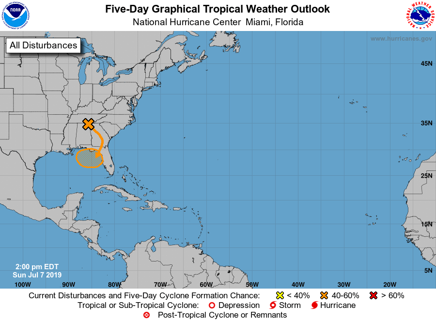
With warmer than average sea surface temperatures across the north-central and northeastern Gulf, along with a favorable upper level wind environment, the potential is present for this disturbed area of weather to strengthen into a tropical depression over the next few days before meandering just off the coastline.
While Gulf Coast beach-goers will need to remain on guard for the threat of more organized unsettled weather during the upcoming period centered on early to mid week, the potential inland impacts are much less certain at this point.
Reviewing the latest midday model guidance shows two different camps:
I. The GFS likes the idea of a heavy inland rain threat impacting the Carolinas (primarily east of the Appalachians) late week and into the weekend.
II. The European forecast model “curls” the area of disturbed weather west. A polar opposite of the GFS solution, the European strengthens the system across the north-central Gulf before bringing potential Barry into LA over the weekend. Thereafter, if this solution proves correct, portions of the OHV (including central Indiana) would deal with rain early next week.
We, obviously, have a long way to go with this set-up, but given the overall upper air pattern we tend to favor more of a GFS solution at this point in time. Needless to say, we’ll keep a very close eye on things over the upcoming few days…
Permanent link to this article: https://indywx.com/getting-to-be-that-time-of-year-major-model-differences-around-tropical-mischief/