
You must be logged in to view this content. Click Here to become a member of IndyWX.com for full access. Already a member of IndyWx.com All-Access? Log-in here.
Category: Client
Permanent link to this article: https://indywx.com/video-dangerous-heat-this-weekend-significant-pattern-change-next-week/
Jul 16
VIDEO: Tropical Downpours Lead To Localized Flooding Later Today; Heat Gives Way To A Much Cooler Pattern…
You must be logged in to view this content. Click Here to become a member of IndyWX.com for full access. Already a member of IndyWx.com All-Access? Log-in here.
Permanent link to this article: https://indywx.com/video-tropical-downpours-lead-to-localized-flooding-later-today-heat-gives-way-to-a-much-cooler-pattern/
Jul 15
Barry’s Moisture Arrives; Dangerous Heat Builds And More On The Cool Pattern To Close The Month…
The remnant circulation of what at one time was Hurricane Barry is over north-central Arkansas and south-central Missouri as of Monday evening.
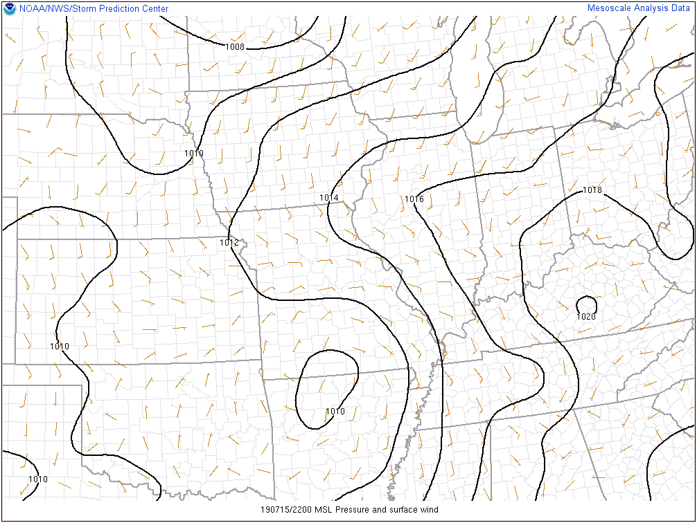
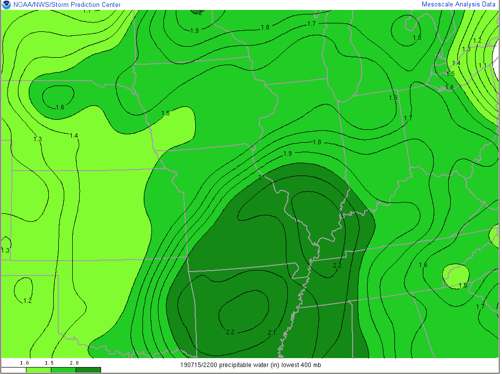
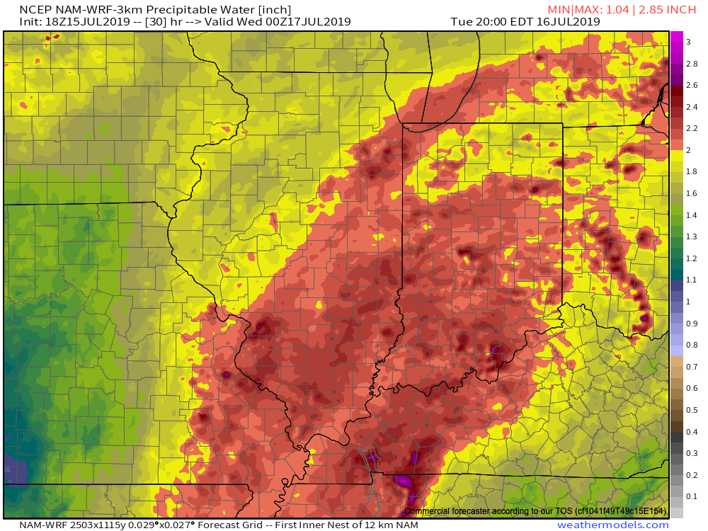
As you might imagine, this is helping pull juicy tropical air northbound. Note precipitable water values are exceeding 2″ now as far north as central Illinois and southwestern Indiana.
Rich, tropical air will continue to surge north and spread over central Indiana tonight and Tuesday. While we still don’t anticipate a widespread uniform soaking rain across central parts of the state, this will help lead to locally heavy downpours in scattered fashion over the upcoming 24-36 hours.
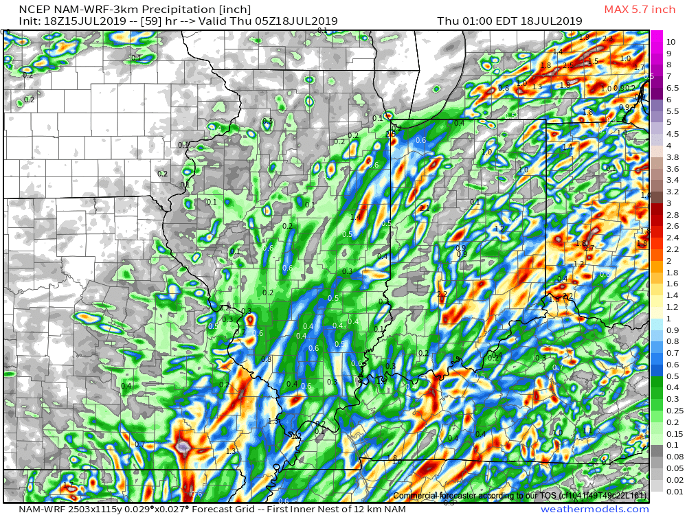
In general, we still think most central Indiana rain gauges will accumulate between 0.50″ and 1″ of rain as Barry’s remnant moisture scoots across the state. That said, there will be locally heavier totals. Latest data continues to not only hint at these heavier totals being located across southeast portions of the state, but perhaps across northwest Indiana, as well.
Once we dry things out (through the day Wednesday) the big story will become the heat and humidity. A 5-day stretch of dangerously hot, humid conditions will claim headlines during the period Thursday through Monday, featuring overnight lows between 75-80 and daytime highs in the lower to middle 90s.
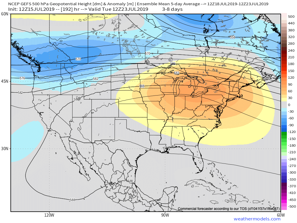
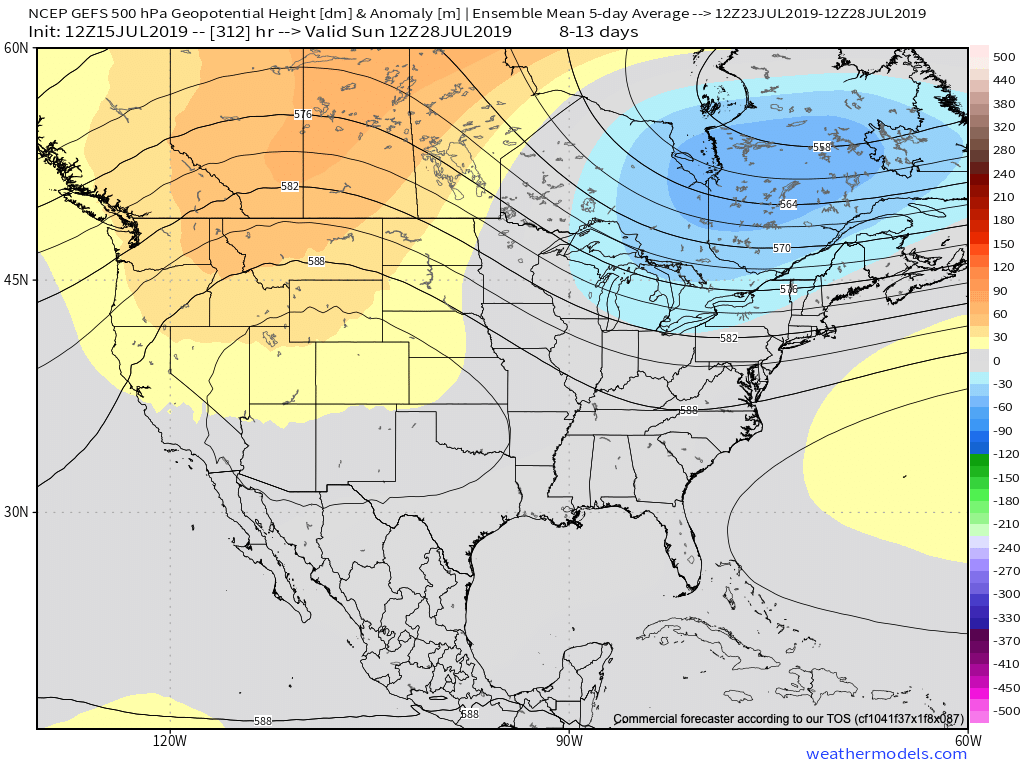
Thankfully, there are drivers that will result in a rather significant pattern change by early parts of next week. A “game changer” of a cold front is expected to sweep across the Ohio Valley Sunday into Monday with gusty storms followed by much cooler conditions as we head into Week 2. These cooler temperatures are expected to carry the day as we put a wrap on the month of July. We’ll replace highs in the lower to middle 90s with upper 70s to lower 80s and overnight lows in the upper 50s to lower 60s for the better part of the late month stretch.
Permanent link to this article: https://indywx.com/barrys-moisture-arrives-dangerous-heat-builds-and-more-on-the-cool-pattern-to-close-the-month/
Jul 14
Weekly #AGwx And Severe Weather Outlook…
Forecast period: 07.14.19 through 07.21.19
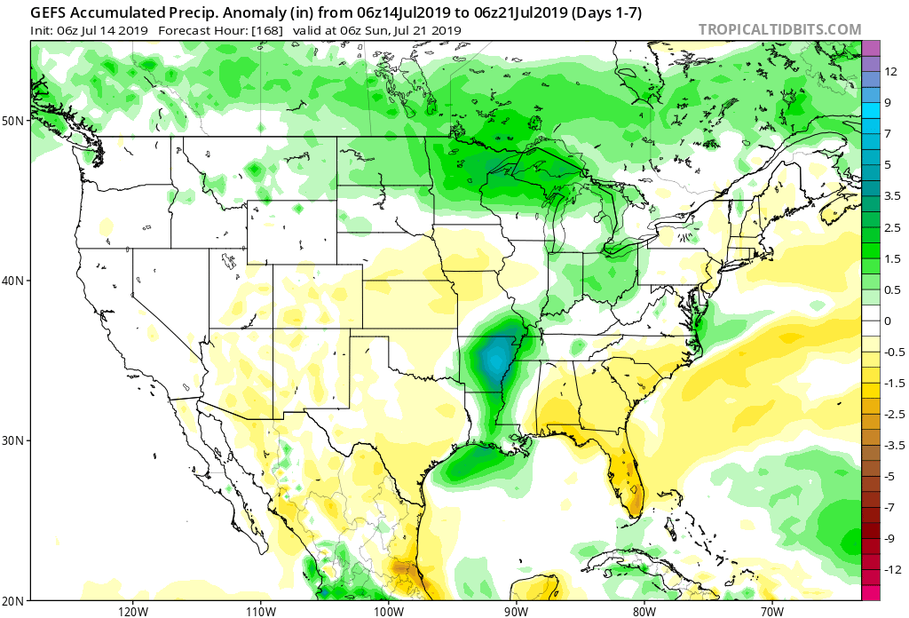
7-Day Precipitation: Rainfall is expected to run near to slightly above average through the period.
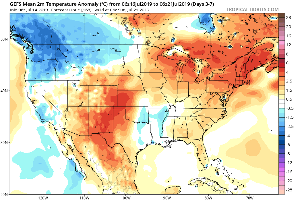
7-Day Temperature Outlook: Temperatures are expected to run well above average by the end of the period.
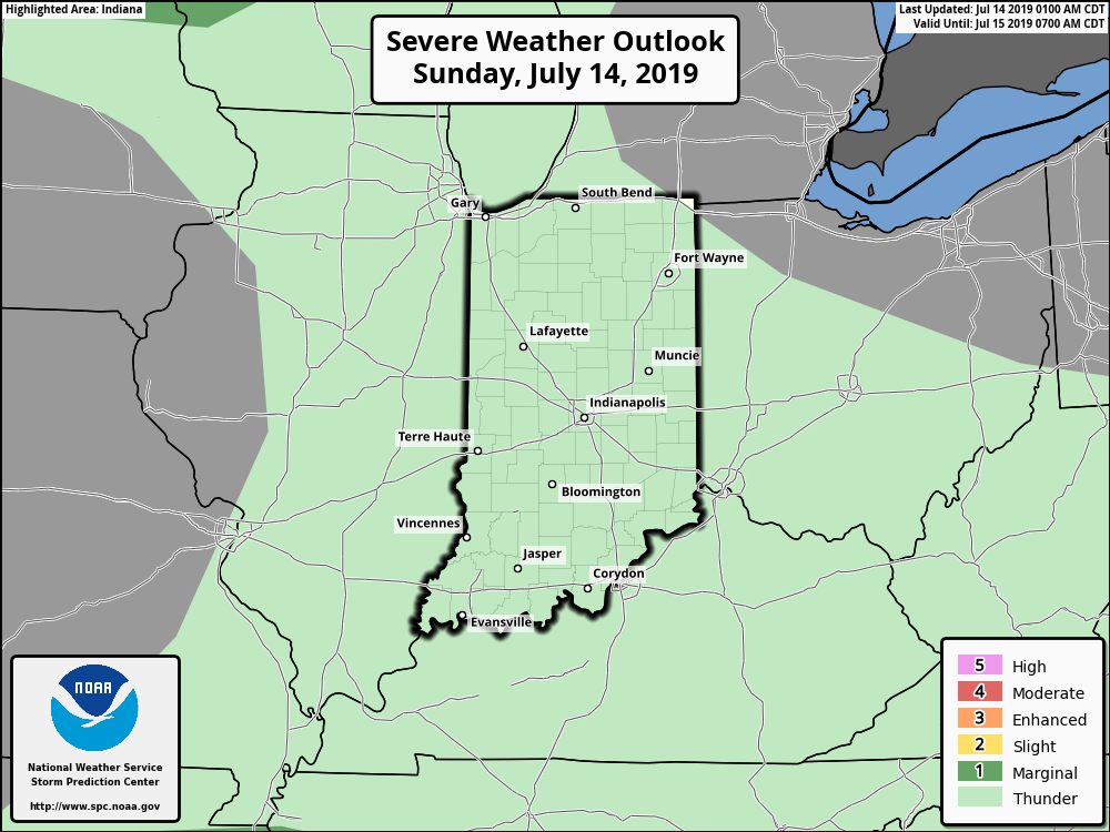
Severe Outlook: While widespread, organized severe weather isn’t expected through the forecast period, a couple isolated strong to severe cells are possible this afternoon (large hail is the primary concern, along with downburst wind potential). Additionally, we’ll also keep an eye on the threat of thunderstorm complexes riding southeast through the state late in the period- towards next weekend.
Summary: The story early in the forecast period will be Barry’s remnant moisture moving north and northeast across the Ohio Valley early in the work week. While we’re not expecting excessive rain across central Indiana, rain chances will be on the increase Monday through Wednesday. Thereafter, heat and humidity will be the story as a ridge of high pressure expands over the region. Dangerous heat and humidity is in store, including highs in the middle 90s and lows of 75-80 degrees into next weekend.
Permanent link to this article: https://indywx.com/weekly-agwx-and-severe-weather-outlook-6/
Jul 13
VIDEO: What Does The 2nd Half Of July Have In Store?
You must be logged in to view this content. Click Here to become a member of IndyWX.com for full access. Already a member of IndyWx.com All-Access? Log-in here.
Permanent link to this article: https://indywx.com/video-what-does-the-2nd-half-of-july-have-in-store/