Category: Client

Stormy At Times For The Indy 500…

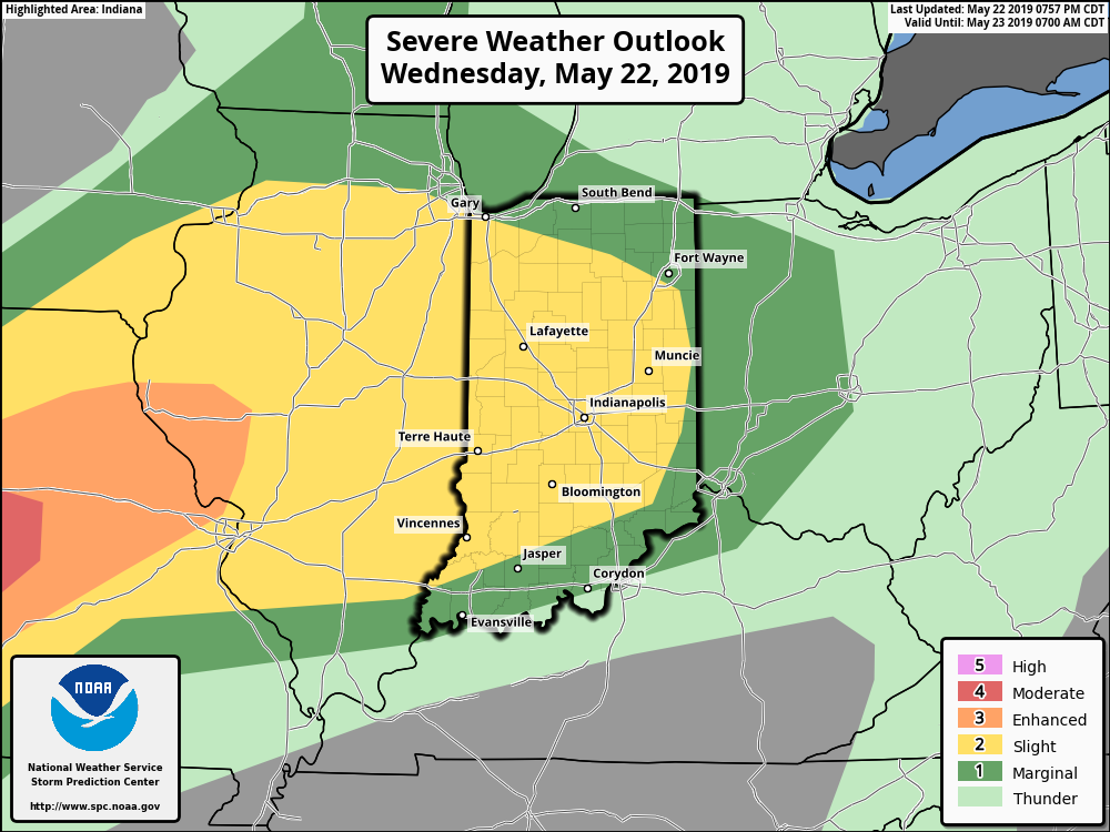
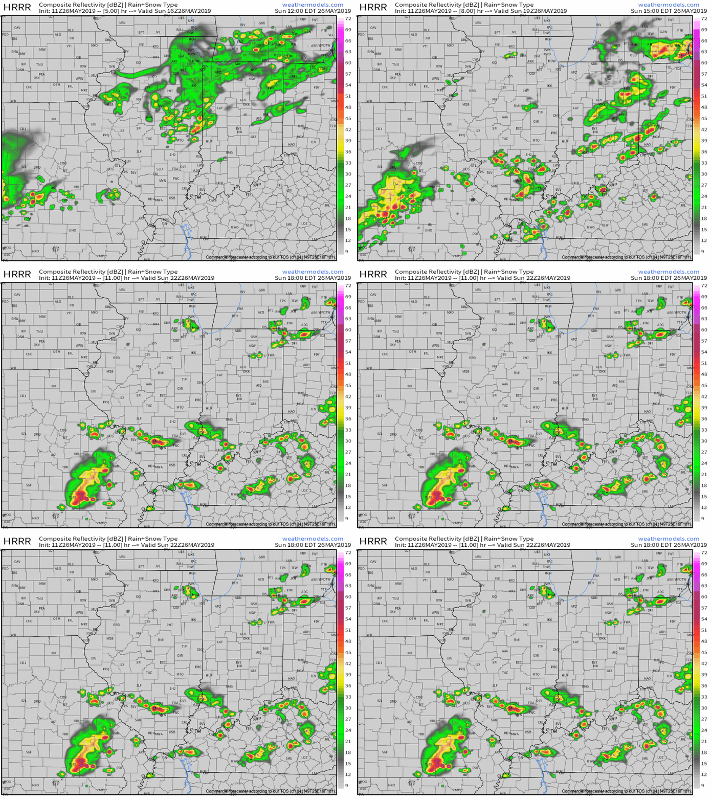
We’ve dealt with one round of showers and thunderstorms already this morning, but the bulk of the action remained north of the immediate area. Accordingly, there will be a greater chance of redevelopment this afternoon across central Indiana. A few of these storms could reach strong to severe levels with damaging winds and large hail the primary concern.

Don’t be surprised if future updates from the Storm Prediction Center (SPC) “pull” this Slight Risk area northward to include Indianapolis. Regardless, the ingredients are in place for a couple of severe cells this afternoon, locally, and it’ll be important to remain weather-aware.

While a shower is still possible this morning, thunderstorm coverage will likely increase in earnest between 1p and 4p. Locally heavy downpours and vivid lightning are a good bet with any storm that develops today.
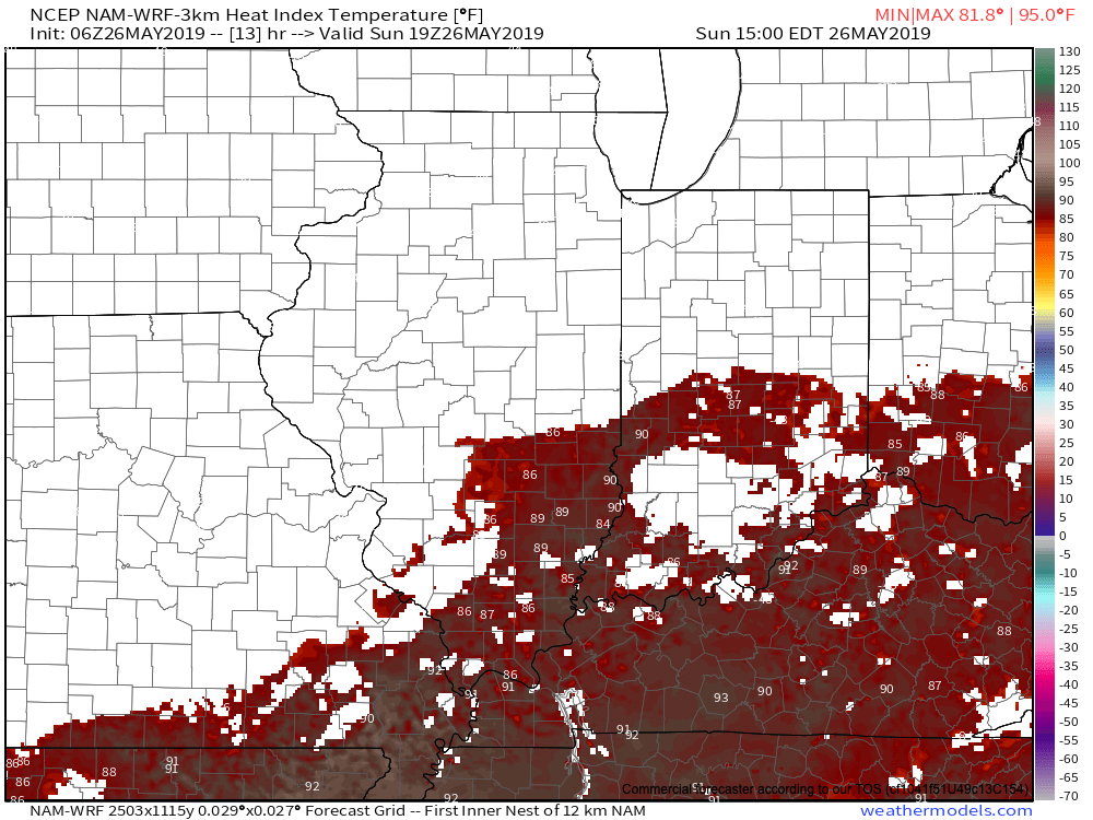
The other item race goers will have to deal with today will be the heat and humidity. Heat indices will flirt with 90 out at the track this afternoon.
Another active day is dialed up for Memorial Day, itself, across portions of the state. More on this and beyond in another update later today.

Permanent link to this article: https://indywx.com/2019/05/26/stormy-at-times-for-the-indy-500/

VIDEO: #Indy500 Update And #AGwx Report…

You must be logged in to view this content. Click Here to become a member of IndyWX.com for full access.  Already a member of IndyWx.com All-Access?  Log-in here.

Permanent link to this article: https://indywx.com/2019/05/25/video-indy500-update-and-agwx-report/

VIDEO: Detailed Short-Term Analysis Of Storm Threats; Discussing The Long Range Pattern Into The 1st Half Of June…

You must be logged in to view this content. Click Here to become a member of IndyWX.com for full access.  Already a member of IndyWx.com All-Access?  Log-in here.

Permanent link to this article: https://indywx.com/2019/05/25/video-detailed-short-term-analysis-of-storm-threats-discussing-the-long-range-pattern-into-the-1st-half-of-june/

VIDEO: Hot, Humid Start To Memorial Day Weekend; Unsettled Into Next Week…

You must be logged in to view this content. Click Here to become a member of IndyWX.com for full access.  Already a member of IndyWx.com All-Access?  Log-in here.

Permanent link to this article: https://indywx.com/2019/05/24/video-hot-humid-start-to-memorial-day-weekend-unsettled-into-next-week/

VIDEO: Short-Term Update; Timing Storms Out Into Next Week…

You must be logged in to view this content. Click Here to become a member of IndyWX.com for full access.  Already a member of IndyWx.com All-Access?  Log-in here.

Permanent link to this article: https://indywx.com/2019/05/23/video-short-term-update-timing-storms-out-into-next-week/

Strong Storms Rumble In Later This Morning…

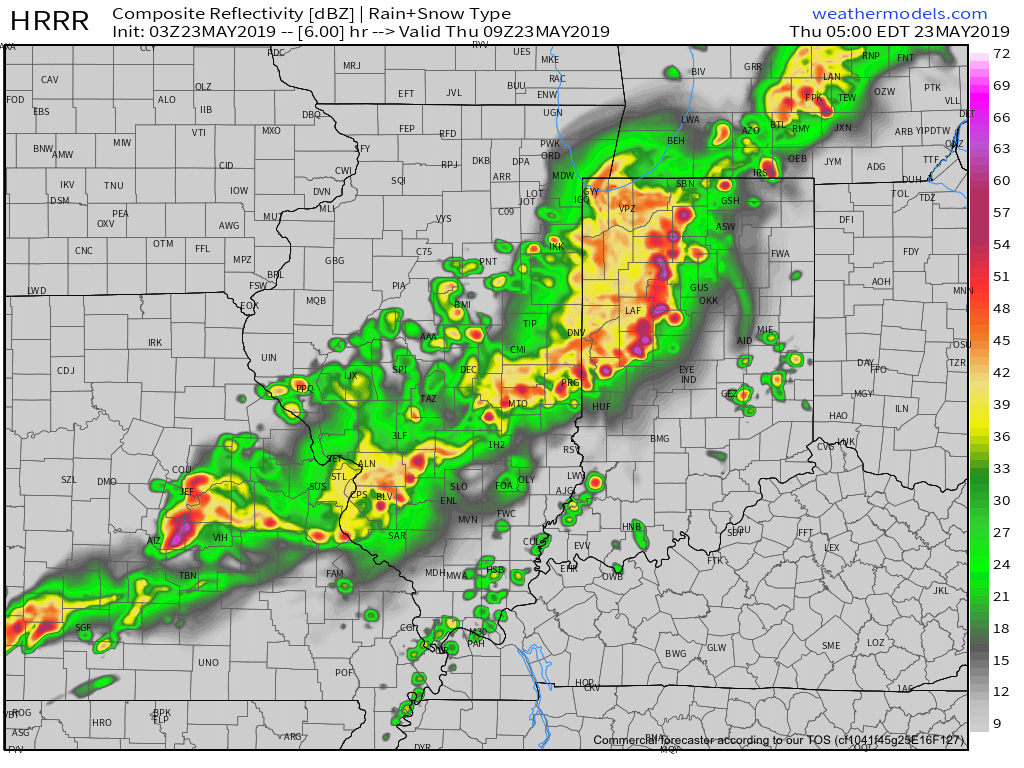
It’s quiet on the home front just after midnight, but that will begin to change in a significant manner as we push through the predawn hours. Strong and severe thunderstorms are ongoing to our west early this morning and the environment should support these storms to remain rather potent pushing into central Indiana between 3a and 5a.

The primary concern with these storms will be damaging winds and localized torrential downpours. Some neighborhoods could very well pick up a quick 1” in less than an hour. Vivid lightning can also be expected. Most of the storms should push south and east of the city after the morning rush.

We’ll have a fresh video update in a few hours.

Permanent link to this article: https://indywx.com/2019/05/23/strong-storms-rumble-in-later-this-morning/

Prolonged Unsettled Stretch Of Weather…

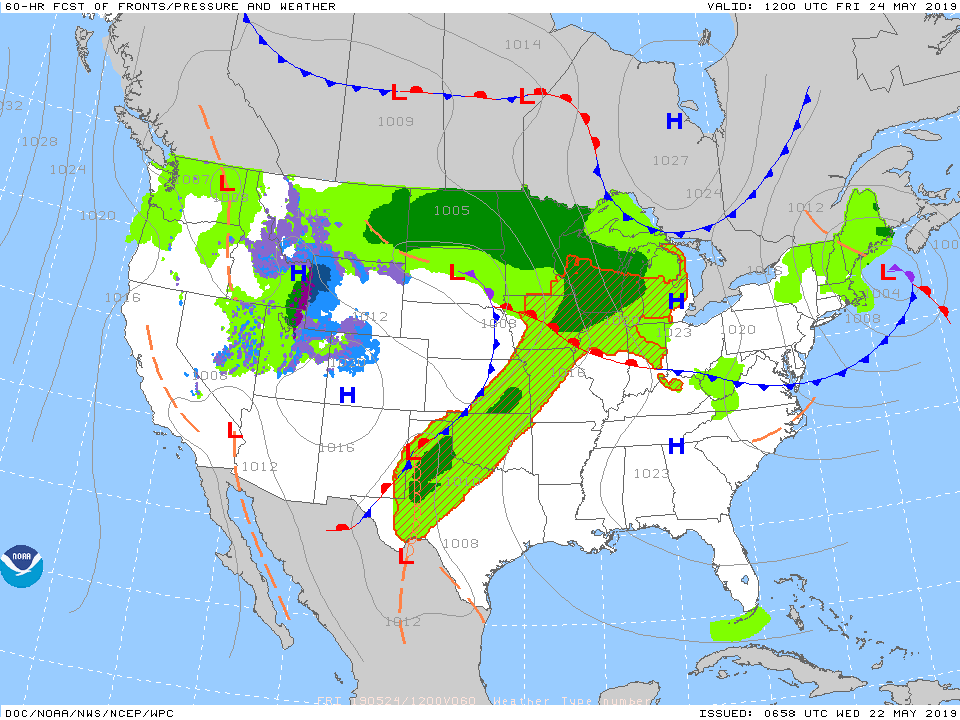
Yesterday was only the beginning of a renewed prolonged stretch of unsettled and stormy weather. A series of fronts will make a move towards the OHV only to stall out and lift north back as a warm front over the upcoming 7-day period. The end result? An extended stretch of wet, stormy conditions.

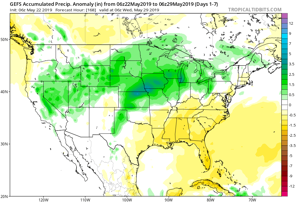
Rainfall amounts will run above normal over the upcoming 7-day period.

Get used to the setup above with a stalled front nearby and waves of low pressure moving along the associated boundaries from time to time. As these ripples of energy scoot along the front, more enhanced showers and thunderstorms can be expected.

It’s still tough from this distance to say with certainty which day(s) will offer up the most widespread shower and thunderstorm coverage in this pattern, but we continue to lean towards Saturday into Sunday. Stay tuned.

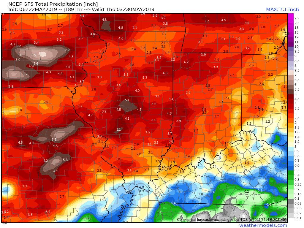
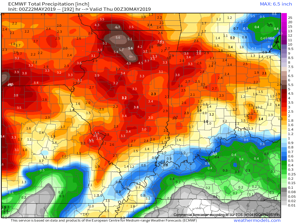
Models agree on widespread 1.5″ to 2.5″ rainfall totals over the upcoming week with locally heavier amounts.

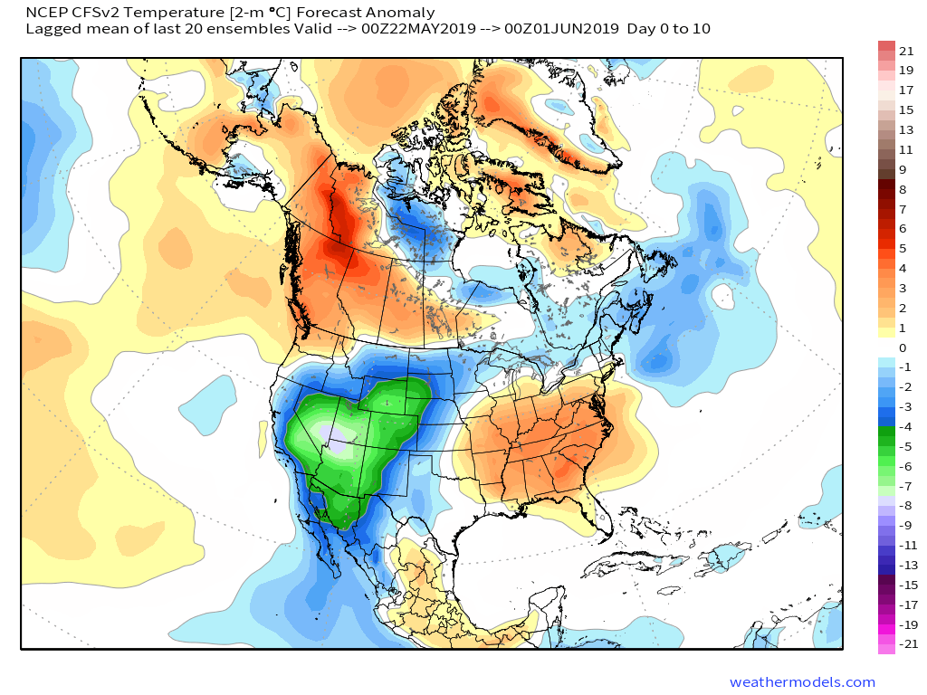
Conditions will also return to a warmer than normal theme into the middle of next week. At times, conditions will become oppressive (depending on which side of the front you find yourself on). If heading to the track, ensure you have means to remain cool and pack the rain gear just to be safe!

More later tonight on the long range, including a video recap of our Summer Outlook.

Permanent link to this article: https://indywx.com/2019/05/22/prolonged-unsettled-stretch-of-weather/

VIDEO: Tuesday Evening Rambles…

You must be logged in to view this content. Click Here to become a member of IndyWX.com for full access.  Already a member of IndyWx.com All-Access?  Log-in here.

Permanent link to this article: https://indywx.com/2019/05/21/video-tuesday-evening-rambles/

VIDEO: Timing Rain Chances Out Into Midweek; Cool Pattern To Close May And Open June…

You must be logged in to view this content. Click Here to become a member of IndyWX.com for full access.  Already a member of IndyWx.com All-Access?  Log-in here.

Permanent link to this article: https://indywx.com/2019/05/21/video-timing-rain-chances-out-into-midweek-cool-pattern-to-close-may-and-open-june/

More Reason To Be Concerned With Overall Wet Pattern Long-Term…

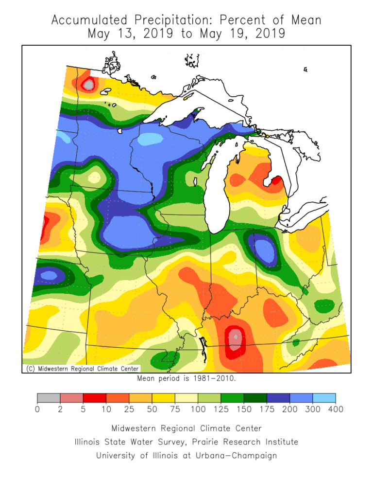
The month of May, though still active at times, has provided drier than normal conditions across a good chunk of the state. Officially, we’re (IND) running around half an inch below normal, month-to-date.

Precipitation departures from normal over the past week and month-to-date can be found below. Note the drier conditions, especially across the southern half of the state. Meanwhile, northern Indiana remains wetter then normal.

Unfortunately, a return of wet times looks likely. Latest data into the forecast office this evening, including the European Weeklies hot off the press, would suggest above normal rainfall can be expected for late-May, June, and a good portion of the summer for that matter.

There’s reason to believe this data is correct when we look at the latest MJO forecast. Note the MJO is expected to roll out of Phase 1 and into Phase 2 late-May and early-June- and potentially Phase 3 a bit later. Not only does this suggest the wet regime should pick back up in earnest across central Indiana, but also that the pattern will trend cooler (after what will be a hot and sultry stretch the 2nd half of this week into early portions of Week 2. The latest European Weeklies go right to this look for June, including a cooler than normal month overall.

Updated model data tonight still says a weak El Nino will continue through summer and this, too, argues for a wetter and cooler than average flavor to the 2019 Summer.

Permanent link to this article: https://indywx.com/2019/05/20/more-reason-to-be-concerned-with-overall-wet-pattern-long-term/

IndyWx.com