Category: Client

Early August Ideas…

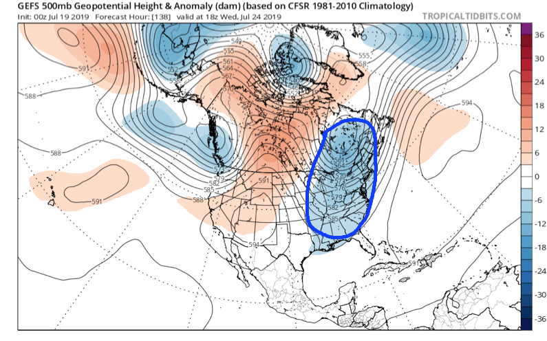
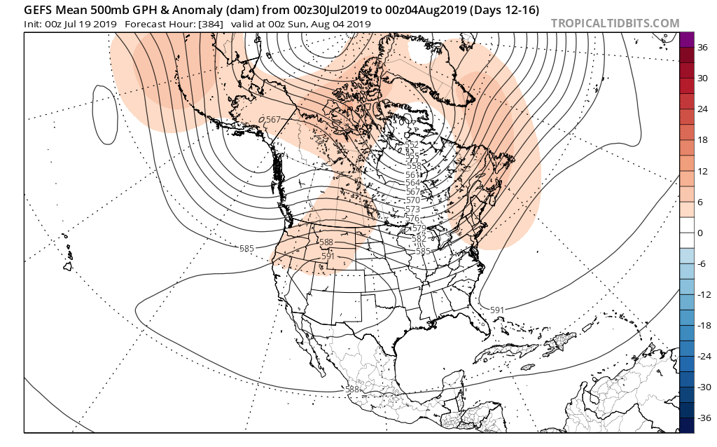
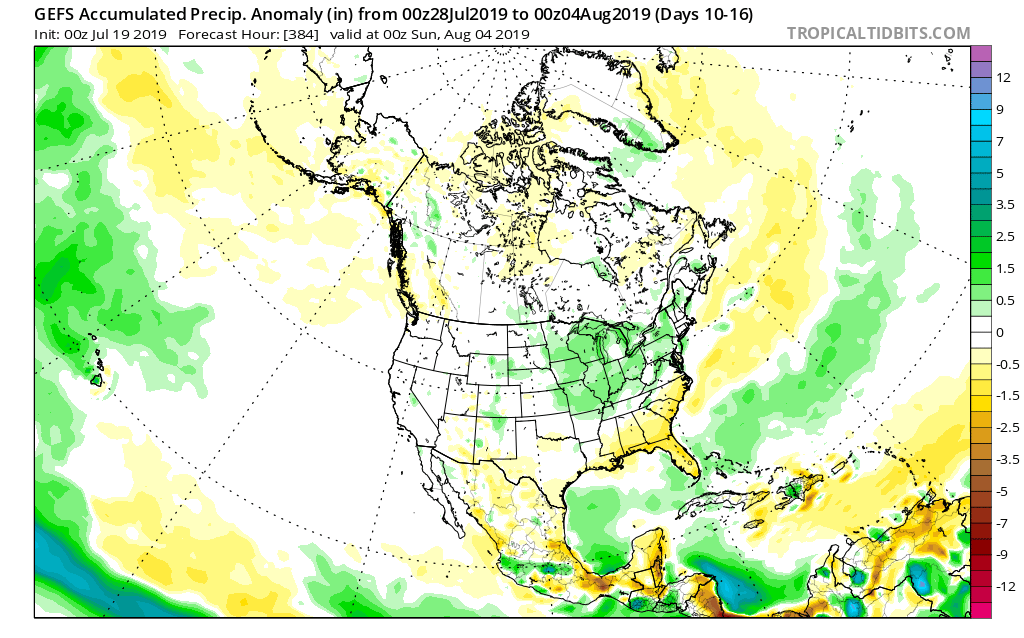
The year continues to fly by! We’re now finalizing our forecast for the last month of meteorological summer and will include a look-ahead to our early fall ideas with the official August Outlook that hits the site later next week. With that said, here are some of our early August ideas:

I. Sea surface temperatures remain well above average through the western Atlantic basin as well as the northeastern Pacific. This should promote warmer than normal conditions, overall, along the coastal areas. Additionally, we’ll need to continue to keep a close eye on the potential of additional “home grown” (Gulf of Mexico and off the southeast US coast) tropical development as we move closer to the peak of the hurricane season.
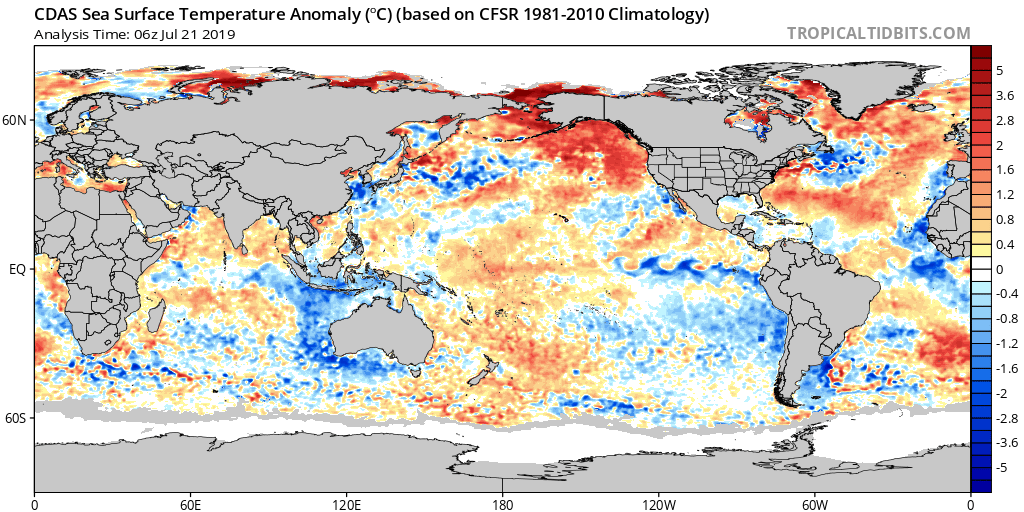
II. The MJO isn’t nearly as hyper as months past. While we’ll continue to keep a close eye on things, we currently don’t anticipate being able to lean on this tool as a good indicator for what may transpire through the month of August (at least early on).

III. We need to keep a very close eye on the EPO over the upcoming week to see if modeling continues to project a significantly negative phase into August. This can “up the ante” for a cooler than normal central US during August if so.

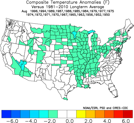
IV. Lack of widespread drought/ dryness. The wet spring and early summer really can help make an impact longer term and that has been seen as early as this week (added humidity with the heat wave), but also helps overall when it comes to late summer and the respect to the staying power, or longevity, of heat waves.

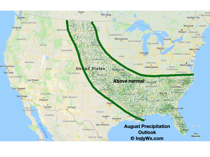
Here’s our early thinking with respect to August temperatures and precipitation. Again, our final, more detailed, outlook will be issued next week!

Permanent link to this article: https://indywx.com/2019/07/21/early-august-ideas/

VIDEO: Big Changes On Deck; Looking Into August…

You must be logged in to view this content. Click Here to become a member of IndyWX.com for full access.  Already a member of IndyWx.com All-Access?  Log-in here.

Permanent link to this article: https://indywx.com/2019/07/20/video-big-changes-on-deck-looking-into-august/

Weekly #AGwx And Severe Weather Outlook…

Forecast period: 07.21.19 through 07.28.19

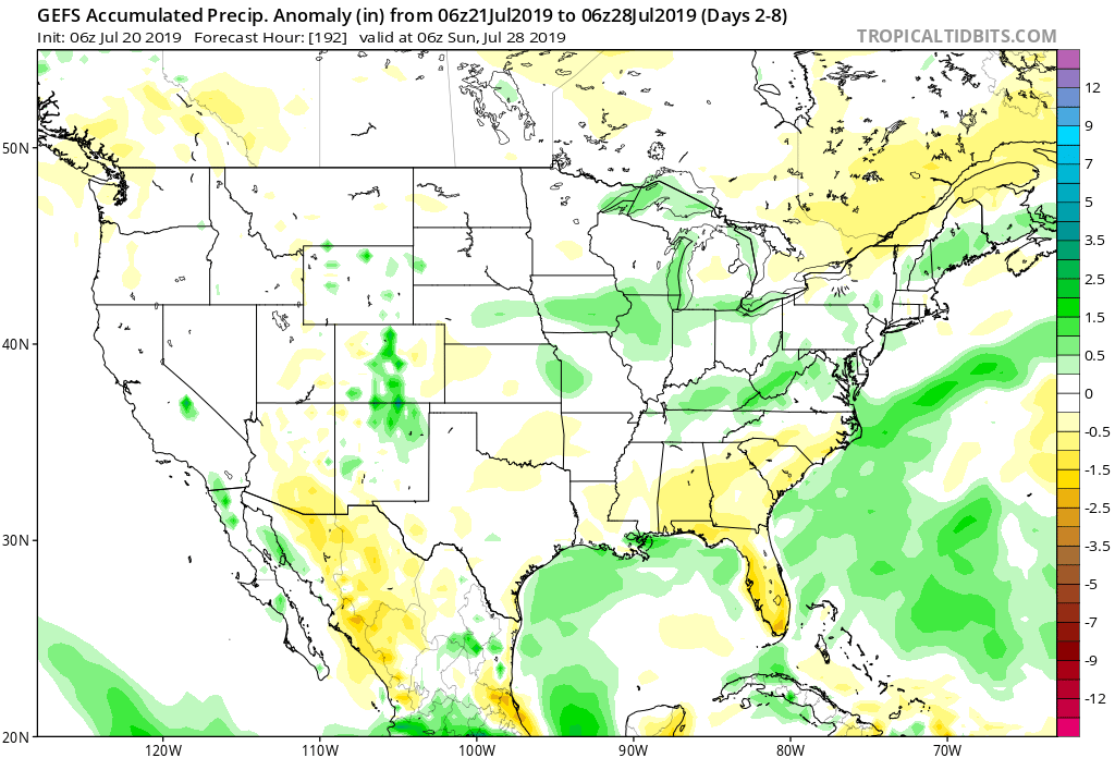
7-Day Precipitation: Rainfall is expected to run near average through the period.

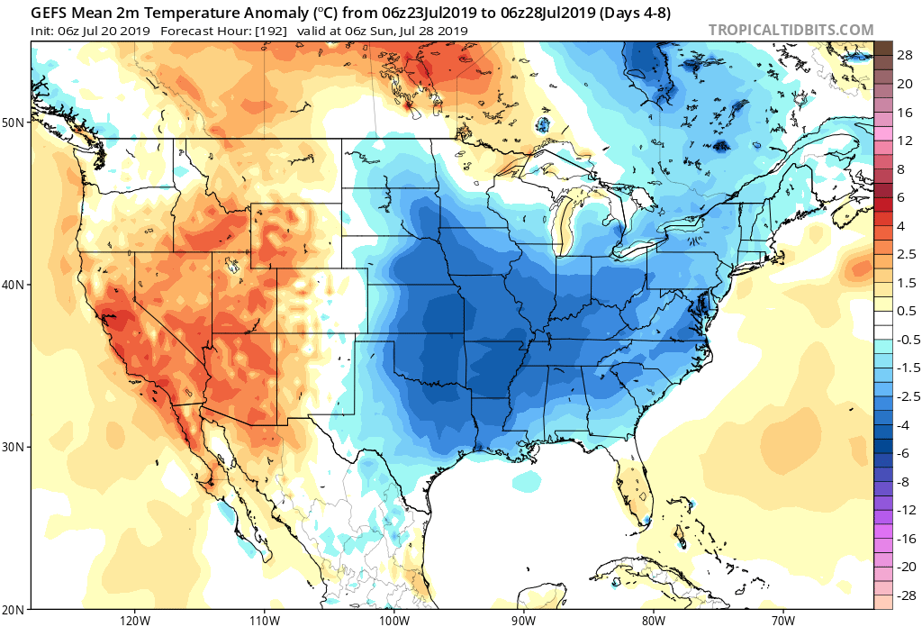
7-Day Temperature Outlook: Temperatures are expected to run below average through the forecast period.

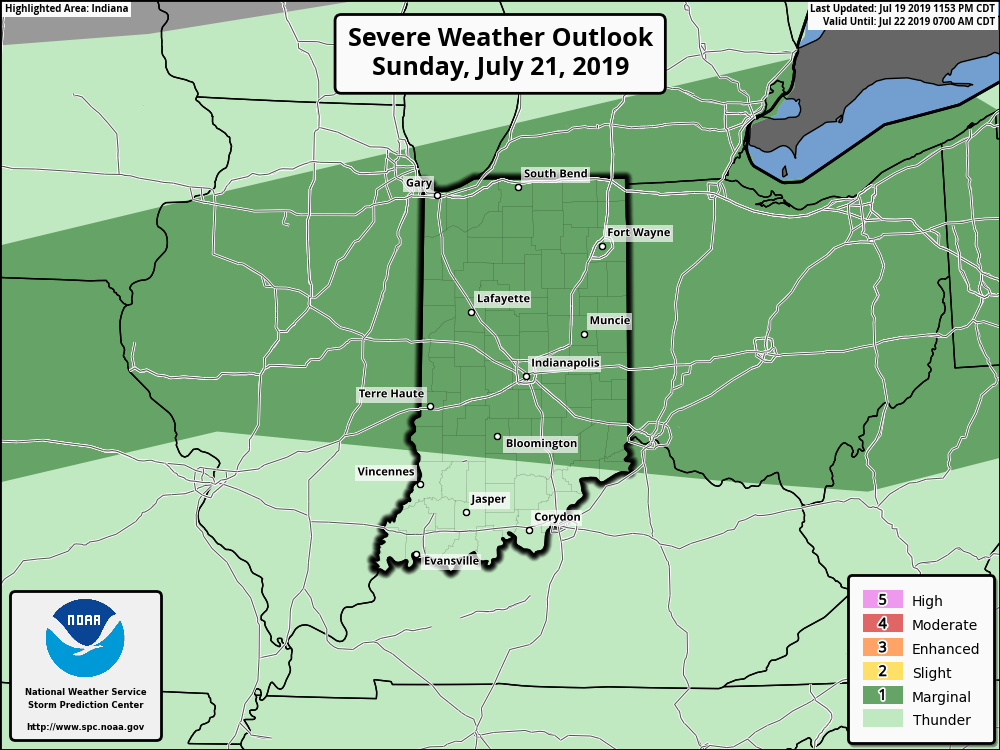
Severe Outlook: A strong cold front will slice into the unusually hot and humid air tomorrow afternoon and likely spark an increase in overall thunderstorm coverage. A few storms may become severe with large hail and damaging winds. Otherwise, after Sunday, severe weather isn’t expected through the remainder of the forecast period.

Summary: Hang in there, friends. Today will be the last ridiculously hot and humid day before we start to note relief. Sunday will still be hot and plenty humid, but will be the start of a cooler regime that will take hold in earnest by early parts of the work week. Before that, a cold front will spark scattered to numerous thunderstorms Sunday afternoon and evening and a few of these could become strong to severe. Linger upper level energy will keep shower chances in our forecast Tuesday with the much cooler temperatures. As we look forward, the next organized chance of rain and thunderstorms will come next weekend as another cold front sweeps through the Ohio Valley along with reinforcing pleasantly cool air behind the boundary.

Permanent link to this article: https://indywx.com/2019/07/20/weekly-agwx-and-severe-weather-outlook-7/

Dangerously Hot Now, But We’re Talking About An Entirely Different Weather Pattern To Close July And Open August…

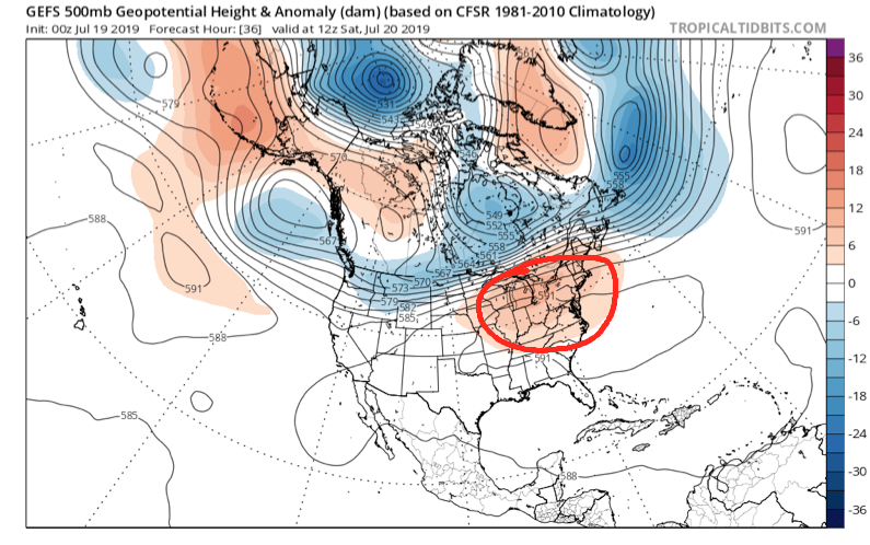
Over the weekend we’ll bake in some of the hottest and most humid air we’ve dealt with around these parts since 2012, however big relief is on the horizon.

We’ll get rid of the expansive upper level ridge responsible for the heat this weekend and replace it with a significant trough (at least by late summer standards).

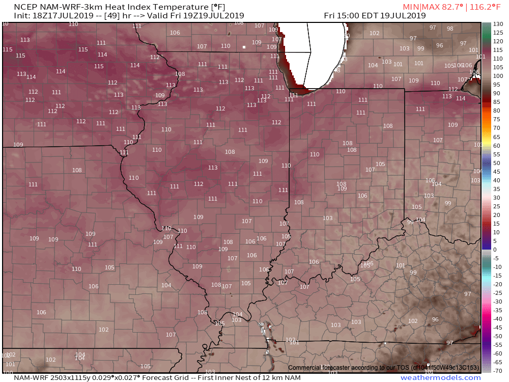
Weekend heat and humidity will be about as bad as it can get around central Indiana. It’ll be important to build in frequent breaks indoors if you have any sort of lengthy outdoor activities planned.
A major pattern flip will result in unseasonably cool and refreshing air next week.

A strong cold front will sweep through the Ohio Valley Sunday and Monday with increasing coverage of showers and thunderstorms (a few may be strong). It’s this front that will help usher in the refreshing changes for next week. We’ll go from heat indices between 104-108 this weekend to overnight lows in the upper 50s to lower 60s at times next week. Ahhhhhh….

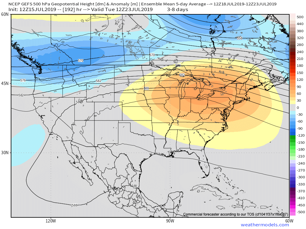
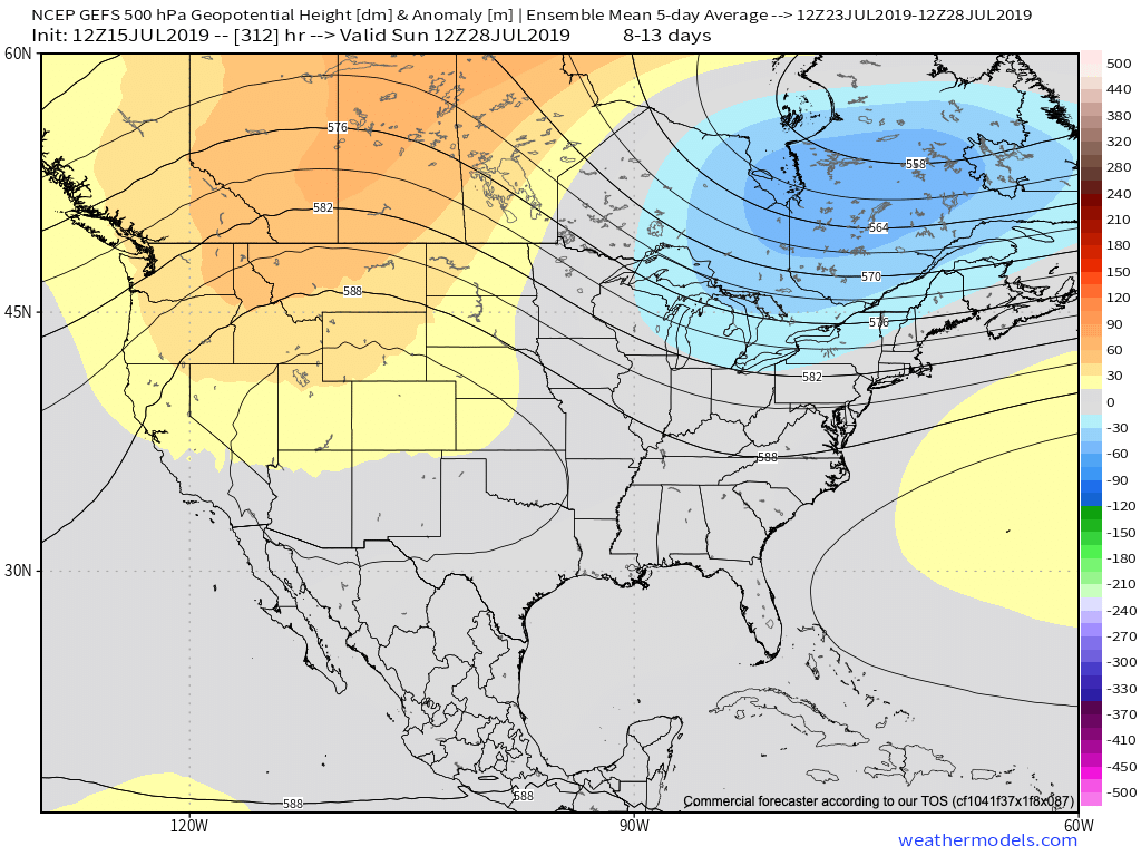
As we look ahead to early August, there’s certain to be additional warm-hot days, however, the mean pattern doesn’t look to promote any sort of sustained significant heat through the early portion of the month. Perhaps the most interesting item showing up on the longer range guidance (EPS and GEFS) is a return of a northwesterly flow aloft and the potential of a wetter regime building in as we traverse the early August period.

Hang in there, the reward on the other side of the weekend will be worth it with cool, Canadian air flowing south.

Permanent link to this article: https://indywx.com/2019/07/19/dangerously-hot-now-but-were-talking-about-an-entirely-different-weather-pattern-to-close-july-and-open-august/

VIDEO: Keeping An Eye On Storms To Our Northwest This Morning; Pattern Change On Deck Next Week…

You must be logged in to view this content. Click Here to become a member of IndyWX.com for full access.  Already a member of IndyWx.com All-Access?  Log-in here.

Permanent link to this article: https://indywx.com/2019/07/18/video-keeping-an-eye-on-storms-to-our-northwest-this-morning-pattern-change-on-deck-next-week/

“Sneaky” Storms Precede Dangerous Heat…

As we prepare for the hottest air of the summer, we’ll have to remain on guard for the potential of thunderstorms impacting at least a part of the state Thursday morning.

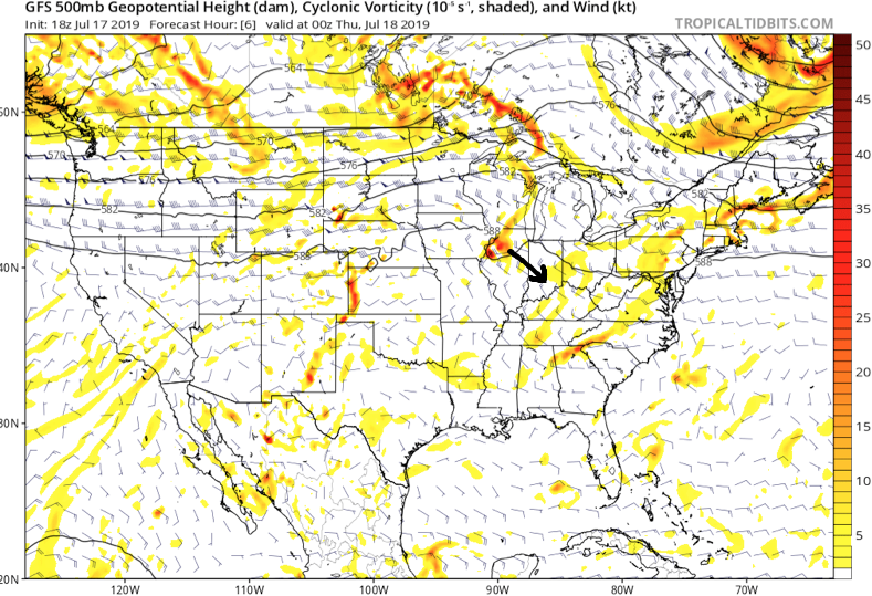
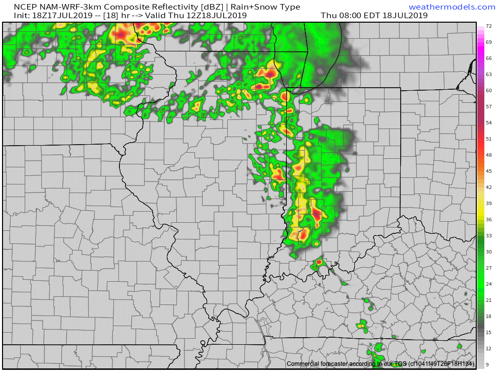
Upper level energy will track southeast into the state late tonight and early Thursday and combine with just enough energy to allow thunderstorms that should develop during the overnight (across southern WI and northern IL) to track into western Indiana during the predawn hours. (It should be pointed out this is separate from the convection that is currently resulting in warnings across MO and IL- as of 6:20p eastern time). Thereafter, these storms are expected to rumble into central Indiana in a weakening format around the morning rush Thursday.

Upper level energy will likely result in a weakening complex of storms pushing into central IN Thursday morning.
Forecast radar at 8a Thursday.

Thereafter, the big story will be the high heat and humidity that will lead to truly dangerous conditions across central Indiana beginning tomorrow afternoon into Sunday. Heat indices will top out between 100-105 each afternoon and in some cases a few degrees higher. It’ll be important to build in frequent breaks inside and drink plenty of water. Most, if not all, neighborhoods can expect to remain rain-free through the first half of the weekend (after we deal with our Thursday morning storms).

Thankfully, we still are forecasting a “game changer” of a cold front to plow through the region late Sunday and early Monday with storms (a few could be severe) followed by a much cooler and more refreshing air mass next week.

This is likely the first of a couple of cold fronts that will pass through the region between now and the end of the month, ensuring we wrap up July seasonal to cooler than average.

Permanent link to this article: https://indywx.com/2019/07/17/sneaky-storms-precede-dangerous-heat/

VIDEO: Dangerous Heat This Weekend; Significant Pattern Change Next Week…

You must be logged in to view this content. Click Here to become a member of IndyWX.com for full access.  Already a member of IndyWx.com All-Access?  Log-in here.

Permanent link to this article: https://indywx.com/2019/07/17/video-dangerous-heat-this-weekend-significant-pattern-change-next-week/

VIDEO: Tropical Downpours Lead To Localized Flooding Later Today; Heat Gives Way To A Much Cooler Pattern…

You must be logged in to view this content. Click Here to become a member of IndyWX.com for full access.  Already a member of IndyWx.com All-Access?  Log-in here.

Permanent link to this article: https://indywx.com/2019/07/16/video-tropical-downpours-lead-to-localized-flooding-later-today-heat-gives-way-to-a-much-cooler-pattern/

Barry’s Moisture Arrives; Dangerous Heat Builds And More On The Cool Pattern To Close The Month…

The remnant circulation of what at one time was Hurricane Barry is over north-central Arkansas and south-central Missouri as of Monday evening.

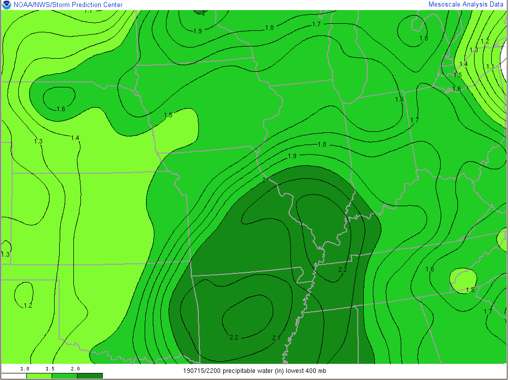
As you might imagine, this is helping pull juicy tropical air northbound. Note precipitable water values are exceeding 2″ now as far north as central Illinois and southwestern Indiana.

Rich, tropical air will continue to surge north and spread over central Indiana tonight and Tuesday. While we still don’t anticipate a widespread uniform soaking rain across central parts of the state, this will help lead to locally heavy downpours in scattered fashion over the upcoming 24-36 hours.

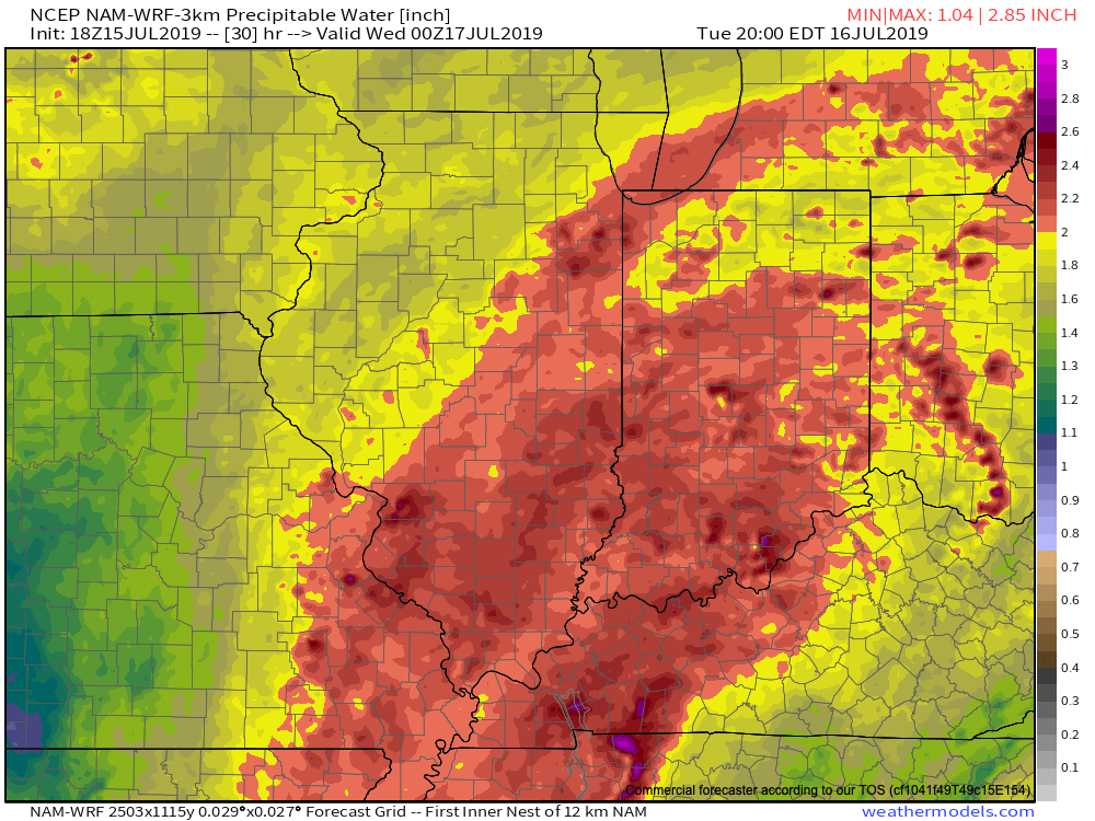
Precipitable water values will exceed 2″ Tuesday across most of the state.

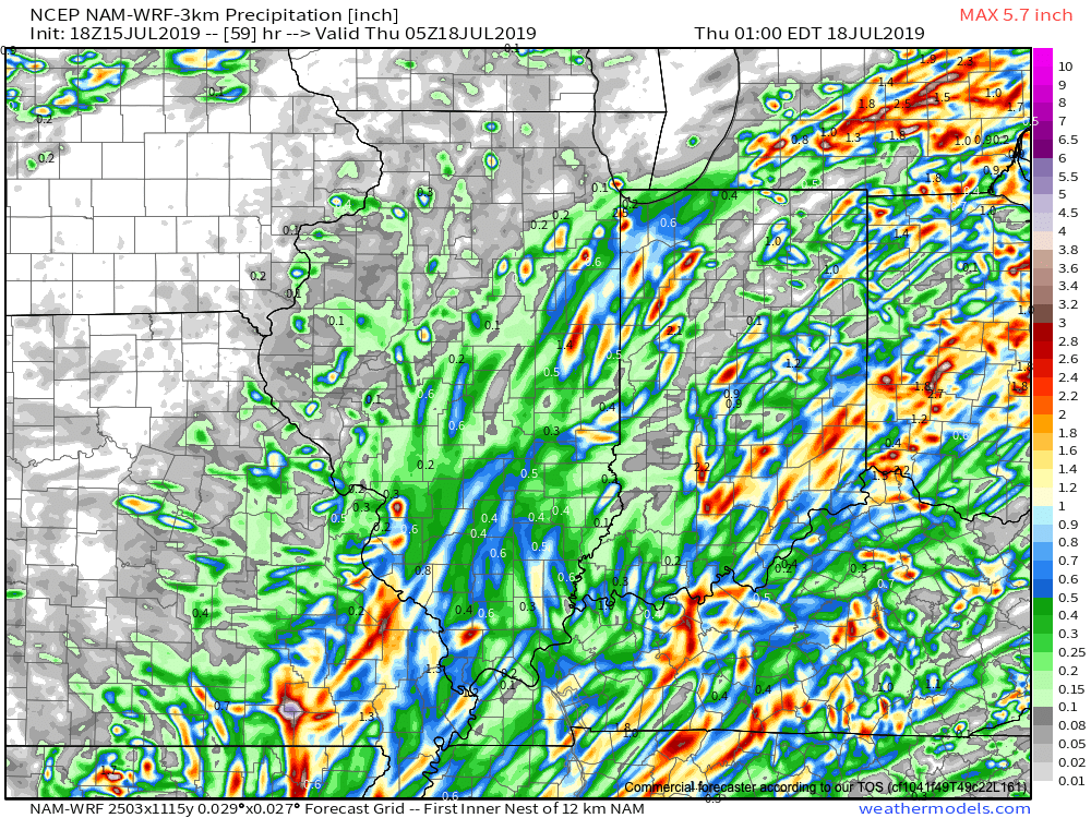
In general, we still think most central Indiana rain gauges will accumulate between 0.50″ and 1″ of rain as Barry’s remnant moisture scoots across the state. That said, there will be locally heavier totals. Latest data continues to not only hint at these heavier totals being located across southeast portions of the state, but perhaps across northwest Indiana, as well.

Once we dry things out (through the day Wednesday) the big story will become the heat and humidity. A 5-day stretch of dangerously hot, humid conditions will claim headlines during the period Thursday through Monday, featuring overnight lows between 75-80 and daytime highs in the lower to middle 90s.

Thankfully, there are drivers that will result in a rather significant pattern change by early parts of next week. A “game changer” of a cold front is expected to sweep across the Ohio Valley Sunday into Monday with gusty storms followed by much cooler conditions as we head into Week 2. These cooler temperatures are expected to carry the day as we put a wrap on the month of July. We’ll replace highs in the lower to middle 90s with upper 70s to lower 80s and overnight lows in the upper 50s to lower 60s for the better part of the late month stretch.

Permanent link to this article: https://indywx.com/2019/07/15/barrys-moisture-arrives-dangerous-heat-builds-and-more-on-the-cool-pattern-to-close-the-month/

Weekly #AGwx And Severe Weather Outlook…

Forecast period: 07.14.19 through 07.21.19

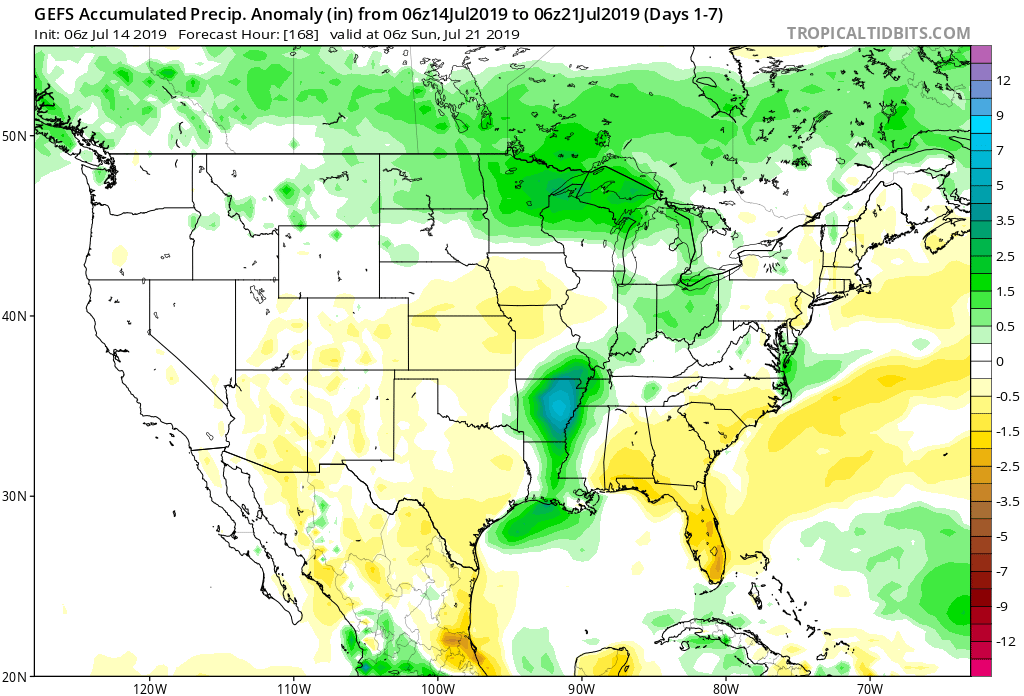
7-Day Precipitation: Rainfall is expected to run near to slightly above average through the period.

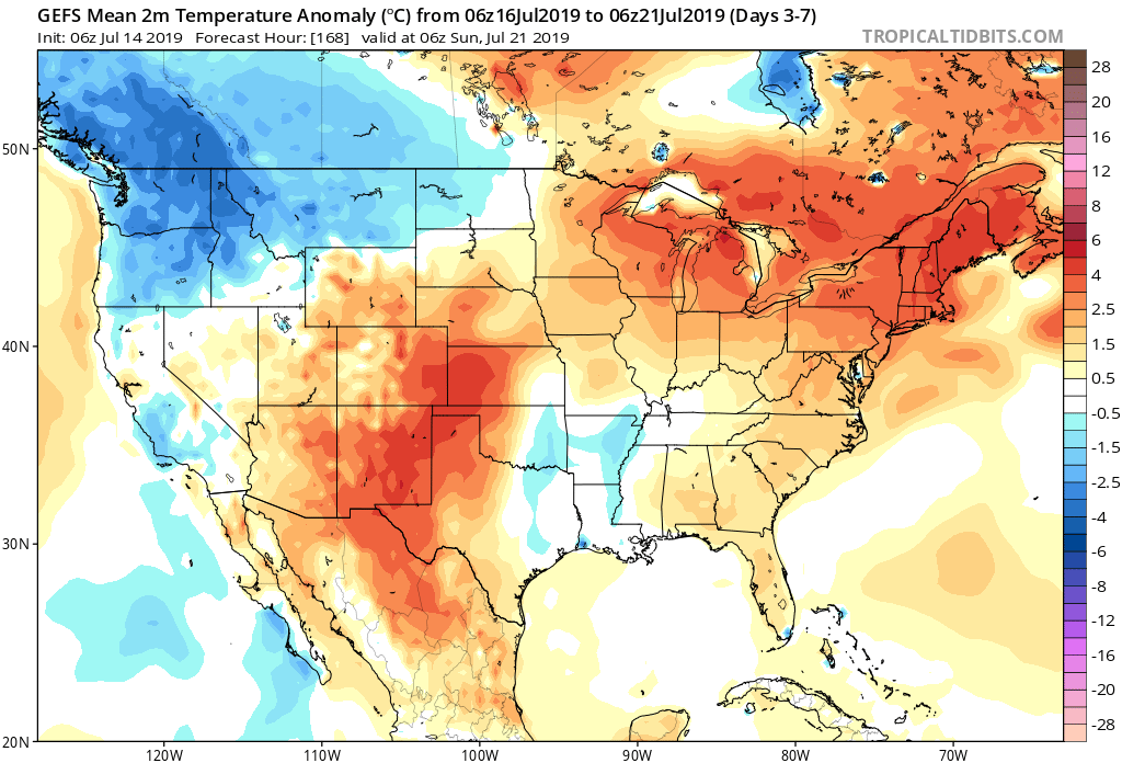
7-Day Temperature Outlook: Temperatures are expected to run well above average by the end of the period.

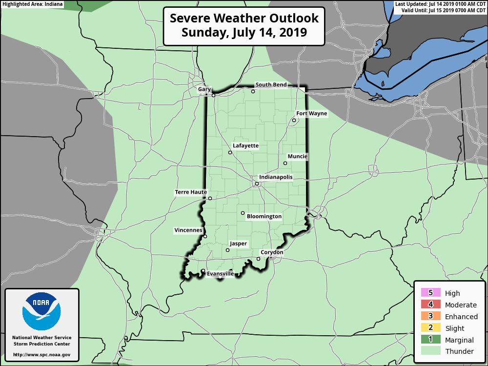
Severe Outlook: While widespread, organized severe weather isn’t expected through the forecast period, a couple isolated strong to severe cells are possible this afternoon (large hail is the primary concern, along with downburst wind potential). Additionally, we’ll also keep an eye on the threat of thunderstorm complexes riding southeast through the state late in the period- towards next weekend.

Summary: The story early in the forecast period will be Barry’s remnant moisture moving north and northeast across the Ohio Valley early in the work week. While we’re not expecting excessive rain across central Indiana, rain chances will be on the increase Monday through Wednesday. Thereafter, heat and humidity will be the story as a ridge of high pressure expands over the region. Dangerous heat and humidity is in store, including highs in the middle 90s and lows of 75-80 degrees into next weekend.

Permanent link to this article: https://indywx.com/2019/07/14/weekly-agwx-and-severe-weather-outlook-6/

IndyWx.com