You must be logged in to view this content. Click Here to become a member of IndyWX.com for full access. Already a member of IndyWx.com All-Access? Log-in here.
Category: Client
Permanent link to this article: https://indywx.com/2019/07/29/video-t-storms-increase-today-hint-of-fall-later-next-week/
Jul 28
Weekly AG And Severe Weather Update…
Forecast period: 07.28.19 through 08.04.19
7-Day Precipitation: Rainfall is expected to run below average through the forecast period.

7-Day Temperature Outlook: Temperatures are expected to run slightly below average through the period.
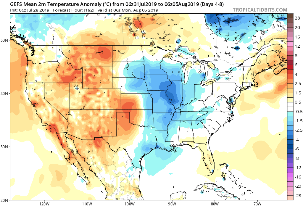
Severe Outlook: While organized severe weather isn’t anticipated through the period, a few strong storms are possible across central Indiana Monday afternoon as a cold front moves into the region.
Summary: It’s generally going to be another quiet week of weather across not only central Indiana, but a large part of the Ohio Valley. A cold front will pass early Tuesday and this will help spark scattered to numerous showers and thunderstorms Monday afternoon and evening. Thereafter, mainly dry conditions are expected through the remainder of the week. As we look ahead to next week, that’s when things are expected to take on an increasingly “busy” regime (both with respect to cooler and wetter trends).
Permanent link to this article: https://indywx.com/2019/07/28/weekly-ag-and-severe-weather-update/
Jul 27
A Different Kind Of “Dog Days” This Year…
Late July and August have been known to produce some serious heat around these parts from time to time. However, it continues to look like this will not be the case this year.
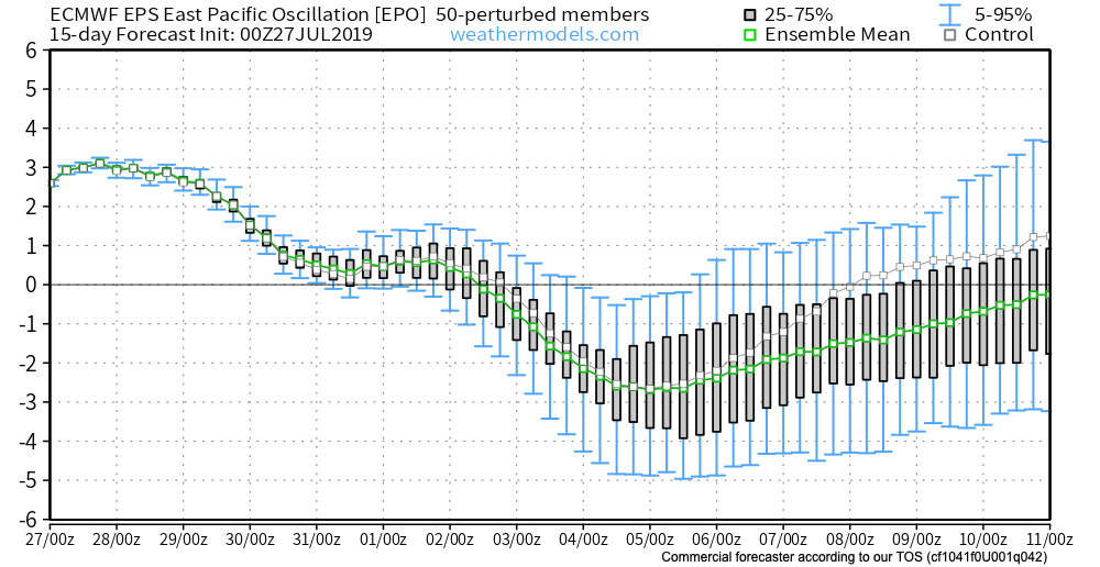
We’ve already discussed the impacts of the negative EPO. (By the way, modeling continues to take the EPO even more strongly negative with every passing update). This supports the cooler idea we have for early August.
Now we see the PNA forecast to trend more positive through the better part of early August. This, too, supports the cooler pattern that will be with us through the period.

It should come as no surprise to see the models trend stronger with the eastern trough in the Weeks 2-3 time period. This period will likely feature a couple of strong frontal passages that serve as a reminder that the fall season is just around the corner.
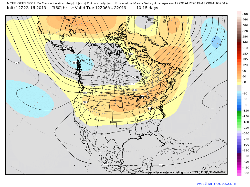
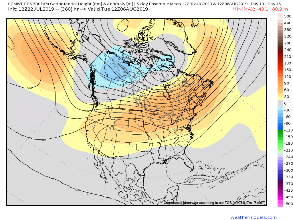
Note the latest GEFS deepen the trough from the Day 5-10 period to Days 10-15.
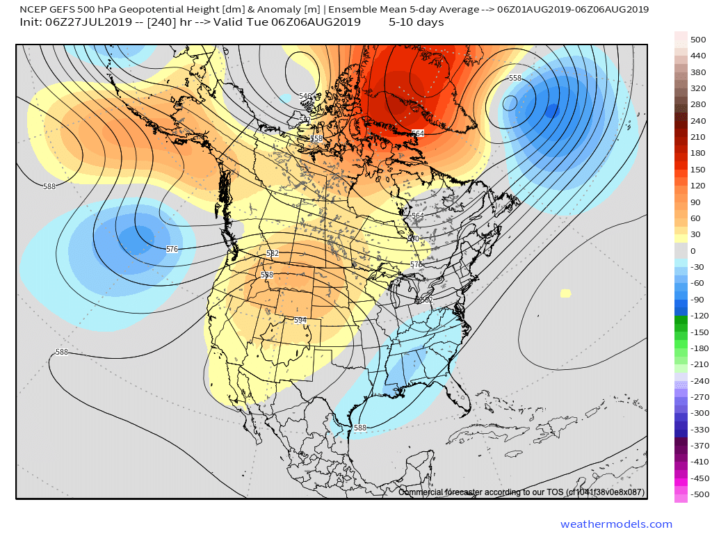
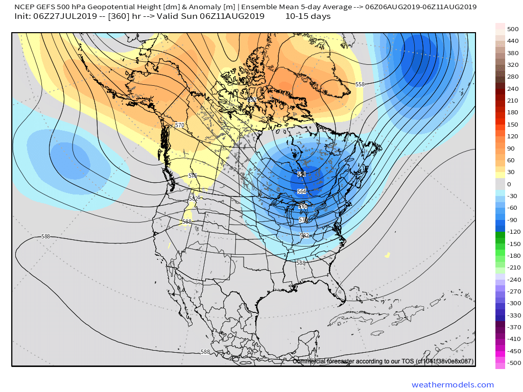
Not only will this serve to provide a rather lengthy period of cooler than normal temperatures through the 1st half of August, but should also help inject wetter conditions to boot (in large part due to the frequent nature of frontal passages).
At a time of year that can feature brutal periods of heat and/ or dry conditions, it sure continues to be the exact opposite this year!
Enjoy your Saturday, friends!
Permanent link to this article: https://indywx.com/2019/07/27/a-different-kind-of-dog-days-this-year/
Jul 26
VIDEO: Dry Weekend; Looking Ahead To The Cool Pattern That Will Return Early-August…
You must be logged in to view this content. Click Here to become a member of IndyWX.com for full access. Already a member of IndyWx.com All-Access? Log-in here.
Permanent link to this article: https://indywx.com/2019/07/26/video-dry-weekend-looking-ahead-to-the-cool-pattern-that-will-return-early-august/
Jul 25
VIDEO: Reinforcing Cool Pattern Develops Through Early August…
You must be logged in to view this content. Click Here to become a member of IndyWX.com for full access. Already a member of IndyWx.com All-Access? Log-in here.
Permanent link to this article: https://indywx.com/2019/07/25/video-reinforcing-cool-pattern-develops-through-early-august/
Jul 24
All-Access Evening Video Update: More Early August Chatter…
You must be logged in to view this content. Click Here to become a member of IndyWX.com for full access. Already a member of IndyWx.com All-Access? Log-in here.
Permanent link to this article: https://indywx.com/2019/07/24/all-access-evening-video-update-more-early-august-chatter/
Jul 24
VIDEO: Dry Pattern Through The Weekend; Timing Out When Storms Return…
You must be logged in to view this content. Click Here to become a member of IndyWX.com for full access. Already a member of IndyWx.com All-Access? Log-in here.
Permanent link to this article: https://indywx.com/2019/07/24/video-dry-pattern-through-the-weekend-timing-out-when-storms-return/
Jul 23
EPO In Control?
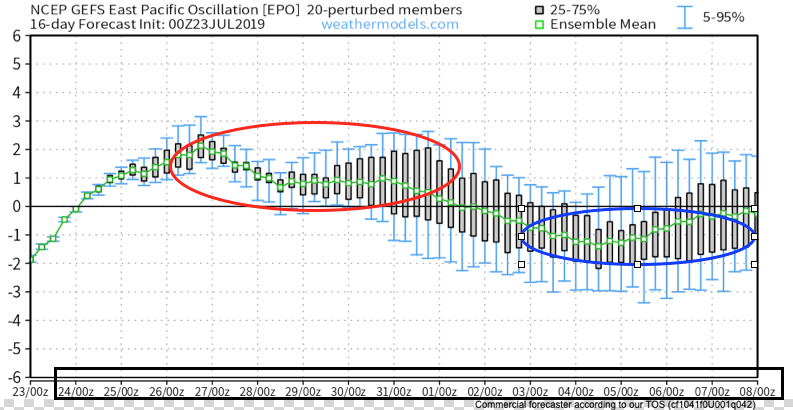
As we look ahead to the August pattern, it’s becoming increasingly apparent that the EPO, or East Pacific Oscillation, is trying to take control.
During positive phases of the EPO, warmer anomalies are usually noted across the eastern United States, whereas negative phases tend to promote cooler anomalies through the central into the eastern portion of the country. While the correlation is greatest in the fall and winter, the EPO phase can also have a say in the summer pattern.
As we look ahead at the forecast EPO and upper level pattern, note the similarities:
First, here’s what a negative and positive EPO would typically yield from the perspective of temperature anomalies:
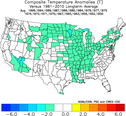
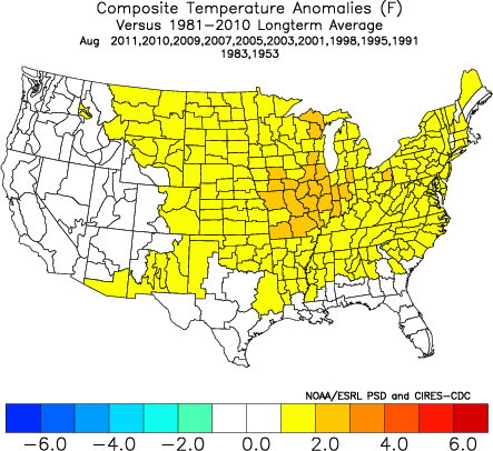
Here’s the forecast EPO into the first week of August.
Note how closely the modeled upper air pattern (and associated surface temperatures) follow suit:
Present (negative EPO)
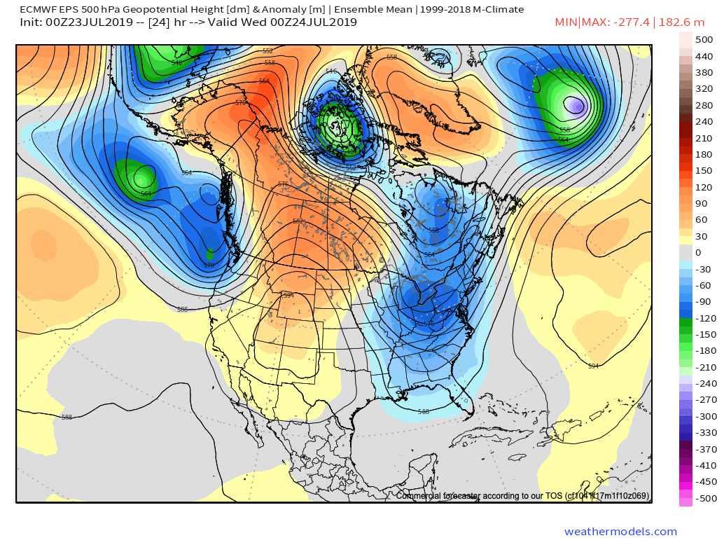
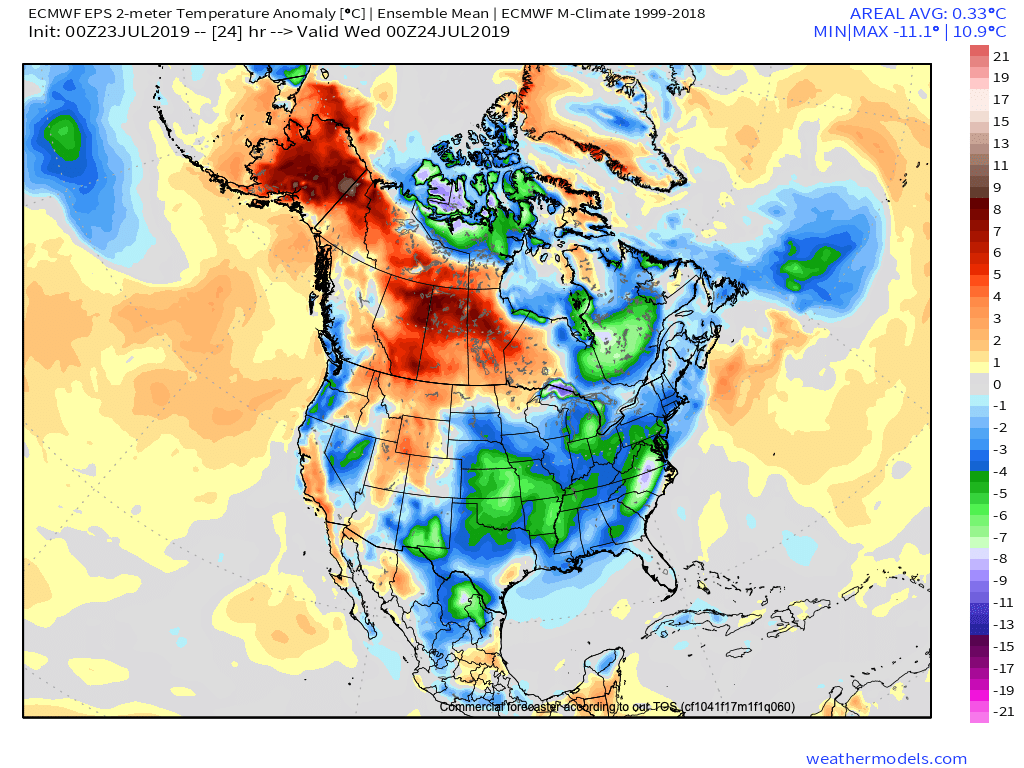
July 27th – Aug 1st (positive EPO)
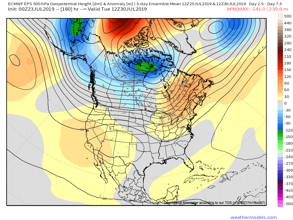
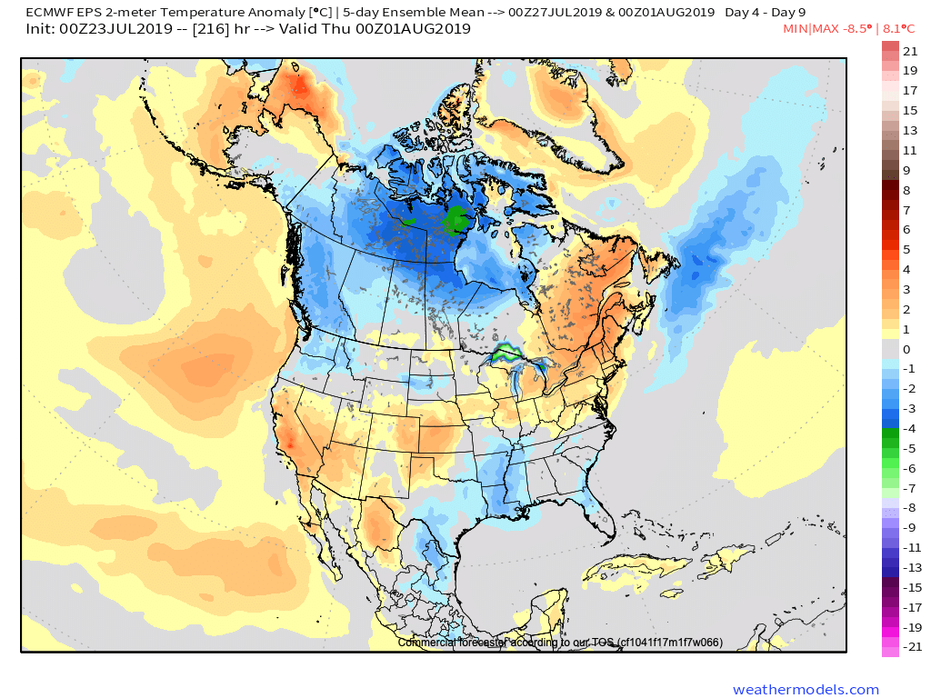
Aug 3rd – Aug 8th (negative EPO)
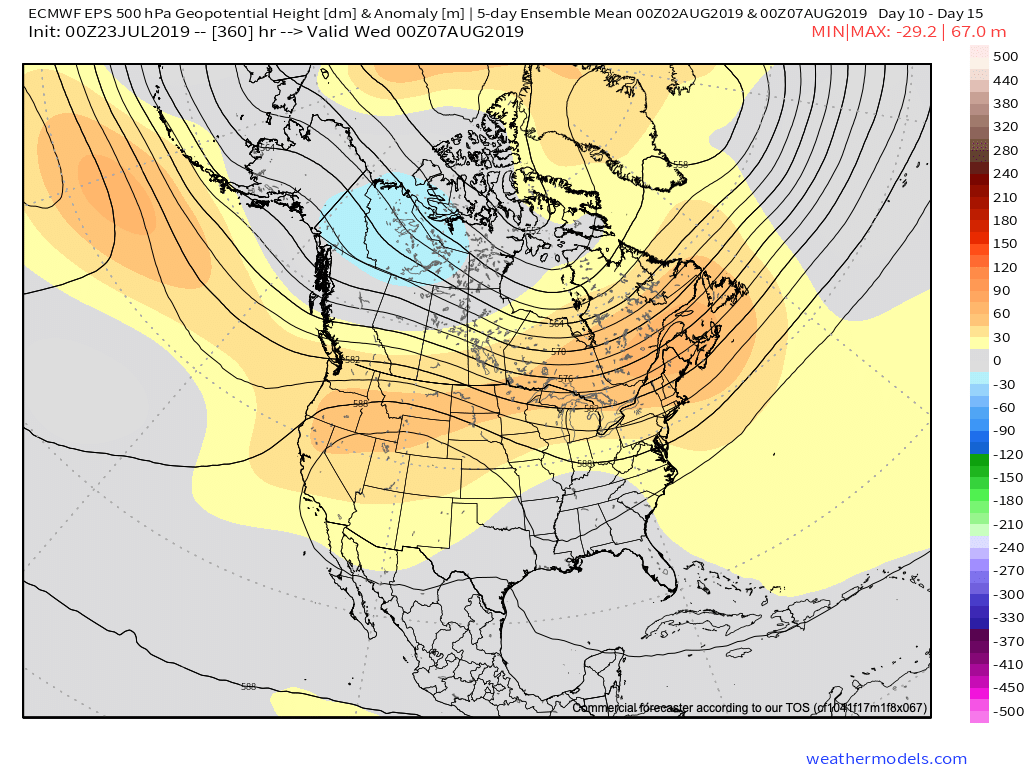
(While we can’t show it here, it’s interesting to see the latest European Weeklies keep the EPO predominantly negative to significantly so through the bulk of August and into September).
So what’s the moral of the story? We believe after a period of transitional heat this weekend into early next week that temperatures will return to seasonal levels in early August, along with an increase in rain/ storm threats as the northwest upper air flow sets up shop. Our official August forecast will be issued early next week.
Permanent link to this article: https://indywx.com/2019/07/23/epo-in-control/
Jul 22
Dinnertime Rambles: Quiet Through The Short-Term And Longer Range Musings…
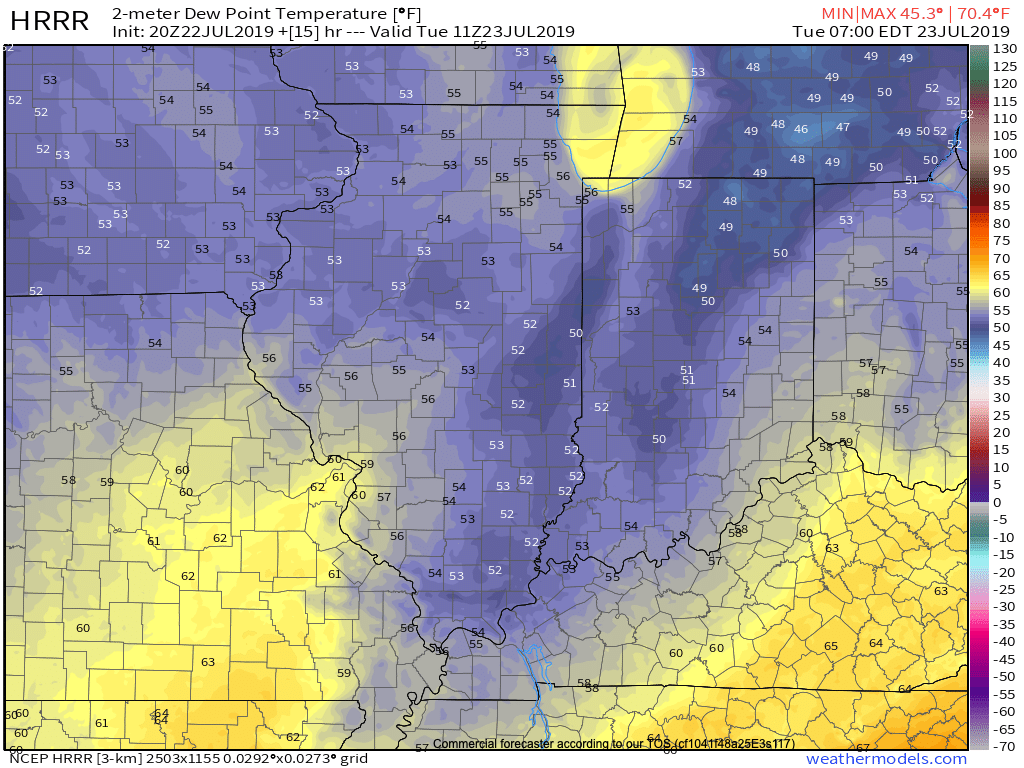
I. Drier air continues to surge south and with it will come much cooler temperatures overnight into Tuesday morning. We still believe most central Indiana reporting sites will fall into the middle 50s Tuesday morning. Turn off that A/C and open up those windows!
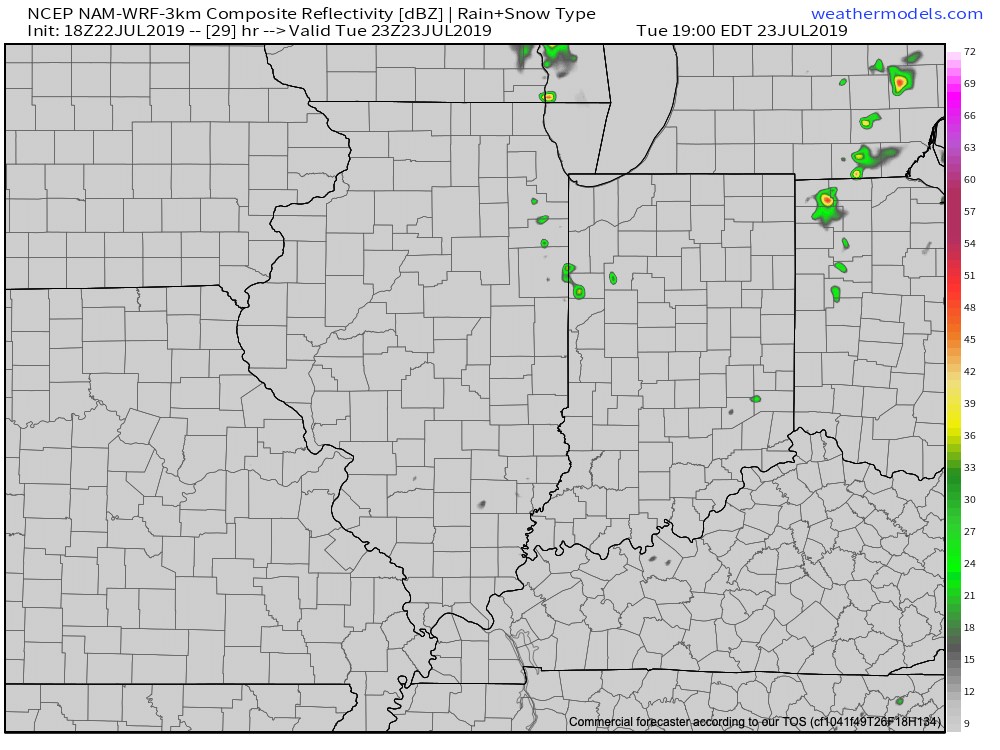
II. Weak upper level energy will push south and lead to isolated to widely scattered instability-driven showers across northern parts of the state tomorrow afternoon. A couple of these quick-moving showers could scoot into central Indiana, but we continue to believe most will remain free of any precipitation tomorrow.
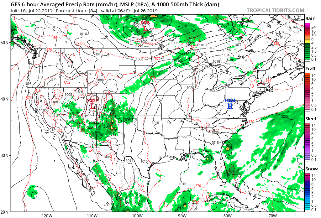
III. Overall, we’re looking at a very quiet weather pattern through the weekend with an extended period of dry weather, thanks to high pressure. Temperatures will slowly warm from the unseasonably cool and refreshing levels into mid week to more of a seasonal feel this weekend.
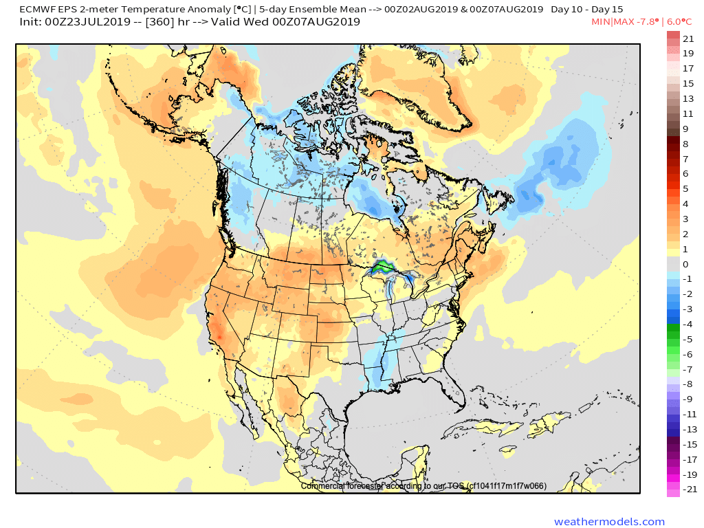
IV. As we look ahead, the upper air pattern should transition to more of a classic summer-like regime to open August. However, data shows the ridge continuing to “retrograde” west with time, resulting in a period of wetter conditions with a northwest flow aloft Days 10-15 (roughly Aug 2nd- Aug 7th). It’s always good to see agreement between the European and GFS ensemble products below.
V. Research continues on the upcoming fall and winter and it’s becoming increasingly difficult to ignore the warm sea-surface temperatures across the northeastern Pacific. Interestingly, most seasonal model data maintains this warm “blob” into the late fall and early winter. Note where we are currently (center photo) vs. where the projection off the UKMET (top left) for Oct-Dec and European (bottom left) for Nov-Jan.
While only 1 of several ingredients used in building our seasonal outlooks, this can promote the tendency for more persistent western ridging and downstream trough (associated colder pattern) across the East…

Permanent link to this article: https://indywx.com/2019/07/22/dinnertime-rambles-quiet-through-the-short-term-and-longer-range-musings/
Jul 22
VIDEO: Relief Is Here; Quiet Pattern Into The Weekend…
You must be logged in to view this content. Click Here to become a member of IndyWX.com for full access. Already a member of IndyWx.com All-Access? Log-in here.
Permanent link to this article: https://indywx.com/2019/07/22/video-relief-is-here-quiet-pattern-into-the-weekend/
