You must be logged in to view this content. Click Here to become a member of IndyWX.com for full access. Already a member of IndyWx.com All-Access? Log-in here.
Category: Client
Permanent link to this article: https://indywx.com/2019/11/18/video-gloomy-open-to-the-work-week/
Nov 17
VIDEO: Week Ahead Outlook; Greenland Block Leads To An “Interesting” Pattern Around Thanksgiving…
You must be logged in to view this content. Click Here to become a member of IndyWX.com for full access. Already a member of IndyWx.com All-Access? Log-in here.
Permanent link to this article: https://indywx.com/2019/11/17/video-week-ahead-outlook-greenland-block-leads-to-an-interesting-pattern-around-thanksgiving/
Nov 16
Leader – Follower…
Our weekend weather will remain relatively quiet. Sure, we’ll have a weak system pass through the state Sunday afternoon. While this could deal out a light shower (potentially mixed with a little sleet), significant accumulation isn’t anticipated. This will allow us to look ahead to potential “more important” items down the road.
Initially, the flow will back to the southwest midweek, allowing a briefly milder regime to blow into the Ohio Valley for about 24-48 hours. An area of low pressure will track from the lee of the Colorado Rockies Tuesday, across the Plains and into the Great Lakes Thursday into Friday. This will result in a period of rain and gusty winds late Wednesday into Thursday. We’re not expecting particularly hefty rain with this system, with most central Indiana rain gauges around the 0.25″ to 0.50″ range.
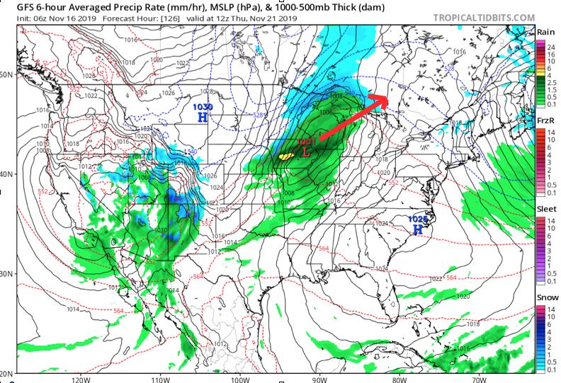
Once the low lifts into the Lakes, it’ll help sling a cold front through the Ohio Valley Thursday night. This will result in a much colder close to the work week.
As colder air is seeping into the region, additional upper level energy will be ejecting out of the Four Corners region Friday evening. Eventually, this will result in a surface wave developing over the mid-South region Friday night into Saturday morning.
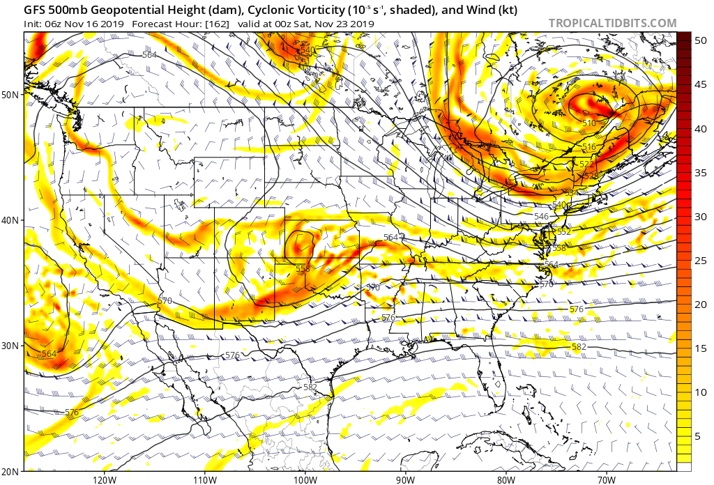
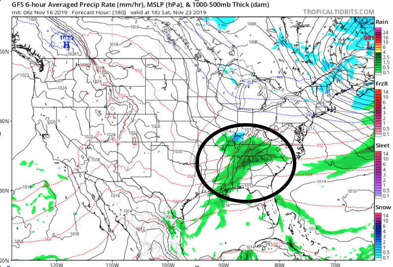
While the majority of operational data currently shows this wave remaining suppressed, history tells us we need to pay special attention to model trends over the next several days. All too often, seemingly “harmless” systems in the medium term that appear to scoot off to our south will trend north. The upper air pattern suggests this may be the case this go around as well.
As it is, some of the individual ensemble members are already jumping on this. Hunch here is that as we go through the upcoming week, a legitimate interior winter threat will be present for next weekend…

Permanent link to this article: https://indywx.com/2019/11/16/leader-follower/
Nov 15
VIDEO: Weak System Sunday; More Interesting Times Mid-Late Next Week…
You must be logged in to view this content. Click Here to become a member of IndyWX.com for full access. Already a member of IndyWx.com All-Access? Log-in here.
Permanent link to this article: https://indywx.com/2019/11/15/video-weak-system-sunday-more-interesting-times-mid-late-next-week/
Nov 14
VIDEO: Long Range Thoughts To Wrap Up November And Looking Ahead To December…
You must be logged in to view this content. Click Here to become a member of IndyWX.com for full access. Already a member of IndyWx.com All-Access? Log-in here.
Permanent link to this article: https://indywx.com/2019/11/14/video-long-range-thoughts-to-wrap-up-november-and-looking-ahead-to-december/
Nov 14
What A Start To November; Looking Ahead…
Indianapolis is running a whopping 11.7° below average through the 1st (13) days of the month. We’ve broken records for cold and snow so far, including Monday’s snow at 2.8″, record lows (8° on Tuesday and 9° low on Wednesday, and record low maximums (21° high on Tuesday).
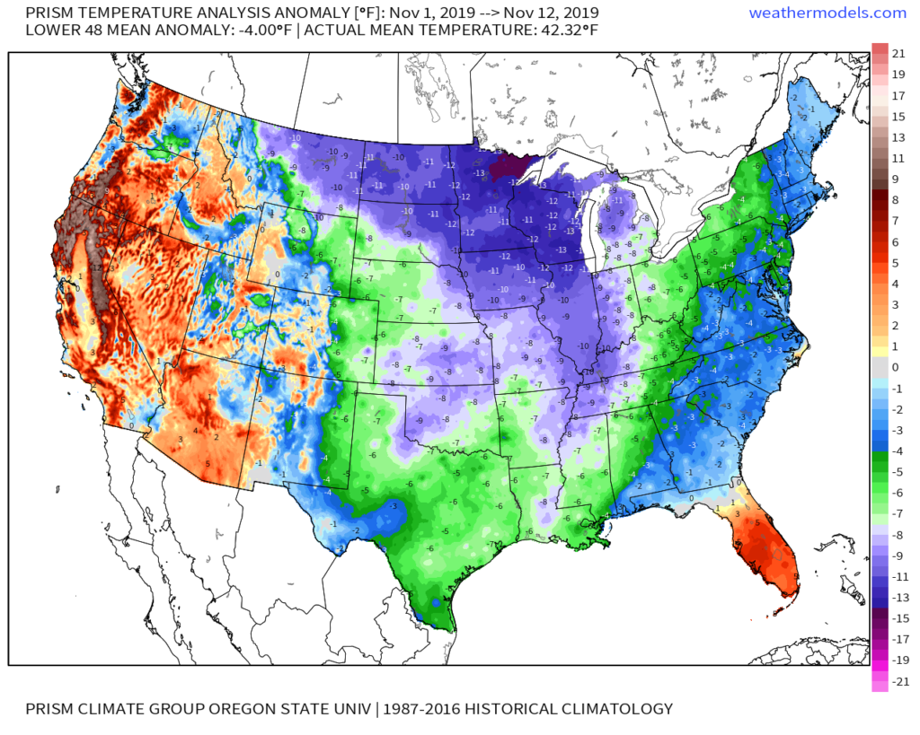
Shades of November ’14 come to mind with the way this month has started:
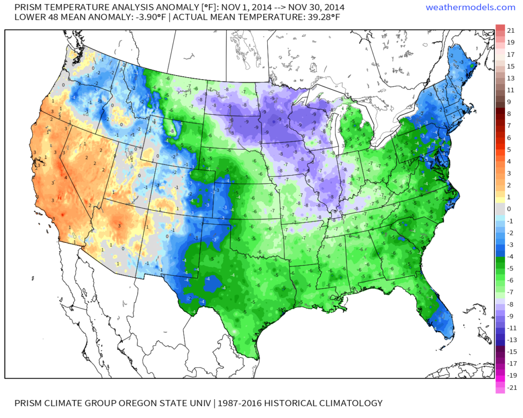
As we look ahead, temperatures are expected to remain below, to significantly below, average through the 2nd half of the month overall.
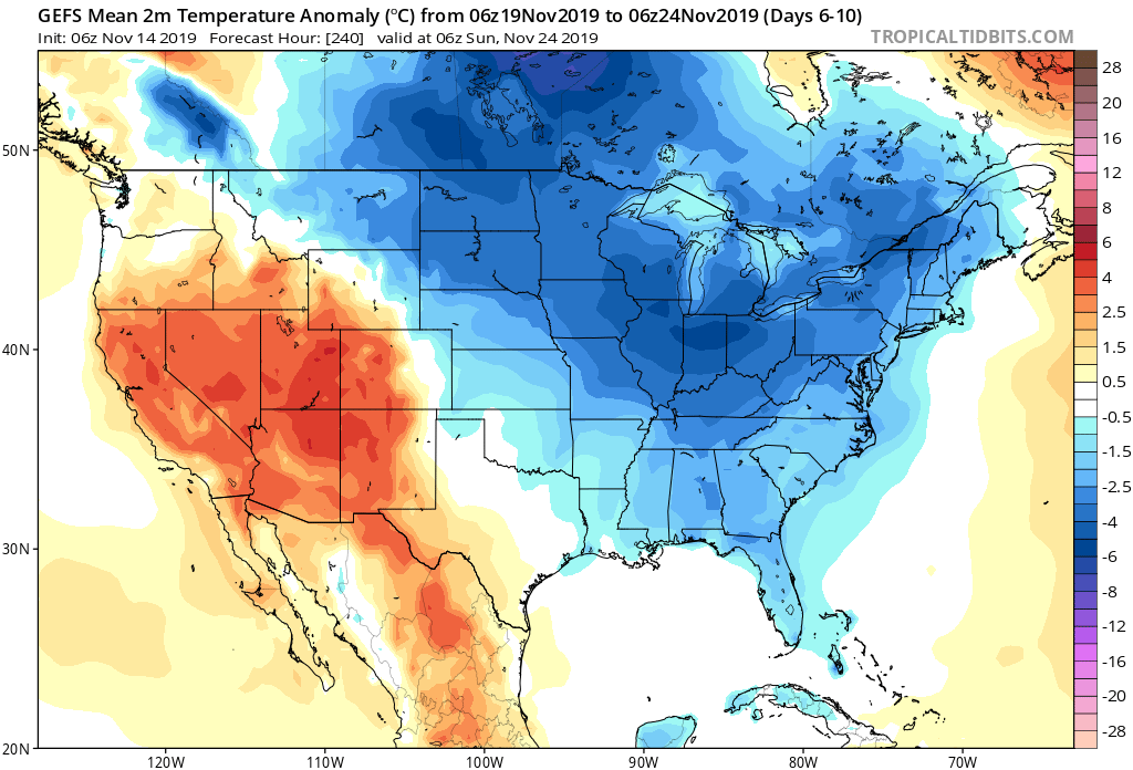
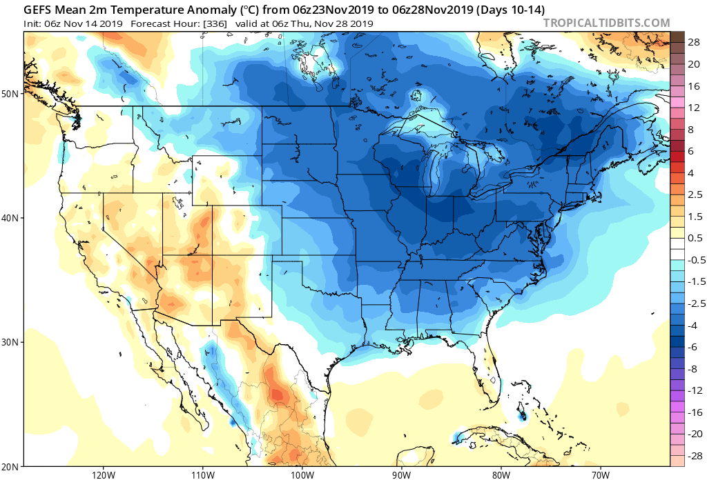
From a storm standpoint, we’re only expecting a couple of fairly weak systems over the upcoming week. A disturbance will scoot across central Indiana Sunday with a few light showers and again Tuesday. Neither is expected to provide significant moisture.
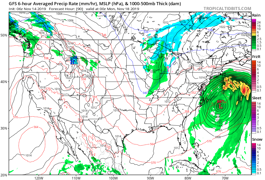
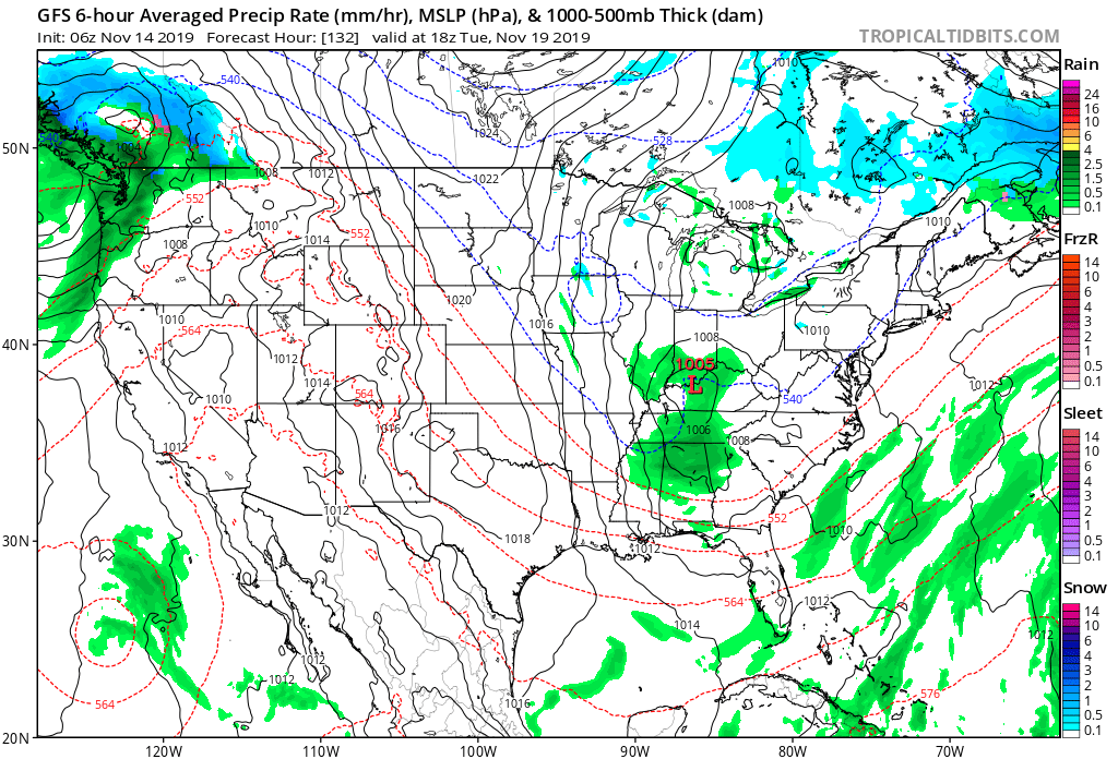
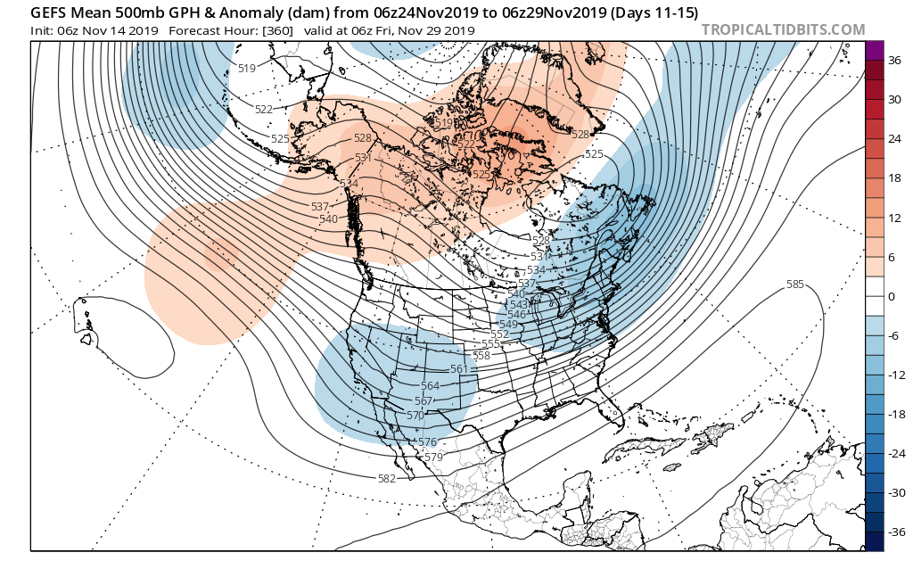
Things begin to potentially turn a little more “exciting” as we grow closer to Thanksgiving. The forecast upper air pattern is one that has “mischief” written all over it and will likely require more attention as time draws closer. More on this and some updated data (including the European and JMA Weeklies) later this evening with our long range video update.
Permanent link to this article: https://indywx.com/2019/11/14/what-a-start-to-november-looking-ahead/
Nov 13
VIDEO: Still Colder Than Normal, But The Pattern Turns Quiet For Now…
You must be logged in to view this content. Click Here to become a member of IndyWX.com for full access. Already a member of IndyWx.com All-Access? Log-in here.
Permanent link to this article: https://indywx.com/2019/11/13/video-still-colder-than-normal-but-the-pattern-turns-quiet-for-now/
Nov 12
VIDEO: Looking Ahead To The Thanksgiving Pattern…
You must be logged in to view this content. Click Here to become a member of IndyWX.com for full access. Already a member of IndyWx.com All-Access? Log-in here.
Permanent link to this article: https://indywx.com/2019/11/12/video-looking-ahead-to-the-thanksgiving-pattern/
Nov 12
Tuesday Morning Rambles: Record Cold Indeed…
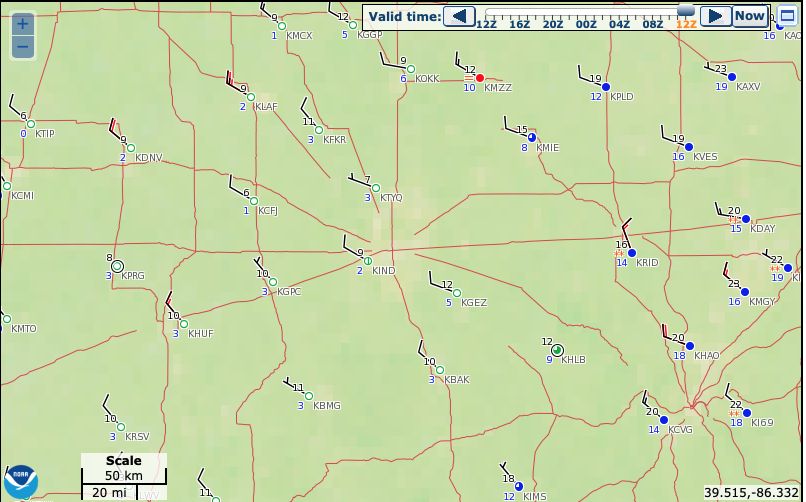
I. Number-Busting Cold: The western half of central Indiana is experiencing downright frigid conditions this morning. Skies that cleared out and combined with the fresh snow pack, along with strong cold air advection overnight now find themselves in the middle single digits! Officially at IND, the low temperature of 9° (as of the 7a hour) sets a record not only for the day, but is the earliest in the fall season that the temperature has fallen into the single digits.
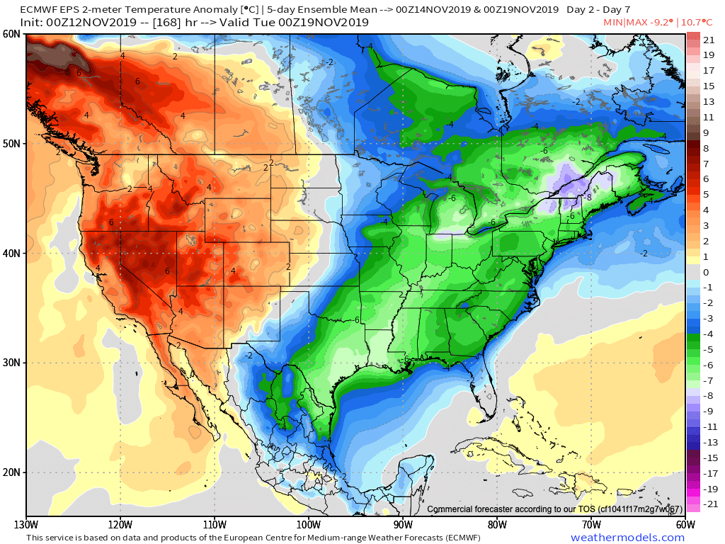
II. Cold Remains: For some perspective on the current cold, average temperatures this time of year include lows in the upper 30s and highs in the middle 50s. Safe to say we won’t be anywhere near those numbers over the next 6-7 days. Even after we pull out of the arctic intrusion over the next couple of days, temperatures will remain well below average through the weekend.
III. Fast Moving Clipper: We’ll keep close tabs on a fast moving clipper system Wednesday night into Thursday morning, but as of now, only expect scattered light snow showers across north-central Indiana Thursday morning with this system (no accumulation anticipated). After this system, we’re talking about a rather dry forecast into early next week. The next chance of precipitation (light rain) would come Monday, but the key word here is “light.”
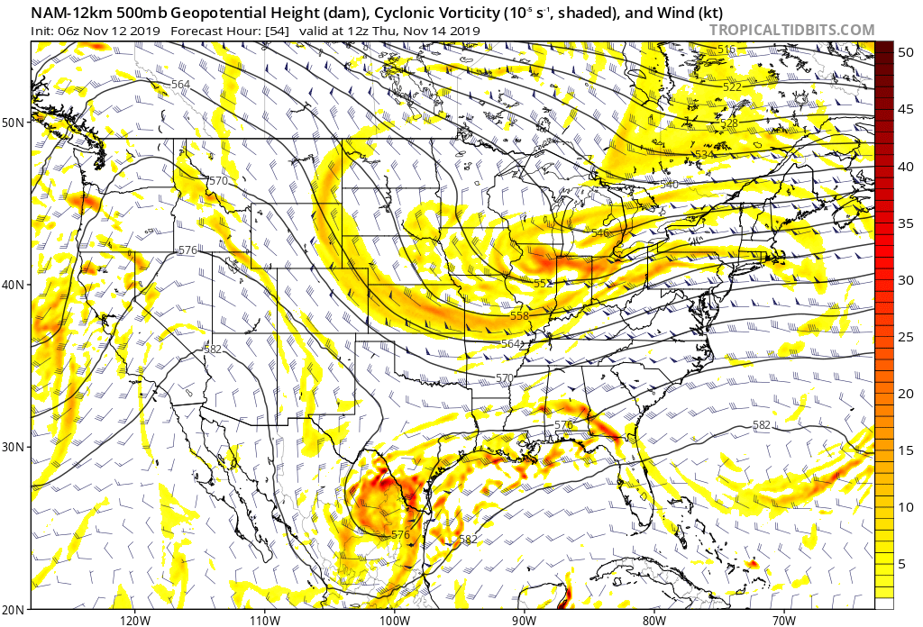
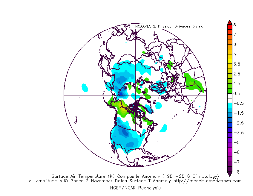
IV. Looking Ahead: We’ll have a more extensive long range update later this evening. One of the items of interest is the way modeling handles the MJO propagation. While the European isn’t nearly as amplified, the American modeling wants to take the MJO into Phase 2 towards Thanksgiving. Phase 2 this time of year would argue for widespread colder than normal conditions. Again, much more on the long range pattern a bit later.
Permanent link to this article: https://indywx.com/2019/11/12/tuesday-morning-rambles-record-cold-indeed/
Nov 11
Evening Video Update: “System” Snow Shifts To Lake Effect Overnight; Midweek Worthy Of Attention…
You must be logged in to view this content. Click Here to become a member of IndyWX.com for full access. Already a member of IndyWx.com All-Access? Log-in here.
Permanent link to this article: https://indywx.com/2019/11/11/evening-video-update-system-snow-shifts-to-lake-effect-overnight-midweek-worthy-of-attention/
