You must be logged in to view this content. Click Here to become a member of IndyWX.com for full access. Already a member of IndyWx.com All-Access? Log-in here.
Category: Blizzard
Permanent link to this article: https://indywx.com/lots-to-look-at/
Jan 24
1st of 3 Rounds Of Wind-Whipped Snow This Weekend!
The first of three rounds of accumulating, wind-whipped, snow is blowing into central Indiana as I type this. We still think widespread 2-3″ totals fall across many central Indiana neighborhoods during the overnight, with snow ending from north to south between 6-8am. Additionally, blowing and drifting snow will be a huge concern and local white-outs/ near blizzard conditions will develop into the morning Saturday. Needless to say, if you don’t have to travel tonight or Saturday, it would be a great time to hunker down at home, start a fire, and enjoy friends and family!
Here’s a look at forecast radar during the “height” of the storm, most likely between 2-4a for most areas:
Snow will end Saturday morning, but we’ll have to contend with continued severe blowing and drifting, especially in central Indiana’s open country. Remain cautious if you must venture out. Winds will back around from the southwest during the wee morning hours Saturday to a colder (yet again) northwest direction late Saturday morning, resulting in another bitter feel to the air Saturday afternoon.
We’ll enjoy a brief calm period Saturday evening (despite continued gusty winds), but our meteorological eyes will already be poised to the northwest, focused on our next round of accumulating snow Sunday morning. We call this “warm advection” snow as it’ll fall on milder southwest winds ahead of yet another arctic front due in here Sunday night. This will likely be a “thumper” snow as additional accumulation Sunday of 1-3″ is a solid bet at this point- most of which falls within a 2-3 hour time period.
Sunday afternoon will likely turn drier (and briefly milder) before that “famous” arctic front slams into the region Sunday night. We think additional snow showers and embedded heavier squalls will accompany the frontal passage (FROPA) and could easily lay down yet another half inch to one inch of accumulation Sunday night/ early Monday.
All of this additional weekend snow will be capped off with some of the most brutally bitter air so far this season (and that’s obviously saying something, considering how cold it’s been). Gusty northwest winds will lead to continued blowing and drifting issues in the open country early next week, but produce dangerous wind chill values, colder than 30 degrees below zero from time to time. Additionally, overnight lows Monday night into Tuesday morning will likely fall to between 15 and 20 degrees below zero and highs on Tuesday will likely struggle just to make it to the 0 degree mark for a high…
Permanent link to this article: https://indywx.com/1st-of-3-rounds-of-wind-whipped-snow-this-weekend/
Jan 06
Dangerous Cold.
The “big dig” may have to wait a couple of days as brutal temperatures and wind chills will make for downright dangerous conditions to be outdoors for any length of time. Coming off the city’s second snowiest day in history (11.1″), we now have to contend with dangerous cold. This is the type of cold that can turn deadly should you be outdoors for any length of time. Take it seriously and remain indoors hunkered down if at all possible.
Before we look at the cold, here’s a snap shot of storm snowfall totals from our winter storm. “Historic,” “Severe,” “Memorable” are all words that come to mind when discussing this storm. Widespread 12″ + totals have been reported across central Indiana, and drifts are approaching 7 feet in spots.
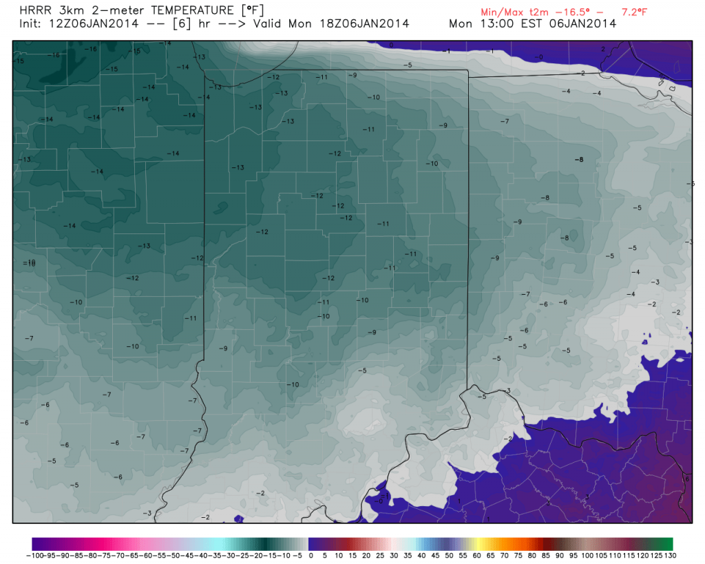
Temperatures today will only reach the 10-12 BELOW zero mark, coupled with wind chills that dip below 40 BELOW zero at times through the day. With the wind, blowing and drifting snow will remain a concern.
Permanent link to this article: https://indywx.com/dangerous-cold/
Jan 05
“Memorable” Winter Storm Just Beginning…
Our severe winter storm is just in the beginning stages and we’ll note rapidly deteriorating conditions moving into the afternoon and on into the night. Please don’t take this storm lightly. Conditions will become life threatening this afternoon into Monday and don’t be surprised if Blizzard Warnings are issued today.
Here are some quick bullet points you need to know:
- 2″ per hour snow rates develop this afternoon
- The pressure “gradient” tightens tonight leading to Blizzard conditions from late afternoon into Monday morning
- 9-12″ of snow from Indy and points north, 5-9″ south-central Indiana
- Drifts grow to 3-5 feet overnight into Monday (local drifts to 6 feet likely for the open country)
- Monday’s high: 12 BELOW zero (not a typo)
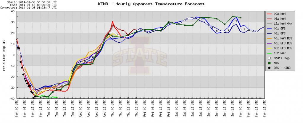
- Wind Chills: 40-50 BELOW zero by Monday morning
Latest high-resolution model data in house puts down widespread snow total of one foot, including Indianapolis, Zionsville, Noblesville, Avon, Anderson just to name a few…
Please be sure to hunker down today and remain inside if at all possible. Conditions will become life threatening upon venturing out of your home tonight and Monday.
Permanent link to this article: https://indywx.com/memorable-winter-storm-just-beginning/
Jan 04
Cold Is Something To Behold!
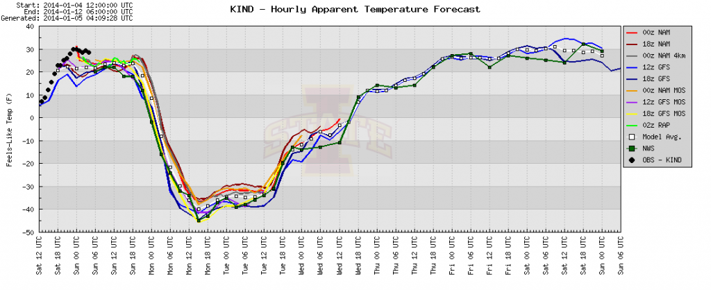
With all of the talk about the snow and near-blizzard conditions Sunday (rightfully so), we wanted to make sure we discussed the pending arctic outbreak and record-smashing temperatures ahead early next week.
(As a side note, our going snowfall accumulation ideas remain unchanged with a band of 9-12″ of snow from Indianapolis and points north with less amounts south of Indy where mixing issues will keep accumulations in the 5-9″ range).
As our winter storm moves northeast into the Great Lakes Sunday night, it’ll help slug a huge piece of arctic air south to the likes not seen around these parts since 1994. We’re talking about dangerous, life threatening, cold Sunday night through Wednesday morning. With a deep snow pack on the ground left behind by our memorable winter storm, the stage will be set for actual temperatures to most likely drop even lower than guidance currently suggests.
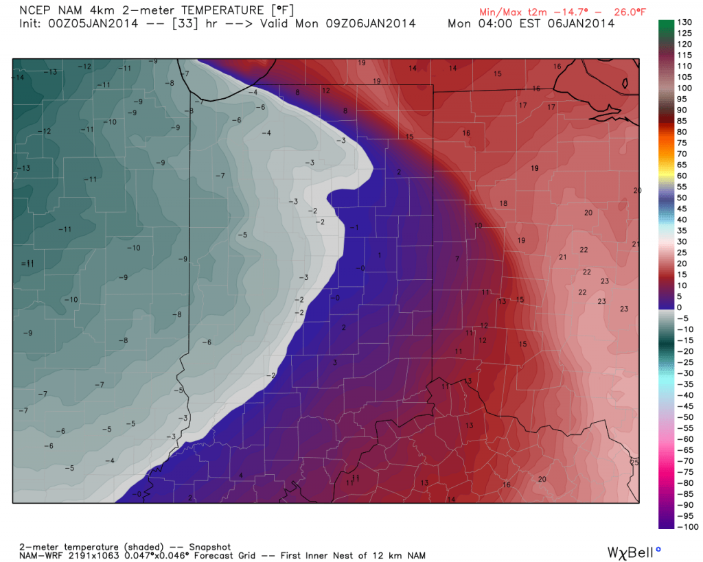
We think actual air temperatures fall below zero as early as 12a-3a Monday, per latest guidance. (Wind chill values will fall below zero shortly after dark Sunday).
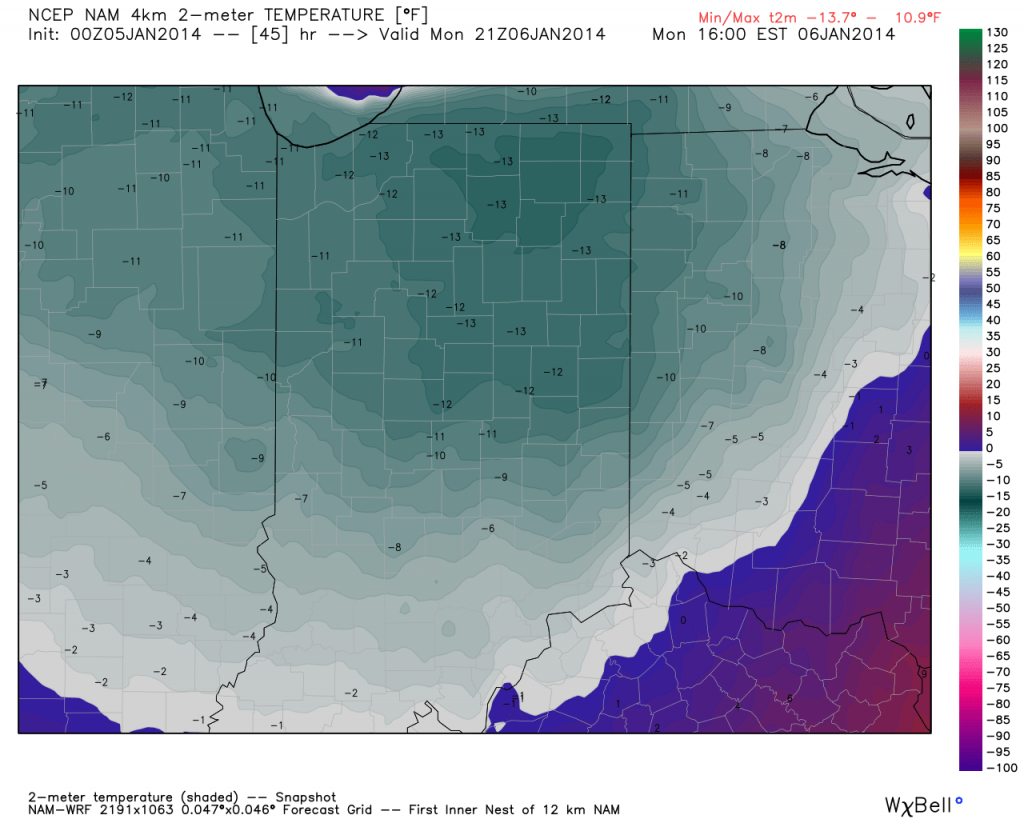
Let’s take a look at high temperatures Monday. Frigid and dangerous temperature conditions continue into mid week…
Daytime Highs Monday will range from 7 to 12 BELOW zero (that’s not a typo).
Additionally, wind chill values will plummet to levels that can quickly lead to frost bite of any exposed skin. We think wind chill values range as low as 50 degrees below zero Monday. At 30 degrees below zero, exposed skin can freeze within 30 minutes. At 40 degrees below zero, exposed skin can freeze within 10 minutes, and at 50 degrees below zero, exposed skin can freeze in under 5 minutes. Here’s a look at forecast wind chill values:
Needless to say, please remain indoors and hunker down the next couple days if at all possible. Weather conditions will be downright dangerous to be outdoors and you risk putting yourself in harms way, as well as first responders, should you venture out of your home. Getting stuck in a snow bank in any sort of weather conditions is dangerous, but when you factor in this type of cold, major problems can, and will, quickly develop.
Permanent link to this article: https://indywx.com/cold-is-something-to-behold/


