Category: Autumn

A Word (Or Two) On Where We Think This Pattern Is Going…

Before we get into the updated thinking on the pattern, lets review what we have out:

  • Step-down process to cooler/ colder weather begins in mid-November.
  • Thanksgiving-Christmas period, as a whole, turns wintry and is snowier than average.
  • Our complete 2016-2017 Winter Outlook can be found here.

The first week of November has featured an incredibly warm start to the month. (Image courtesy of MRCC).

month-tdevSpeaking of warmth, 2016 has been a very warm year.

ncep_cfsr_t2m_anom_ytd(The cold of 2014 seems so long ago…)

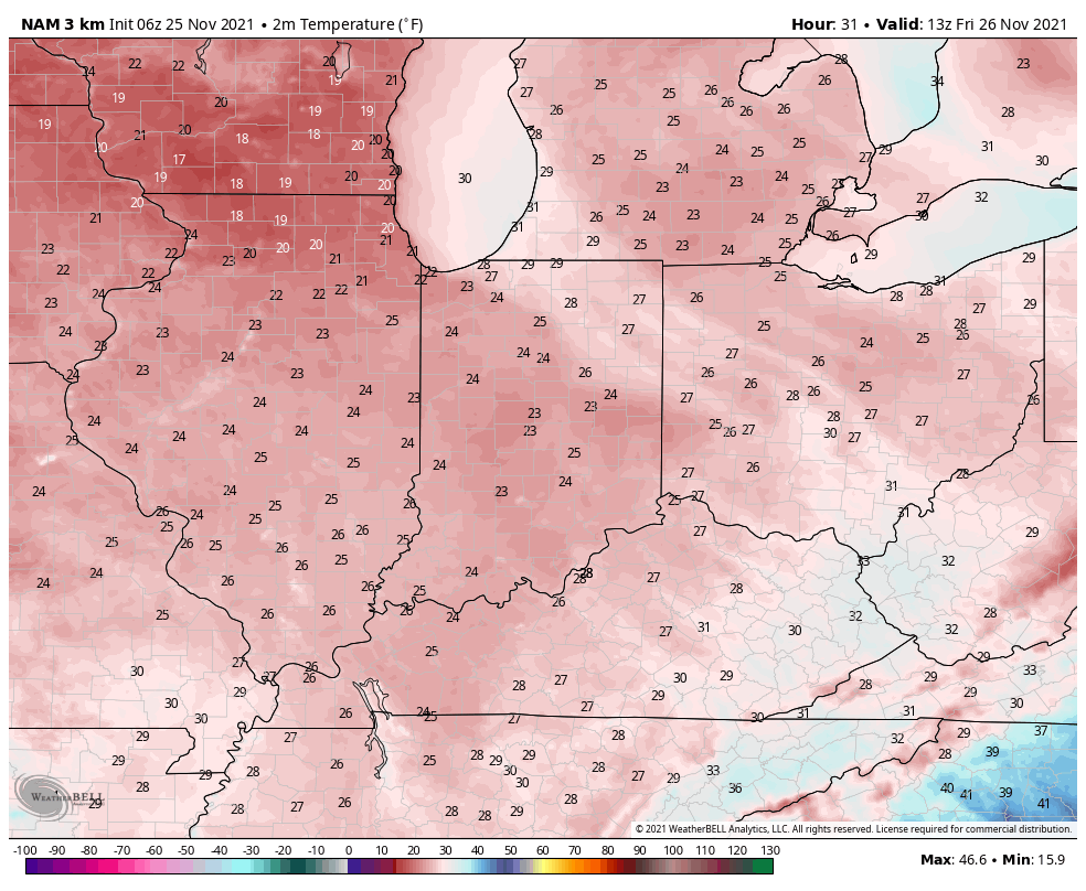
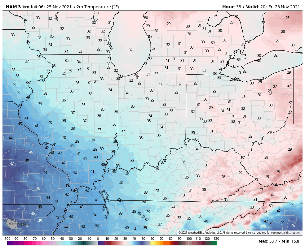
ncep_cfsr_t2m_anom_2014Back to present.  We’ve targeted the middle part of November to finally beginning “bucking” the recent warm trend.  This won’t happen overnight and will be a battle of back and forth, initially.  Thus, the “step-down” label.  To be clear, November, as a whole, will finish much warmer than average.  It’s virtually impossible to counter the incredibly warm start.  That said, we do anticipate “jabs” of colder air working in here over the next couple weeks. For instance, this weekend will feature lows in the 20s for most and highs not making it out of the 40s Saturday afternoon.  (The average low and high at IND Saturday are 37 and 54).

Despite being in a weak La Nina, the pattern is taking a while to respond.  Remember, we’re coming off one of the strongest El Ninos on record.  Until we slow the PAC jet, significant, long-lasting, changes won’t occur.  We can lean on the AAM (Atmospheric Angular Momentum) forecast for clues as to when this may occur.  You can read more about the AAM here.  My fellow local weather compadres, Michael Clark, Ed Valley, and Kirk Hinz have also written/ blogged extensively about the AAM and resulting impacts.

gfsgwo_1

gfs1When we look at the AAM forecast (above), we note the westerlies may begin to slow (indicative of the negative values) in the 8-10 day period.  This is crucial and, simply put, has to happen for the pattern to begin shifting into more of a position to allow sustained cold to enter the equation.  We want to reiterate that this, in and of itself, doesn’t create the cold, but instead allows the pattern to begin shifting away from the Nino-like (warm) regime into more of a La Nina pattern, as a whole.  – Hey, you have to start somewhere.

If we can finally get the westerlies to slow, other elements are in play that could (and should) lead to a colder pattern as we move forward.  Our (3) big teleconnections are in a position favorable for cold for mid/ late November, into early Dec.

cw5yrrsxaaefhiy-jpg-largeAdditionally, the EPO is forecast negative off the GEFS and EPS. (Images courtesy of Weatherbell.com).

eps_epo_bias

gefs_epo_12Again, this is a cold signal. (Image courtesy of Madusweather.com).

eponew_neg_11novThe ensemble data is also beginning to key-in on higher heights (blocking) developing over the top.  Notice the significant changes in the overall look to the pattern between now and days 11-16. (Images courtesy of Weatherbell.com).

cw5qrw0wgaaphxr-jpg-largeIn summary, and in the face of *most* seasonal data that is screaming warm, warm, warm, we still don’t have any significant changes to our overall thinking of “step-down” mid-November giving way to more sustained wintry-like conditions in the overall sense from the Thanksgiving-Christmas period.  Time will tell and only the Good Lord knows what the future holds, but we’ve done far too much work and research to throw the “game plan” in the trash before the game even begins…

Permanent link to this article: https://indywx.com/2016/11/10/a-word-or-two-on-where-we-think-this-pattern-is-going/

Weekend Freeze…

screen-shot-2016-11-09-at-7-06-07-pmHighlights:

  • Reinforcing chilly air blows in
  • Weekend freeze
  • Mainly dry

Dry; Reinforcing Chilly Air…We’ll wrap up the work week on a dry note, but a breezy one as reinforcing chilly air blows into town.

First thing’s first and that’s Thursday.  Frosty conditions will greet many out the door tomorrow morning before an increasingly breezy afternoon and evening.  This is ahead of a front that will sweep through here Friday and result in the coldest air of the fall season so far over the weekend.  In addition to our first freeze (many neighborhoods away from the city will fall into the 20s this weekend), highs Saturday likely won’t make it out of the 40s for most.

Despite an isolated shower chance Monday, it’s a dry 7-day, along with fairly seasonable conditions when you total everything up.  The potential is there for more active times just beyond the forecast period…

Upcoming 7-Day Precipitation Forecast:

  • Snowfall: 0.00″
  • Rainfall: Trace – 0.05″

Permanent link to this article: https://indywx.com/2016/11/09/weekend-freeze/

Election Night Video Update…

You must be logged in to view this content. Click Here to become a member of IndyWX.com for full access.  Already a member of IndyWx.com All-Access?  Log-in here.

Permanent link to this article: https://indywx.com/2016/11/08/election-night-video-update/

Showers Today; Weekend Freeze…

screen-shot-2016-11-08-at-7-18-13-amHighlights:

  • Damp weather at times later today
  • Dry, cool weather returns
  • Weekend freeze

Election Day Showers…The morning is starting off dry across central IN, but showers will increase later today- especially this afternoon.  Rainfall totals won’t be impressive and most neighborhoods should check-in with 0.10″-0.25″ by evening. Drier, cooler air will work in tonight and set up a very pleasant mid week stretch as the cold front sweeps southeast.

Reinforcing cool air will blow into town Friday evening and result in back-to-back freezes this weekend.  Many away from the city can expect to dip into the upper 20s Saturday and Sunday mornings.  Highs will likely remain in the 40s Saturday.  Dry skies will continue through the remainder of the period.

Upcoming 7-Day Precipitation Forecast:

  • Snowfall: 0.00″
  • Rainfall: 0.10″ – 0.25″

Permanent link to this article: https://indywx.com/2016/11/08/showers-today-weekend-freeze/

VIDEO: Election Day Weather And Looking Ahead…

You must be logged in to view this content. Click Here to become a member of IndyWX.com for full access.  Already a member of IndyWx.com All-Access?  Log-in here.

Permanent link to this article: https://indywx.com/2016/11/07/video-election-day-weather-and-looking-ahead/

Election Day Showers; Unseasonably Chilly Weekend…

screen-shot-2016-11-07-at-7-38-28-amHighlights:

  • Dry, mild open to the work week
  • Election Day showers
  • Freeze likely this weekend

Enjoy Today; Changes Loom…High pressure will supply a beautiful open to the work week, complete with plentiful sunshine and highs close to 10 degrees above normal.  Find a way to get outside and soak in this pleasant late-autumn weather!

A cold front will sweep through the state on Election Day.  The day will open dry, but a band of light showers will move through the state during the afternoon-evening.  This won’t be a big event and “light” is the key word.  Chilly air will filter into the area behind the boundary for mid week.

Speaking of chilly air, the coolest air of the season thus far is slated for a weekend arrival.  Winds will shift to the north Friday evening and help usher in the season’s first freeze for many by Saturday morning (some upper 20s can be expected away from the city).  Dry conditions will remain this weekend.

Looking ahead, plenty of “fun and games” await by mid-month…

Upcoming 7-Day Precipitation Forecast:

  • Snowfall: 0.00″
  • Rainfall: 0.10″ – 0.25″

Permanent link to this article: https://indywx.com/2016/11/07/election-day-showers-unseasonably-chilly-weekend/

VIDEO: Times Are Changing…

You must be logged in to view this content. Click Here to become a member of IndyWX.com for full access.  Already a member of IndyWx.com All-Access?  Log-in here.

Permanent link to this article: https://indywx.com/2016/11/06/video-times-are-changing/

Trending Colder Late In The Period…

screen-shot-2016-11-05-at-9-24-45-amHighlights:

  • Frosty start
  • Pleasant fall weather
  • Light scattered shower Tuesday evening

Lots Of Sunshine…Most folks around central IN woke up to the most widespread frost of the season so far.  Many neighborhoods away from the city slipped into the middle 30s overnight.  (It’s about time)!

High pressure will supply dry conditions through the weekend and into early next week.  With crisp, dry air in place, it’ll feel mighty nice outside.  Given what will likely be an increasingly “busy” (and cooler) second half of November, we’d recommend spending as much time outdoors as possible this week.

A weak frontal boundary will pass through central IN Tuesday night.  Though the air mass will be very dry in front of this system, we can’t completely rule out the chance of a light shower Tuesday evening as the front moves through.  (This won’t be a big deal).

Reinforcing chilly air will blow into town to wrap up the work week and early indications hint at the first freeze for many by next weekend.

The 2016-2017 IndyWx.com Winter Outlook has been posted and is available here.

Upcoming 7-Day Precipitation Forecast:

  • Snowfall: 0.00″
  • Rainfall: 0.10″

Permanent link to this article: https://indywx.com/2016/11/05/trending-colder-late-in-the-period/

Pleasant; Dry Stretch…

screen-shot-2016-11-04-at-7-40-19-amHighlights:

  • Morning fog and drizzle burns off
  • Pleasant fall weather this weekend
  • Extended dry stretch

Morning Fog Gives Way To Weekend Sunshine…There’s really no reason to waste a lot of pixels in this morning’s 7-day.  High pressure will supply an extended stretch of dry weather, complete with plentiful sunshine.  Morning fog and drizzle will give way to PM sunshine today.  Though cooler than we’ve been, with the exception of seasonable temperatures today, every day through the rest of the forecast period will be above normal.

We’re still eyeing a mid-month pattern transition that should set up a much more active and wintry regime Thanksgiving to Christmas.  Speaking of that, our complete winter outlook was released last weekend.  If you haven’t had an opportunity to see it, click here.

Upcoming 7-Day Precipitation Forecast:

  • Snowfall: 0.00″
  • Rainfall: 0.00″

Permanent link to this article: https://indywx.com/2016/11/04/pleasant-dry-stretch/

Wednesday Evening Rambles…

A rainy and (at times) stormy night is ahead for central Indiana as a cold front approaches.


While scattered thunderstorms are impacting portions of central IN as we type this (6p and looking at you Whitestown), more widespread showers and embedded thunderstorms will blow into town late tonight. Here’s an idea of what the radar may look like around 10p.


For most neighborhoods, expect 0.25″-0.50″ of needed rain tonight into the wee morning hours Thursday. There will be localized heavier totals through central Indiana.


Temperatures will be cooler Thursday, but will remain above normal- generally topping out in the middle and upper 60s in the afternoon before falling Thursday evening. Cooler air will be with us to close the work week (upper 50s to around 60° for most for highs Friday).


Our next storm system has it’s eyes on the area Tuesday evening into Wednesday, but looks less significant when compared to 24-48 hours ago. We’ll continue to keep an eye on things.

GFS ensemble members aren’t terribly “excited” about our next storm potential next week.


There continues to be a great deal of interest around colder times and a pattern change around mid-month. We want to reiterate a couple things:

1.) Wholesale significant pattern changes can (and normally do) wreck havoc on medium and long range data. To our fellow weather friends out there who love to look at run-to-run operational data, expect wild swings as the pattern transition gets underway mid month.

2.) While we’re fully in the camp of a major reversal to cold, we caution the initial pattern transition will likely feature a “step-down” process before shifting to more of a true winter-like pattern (likely complete with plenty of storminess; hello snow lovers) from the Thanksgiving to Christmas period.


Finally, our complete 2016-2017 IndyWx.com Winter Outlook can be found here.

Permanent link to this article: https://indywx.com/2016/11/02/wednesday-evening-rambles-2/

IndyWx.com