Beautiful Weather…
 Highlights:
- Lots of sunshine to open November
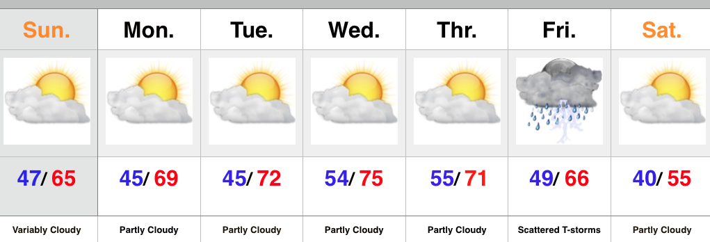
- Unseasonably warm weather
- Late week storms with a cold front
We couldn’t ask for better weather to open November. Look for an extended stretch of unseasonably warm, tranquil conditions. It’ll be perfect to finish last minute yard clean up or get an early start on putting those Christmas decorations up. Enjoy!
The next weather system of note will arrive Friday in the form of a cold front. While timing issues are present, we’re keeping an eye on the possibility of scattered showers and thunderstorms (some strong). A drier and cooler air mass will build in next weekend. An early look at weather next Sunday would suggest frosty conditions for many…
Upcoming 7-Day Rainfall Forecast: 0.25″ – 0.50″


