Severe Weather Sunday; Much Colder Next Week…
 Highlights:
- Clouds more bark than bite today
- Stormy setup Sunday
- Trending colder next week
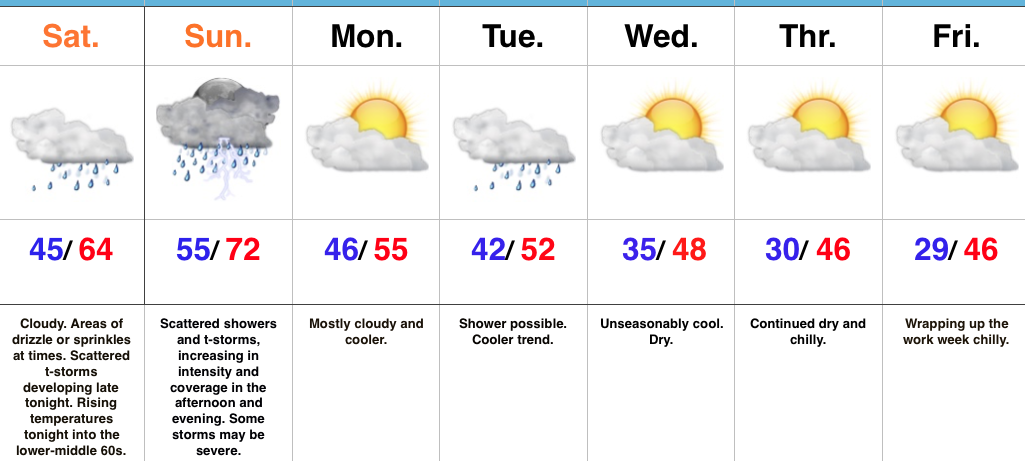
All Eyes On Sunday…The cold front that passed through the region Thursday night and setup the gorgeous close to the work week is lifting back north this morning as a warm front. This will result in overcast conditions today, areas of sprinkles or drizzle later in the day, and rising nighttime temperatures. Scattered thunderstorms will develop across central Indiana late tonight with a warmer and increasingly moist environment.
Sunday will certainly be a day to remain weather-aware. The overall setup hasn’t changed from what was discussed yesterday with a warm and moist southwesterly air flow in place ahead of an approaching cold front and associated area of low pressure. Additional ingredients in play suggest we need to monitor the threat of large hail, damaging straight line winds, and potentially tornadoes. Individual storms (potential super cells) are expected to fire across central and northern portions of the state Sunday afternoon into early evening. These will be capable of quickly pulsing to severe levels and include potential of large hail, as well as tornadoes (particularly in the vicinity of the warm front which is expected to be draped across north-central parts of the state). Individual cells are anticipated to “morph” into a squall line Sunday evening, including potential of a quick spin-up tornado, as well as damaging straight line winds. With a moisture-rich air mass in place (precipitable water values are expected to approach 2″ Sunday evening), locally heavy rainfall is also expected.
All of our “excitement” will come to an end overnight Sunday and we’ll trend much colder (and calmer) during the new work week ahead. Our next storm system will pass by to our south Tuesday, but may be close enough to spark a light shower across central portions of the state. Drier and colder conditions build in later in the week.
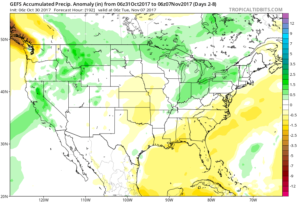
Upcoming 7-Day Precipitation Forecast:
- Snowfall: 0.00″
- Rainfall: 1.50″ – 2.50″
 Highlights:
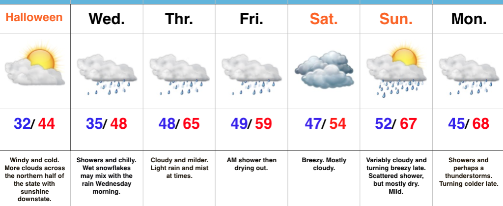 Highlights:
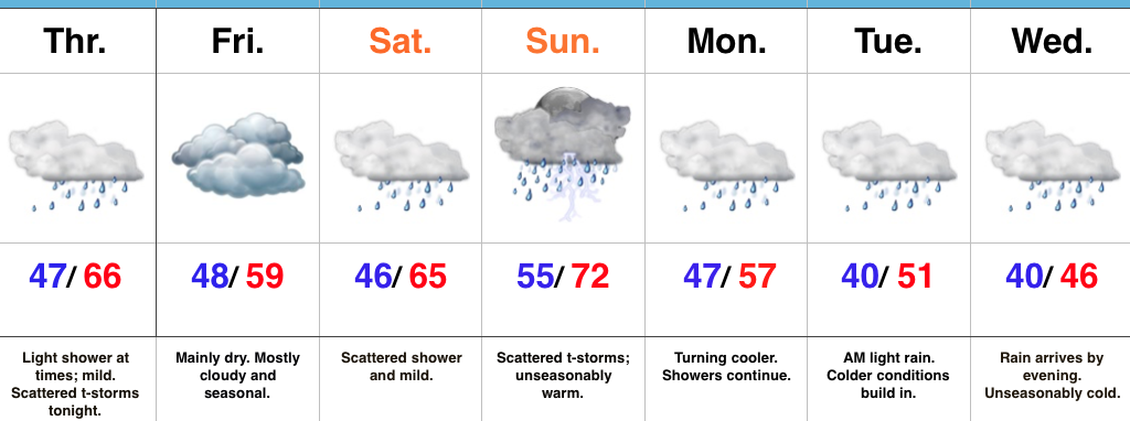
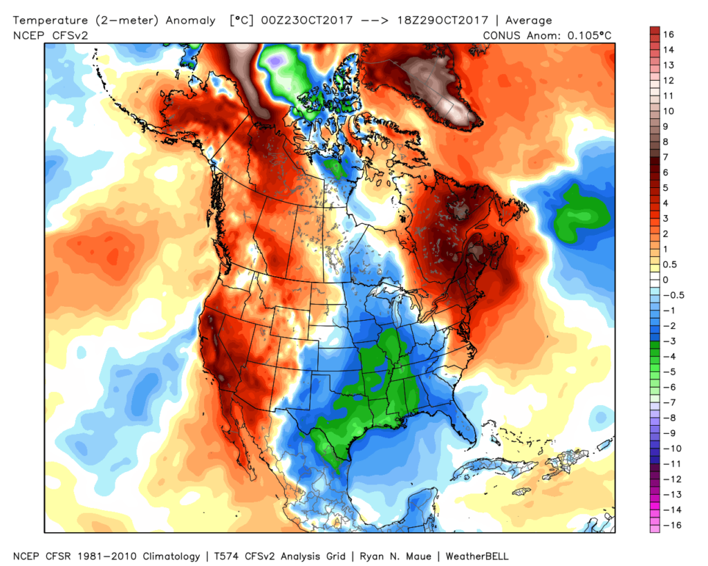 The upcoming few days will feature additional unseasonably chilly conditions before moderating through the second half of the week.
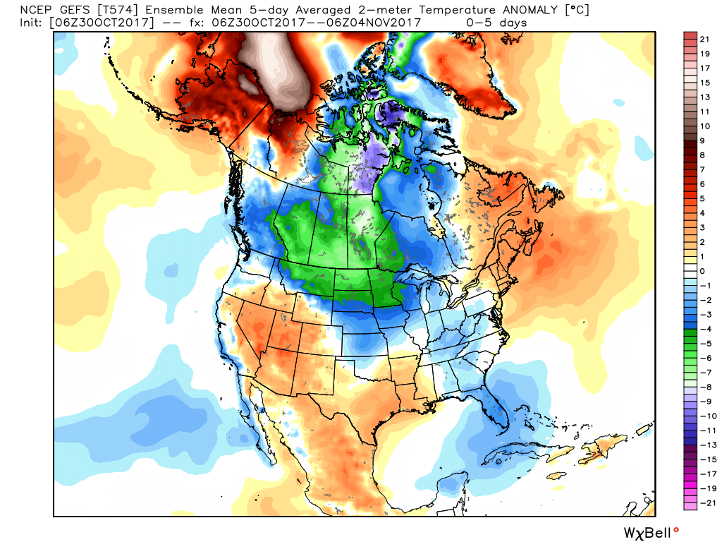 This will feature a hard freeze for central Indiana tonight. We dipped to the first 32° temperature of the season here at IndyWx.com HQ this morning and will likely beat that Halloween morning. Widespread upper 20s to around 30° can be expected.
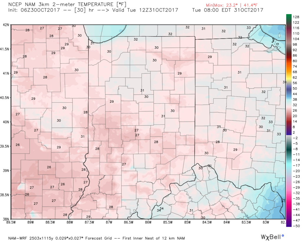 This cold air is thanks to a cold front and reinforcing chill that will feature a band of showers that scoots through the state late morning into the early afternoon.
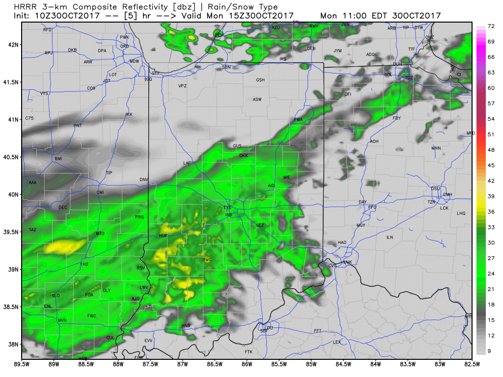 Rainfall amounts won’t be significant and feature totals between 0.10″ to 0.20″ through most of central Indiana.
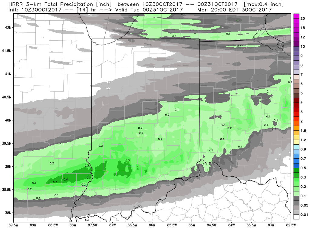 Unsettled weather will return late week and through the upcoming weekend, but temperatures will moderate and return to levels that are above average. There are indications cold will push again in the 8-10 day period, but a warmer pattern will engulf our region during the medium range period and feature temperatures that will reach the 60s by Thursday and Friday.
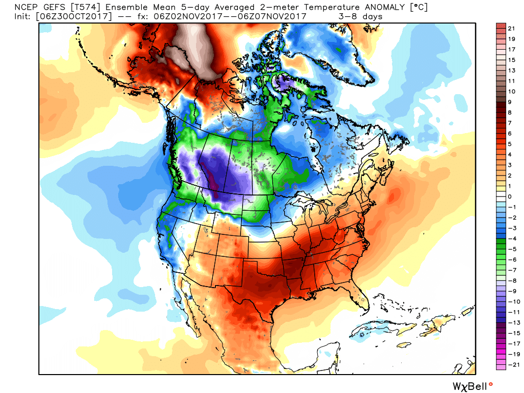 The warmer conditions will also come with rain. A “wavy” cold front will approach late week with showers before returning north as a warm front late in the weekend. Finally, this frontal boundary will push southeast early next week with cold air returning. With the movement and stubborn nature of the front, expect a prolonged duration of unsettled conditions. It won’t rain the entire time, but we’ll keep showers in our forecast beginning Wednesday into the weekend.