The short and medium range weather pattern will be highlighted by a colder than average regime, but one that’s also drier than normal.

A cooler than average, but drier than normal pattern will remain in place through the upcoming (10) days. Image courtesy of Weathermodels.com.

A few weak weather makers will scoot through the region over the upcoming (10) days, but be moisture starved. Image courtesy of Weathermodels.com.

After a warm open to October, the sustained period of chilly air is welcome by many. Image courtesy of Weathermodels.com.
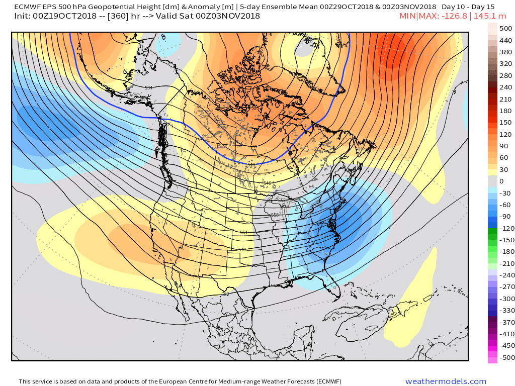
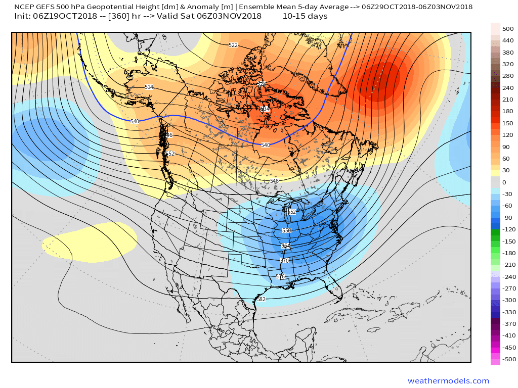
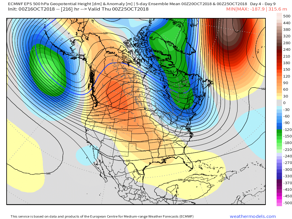
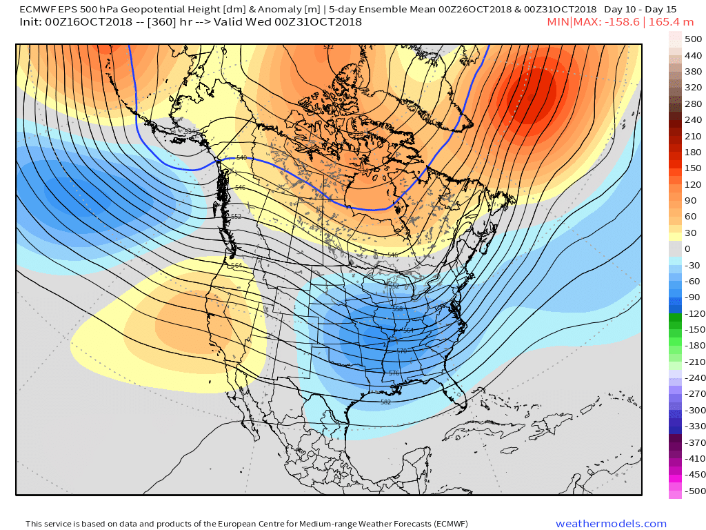
The positive PNA will continue to support the mean trough position in the central and eastern portion of the country as we rumble into late October.

As we look ahead, there are growing indications a more significant storm may impact the general region as we get closer to Halloween. This is the next time frame we’re closely monitoring for the potential of an impactful storm system. Given the overall setup, we would be surprised if this particular storm didn’t present a wintry side, as well, but it’s simply too early to know the details from a couple of weeks out. Stay tuned.

Potential is present for “fun and games” around Halloween… Image courtesy of Weathermodels.com.

