
You must be logged in to view this content. Click Here to become a member of IndyWX.com for full access. Already a member of IndyWx.com All-Access? Log-in here.
Category: Arctic Cold
Permanent link to this article: https://indywx.com/video-plowable-snow-inbound-to-open-the-work-week-record-cold-follows/
Nov 09
Client Brief: First Accumulating Snow Of The Season…
Type: Impactful wintry weather
What: Accumulating snow
When: Monday
Temperatures: Falling from the upper 30s into the 10s by Tuesday morning.
Wind: North shifting to the northwest with gusts of 20-25 MPH.
Blowing/ Drifting: Minimal

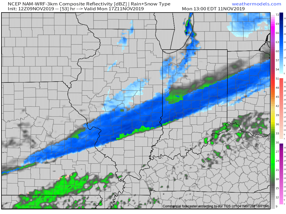
The first accumulating snow of the season (for at least most of central Indiana) awaits Monday. While this won’t be any sort of blockbuster winter storm, it’ll likely have some impacts due to the first accumulation of the season, along with plummeting temperatures Monday evening into Tuesday morning. Monday will start dry with cloudy skies and a stiff north breeze, but snow will overspread central Indiana late morning into the early afternoon. A burst of steady to moderate snow is possible into the early afternoon hours. Temperatures will crash from the upper 30s just after daybreak into the upper 20s by the evening rush. Snow will begin to diminish from north to south around 5p to 6p. Please note, the above “1st call” doesn’t include the additional lake effect snow that will follow for the northern IN snow belt. While heavy snow isn’t expected, local slick spots will develop on untreated surfaces as temperatures continue to plummet into the 10s during the overnight period.
Confidence: Medium
Next Update: Late Saturday night or early Sunday morning
Permanent link to this article: https://indywx.com/client-brief-first-accumulating-snow-of-the-season/
Nov 09
VIDEO: Wintry Open To The Work Week…
You must be logged in to view this content. Click Here to become a member of IndyWX.com for full access. Already a member of IndyWx.com All-Access? Log-in here.
Permanent link to this article: https://indywx.com/video-wintry-open-to-the-work-week/
Nov 08
VIDEO: First Accumulating Snow Of The Season Precedes Record Cold…
You must be logged in to view this content. Click Here to become a member of IndyWX.com for full access. Already a member of IndyWx.com All-Access? Log-in here.
Permanent link to this article: https://indywx.com/video-first-accumulating-snow-of-the-season-precedes-record-cold/
Nov 07
Appetizer To The Main Course…
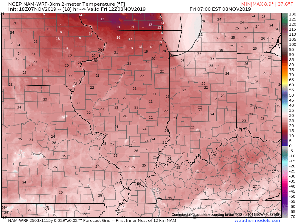
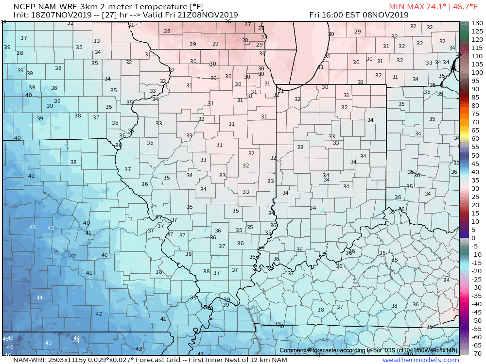
The cold front that moved through the state today will serve as an “appetizer” to the “main course” early next week. This is rather incredible considering lows tonight will fall into the lower 20s for most of central Indiana with highs Friday only topping out in the lower to middle 30s. Keep in mind averages for this time of year include a low of 38° and high of 56°!
Dry conditions should prevail through the weekend, but a strong early season arctic cold front has its eyes set on the region Sunday night. This front will slide south through the state Monday, but there’s an interesting twist that will take place as it does so. A wave of low pressure is expected to develop along the boundary and push northeast Monday. This should result in precipitation growing in overall coverage across the region to open the work week. With cold air pressing south at this point in time, the majority of precipitation should fall in the form of snow. While we’re not expecting a major winter storm, this should result in the first widespread measurable snow of the season for central Indiana and our weekend products will begin to include more detailed specifics as time draws closer. (The famous “ridiculously” early call from this distance is for a 1″ to 2″ type event).
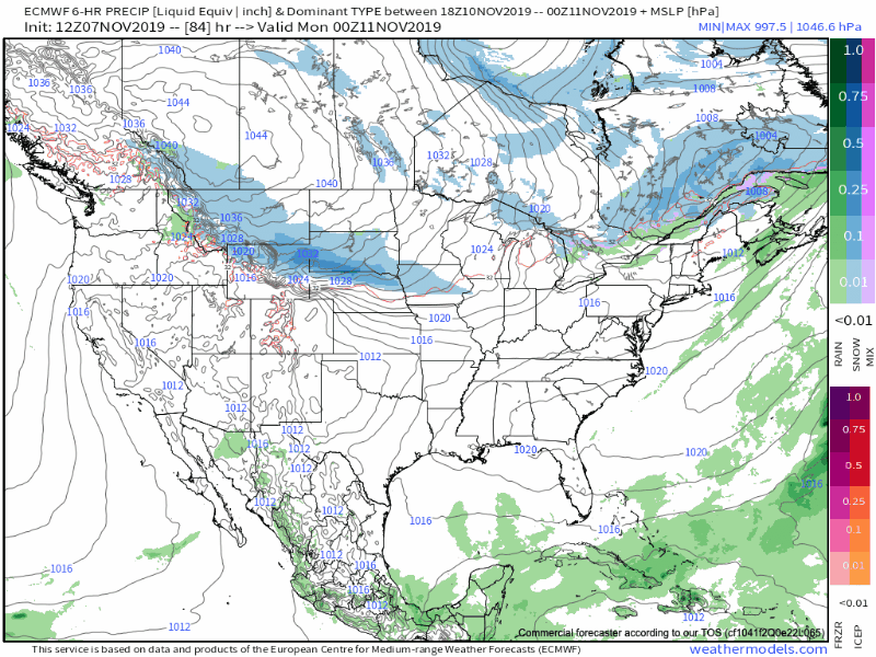
With true arctic air pressing south so early in the season, expect heavy lake effect snow in the traditional snow belt communities across northern IN, MI, OH, PA, and NY. (May need a yard stick to measure snow in spots in these areas before the snow guns shut off mid to late next week). Accumulating snow will extend as far south as the southern Appalachians in this pattern Monday night into Tuesday.
The cold will be something to behold on the backside of this arctic boundary. Highs across central Indiana will only top out in the middle to upper 20s Tuesday and Wednesday with overnight lows in the 10° to 15° range. Below zero wind chill values can be expected.
Much more on the cold and snow early next week will come here throughout the weekend. We leave you with one last item of interest- looking ahead to the 2nd half of November…
The latest JMA Weeklies suggest a similar pattern- western ridge with a cold eastern trough.
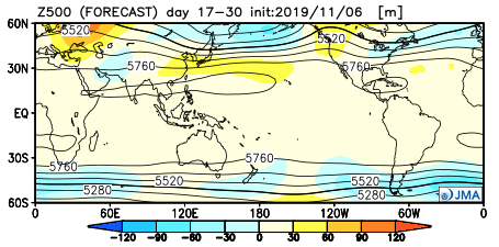
Time to go ahead and bring out the heavier winter gear with the persistent nature of this pattern…
Permanent link to this article: https://indywx.com/appetizer-to-the-main-course/