
You must be logged in to view this content. Click Here to become a member of IndyWX.com for full access. Already a member of IndyWx.com All-Access? Log-in here.
Category: Arctic Cold
Permanent link to this article: https://indywx.com/video-looking-ahead-to-the-thanksgiving-pattern/
Nov 12
Tuesday Morning Rambles: Record Cold Indeed…
I. Number-Busting Cold: The western half of central Indiana is experiencing downright frigid conditions this morning. Skies that cleared out and combined with the fresh snow pack, along with strong cold air advection overnight now find themselves in the middle single digits! Officially at IND, the low temperature of 9° (as of the 7a hour) sets a record not only for the day, but is the earliest in the fall season that the temperature has fallen into the single digits.
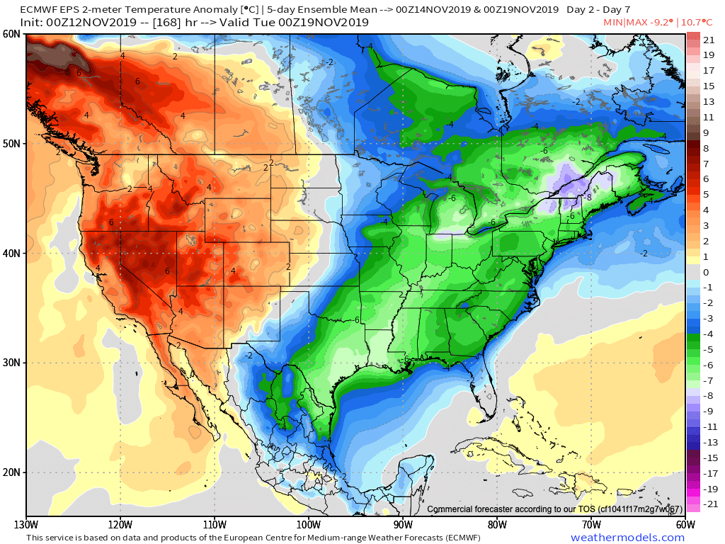
II. Cold Remains: For some perspective on the current cold, average temperatures this time of year include lows in the upper 30s and highs in the middle 50s. Safe to say we won’t be anywhere near those numbers over the next 6-7 days. Even after we pull out of the arctic intrusion over the next couple of days, temperatures will remain well below average through the weekend.
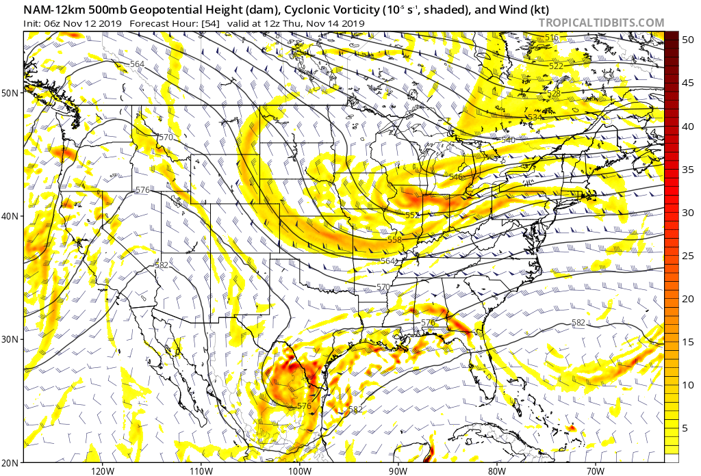
III. Fast Moving Clipper: We’ll keep close tabs on a fast moving clipper system Wednesday night into Thursday morning, but as of now, only expect scattered light snow showers across north-central Indiana Thursday morning with this system (no accumulation anticipated). After this system, we’re talking about a rather dry forecast into early next week. The next chance of precipitation (light rain) would come Monday, but the key word here is “light.”
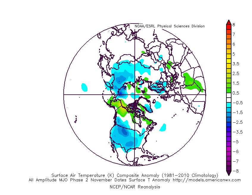
IV. Looking Ahead: We’ll have a more extensive long range update later this evening. One of the items of interest is the way modeling handles the MJO propagation. While the European isn’t nearly as amplified, the American modeling wants to take the MJO into Phase 2 towards Thanksgiving. Phase 2 this time of year would argue for widespread colder than normal conditions. Again, much more on the long range pattern a bit later.
Permanent link to this article: https://indywx.com/tuesday-morning-rambles-record-cold-indeed/
Nov 11
Evening Video Update: “System” Snow Shifts To Lake Effect Overnight; Midweek Worthy Of Attention…
You must be logged in to view this content. Click Here to become a member of IndyWX.com for full access. Already a member of IndyWx.com All-Access? Log-in here.
Permanent link to this article: https://indywx.com/evening-video-update-system-snow-shifts-to-lake-effect-overnight-midweek-worthy-of-attention/
Nov 11
VIDEO: Detailed Analysis Of Today’s Impactful Snow And Associated Lake Effect/ Record Cold To Follow…
You must be logged in to view this content. Click Here to become a member of IndyWX.com for full access. Already a member of IndyWx.com All-Access? Log-in here.
Permanent link to this article: https://indywx.com/video-detailed-analysis-of-todays-impactful-snow-and-associated-lake-effect-record-cold-to-follow/
Nov 10
Client Brief: Weather Goes Downhill Quickly Monday PM…
Type: Impactful wintry weather
What: Accumulating snow
When: Monday afternoon into Tuesday morning
Temperatures: Falling from the lower 40s around daybreak into the lower 20s by late evening.
Wind: North shifting to the northwest and gusting 20-25 MPH.
Blowing/ Drifting: Minimal
Pavement Impacts: Salting and plowing will be required

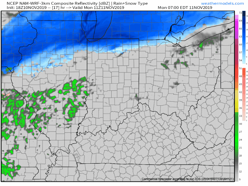
We type this with a quiet and pleasant early-November evening underway, but major changes await on deck. An arctic cold front will continue to press south through the state during the overnight period. Monday will dawn with overcast and dry conditions across immediate central Indiana, along with a stiff northerly breeze. That said, a cold rain will develop by mid morning and this will transition to wet snow around or just after lunch north of the city and early afternoon for the city, itself. Some embedded banding is possible within the snow shield Monday afternoon into the evening hours, thanks to a strengthening surface wave moving northeast along the arctic front. This will create the potential of heavier snow rates around the evening rush. Combine this with the fact temperatures will be falling into the 20s around this time frame and it’s a safe bet that weather will create a high impact on evening travel Monday all throughout central Indiana. The “system” snow will diminish off to the southeast late evening, but by this time, lake effect streamers are expected to pivot across central Indiana before eventually setting up shop across east-central and northeast Indiana Tuesday morning. Record cold will follow the fresh snow with a low Tuesday and Wednesday mornings between 10° to 15°.
Confidence: High
Next Update: Monday morning
Permanent link to this article: https://indywx.com/client-brief-weather-goes-downhill-quickly-monday-pm/