Category: Arctic Cold

Dinner Time Rambles: Prospects Of HVY Rain On The Increase And Brief, Yet Potent Early Season Arctic Jab…

Updated 10.23.23 @ 5:45p

I. Today’s model suite continues to suggest quite the unsettled stretch of weather awaits for pre-Halloween festivities. I know, please don’t shoot the messenger. The culprit? A strong autumn cold front stalling out for a time in response to waves of energy riding along the boundary. The end result will likely be a widespread swath of 1″+ rains over the weekend with a more localized 2″+ band. Details will have to be fine tuned as we get closer, but folks with outdoor activities and ag/ harvest ’23 interests should plan on a rough stretch of weather in the Saturday through Monday timeframe.

Multiple rounds of moderate-heavy rain are becoming likely over the pre-Halloween weekend.

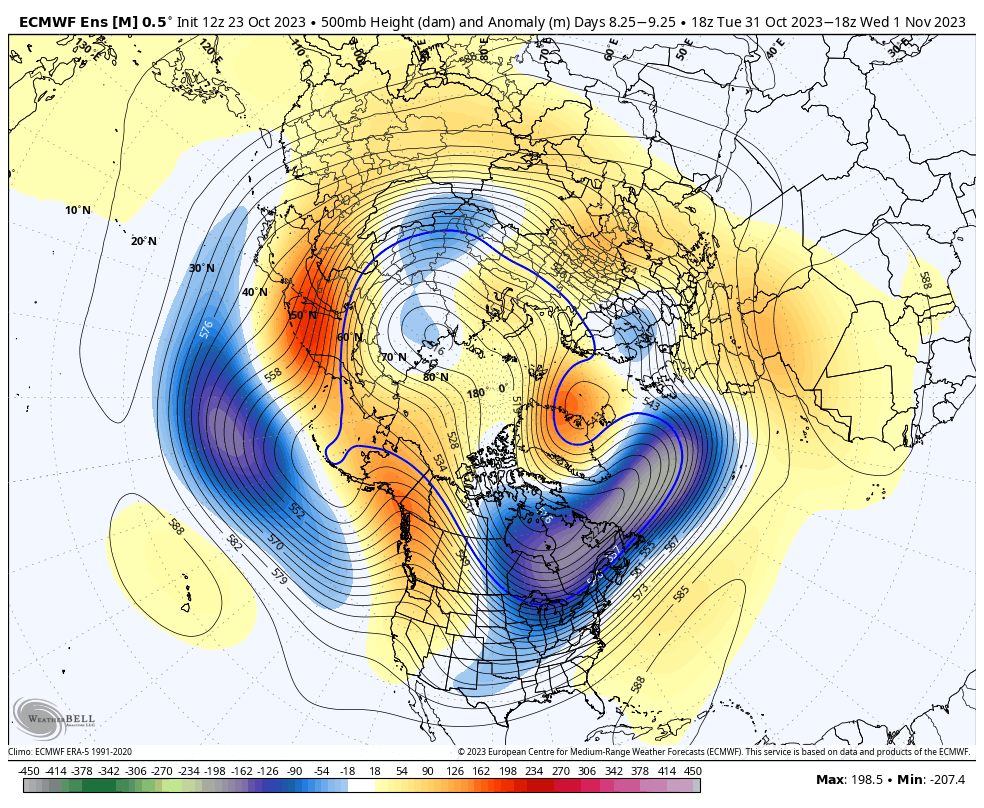
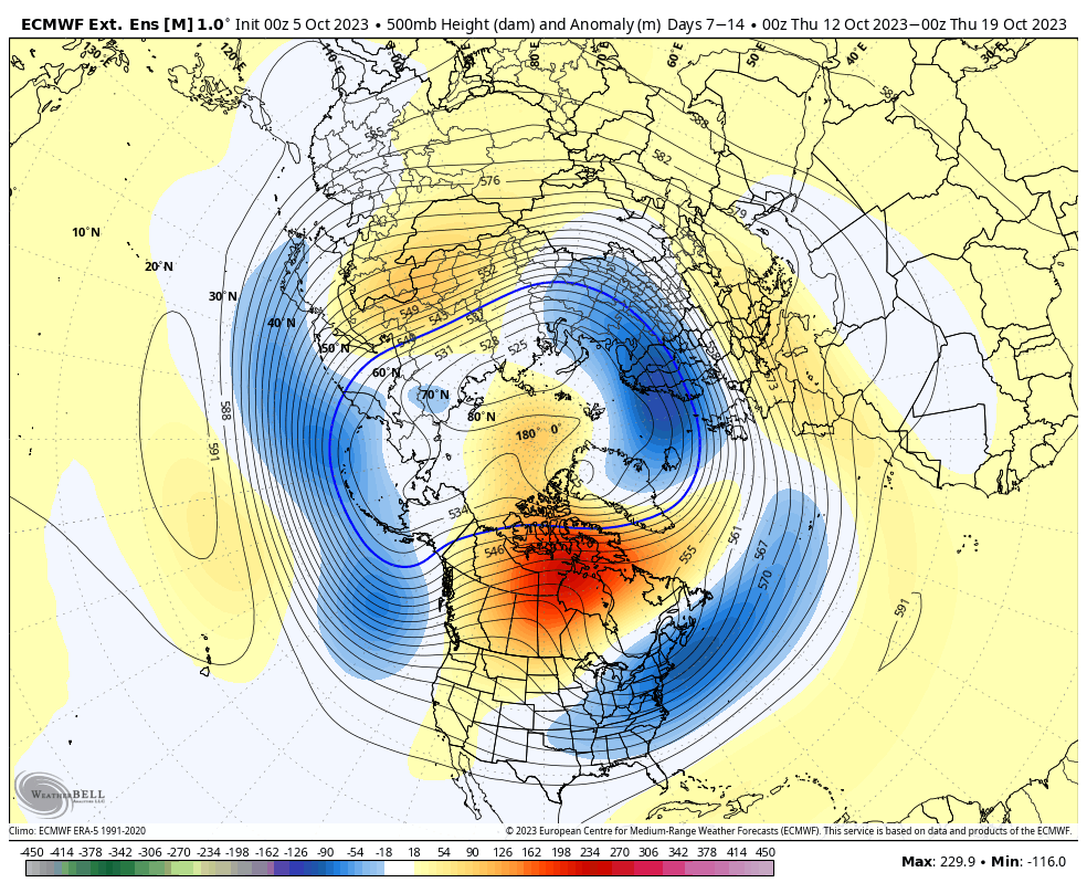
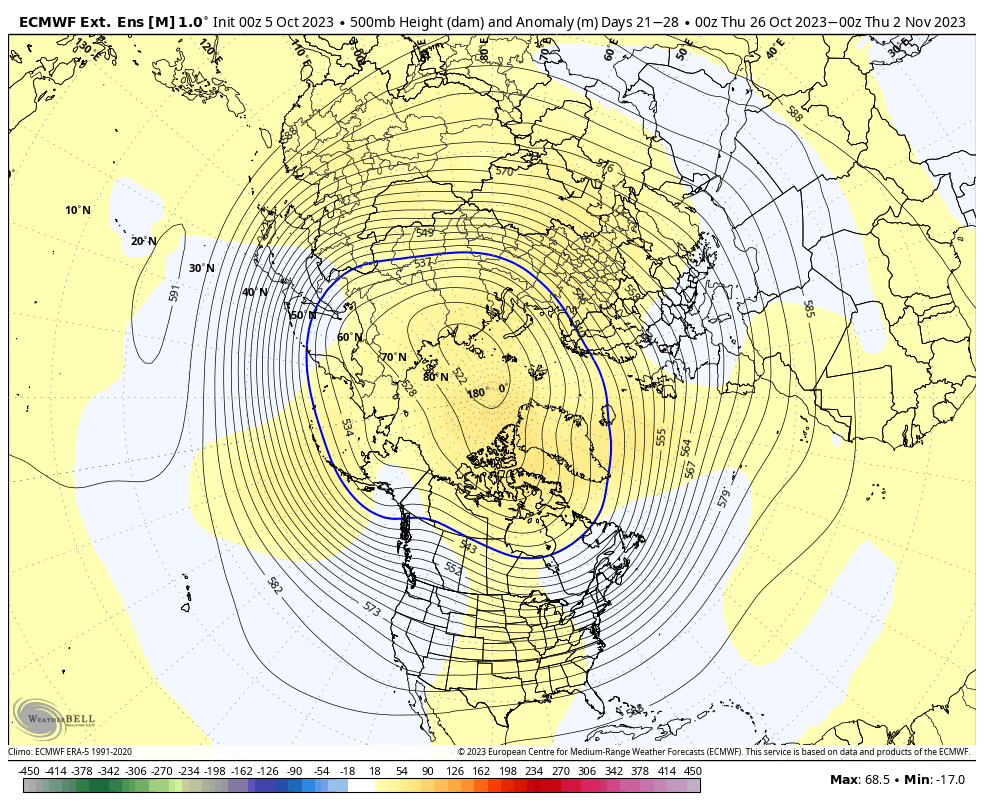
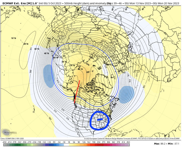
II. The coldest air so far this fall season will come rushing in on the heels of all of the aforementioned rain in the 8-10 day timeframe. Today’s European guidance is going all-in on a potent early season “jab” of arctic air, including highs around freezing and lows deep into the 20s. Perhaps extreme? Certainly, but this also has merit given where the pattern is. Though this will likely only be a brief intrusion of bitter air (at least by early November standards), I’d certainly go ahead and plan on the growing season coming to a screeching halt in just a little over a week from today.

Permanent link to this article: https://indywx.com/dinner-time-rambles-prospects-of-hvy-rain-on-the-increase-and-brief-yet-potent-early-season-arctic-jab/

Trend Hasn’t Been Our Friend As Of Late Around The Holidays; Reason To Believe This Year Is Different?

Updated 10.07.23 @ 6:09a

Though officially, we’re only a couple weeks into autumn, attention here has begun to shift towards the potential predominant pattern as we push into the holiday season.

A quick, simple look back over the most recent November and December patterns is a sight that generates anxiety for most winter lovers. At a time when the majority of even non-winter lovers would like snow (i.e. the holidays), well above normal temperatures, and almost record warmth has become all too common over the years.

November 2015-2022

December 2015-2022

Is there reason to believe that could be different this year, especially with our base transition to El Nino? Simply put, not so fast my friend. El Nino winters are notorious for getting off to slower, warm starts. Our research shows that many times November can start cold but that the December pattern flips warmer around these parts. That’s, obviously, not to say it “has” to be that way. Many other factors contribute to the overall regime, but just that when you simply bundle all 1st year Nino events together, it’s more typical than not to find things play out such as illustrated above.

Let’s take a more specific look at our analog package (’82-’83, ’91-’92, ’02-’03, ’09-’10, and ’15-’16) and see what that suggests may be in store as we begin to set our eyes on the holidays.

November: Slightly above normal, locally. Unseasonably cold west and unseasonably warm New England are the headliners.

December: Greatest warm anomalies are centered over the Ohio Valley, in what otherwise is a large-scale warmer than normal regime from the Plains east.

January: The pattern begins to really flip around with cold bleeding southeast as the northern Plains and Northwest turn warmer than normal.

What does this all mean to me? While there’s only one that knows the future, if I was a betting man, I’d lean towards another holiday season that features above normal temperatures and most likely a greater than normal chance of below average December snowfall. I’d anticipate a few cold shots in November and the possibility of one or 2 accumulating snow events that gives way to the overall warmer idea in December. There’s always the chance the pattern begins to shift that last week of December for the colder January look… That’s the hope we’ll leave you with in this post in what otherwise will likely be a warmer than normal month as a whole.

Permanent link to this article: https://indywx.com/trend-hasnt-been-our-friend-as-of-late-around-the-holidays-reason-to-believe-this-year-is-different/

LR Discussion: Pattern Discussion Through The Remainder Of October And Into November…

Updated 10.06.23 @ 7:56a

As we type this, we’re in the midst of the season’s 1st big blast of chilly air. These shots will become progressively cooler (colder) in the coming weeks and months. Speaking of that, we’re also working on a post that we’ll unveil over the weekend looking specifically at the upcoming holiday season and what our analog package/ respective SST configuration says we may have in store this season.

For the purpose of this post, we’ll focus squarely on the pattern through the remainder of October.

As we typically do, the pattern drivers (+ PNA and – EPO) both suggest a ‘mean’ trough should take up shop across the eastern 1/3 of the country over the next couple weeks. What’s interesting is that the updated European Weeklies also suggest this general theme should continue into at least mid-November. Despite a favorable setup with respect to the PNA/ EPO, the model tries to wash out the chill and hints at a ridge down the road. In my humble opinion, this is the model feeding back on itself and once again showcasing an inability to see below normal temperatures in the longer range. We’ve shown time and time again over the summer and even into the early fall where the model is “forced” to cool the closer we get to a given period and believe that will, once again, be the case this go around, especially with the anticipated positive PNA and negative EPO.

The Pacific North American pattern (PNA) is expected to remain in a positive state through the majority of the upcoming 5-6 weeks.
The East Pacific Oscillation (EPO) is anticipated to remain largely in a negative state through the upcoming 5-6 weeks.

The upper pattern, illustrated with last night’s European Weeklies, is one that breaks the trough down towards Halloween. While there is a possibility of some brief warming around this timeframe, I suspect we’ll once again look back at the model having to correct colder over the east as we rumble into November. More on that in a moment.

Week 1: 10/5 through 10/11

Week 2: 10/11 through 10/18

Week 3: 10/18 through 10/25

Week 4: 10/25 through 11/1

The period ends with a warmer look around Halloween and while this is on the table, it’s also a look that should promote building heights over AK and western Canada and another period of blocking with a subsequent cold trough developing over our neck of the woods and the central/ east as we rumble through into November. The model is seeing the building heights, but not picking up on the magnitude of a downstream trough and associated colder pattern, IMO. Frankly, this 500mb look is capable of producing very cold weather sometime during mid-November and I suspect the model will have to start playing catch up as we move forward.

Permanent link to this article: https://indywx.com/lr-discussion-pattern-discussion-through-the-remainder-of-october-and-into-november/

Unsettled Close To The Work Week; Cold Weekend On Tap…

Updated 03.15.23 @ 6:58a

Let’s start with the good news and that’s today’s forecast. Despite a bitterly cold start (most are waking up to temperatures between 18° and 22°), expect plentiful sunshine today. Though it’ll be unseasonably chilly, that March sun angle will go a long way in making it feel a lot better by this afternoon.

Clouds will increase overnight and Thursday morning and eventually give way to light rain by afternoon. We anticipate rain to reach the city, itself, between 2p and 3p.

Rain will become steadier and more widespread as we progress through the evening and Thursday night.

Precipitation may end as a brief period of snow Friday morning, but “brief” is the key word. In general, heaviest rain is expected to fall across the southern half of the state, mostly along and south of the I-70 corridor. This is a 0.25” to 0.75” type event for most.

The bigger story comes in the form of another late season arctic “jab” behind the frontal passage. Highs both Saturday and Sunday will remain stuck in the 30s with overnight lows once again dropping into the upper 10s to lower 20s. Wind chill values will fall into the single digits to lower 10s.

Permanent link to this article: https://indywx.com/unsettled-close-to-the-work-week-cold-weekend-on-tap/

VIDEO: Cold Air Reinforcements Just In Time For The Weekend…

Updated 03.14.23 @ 6:04a

You must be logged in to view this content. Click Here to become a member of IndyWX.com for full access.  Already a member of IndyWx.com All-Access?  Log-in here.

Permanent link to this article: https://indywx.com/video-cold-air-reinforcements-just-in-time-for-the-weekend/