Updated 11.24.23 @ 7:50a Quiet, but colder (and blustery) weather will be with us for our Black Friday and Small Business Saturday. Our next weather maker arrives Sunday as the…
You must be logged in to view this content. Click Here to become a member of IndyWX.com for full access. Already a member of IndyWx.com All-Access? Log-in here.
Updated 11.23.23 @8:21a Here’s wishing you and your family a blessed and very happy Thanksgiving holiday. We’re so incredibly thankful for your support- and more importantly friendship over the years.…
You must be logged in to view this content. Click Here to become a member of IndyWX.com for full access. Already a member of IndyWx.com All-Access? Log-in here.
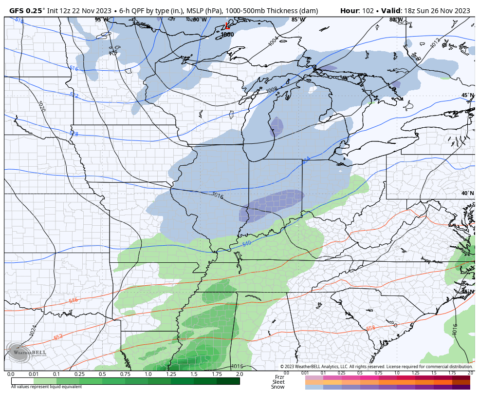
We’ve been keying in for several days on the energy that will lead to a Thanksgiving and Black Friday Winter Storm for the Rockies, and eventually a swath of accumulating snow into the Plains over the holiday weekend. To no surprise, modeling continues to trend more organized with this energy as it moves across the Plains and into the Ohio Valley this weekend. The time we’re monitoring for potential wintry impacts across central Indiana come early Sunday morning, continuing into the afternoon.
As bullish as we’ve been on this trending towards a more substantial system, capable of producing snow, locally, we remain confident that this won’t be some sort of significant winter storm. Why? Pattern recognition on both fronts. That said, the potential of a light snow accumulation across central Indiana Sunday is very much alive and kicking as of this evening. Know that we’ll be here right through the holiday and the weekend tracking the latest and will continue to keep you posted moving forward.
Regardless if we receive snow or not, the coldest air so far this season is on deck early next week.
Models continue to trend more organized with our holiday weekend system, potentially capable of the 1st widespread snow of the season for central Indiana.
Updated 11.22.23 @ 7:48a A dry (but at times breezy) airmass will continue settling overhead just in time for our Thanksgiving holiday. High pressure will keep us quiet until Sunday.…
You must be logged in to view this content. Click Here to become a member of IndyWX.com for full access. Already a member of IndyWx.com All-Access? Log-in here.
Permanent link to this article: https://indywx.com/video-dry-weather-returns-just-in-time-for-thanksgiving-cold-pattern-settles-in-to-close-november-and-open-december/
Updated 11.21.23 @ 7:24a A cold front will work through the region this morning. We’ll notice a wind shift to the northwest and colder air building into central Indiana through…
You must be logged in to view this content. Click Here to become a member of IndyWX.com for full access. Already a member of IndyWx.com All-Access? Log-in here.