Category: Arctic Cold

Snow Talk And A Look Ahead Towards Christmas Week…

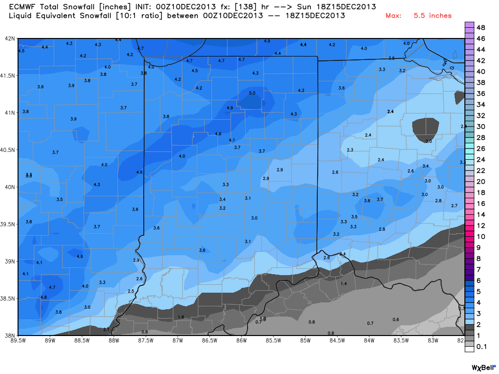
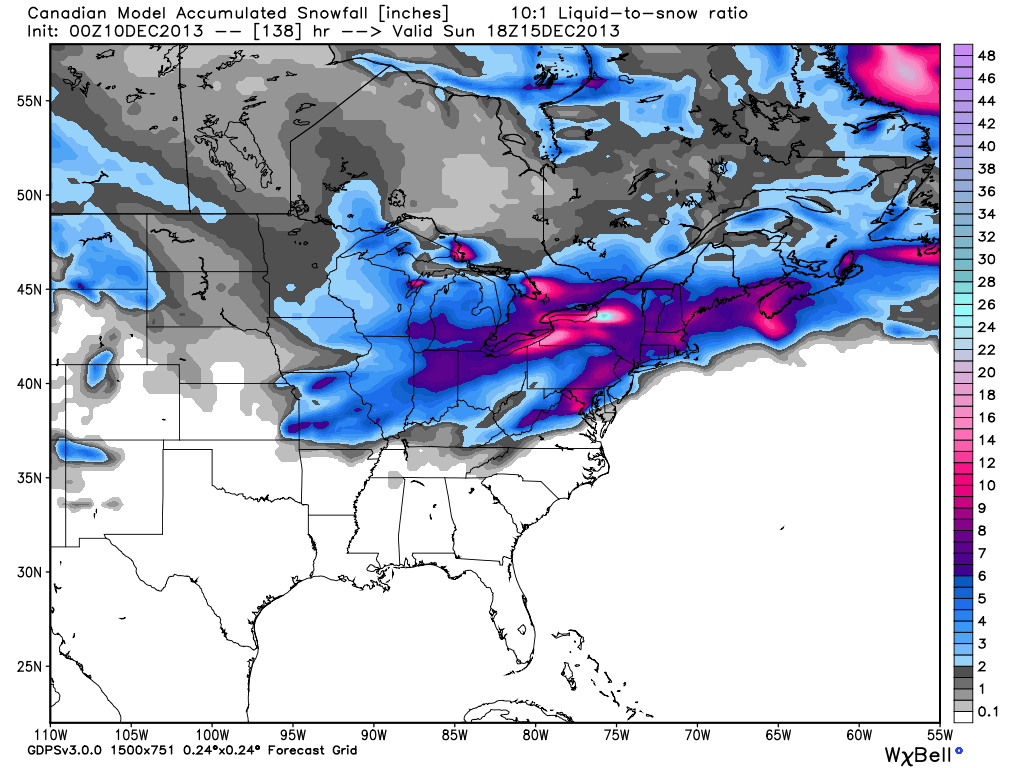
Latest data in house still suggests a plowable snow is ahead for most of central Indiana this weekend.  We think wintry precipitation expands northeast to encompass all of the region between 7pm-9pm Friday evening (southwest to northeast).  This wintry precipitation still appears to take the form of all snow for IND and points north, but we caution that south-central Indiana communities will have to deal with a mixed bag of precipitation, including sleet and perhaps some freezing rain along with the snow.  The primary snow zone will have no trouble seeing snow amounts of 4-5 inches, but for south-central Indiana neighborhoods, snowfall accumulations appear to be closer to 2 inches, with additional accumulations of sleet also possible.  Needless to say, we feel pretty good about our initial snowfall forecast posted last night in our 7-Day forecast video (always available to the right of these posts in the video player).  The limiting factor, in our opinion, of even higher snowfall totals will be due to the speed of the system.  We think this is primarily a quick 6-8 hour “thump and go” type snow storm followed by some lingering light snow/ snow showers and gusty winds Saturday PM.  The sunshine returns for Sunday along with another surge of bitterly cold air with highs in the 20s.

Friday night-Saturday Snow Storm Highlights:

  • Wintry precipitation arrives between 7p-9p Friday across central Indiana.
  • Primarily all snow from Indianapolis and points north
  • Mixed precipitation south of IND will include sleet and freezing rain
  • Snowfall accumulations of around 2″ south-central Indiana, increasing to 4-5″ amounts along and north of the I-70 corridor.
  • Accumulating snow tapers off late Saturday morning.

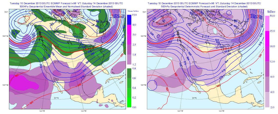
Our attention then turns to what may lie ahead Christmas week.  After the chance of some brief “relaxation” from the current bitterly cold pattern, we look to reload the cold with authority around Christmas week.  In fact, if latest data comes to fruition, the current cold would pale in comparison to what lies ahead.  Additionally, a rather significant storm system could precede the arctic blast.  It’s far too early to talk specifics on precipitation type or amounts, but don’t be surprised if a storm of “significance” is on the maps as we approach Christmas week…

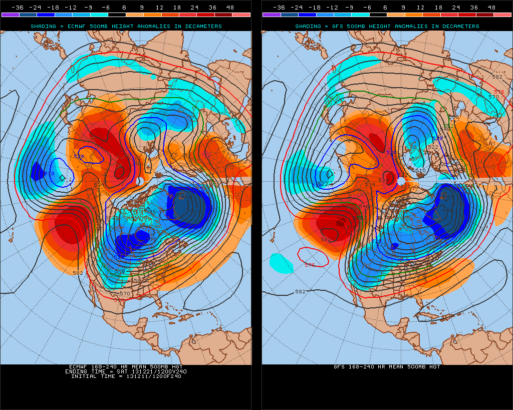
The latest ensemble plot from the GFS and European (below) agree on first class cross-polar flow setting up shop, which will help refrigerate the Lower 48 with some seriously bitter air just in time for Christmas.  Stay tuned…

test8

Permanent link to this article: https://indywx.com/snow-talk-and-a-look-ahead-towards-christmas-week/

What A Difference A Year Makes!

Our colder than normal pattern has really been in place since mid October.  Looking ahead, despite some potential brief “relaxation” from the cold a few days next week, the mid to long range pattern continues to look colder than normal.  Here’s a look at December so far, temperature-wise.  Note the presence of the southeast ridge keeping that particular portion of the lower 48 warmer than normal, so far.  Everywhere else, the freezer door has been left open!

4

What a difference a year makes, snow-wise, as well!  Here’s a look at the snow cover on this date last year compared to present.  Amazingly, this year, nearly 64% of the country is snow covered compared to 31% on this date last year.

The combination of more than normal snow and colder air for the majority of the country can be traced back to the expanding snow pack across Canada earlier this fall.  Now, the cold and snow are essentially in “feed back” mode with one another, as the overall pattern ahead is one that’s plenty cold…and snowy.

21

Permanent link to this article: https://indywx.com/what-a-difference-a-year-makes/

Snowy Pattern Continues…

Considering we’re only a third of the way through December, we’re certainly running “snowier” than normal at this very early stage in the game.  As we look ahead at the upcoming 10 days, or so, we see this snowier than normal pattern continuing with multiple systems to contend with over the course of the upcoming couple weeks.  Up next will be the threat of some light snow showers and flurries with reinforcing arctic air Wednesday PM.  Nothing significant is anticipated here on Wednesday, accumulation-wise, but snow showers will blow through the area Wednesday afternoon.  The latest high-resolution NAM shows this well.

hires_ref_indy_37


Then our attention turns to a developing winter storm for the weekend. We think clouds increase Friday and snow develops Friday night into early Saturday.  Here’s a look at the latest GFS forecast model, valid Friday night.

gfs_ptype_slp_east_17


Fast forward that to Saturday morning and snow grows heavier…

gfs_ptype_slp_east_18


The GFS suggests a weak surface low tracks into eastern Ohio with backlash snow showers and embedded squalls continuing here Saturday night into Sunday.

gfs_ptype_slp_east_20


It’s important to remember that we’re still a few days out from this event and I can guarantee you things will change as we go through the course of the upcoming few days that will require us to do some adjusting to our forecast Friday-Sunday.  That said, at this early stage in the game, unlike with our last storm, I’d favor areas from IND and points north as the place where heavier snow falls this go around.

Latest GFS ensembles suggest something similar to the operational run shown above with one low tracking into the eastern Ohio Valley as another coastal low develops.

f120

The European ensembles provide an “intriguing” look for an Ohio Valley winter weather event this weekend, as well.

Geopotential32at32500hPa_North32America_96


A couple of additional items to consider at this early juncture- this will be a fast moving winter storm so that will have an impact on snowfall accumulation.  Additionally, there’s also the chance enough warm air aloft advects (WAA or warm air advection) into the southern portions of the region to result in “mixing” issues (i.e. sleet and freezing rain).  In the primarily “snow zone” Friday night-Saturday (again, we’re currently targeting IND and points north for the snow zone) several inches of snow could accumulate.

Here’s an early look at what the latest mid-range forecast models are seeing in terms of potential accumulations with this event.  Top to bottom: ECMWF, GFS, and Canadian.  Stay tuned, we’ll have another update later!  Enjoy your day!

ECMWFGFScmc_snow_acc_east_24

Permanent link to this article: https://indywx.com/snowy-pattern-continues/

Monday Morning Weather Rambles…

1.)  Light freezing rain and freezing drizzle led to numerous reports of a light glaze and associated very hazardous travel across central Indiana overnight.  With temperatures remaining below freezing today,…

You must be logged in to view this content. Click Here to become a member of IndyWX.com for full access.  Already a member of IndyWx.com All-Access?  Log-in here.

Permanent link to this article: https://indywx.com/monday-morning-weather-rambles/

A Closer Look At Two Winter Weather Events.

Your updated, custom-built, Thursday video forecast can be found to the right of this post in the video player.  We typically update our video forecast during the evening.

Good Morning and happy Thursday!  We continue to monitor the latest data for our upcoming winter weather events.  It’s a busy time of things and by the looks of the overall pattern, I’ll have to stock up on the coffee for the weeks ahead.  Quite honestly, a very cold and snowy pattern appears to be setting up shop now through the end of the month.  Anyone dreaming of a white Christmas? 😉

Here are some quick bullet points for the upcoming few days:

  • Snow/ sleet overspreads the region this evening
  • (2) waves of snow/ sleet move through the region between this evening and Friday
  • Saturday will be a very cold and dry day
  • Renewed snow and potentially freezing drizzle move in Sunday
  • We continue to forecast a total of 3-6″ of snow between tonight and Monday morning

Latest forecast models continue to suggest temperatures fall through the day with a mixture of snow and sleet overspreading the region as early as 3-5pm from southwest to northeast.  We anticipate a rather rapid transition from sleet to snow, especially from IND and points north.  Here’s a look at the latest HRRR simulated radar data, valid tonight at 6 o’clock:

hrrr_ref_indy_15

Here’s a look at the GFS model.  (We think this particular model has a much better handle on things now that we’re closer to the event).  Note the “waves” of wintry precipitation forecast and we agree with this.  Wave #1 arrives for the evening rush with wave #2 arriving Friday morning into the afternoon.

GFS1GFS2GFS3

Additionally, after a very cold and dry Saturday, renewed accumulating snow will overspread the region Sunday, potentially ending as a mixture of light freezing rain or freezing drizzle atop the fresh snow Sunday afternoon.

GFS4GFS5

Permanent link to this article: https://indywx.com/a-closer-look-at-two-winter-weather-events/