Highlights:
- Dangerous Cold
- Blowing And Drifting Snow
- 2nd Shot of Arctic Air
- More Wintry Mischief Ahead
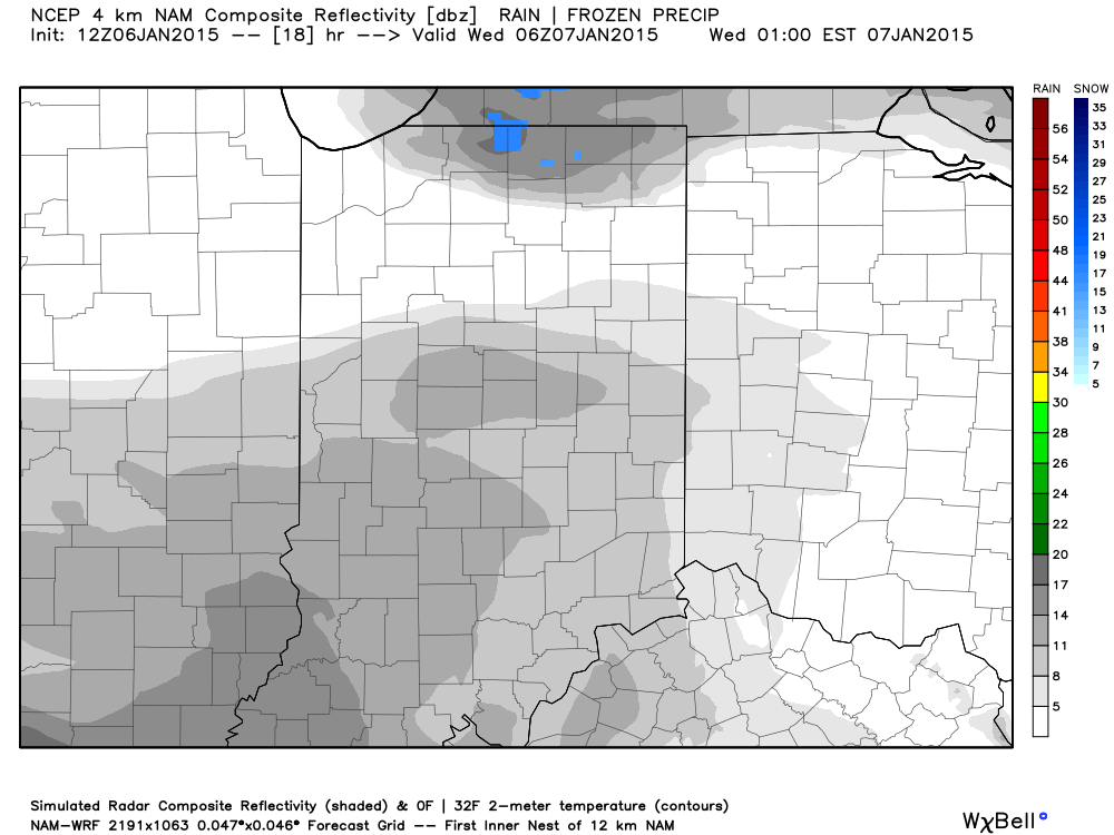
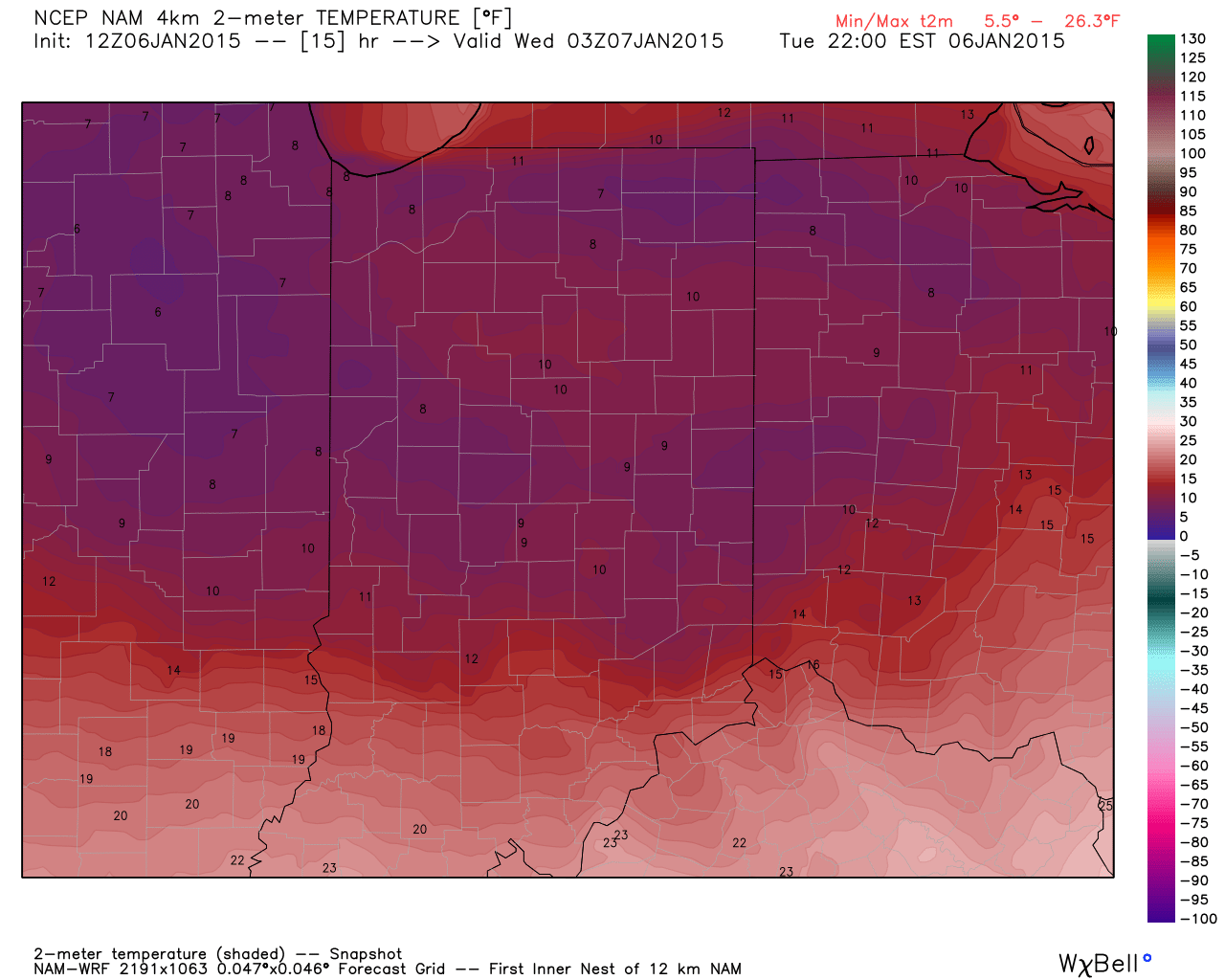
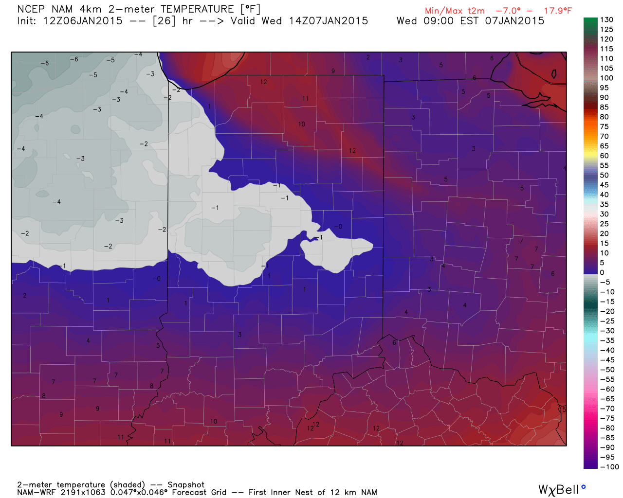
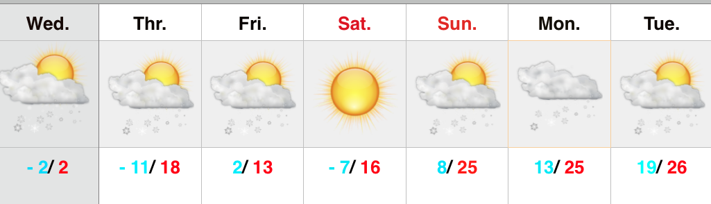
Dangerous Weather…Severely cold, arctic, air will continue to pour into the region today. Snow showers accompanied the arctic push during the early morning hours and a few flurries can be expected from time to time today (heavier lake effect snows northeast). Winds will be strong and gusty, including considerable blowing and drifting snow. Wind chill values will approach 30 degrees below zero this afternoon into Thursday morning. Needless to say, have a winter survival kit in your car if you must travel.
Additional impulses of energy will rotate through the region Thursday and Friday with periodic scattered snow shower potential Thursday afternoon into early Friday.
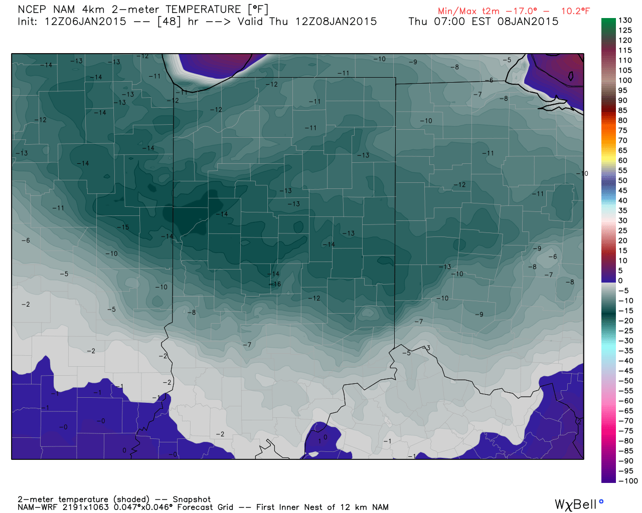
A second surge of arctic air will invade Friday night and Saturday morning and result in temperatures, yet again, below zero.
As we move forward, all eyes will turn to the potential of new “wintry fun and games” late in the weekend into early next week.
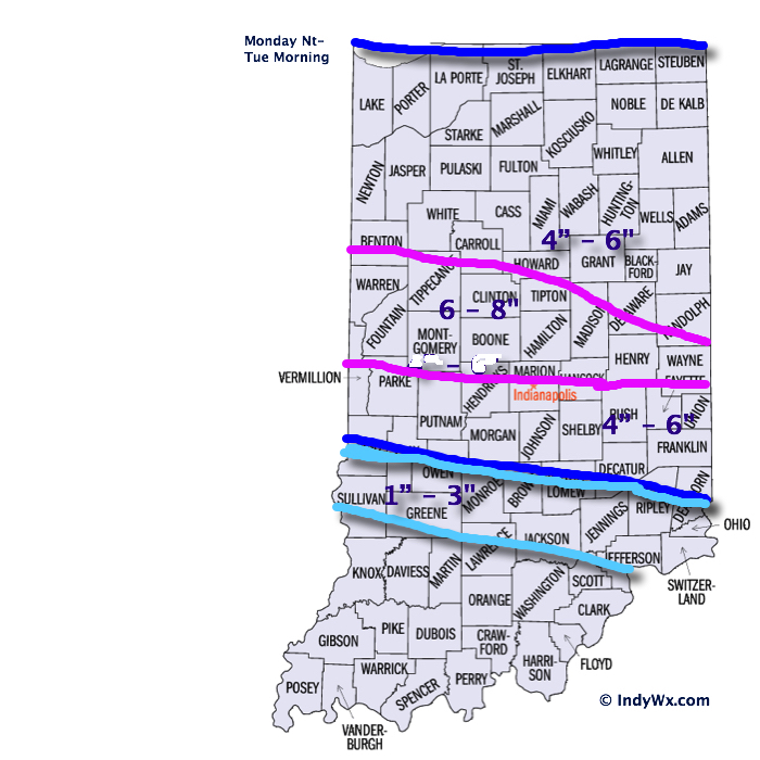
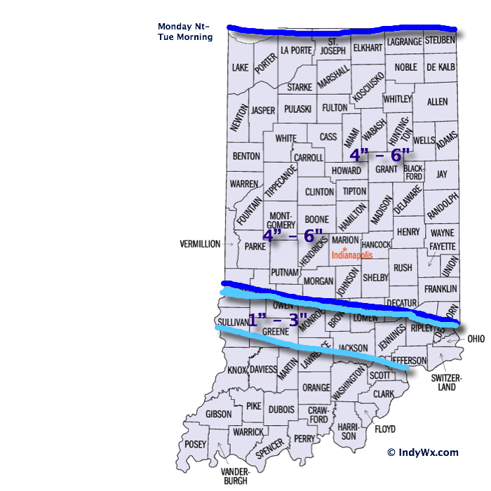
Upcoming 7-Day Precipitation Forecast:
- 7-Day Snowfall Forecast: 1″ – 3″
- 7-Day Rainfall Forecast: 0.00″