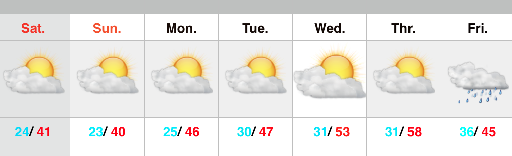
 Spring Fever Anyone?! A weak weather system is racing through the region this morning. Clouds and gusty southwest winds are accompanying this, but the air mass is too dry to sustain any sort of precipitation (with the exception of a snow flurry across northern portions of the state). Sunshine should increase as we progress from morning into the afternoon hours. Although we’ll remain colder than average this weekend, highs in the lower 40s will feel downright balmy when compared to the bitterly cold times we’ve gone through over the past several weeks.
Early next week will feature a wet weather maker move northeast out of the Deep South, but this should remain east of our region. We note the European model tries to deliver some light rain Tuesday, but for now we’ll keep our forecast rain-free and dry.
A real surge of “spring fever” will push in here by the middle of the week with highs in the middle 50s Wednesday and upper 50s Thursday (some areas will touch 60 Thursday). White Leg Warnings will have to be issued, no doubt ;-).
Unfortunately, weather conditions will take a dramatic turn downhill late week into the weekend as a big storm system lifts north out of the Gulf of Mexico. Colder and raw times are ahead, including a gusty wind-driven rain. Moderate to heavy rainfall totals appear to be a good bet from 6-7 days out.
Upcoming 7-Day Precipitation Forecast:
- 7-Day Rainfall Forecast: 0.50″ – 1.00″
- 7-Day Snowfall Forecast: 0.00″
