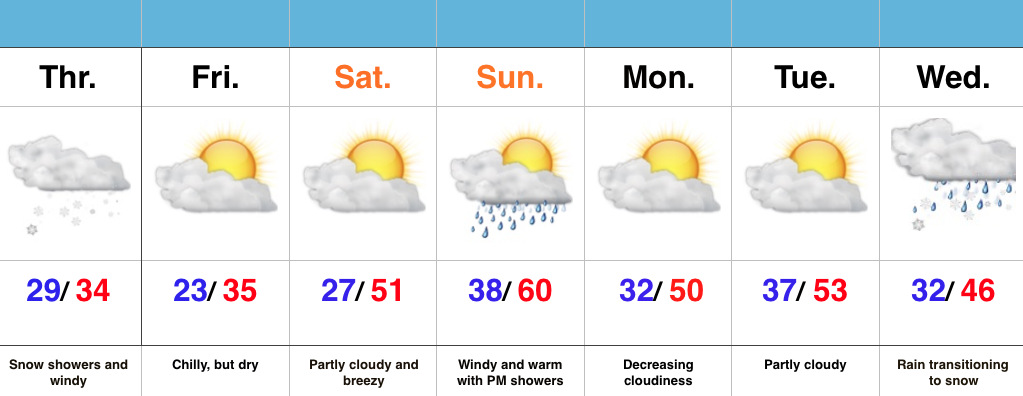
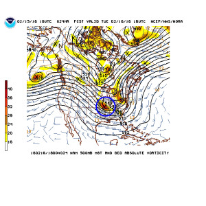
1.) Tuesday’s upper air disturbance looks to track further and further SW with each and every passing model run. While we’ll keep an eye on things, it’s apparent that best snow chances will be across far SW counties, and even that may be generous (this thing is tracking much further west than what appeared a couple days ago), courtesy of NCEP.
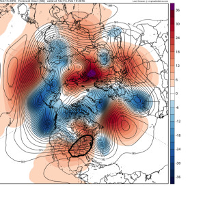
 2.) A significant warm-up is still on schedule for late week, centered on Friday, where temperatures will likely push to, or exceed, 60 degrees as ridging builds in. Image courtesy of Tropicaltidbits.com.
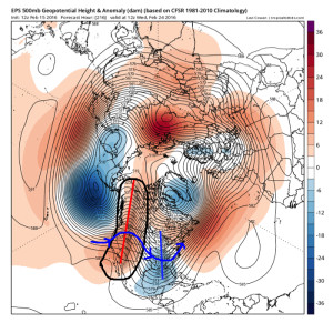
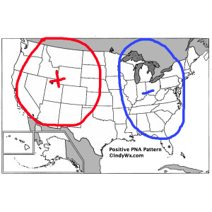
 3.) The warmth will be brief, however, as a colder pattern returns (thank you positive PNA), including an interesting look for winter storm potential across the east days 8-10. (No need to get fancy with specifics at this juncture).
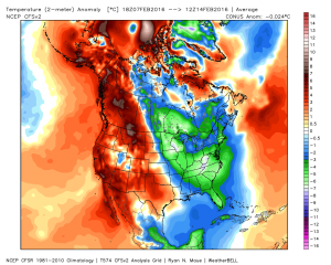
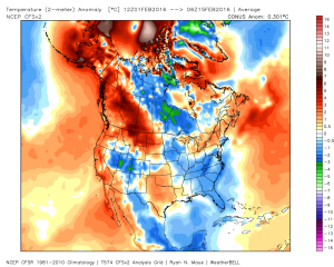
 4.) The significant cold over the past 7 days has really eaten away at the warm start to the month, courtesy of Weatherbell.com.
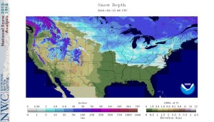
 5.) Nearly 44% of the Lower 48 is snow covered at present. That compares to 25.6% of the Nation covered in snow for the same time last year.