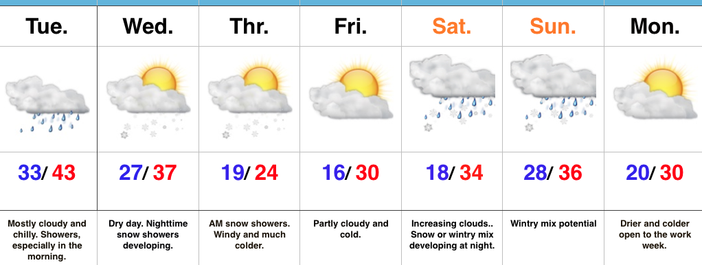
1.) Rain builds back in late tonight and Tuesday morning and will favor the southern and eastern half of the state. Drier trends develop Tuesday afternoon as the moisture pulls northeast.
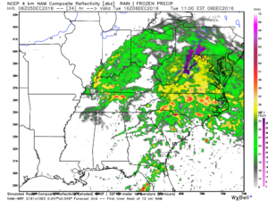
Forecast radar 11a Tuesday
2.) A surge of arctic air will pour into the region as we wrap up the work week, including single digit wind chills. Lows in the 10s and highs in the 20s can be expected Thursday and Friday.
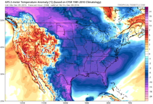
Forecast temperature anomalies to close the work week.
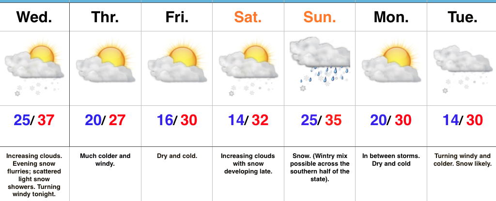
3.) Despite the cold, snow chances look unimpressive, per the latest data. While we, personally, still believe there will be more of an arctic wave to deal with along the arctic boundary pressing Wednesday night into Thursday (enough to accumulate), modeling says “we’re crazy” and brings the arctic plunge in without much fanfare (flurries).
4.) Speaking of snow, modeling also says the 3rd wintry threat we spoke of Sunday (for about a week from now) arrives with a warm-up and is more of a liquid event. While we tend to think this is still a threat that could deal our region wintry conditions, it would be irresponsible of us not to convey the lower confidence (heck, modeling suggests we’re close to 60 degrees next Monday).
5.) Our thoughts on a snowy December began last summer as research began on the upcoming winter. It’s based off a variety of solutions, but leans heavily on the idea blocking would develop and help “lock in” an active pattern with just enough cold air to create the wintry “goods.” (Pressing cold and an active jet undercutting the cold to create winter storm potential). While bullish on snow (still are), we’ve never had out a very cold December forecast (instead only “slightly,” or 1 degree, below average). If the recent weekend trend is correct, it says the upcoming (10) day period we thought would essentially deliver a month’s worth of snow is incorrect. Sure that gives us the second half of the month to still make up for it, but it becomes increasingly difficult to see the wild model swings and inconsistency without relaying those inconsistencies to you, the viewer.
Our overall thinking remains (as stubborn as it may seem) on December, but please know we also see how this could bust. There’s a fine line between communicating both ideas to you. Confidence is lower than we would like it to be…

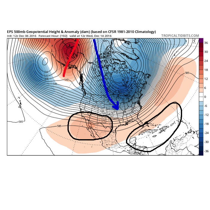 The overall set-up is certainly an intriguing one. Cross-polar flow seeds pressing arctic air into the pattern (again, it comes in “waves” over the next couple weeks, each subsequently stronger). What’s of particular interest is the battle that develops between a tag-team of ridges- SW and SE (at times these will put up more resistance than the other). Long-time Hoosiers know that when cross-polar flow gets involved it can “suppress” storms, but rest easy in knowing that the SE ridge will provide resistance. In fact, some across the lower Ohio and TN Valleys may eventually complain that the southeast ridge is providing too much resistance.