 Highlights:
- Snowy Tuesday
- Bitter Mid Week
- Weekend Storm
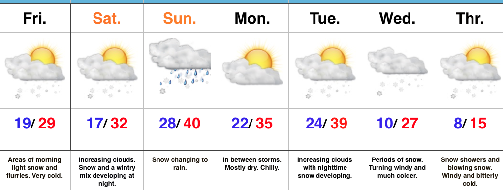
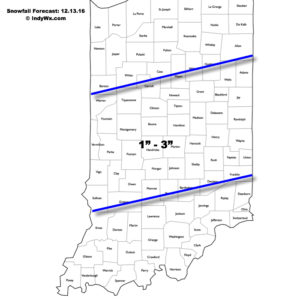
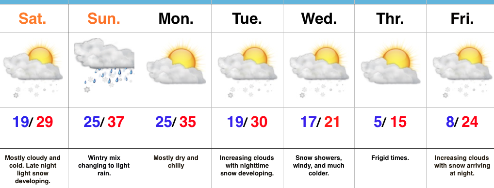
Accumulating Snow Event…Upper energy will combine with an approaching arctic front to lead to an accumulating snowfall event for many across central Indiana Tuesday. We expect snow to increase in coverage and intensity just prior to sunrise before turning moderate to briefly heavy from mid to late morning on into the early afternoon hours. In general, we paint a band of 1″-3″ through the heart of central Indiana, but do have some concerns localized banding features could result in a 4″ pop here and there (impossible to pinpoint the precise locations these bands may set-up across central IN as of this update). Expect a messy morning commute.
 Fresh arctic air will pour into the region tomorrow evening, along with a gusty NW wind. Tuesday’s snow should be rather wet in nature so we don’t anticipate blowing/ drifting issues to result as the arctic hounds roar into town. However, there will likely be periods of flurries and scattered snow showers as the bitterly cold air arrives in the Wednesday-Thursday time frame and this could lead to light additional coatings in spots. The big weather story through mid and late week will be the bitter air. “Air that hurts” is what we’re calling it and wind chill values will approach 20 degrees below zero Wednesday night/ Thursday morning.
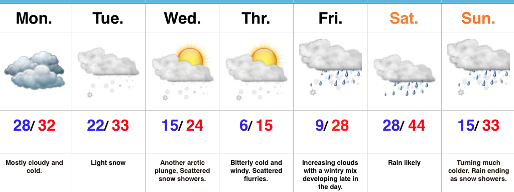
Our next storm system is still slated to arrive for the weekend. As of now we forecast snow and a wintry mix Friday evening. This will then change to rain Saturday before arctic air quickly oozes back in here and leads to a potentially messy Saturday night-Sunday morning. Rain will transition to freezing rain and sleet Saturday evening before ending as a period of snow. It’s back to the ice box we’ve come to know all too well Sunday into Monday.
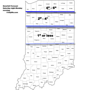
Upcoming 7-Day Precipitation Forecast:
- Snowfall: 2″ – 5″
- Rainfall: 0.50″
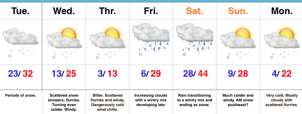
 We’ll open the work week with dry and cold conditions, but all eyes will be on the next arctic front by this time. It’ll blast through here the middle of the week with