Turning Warmer, But Unsettled…
 Highlights:
- Another cold morning
- Turning unsettled
- Warmer heading into early next week
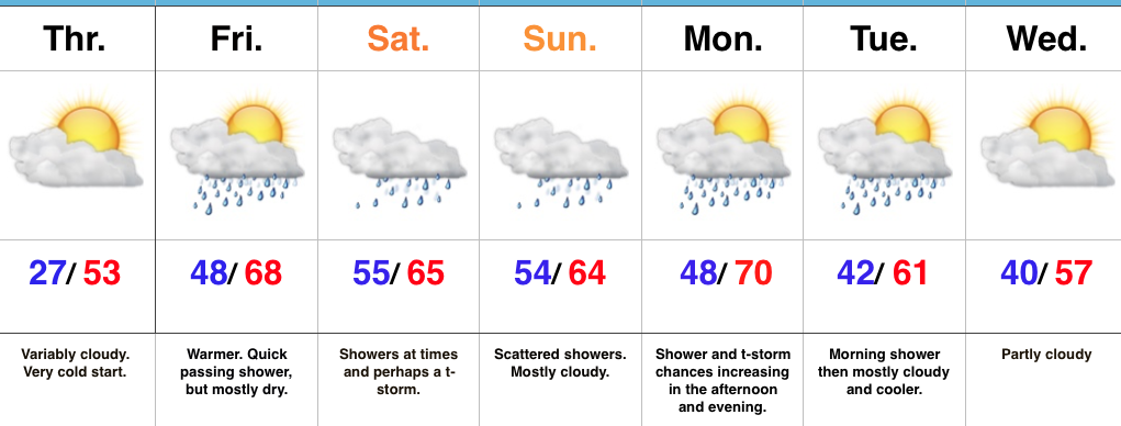
Warmer, But Rain Chances Return…Before we enjoy the warmer temperatures to close the week, we have one more very cold morning to go through. Many central Indiana neighborhoods are once again starting the day in the mid to upper 20s. Though we’ll add more clouds to our Thursday forecast (compared to all of that Wednesday sunshine), it won’t prevent temperatures from moderating close to seasonal levels later this afternoon.
Though we’ll mention a quick passing shower chance Friday, most of the day should be dry and the bigger story will actually be temperatures that approach 70° by the afternoon with periods of sunshine. Sounds like a recipe for getting out of the office early and finding a local patio, huh?!
Unfortunately, shower chances will be on the uptick this weekend and while it won’t rain the entire time, really any time of the weekend is fair game for the potential of a shower or perhaps a thunderstorm. As of now, best shower coverage should be Sunday.
Shower and thunderstorms chances continue early next week (Monday afternoon through Tuesday morning) before drier air and slightly cooler temperatures return the middle of next week.
Upcoming 7-Day Precipitation Forecast:
- Snowfall: 0.00″
- Rainfall: 1.00″ – 1.50″
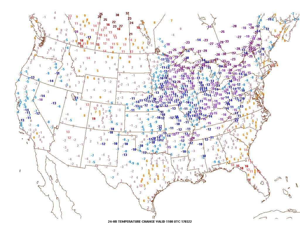 2.) Speaking of cold, to-date, March is running slightly colder than average (by 1.1°). Note the spring and summer-like warmth across the SW. “Pieces” of that warmth will eject northeast in modified fashion late March into April.
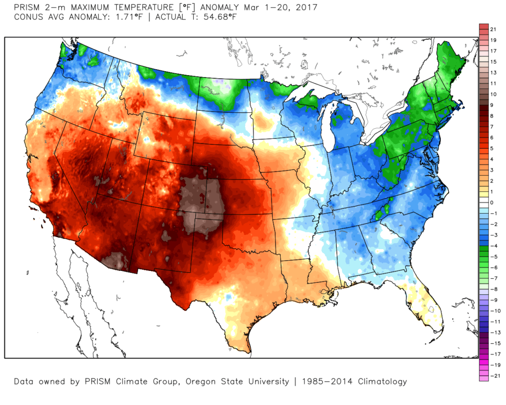 3.) High pressure will supply a dry, but cold Wednesday. Highs will run close to 10° below average (lower 40s), but at least we’ll enjoy the sun!
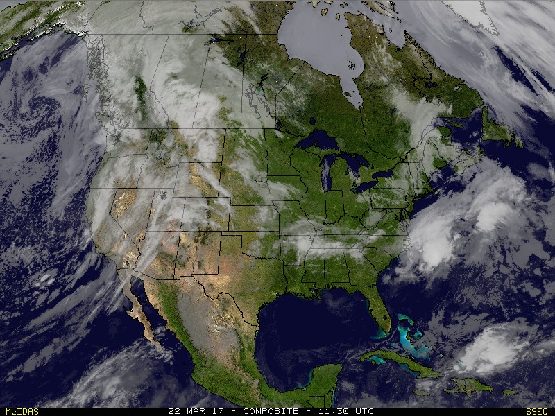 4.) Temperatures will begin to warm as we progress through the latter portions of the week. We’ll be near seasonal norms Thursday (low 50s), and above normal Friday into the weekend (mid-upper 60s). With the warmer air, rain and storm chances will also be on the increase. As of now, we target best rain chances late Saturday into Sunday. A couple thunderstorms are also possible. Rainfall totals of 0.50″-1.00″ seem like a good bet with locally heavier amounts.
 5.) This is just the beginning of an active stretch of weather to wrap up the month of March. (3) additional storms will have to be monitored next week. Accordingly, precipitation anomalies will run above normal.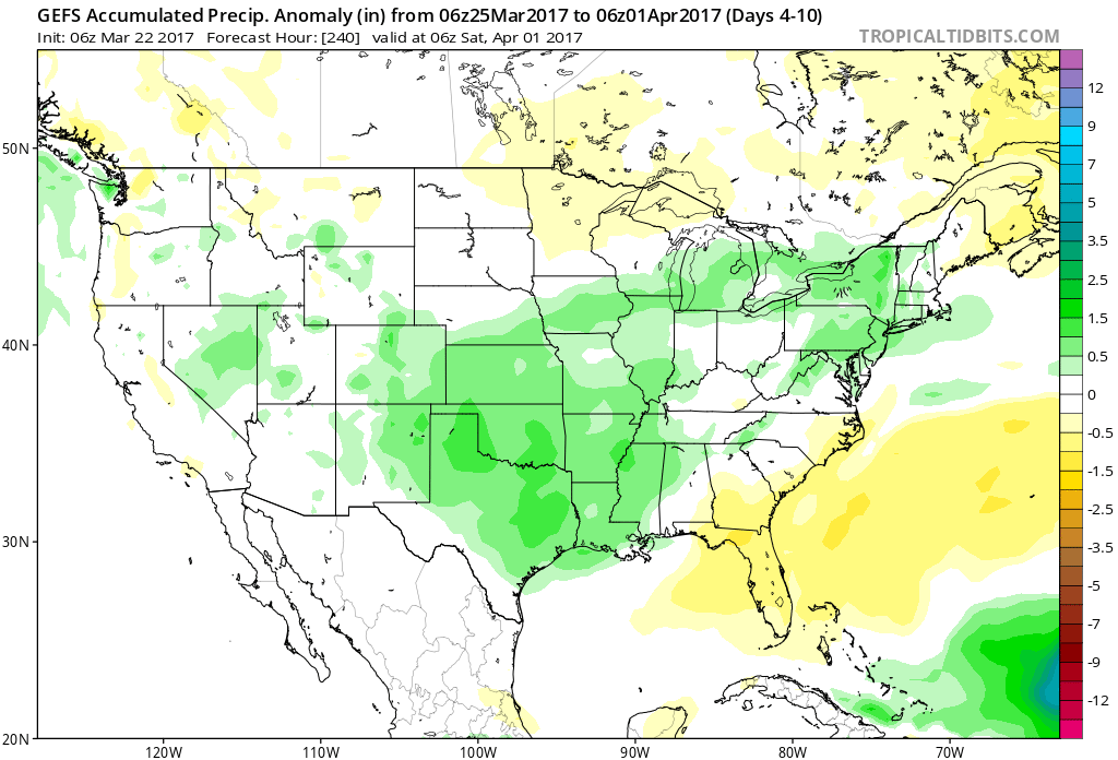
 Highlights:

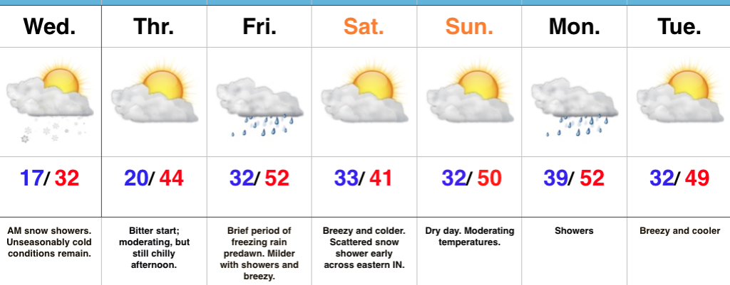
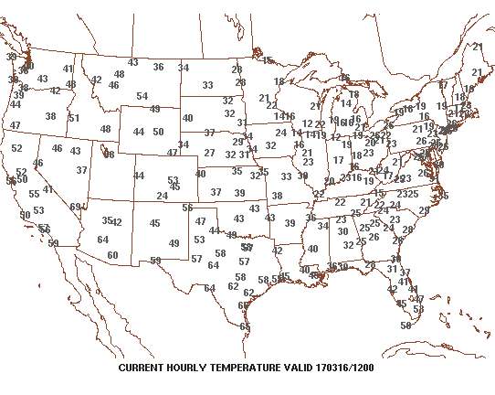 3.) Sunshine can be expected today and after the frigid beginning, a moderating trend will begin this afternoon that will send temperatures into the lower to middle 40s. That’s still close to 10° below average for daytime highs, but will feel much better than what we’ve been dealing with over the past several days. Add in that high March sun angle and it’ll actually be a very pleasant afternoon.
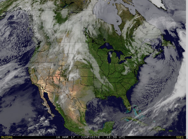 4.) Unfortunately, we won’t hang on to the sunshine for St. Patrick’s Day. A warm front will lift northeast through the region during the overnight and lead to an increase in clouds by evening. A wintry mix of sleet and freezing rain will impact central IN predawn Friday morning before transitioning to showers mid-to-late morning. “Light” is the key word here with models suggesting less than 0.20″ total. By Friday afternoon we’re back to dry times.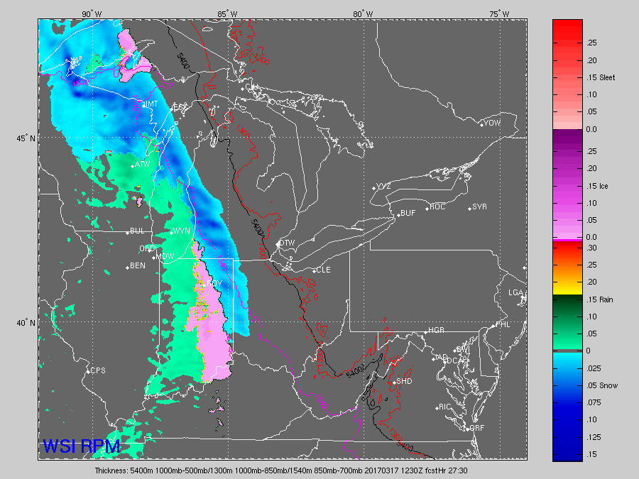
 5.) We’ll turn a touch cooler Saturday and it’ll be a blustery day, as well. A couple of early snow showers are possible across east and northeast portions of the state before afternoon sunshine returns. High pressure settles in overhead Saturday evening and will set up a nice second half of the weekend- lots of sunshine and milder temperatures by Sunday (lower 50s).
 6.) Looking ahead, the quiet times will be hard to come by as we progress through the latter portions of the month. Both the new JMA Weeklies (shown below) and other ensemble guidance is bullish on a wetter than average close to the month, and also one that features wild temperature swings. Thoughts shift back to severe prospects, especially for our friends to our south and the potential of backlash wet snow showers in the colder air. From a temperature perspective, it’s a pattern that will be very “transient” with no true long-lasting periods of significant warmth, or cold- relative to average.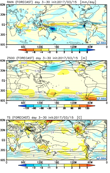
 Highlights: