
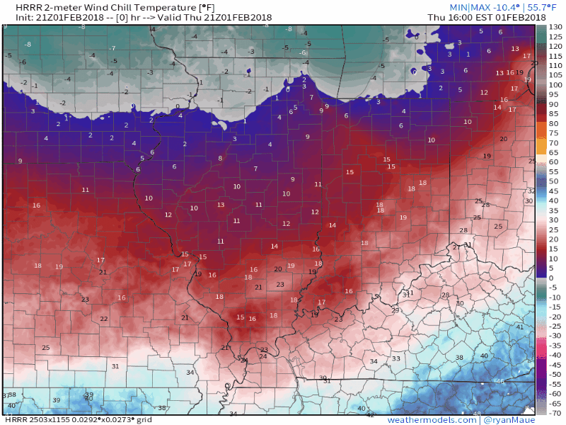
Arctic air is pressing into the state this evening. As we type this (just after 6p), wind chill values are already plummeting into the single digits across central Indiana. Those values will turn even more frigid overnight- dropping to below zero towards midnight. This is “number-busting” cold as many central Indiana communities will wake up Friday to the single digits (it was only this morning when the majority of model data suggested lower teens). Obviously, wind chill values will be flat-out bitter, as shown below:
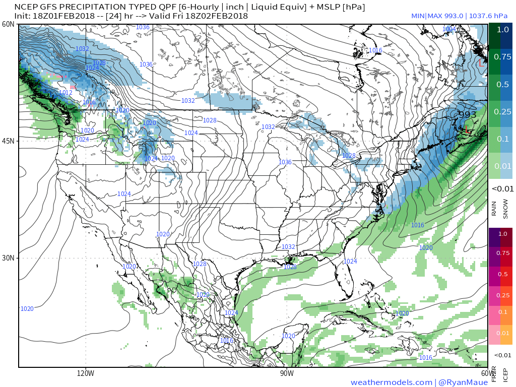
 Arctic high pressure will result in a cold, but dry (and sunny) close to the work week.
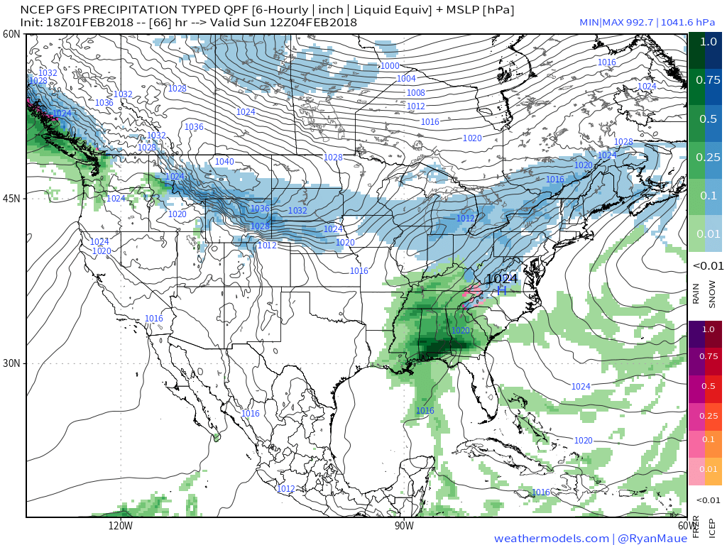
 As we move into the weekend, our weather will begin to turn more active. This will be the first of a series of snow systems over the upcoming 7-10 days. While this initial event won’t be significant, it’ll get the ball rolling on (at least what we believe will be) another extended stretch of wintry conditions. We forecast a couple periods of light snow (“light” being the key word) this weekend: Saturday evening and again Sunday evening. It appears as if the energy will remain very disorganized over the weekend and the result will be light snow accumulations during the Saturday through Sunday period.
 Again, this is only the beginning of a very active pattern; one that will shoot snow systems at us in an “every other day” fashion over the upcoming 7-10 days. We’ll keep close tabs on last minute adjustments that may be needed with such a pattern. Often times modeling will struggle with the fast-paced northwest flow and models will have to “correct” last minute towards a more significant event.
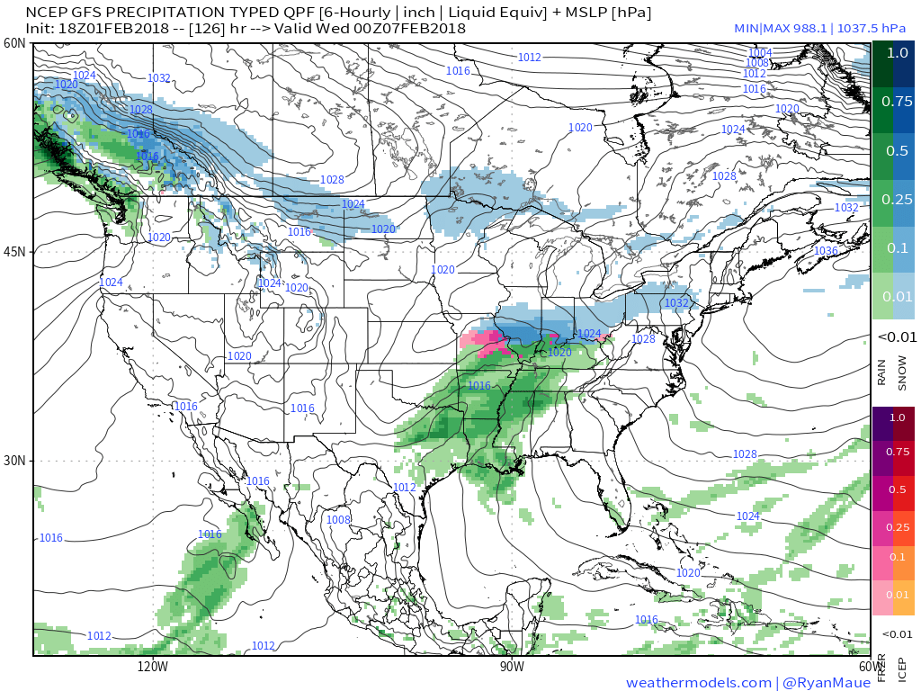
Our next snow maker approaches Monday evening into Tuesday. This would seem to be a more important event and one capable of depositing heavier snow across the general region. We’ll monitor things this weekend, but the pattern is such that this looks to be more of a central or northern Ohio Valley hit. Solutions painted of suppression look suspect to us from this distance given the look.
 Additional opportunities for accumulating snow lie ahead, including:
- Thursday night – Friday
- Next Saturday – Sunday
This is all part of the equation we’ve had in thinking that the big story, at least initially, is a very active pattern (snowier version of what we dealt with late December through mid January) before the truly severe cold can get involved mid-and-late February. On that note, the pattern, as a whole, looks much colder than normal from late February into March this year, as well.
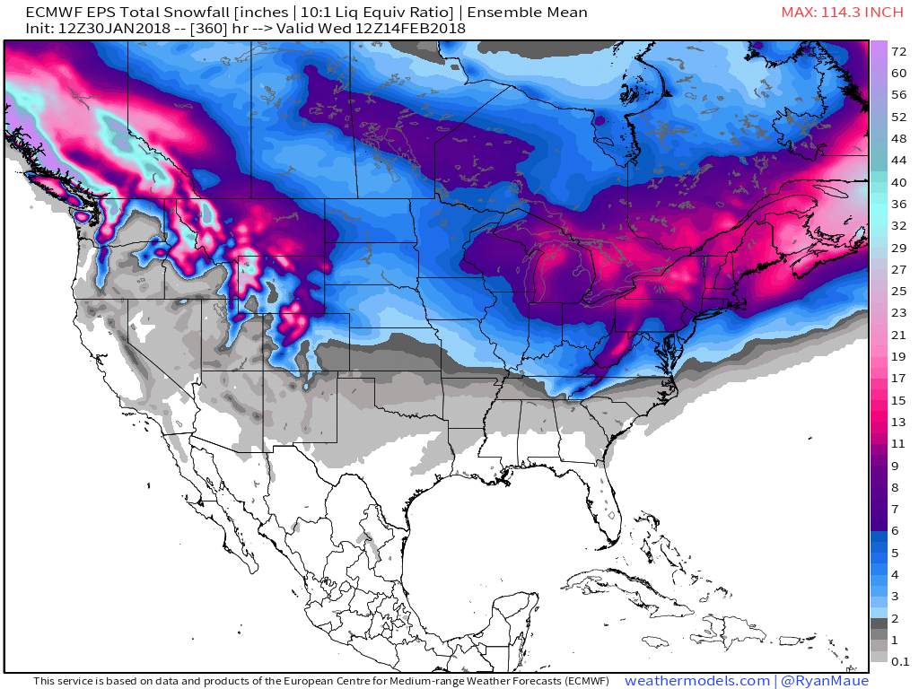
As for snow, the majority of these events will produce light to moderate amounts, but the active nature of the flow will likely allow things to stack up. We have no changes to our thinking that the period Feb. 1st through March 6th yields between 15″ and 20″ of snow at IND. Let’s just remain on guard for the potential of one or two of these systems to potentially lead to heavier totals along the way.
Make it a great evening!
 The GEFS might be a bit quick on dropping the arctic hammer, but the consistency of the model is impressive. Meanwhile, the European (even it’s ensemble data) has been much less consistent and has really been struggling the past couple of winters, overall, as a whole.
 Let’s also keep in mind that the initial cold onslaught is coming in the face of the MJO still rumbling through the warm phases. We note the European is consistently having to correct towards a more “amped up” MJO- swinging into the cold phases as we approach mid-month. And it’s mid-February that continues to have us concerned for the potential of truly nasty, severe cold.
 As for snow, it’ll come in this pattern. Again, don’t get caught up in the operational output, but understand that the pattern over the upcoming 7-10 days favors numerous fast-moving snow systems. While most of these will be light, we’ll have to keep a close eye on things as the potential exists for one of these waves to spin up a moderate event.
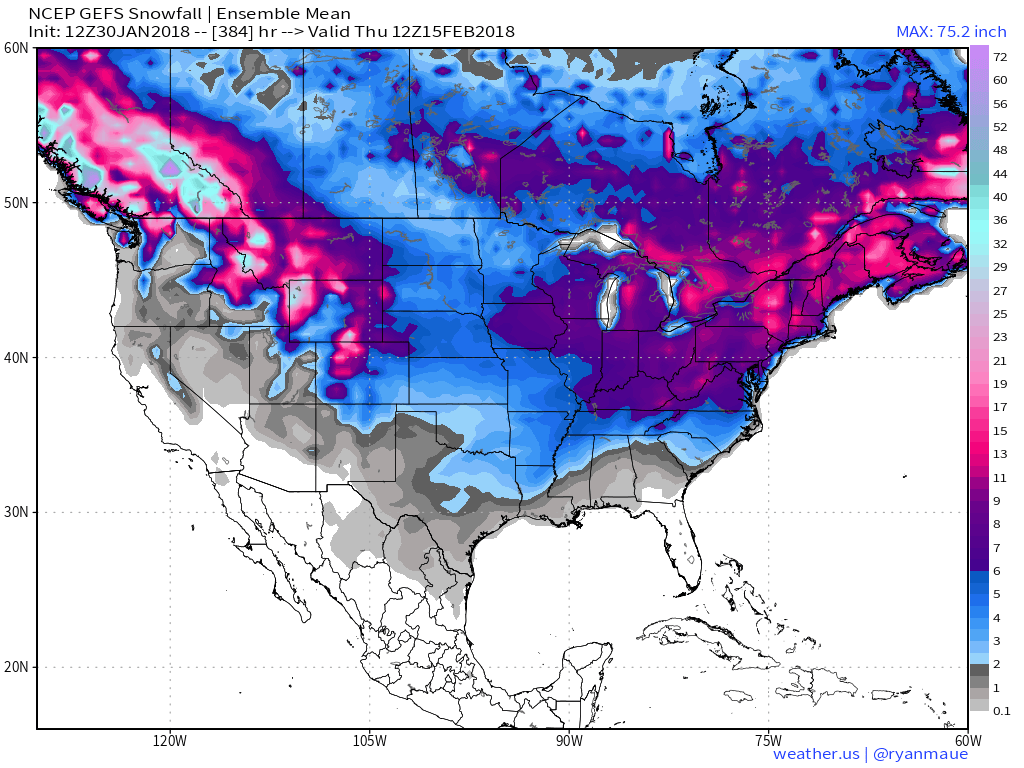
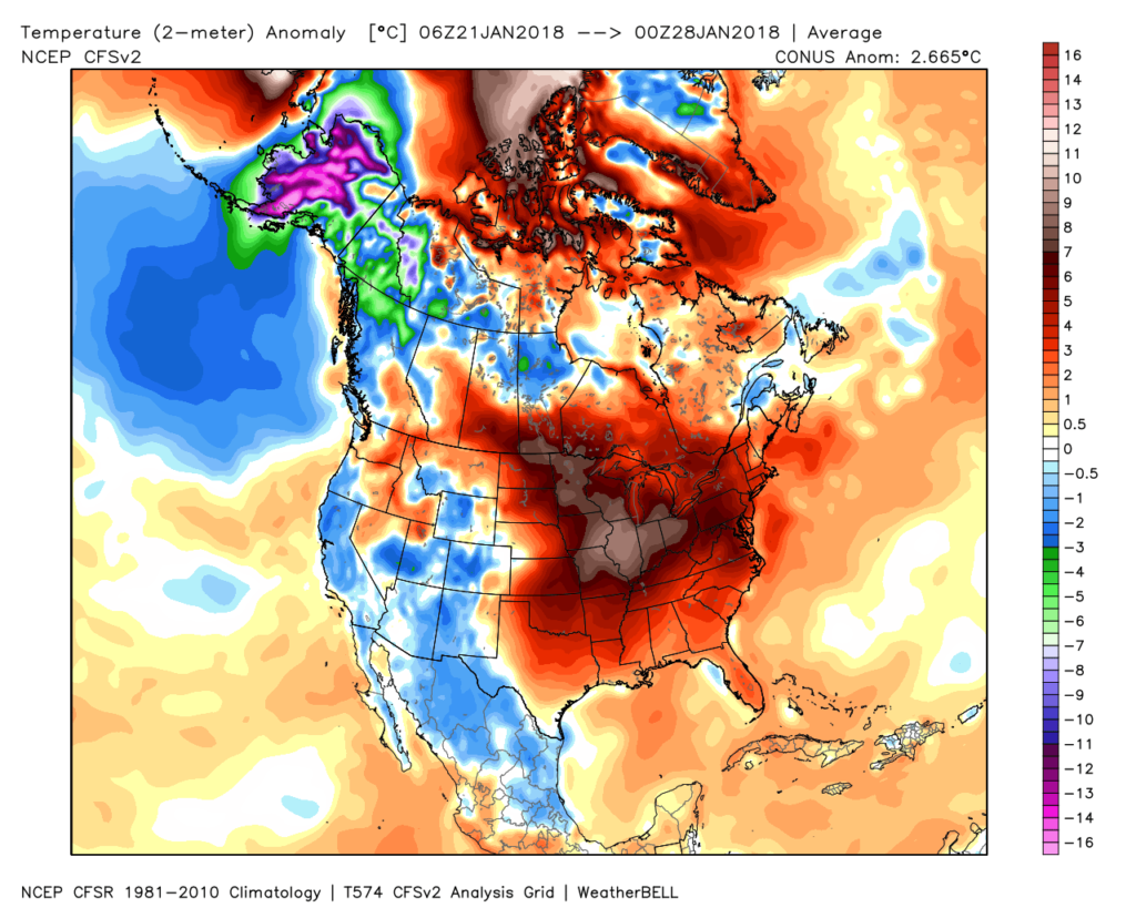 Despite the milder air over the past week, January, as a whole, is still running 4° below average at Indianapolis- a byproduct of just how frigid the first half of the month was.
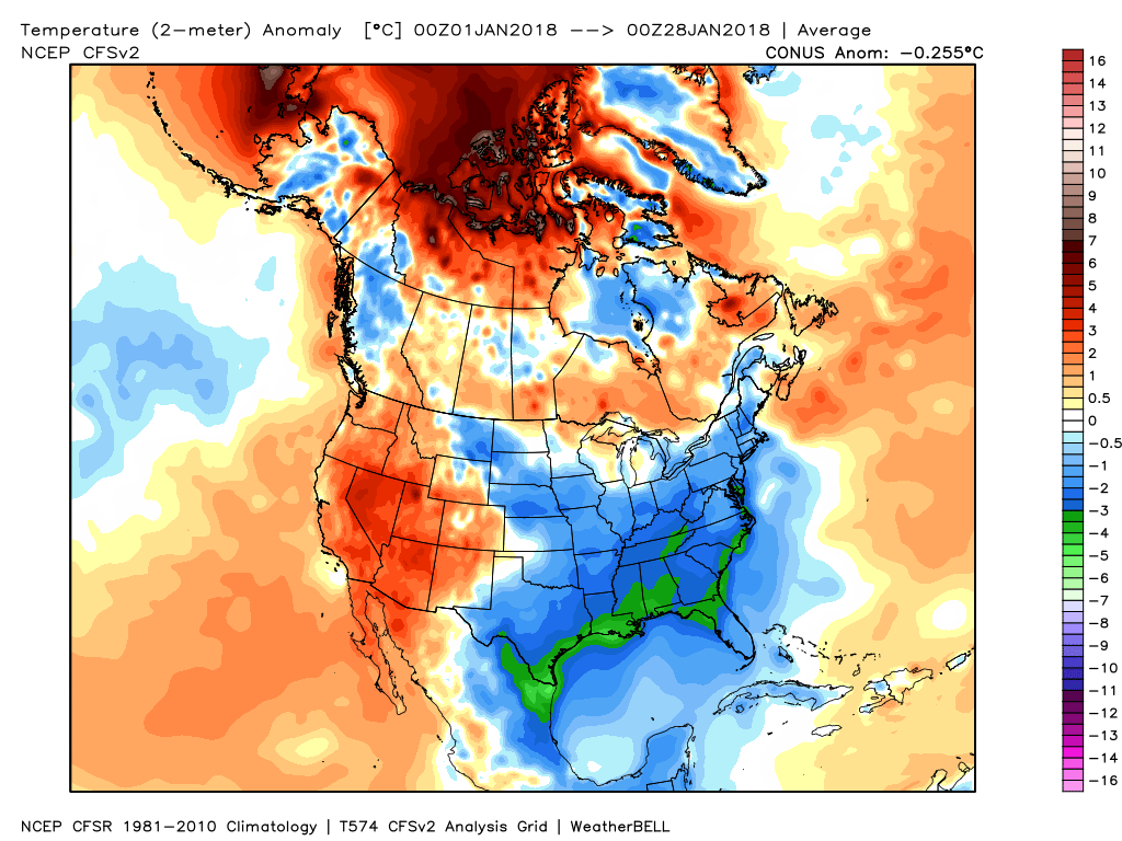 While the January thaw has been nice, times are changing and winter sure seems to be reloading for a very active second half.
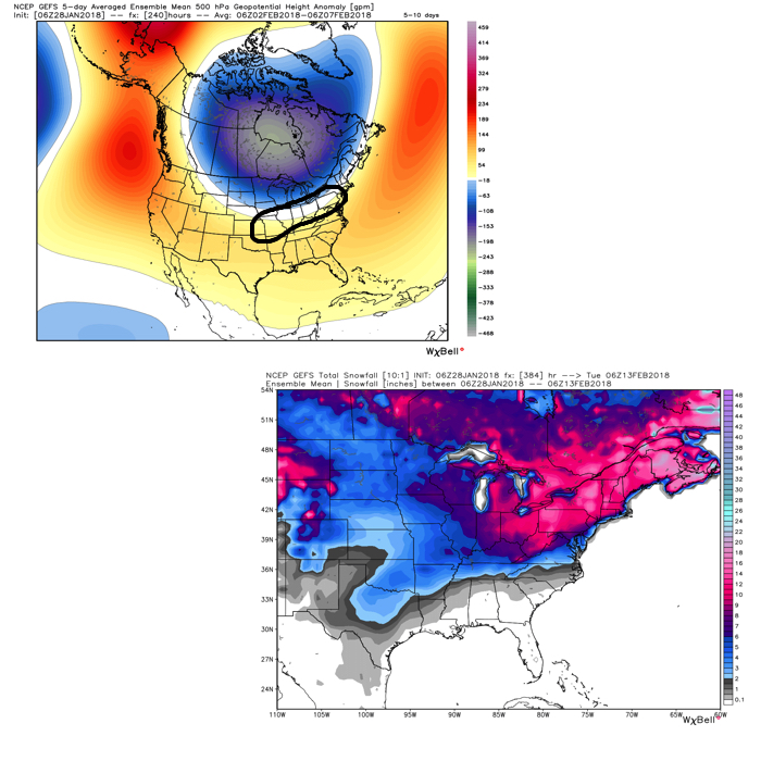 Once we get a snowpack laid down, arctic highs oozing southeast will likely lead to bitterly cold air. Recall our expectation for this pattern to yield at least (1) night of double-digit below zero lows, but it’s more towards mid-month that we think the severe cold takes hold.
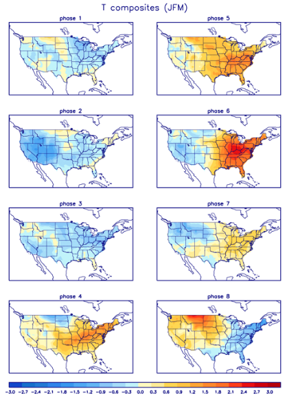
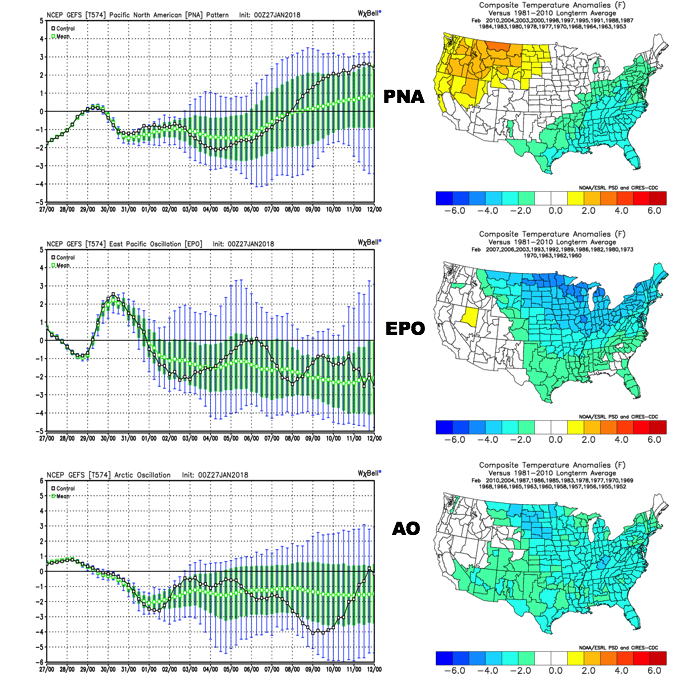 The Madden-Julian Oscillation (MJO) is forecast to rotate into the colder phase 8 as we rumble from early to mid February. Given the amplitude of the MJO, it should continue to rumble right through the cold phases of 1,2, and 3.
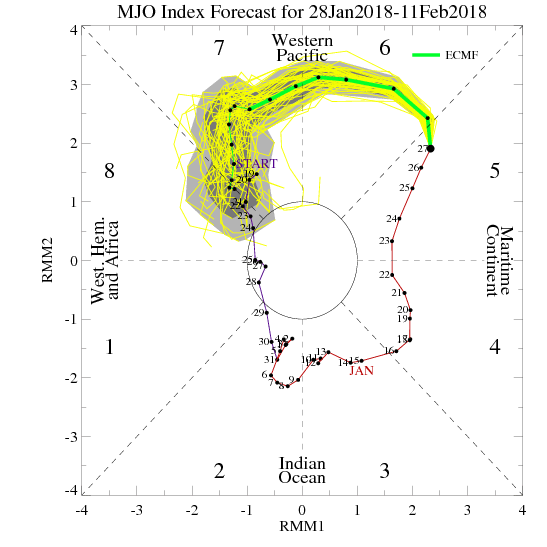
 All of these moving pieces that lead up to extended periods of cold, wintry conditions are part of a bigger outcome low solar, easterly QBO winters deal up. What we should experience with this setup is a 6-7 week period of wintry conditions, including times of severe cold. It appears to be a snowier version of what we went through late-December through mid-January. Hang in there, spring will come…eventually.