Category: Arctic Cold

Putting The Cold Into Perspective…

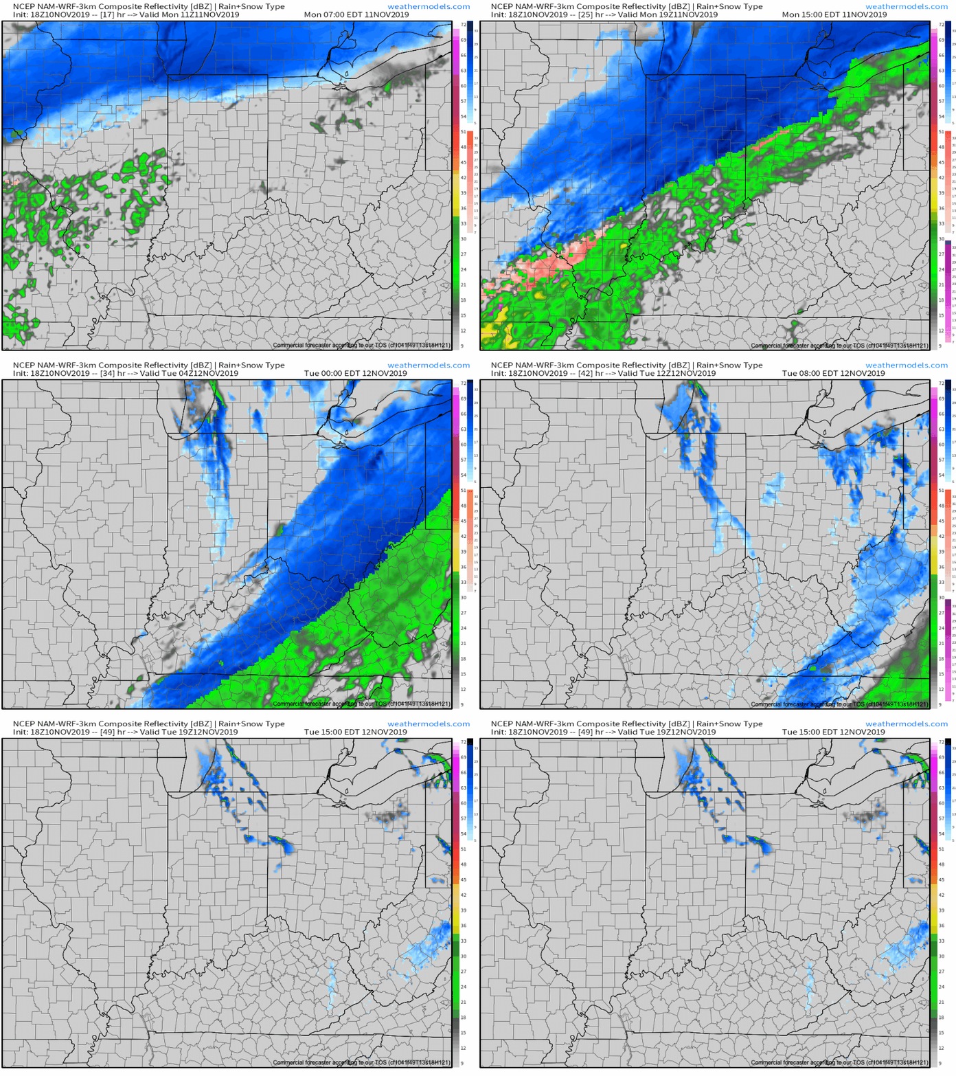
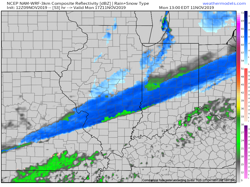
An impressive shot of early season arctic air will come at us in a 1-2 punch format to wrap up the week and head into early next week.  Before we dig deeper into the details, let’s keep in mind averages for November 9th-15th include lows in the middle 30s and highs in the middle 50s.  Multiple days during that time frame will feature highs where our average lows should be (if not even colder a couple days) and overnight lows deep into the 20s (10s perhaps on a couple nights).

The initial blast of cold air will blow into town Thursday night and Friday and will be accompanied by a chilly rain ending as a touch of wet snow across central Indiana.  This will be a “novelty” level event for most across the region, but there could be a couple of slushy accumulation reports- especially north of the city.

The bigger story will be localized, but intense snow bursts that will likely develop as the true push of arctic air arrives Friday evening.  These will be accompanied by strong and gusty winds, as well.

We’ll awake to temperatures in the lower 20s across most of central Indiana Saturday morning.  By this point in time, attention will shift to what awaits during early stages of the new work week.  While details are murky with respect to the specifics associated with an eastern storm, cold air will be reinforced Monday night into Tuesday.

Keep a note in the back of your mind to check back often over the weekend concerning the forecast for early next week.  Model bias (“progressive” GFS; “sluggish” Euro) appears to be running rampant from this distance and what will likely be the ultimate result is something in between.  The sensible weather that would result is the opportunity for perhaps a better chance of more widespread accumulating snow across portions of the Ohio Valley Monday night into Tuesday.

Snow prospects aside, confidence remains high that the upcoming cold pattern will be the most significant so early since the early season bitter blast of air in November ’14!

Permanent link to this article: https://indywx.com/putting-the-cold-into-perspective/

Strong Storm Potential & Old Man Winter Comes Knocking Next Week…

The upcoming work week will feature a busy time of things as the fight between fall and winter begin.  Initially, it’ll be the warmer side of things that will promote the potential of strong and gusty storms Monday night into Tuesday, but by mid and late week, drastically colder conditions will lead to the chance of scattered snow showers…

A couple of showers and gusty southerly winds will help close out the weekend, but it’s the storm system that moves in Monday night and Tuesday that has more of our attention.  Surface low pressure will move off the lee of the Rockies and on into MO and IL Tuesday- strengthening along the way and eventually tracking through the Great Lakes Tuesday evening.  Not only will this deliver another round of hefty rains across central parts of the state, but we may have to deal with a couple of strong to severe storms (wind being the biggest concern).

Additional rainfall totals of 1″ to 2″ with locally heavier amounts are a good bet in that Monday night – Tuesday time frame.

While we’ll certainly turn colder behind this storm system, the true early season push of arctic air will wait a couple of days to arrive- Thursday afternoon into Friday.  Not only will this be the coldest air of the season (lower-middle 20s Friday morning and likely colder next Saturday), but the first flakes of the season are also likely to fly across central Indiana to wrap up the work week.  Furthermore, Snow Belt communities can expect the first “shoveable” snow of the season.  Giddy up!

Don’t look now, but more “fun and games” await the following week…

Permanent link to this article: https://indywx.com/strong-storm-potential-old-man-winter-comes-knocking-next-week/

Looking Ahead To The Merry Month Of May…

Folks are growing tired of the cold and snow, and for good reason; it’s mid-April for goodness sakes.  As of today, we’re currently ranked as the 5th snowiest spring (March-May) in recorded history, with Indianapolis recording 14.2″ thus far.  By the way, we’re only .3″ from moving into the 4th place spot.

With that said, it’s not just April that’s been unusually cold and snowy, but the entire year thus far.  As of April 15th, year-to-date CONUS temperatures are running more than 1° below average:

More specific to Indianapolis, here’s the monthly temperature breakdown so far for 2018:

  • April: 5.7° below normal (MTD)
  • March: 3.3° below normal
  • February: 5.6° above normal
  • January: 3.0° below normal

As we look ahead, there are a couple of key items that we’re monitoring closely to get a better idea as to where this pattern is heading as we rumble into the merry month of May:

NAO- does it show signs of finally flipping to a positive state with any sort of duration?

MJO- does it go into the “wheelhouse” or continue to rumble into the milder phases (5 and 6 this time of year)?

The North Atlantic Oscillation (NAO) is a bit troubling as it shows signs of heading towards a negative phase once again as we open the month of May.  This would promote the threat of colder than normal temperatures continuing in early May. With that said, May is the first month of the next several (until winter returns) where the overall influence of the NAO state begins to lessen it’s grip.  Unlike from the mid and late winter months into the early spring (Jan through April), mid and late spring, through the fall, isn’t controlled by the NAO.  With May being a “transition” month, we’ll favor a colder than average pattern continuing during the early portion of May as the NAO looks to trend negative.  As we move towards mid and late month, we won’t rely on the NAO like we have been lately as the said influence “wanes.”

The Madden Julian Oscillation (MJO) is forecast by most data to head towards the “null” phase.  The consensus of modeling takes it into the wheelhouse after traversing Phase 3 (present) which is a cold phase.  The end result?  Unfortunately, we can’t rely on the MJO with any sort of confidence from this distance for the month of May.

Looking at the data itself, the CFSv2 and European Weeklies (just to name a couple) show conflicting ideas.  The CFSv2 (courtesy of weatherbell.com) is in the warmer than normal camp for May while the NEW European Weeklies (courtesy of weathermodels.com) suggest the chill lingers throughout the month.

While we have conflicting temperature ideas, both suggest a drier than average month emerging:

At the end of the day, our call on May’s forecast from mid-April would be for an early cooler than average start before flipping towards more of a seasonable to slightly warmer than normal regime.  Our idea all along this spring has been that when this pattern flips, the potential is present to jump right to a summery feel.  In the face of the new European Weeklies, we still feel this warmer idea mid and late May is on the table.  We’re in agreement with the data of a drier than average month.

Permanent link to this article: https://indywx.com/looking-ahead-to-the-merry-month-of-may/

VIDEO: Weekend Ends With More April Snow…

The weekend will end with more April snow. As we look ahead deeper into next week, a transient, but significant, push of warmth will arrive Thursday and Friday.

You must be logged in to view this content. Click Here to become a member of IndyWX.com for full access.  Already a member of IndyWx.com All-Access?  Log-in here.

Permanent link to this article: https://indywx.com/video-weekend-ends-with-more-april-snow/

Weekend Cold Is Something To Behold…

An anomalous pattern will result in unseasonably cold air this weekend.  A cold front will blow through the state this evening and while a period of snow will accompany the FROPA (frontal passage), the bigger deal will be the weekend cold.  Keep in mind, averages for the weekend include lows of 40° and highs in the lower 60s.

An anomalous weather pattern will grip the region this weekend.

The pattern will deliver a feel more like mid-February (when highs average in the lower 40s and lows fall into middle 20s), as opposed to early-April.

Most of Saturday will be spent in the 30s, and the coldest morning should come Sunday with widespread lows in the middle 20s.

Highs around 40 would be “normal” for mid-Feb and a good 20+ degrees below average.

Lows Sunday morning will be downright bitter by April standards.

And if the unseasonably cold air isn’t enough, a disturbance will “attack” the cold Sunday night leading to a mix of rain and snow that should transition to mostly snow Sunday night.  While this won’t be a big deal, just the fact that we’re talking about snow yet again is getting old for most folks.  Unfortunately, the pattern looks to remain colder than average through late April, despite a brief break late next week.

Permanent link to this article: https://indywx.com/weekend-cold-is-something-to-behold/