
You must be logged in to view this content. Click Here to become a member of IndyWX.com for full access. Already a member of IndyWx.com All-Access? Log-in here.
Category: Arctic Cold
Permanent link to this article: https://indywx.com/video-sun-filled-weekend-changes-brewing-next-week-worthy-of-our-attention/
Feb 20
Thursday Morning Rambles…
Quick update from the road this morning- a more extensive video update will hit later this evening with fresh long range thoughts! I. Upper level energy and reinforcing cold air…
You must be logged in to view this content. Click Here to become a member of IndyWX.com for full access. Already a member of IndyWx.com All-Access? Log-in here.
Permanent link to this article: https://indywx.com/thursday-morning-rambles-4/
Feb 19
VIDEO: Shot Of Cold Air Inbound; More Chatter Around A Wintry Close To Feb And Open To March…
You must be logged in to view this content. Click Here to become a member of IndyWX.com for full access. Already a member of IndyWx.com All-Access? Log-in here.
Permanent link to this article: https://indywx.com/video-shot-of-cold-air-inbound-more-chatter-around-a-wintry-close-to-feb-and-open-to-march/
Feb 15
Week Ahead Outlook: Light Snow For Some This Evening; Tuesday Rain Followed By Another Blast Of Cold Air…
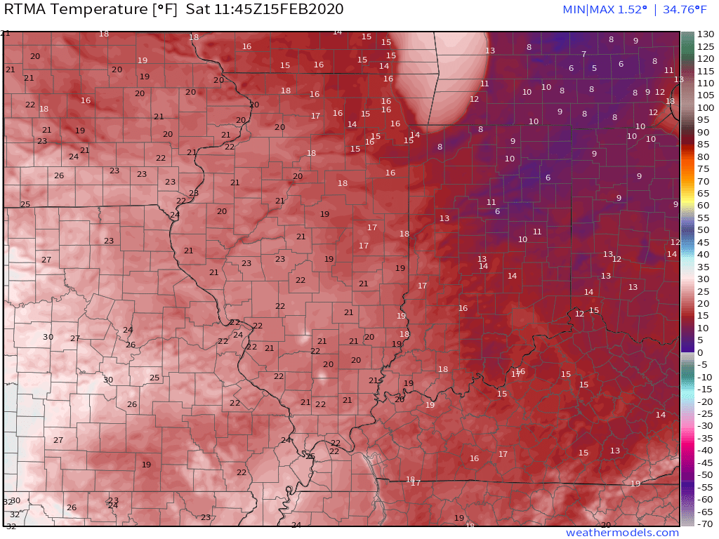
It’s another frigid start to the day with widespread lower to middle 10s across central Indiana. Even colder air resides across the eastern Ohio Valley with single digits over the fresh snowpack.

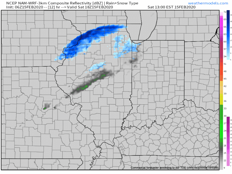
Today will feature quiet weather until later this evening when a weak clipper-like system slides southeast. This feature will help increase our cloud cover and result in a few light snow showers across the northern half of the state. Those snow showers may make it as far south as the I-70 corridor by evening before dissipating. Not expecting much, if any accumulation, locally, across central Indiana.
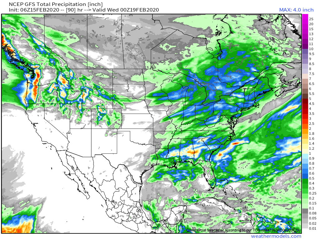
Quiet conditions will return as we open up the new week, but a fast moving storm system will result in increasing cloudiness through the day Monday and rain returning Monday evening into Tuesday.

In general, we anticipate this system to deposit somewhere between 0.50″ and 0.75″ Monday night into Tuesday morning.
Much colder air will follow the cold frontal passage for midweek, including a stretch of highs in the upper 20s and 30s and lows in the 10s.

High pressure will supply dry and sunny weather as we get set to close the work week, and as we look ahead, it doesn’t appear as if our next storm system will impact the region until the 2nd half of next weekend.
Permanent link to this article: https://indywx.com/week-ahead-outlook-light-snow-for-some-this-evening-tuesday-rain-followed-by-another-blast-of-cold-air/
Feb 14
VIDEO: Long Range Update Into Late Feb/ Early March…
You must be logged in to view this content. Click Here to become a member of IndyWX.com for full access. Already a member of IndyWx.com All-Access? Log-in here.
Permanent link to this article: https://indywx.com/video-long-range-update-into-late-feb-early-march/