Category: Arctic Cold

NEW JMA Weeklies Are In; November Preview…

This evening’s client video will have our complete long range update included within. This morning we wanted to review the latest JMA Weeklies and look ahead to at least a “hint” of what November could provide:

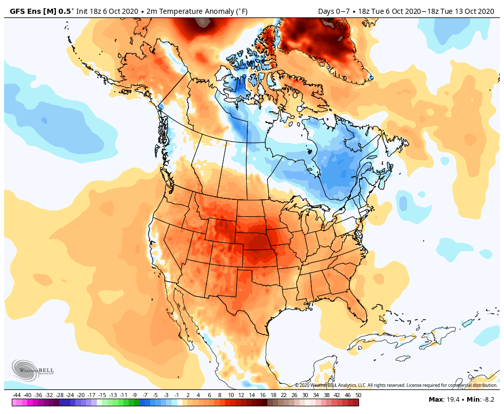
In short, the evolution from Week 1 to Weeks 3-4 shows the anomalous cold spreading east, but modifying from the mid-winter like conditions presently across the northern Plains by the time the chill reaches the eastern seaboard.
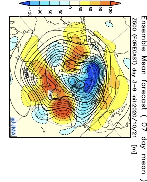
Week 1

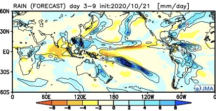
Notice how the pattern is expected to remain wetter than normal during the Week 1 period.

Week 2 features the chill spreading east and a drier pattern evolving. We agree with both.

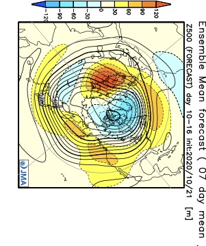
By the time we get to the Weeks 3-4 period, a northeastern ridge is shown to develop with the ‘mean’ trough position settling into the West. I would expect future updates to trend warmer across the East during this time frame and, conversely, colder across the West.

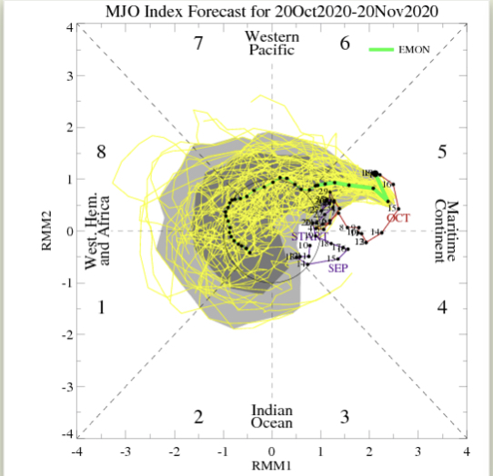
By this time, of course, we’ll be into November. While our complete November Outlook will be posted next week, I believe it’ll be an average to slightly above average month from a temperature perspective, locally (after the chilly start). Some of this has to do with the expected MJO movement and likelihood for the ‘mean’ trough to be favored across the West.

More later tonight! Have a great Thursday!

Permanent link to this article: https://indywx.com/new-jma-weeklies-are-in-november-preview/

VIDEO: No Changes To The Idea Of A Very Active Close To The Month; Timing Out Storms To End October…

You must be logged in to view this content. Click Here to become a member of IndyWX.com for full access.  Already a member of IndyWx.com All-Access?  Log-in here.

Permanent link to this article: https://indywx.com/video-no-changes-to-the-idea-of-a-very-active-close-to-the-month-timing-out-storms-to-end-october/

VIDEO: Disruption In The Force, But Can We Get Our First Snowflakes Of The Season By Month’s End?

You must be logged in to view this content. Click Here to become a member of IndyWX.com for full access.  Already a member of IndyWx.com All-Access?  Log-in here.

Permanent link to this article: https://indywx.com/video-disruption-in-the-force-but-can-we-get-our-first-snowflakes-of-the-season-by-months-end/

Saturday Morning Rambles: Time To Pull Out The Heavier Cold Weather Gear…

Delta– the remnants of one time powerful Hurricane Delta will curl northeast into the TN Valley today and cross the southern Appalachians Sunday. Central Indiana will miss out on any…

You must be logged in to view this content. Click Here to become a member of IndyWX.com for full access.  Already a member of IndyWx.com All-Access?  Log-in here.

Permanent link to this article: https://indywx.com/saturday-morning-rambles-time-to-pull-out-the-heavier-cold-weather-gear/

What Can We Learn From A Persistent Negative October AO For The Upcoming Winter?

October has opened on quite a chilly note across not only central Indiana, but a good chunk of the eastern half of the country. Officially, Indianapolis is running 8.4° below average, month-to-date.

While warming will occur in the upcoming 7-day period, there are already seeds being planted for the return of unseasonably chilly conditions after this transitional warmth.

A transitional period of warmth will engulf the region over the better part of the upcoming 7-days.

The pattern will take on signs that you’d expect from a positive PNA and trending negative EPO. That will pull the chill back into the east and we may just may trend wetter during the mid and late month period, as a series of cold fronts sweep through the region (fingers crossed).

The purpose of this post is to focus on the predominantly negative Arctic Oscillation (or AO) and what, if anything, we can learn for the upcoming winter. Note the AO continues a negative look over the upcoming couple weeks (it’s been negative so far this month, as well).

The combination of the persistent negative AO so far this month, along with what’s forecasted over the coming few weeks, got us interested to see what kind of patterns occurred during the following winter (Dec. through Feb.). We went back and looked at all October with a negative AO of 1, or more, since 1960 and this is what the analogs produced:

There’s obviously a lot of other ingredients we’ll factor into our winter outlook this year (per usual), but this is another interesting case study in front of us, especially with so many climate models blow torching the upcoming winter.

Our complete annual winter outlook will be online Sunday, November 1st.

Permanent link to this article: https://indywx.com/what-can-we-learn-from-a-persistent-negative-october-ao-for-the-upcoming-winter/