I. Scattered light showers will impact the southern half of the state today, but these won’t be a big deal and more of just a nuisance for our Valentine’s Day. Temperatures will remain in the 40s for most of the afternoon before rising overnight.
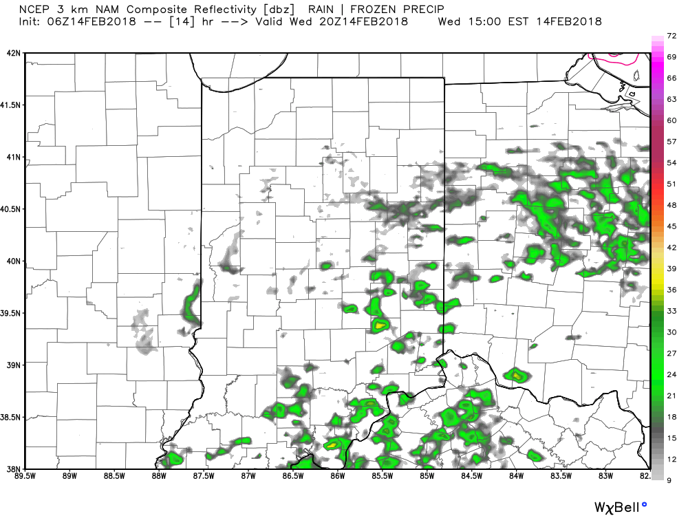
Forecast radar today at 3p shows scattered light showers around.
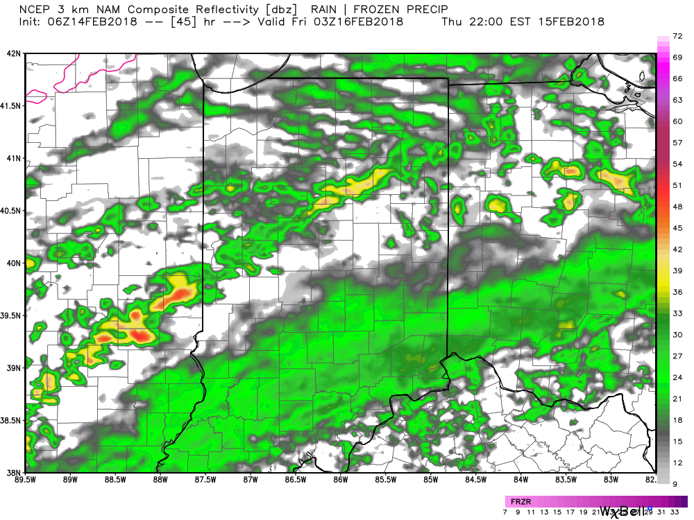
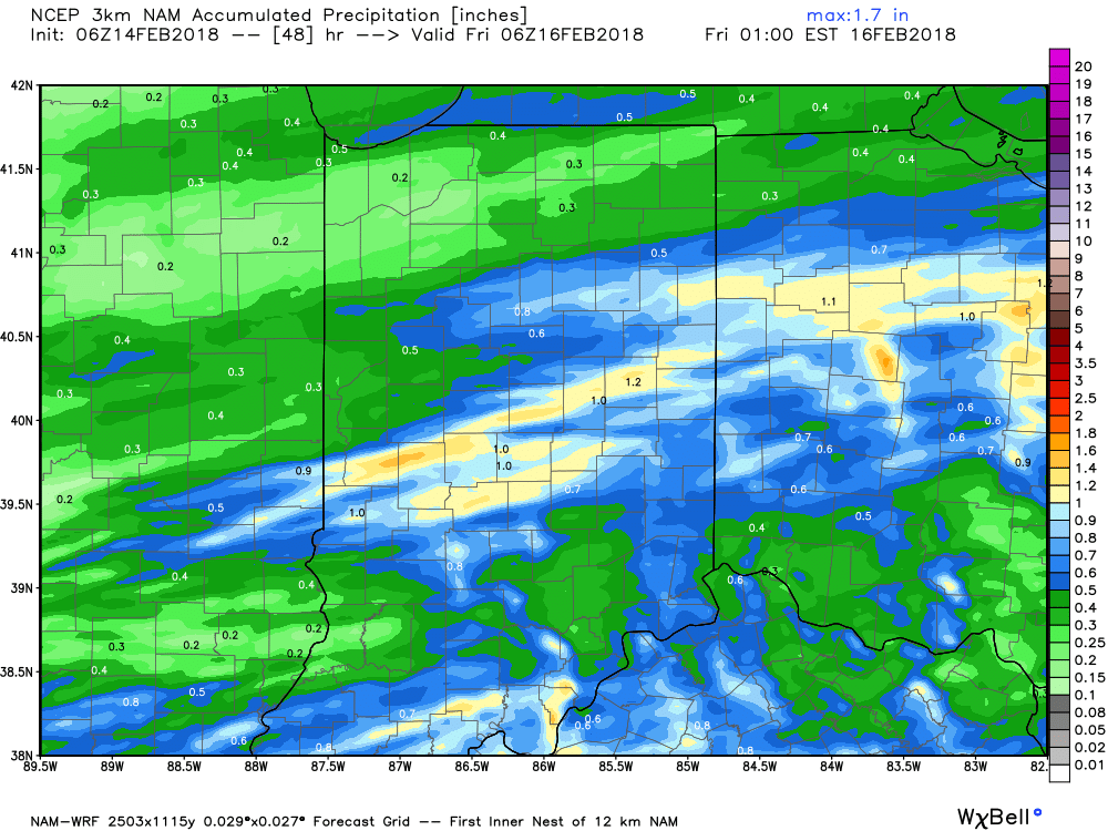
II. A cold front will drop in Thursday evening and this will deliver more widespread heavier rainfall and even a couple of thunderstorms Thursday night. In general, we expect 0.50″ to 1″ of rain to fall.
 III. We’ll turn briefly colder to close the work week. A couple of light snow showers are possible Friday morning and a wave of low pressure will “try” to push moisture into the cold air Saturday. As of now, we remain unimpressed with the prospect of impactful wintry weather Saturday, but have included the potential of wet snow in our Saturday forecast. Precipitation appears to be very light. Nonetheless, we’ll continue to keep an eye on things.
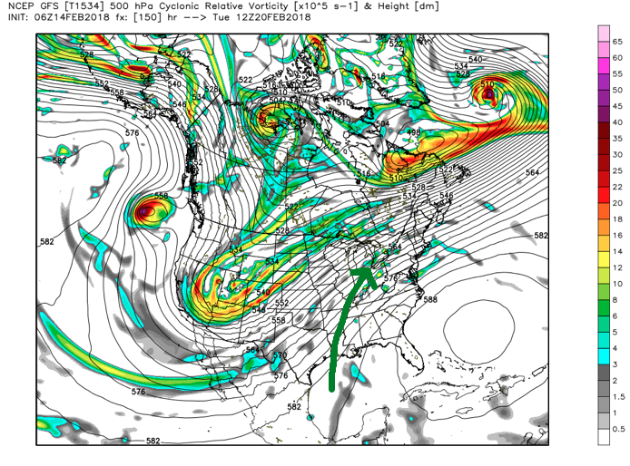
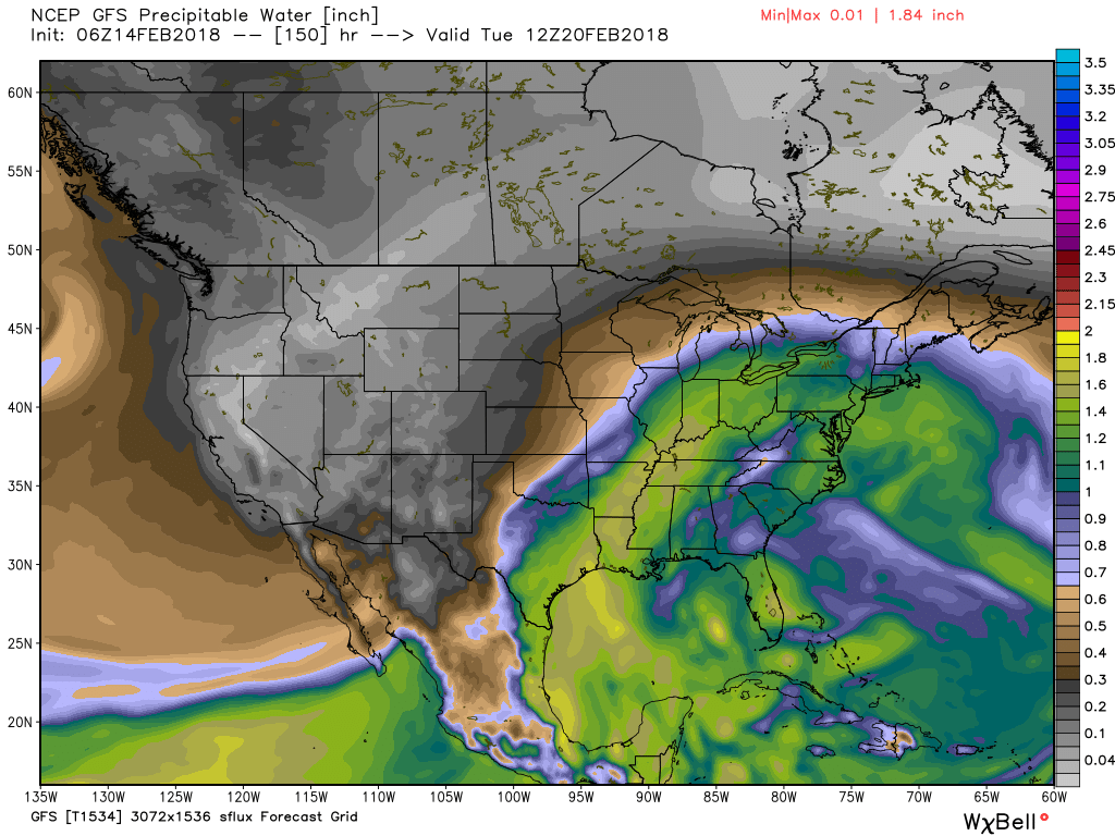
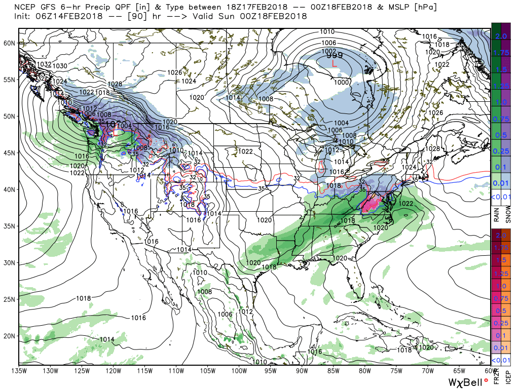 IV. The pattern continues to scream and warm and wet next week as a big ole southeast ridge remains in place. This will direct the steering current into the TN and OH Valley regions and multiple waves of rain, occasionally heavy, will result beginning early next week and continuing into the middle and latter portions of the week. Widespread 2″ to 3″ totals with locally heavier amounts seems to be a good bet next week.
We note a true Gulf connection and precipitable water values that will exceed 300% of normal at times. Parts of the Ohio Valley will deal with flooding, but it’s premature to get more specific than that from this distance. If you live near waterways, plan to keep a close eye on future updates and forecasts.
 V. We note data continues to suggest a colder period looms as we close out the month of February and head into March. Note how the GEFS and EPS continues to tank the Arctic Oscillation (AO). Winter’s not over, not by a long shot…
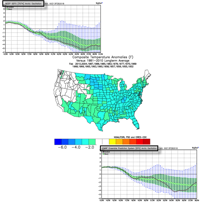
 The GEFS might be a bit quick on dropping the arctic hammer, but the consistency of the model is impressive. Meanwhile, the European (even it’s ensemble data) has been much less consistent and has really been struggling the past couple of winters, overall, as a whole.
 Let’s also keep in mind that the initial cold onslaught is coming in the face of the MJO still rumbling through the warm phases. We note the European is consistently having to correct towards a more “amped up” MJO- swinging into the cold phases as we approach mid-month. And it’s mid-February that continues to have us concerned for the potential of truly nasty, severe cold.
 As for snow, it’ll come in this pattern. Again, don’t get caught up in the operational output, but understand that the pattern over the upcoming 7-10 days favors numerous fast-moving snow systems. While most of these will be light, we’ll have to keep a close eye on things as the potential exists for one of these waves to spin up a moderate event.
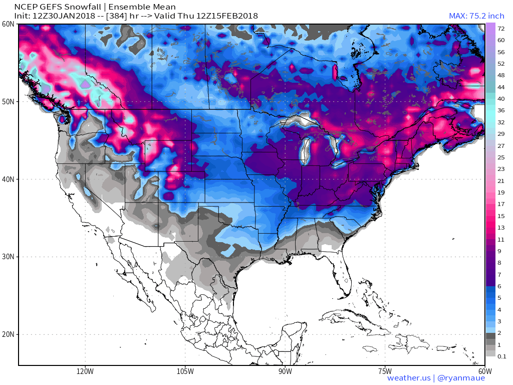
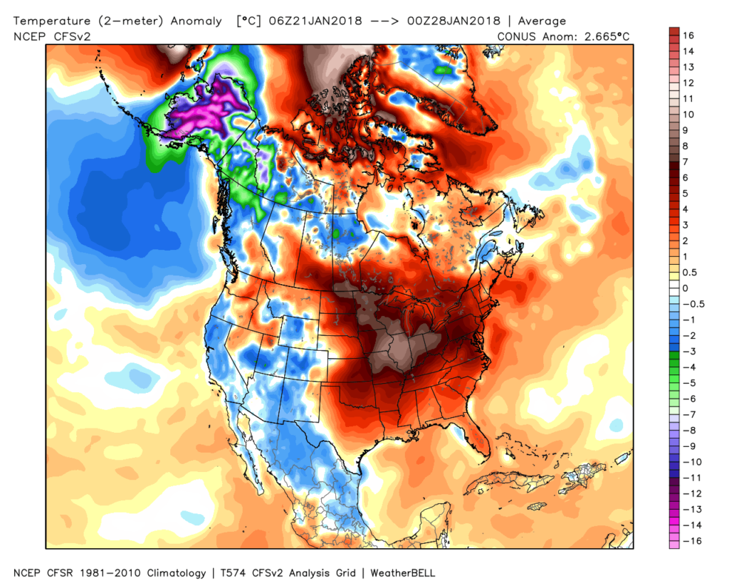 Despite the milder air over the past week, January, as a whole, is still running 4° below average at Indianapolis- a byproduct of just how frigid the first half of the month was.
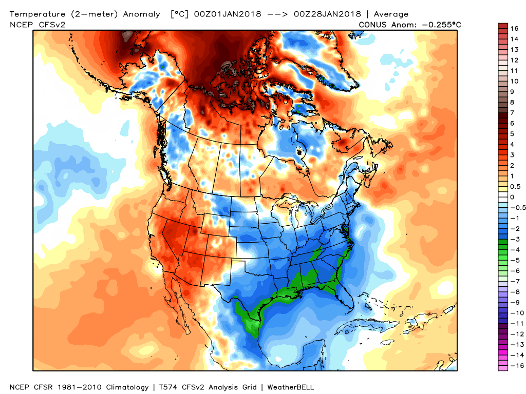 While the January thaw has been nice, times are changing and winter sure seems to be reloading for a very active second half.
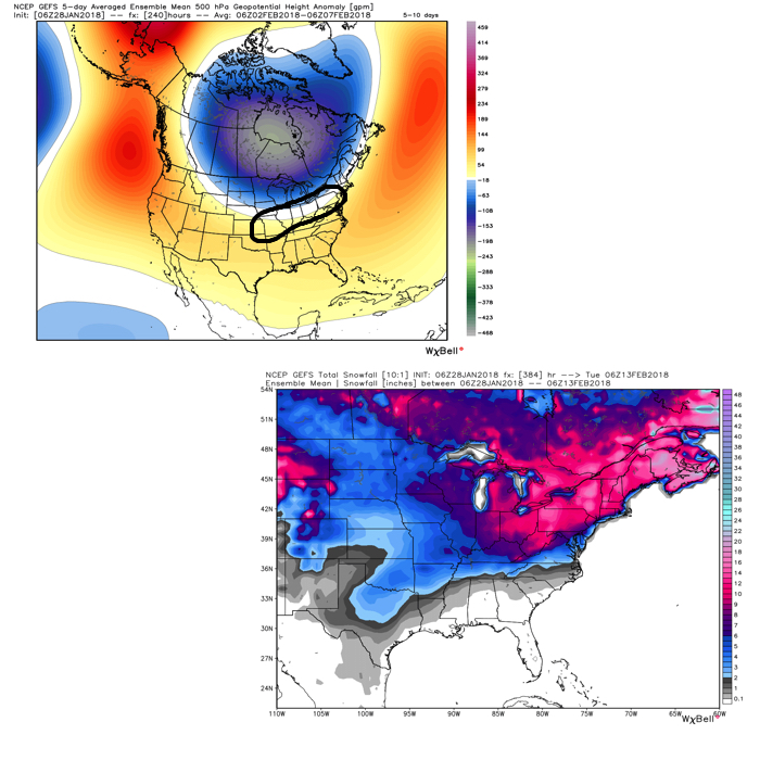 Once we get a snowpack laid down, arctic highs oozing southeast will likely lead to bitterly cold air. Recall our expectation for this pattern to yield at least (1) night of double-digit below zero lows, but it’s more towards mid-month that we think the severe cold takes hold.
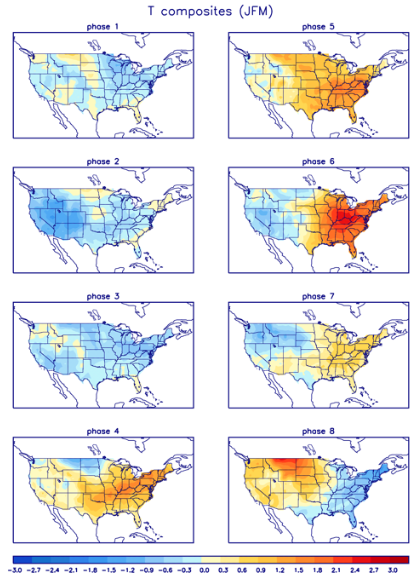
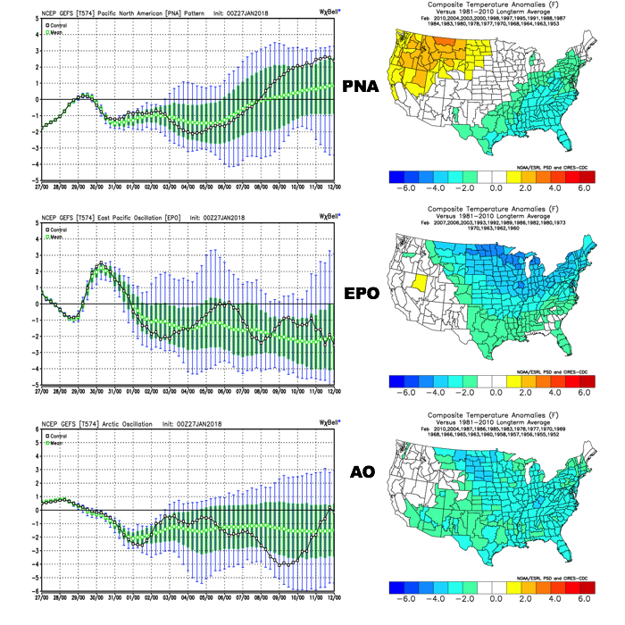 The Madden-Julian Oscillation (MJO) is forecast to rotate into the colder phase 8 as we rumble from early to mid February. Given the amplitude of the MJO, it should continue to rumble right through the cold phases of 1,2, and 3.
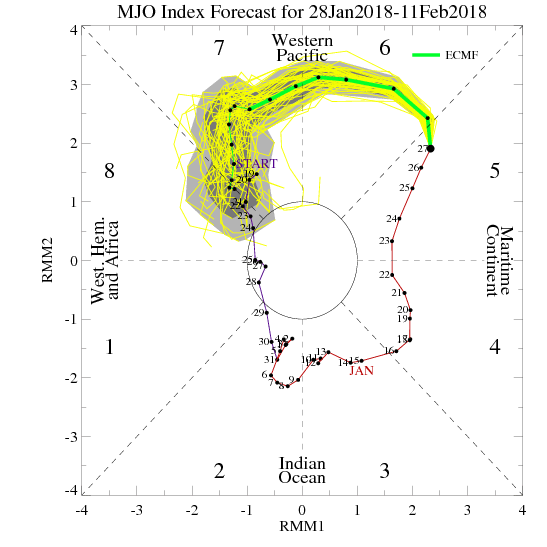
 All of these moving pieces that lead up to extended periods of cold, wintry conditions are part of a bigger outcome low solar, easterly QBO winters deal up. What we should experience with this setup is a 6-7 week period of wintry conditions, including times of severe cold. It appears to be a snowier version of what we went through late-December through mid-January. Hang in there, spring will come…eventually.
 When we look ahead, the shelf life of this warmth is certainly limited. The GEFS showcases this shift in the pattern from a warm open to the month towards a much colder pattern very nicely. The GEFS has other model support, as well.
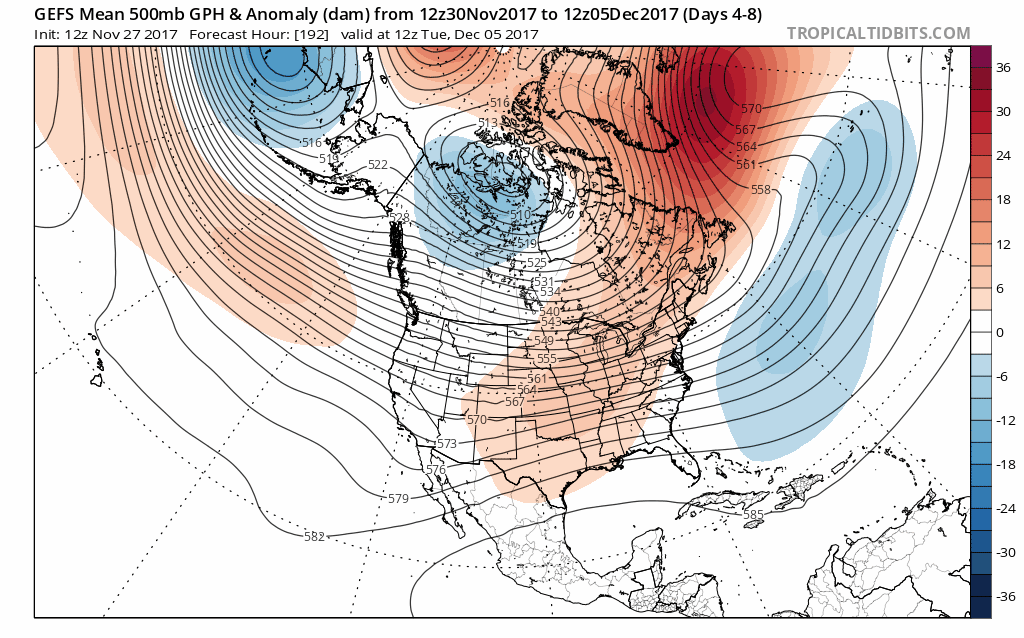 This is the type of dramatic shift in the overall pattern that not only threatens to “lock in” a colder than average regime, but potentially lead to plenty of wintry mischief to boot, and just in time for the holiday season.
 To summarize, while unseasonably quiet and mild conditions will rule in the short-term, Mother Nature sure seems to have an attitude of making up for “lost time” in the medium to longer range. This is the type pattern that we’ll have to monitor the potential of some sort of leader-follower scenario as the transition from warm to cold takes place, and given the blocky nature of the pattern, it sure seems like we’re heading into a busy time of things from a wintry perspective mid and late month.