Great Weekend Weather…
 Highlights:
- Dry and pleasant weekend
- Moisture and storms return next week
- Another push of cool air next weekend?
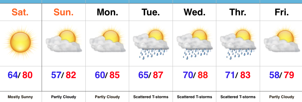
Sunglasses Required…What a great feel we’re greeted with out there this morning! Low humidity and pleasant temperatures will be with us through the weekend, along with lots of sunshine. Sunday morning will feature many neighborhoods in the middle to upper 50s across central IN. Mid-July, what?! 🙂
Moisture will slowly return as we back our air flow around to the SW early next week. Additionally, we’re tracking multiple disturbances mid week that will promote increased chances of thunderstorms.
An early look at late week shows potentially another push of dry and cool air to set-up a beautiful close to the work week. We’re getting spoiled.
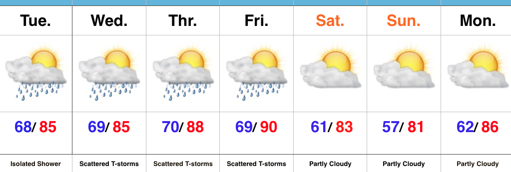
Upcoming 7-Day Precipitation Forecast:
- Snowfall: 0.00″
- Rainfall: 0.75″-1.50″ (locally heavier totals)
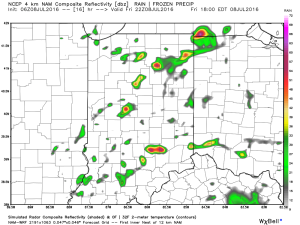 2.) The aforementioned cold front will sweep through the state tonight and allow a much drier and cooler air mass to push in for the weekend. We’ll enjoy a downright pleasant feel this weekend, including lots of sunshine. Enjoy!
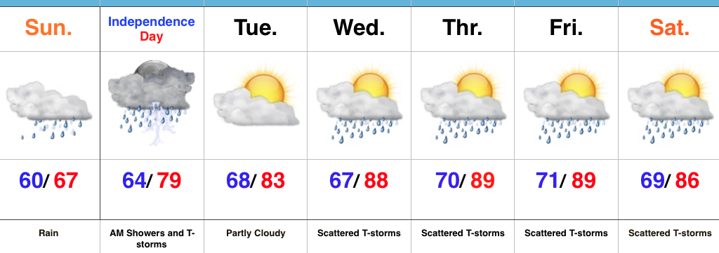
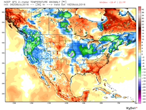 3.) Dry weather should continue into early next week, but wet and stormy weather will return as early as Tuesday, continuing into the latter portions of the week.
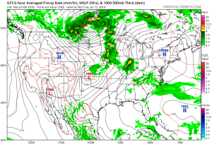 This is the start of what should be a rather wet period for mid and late month.
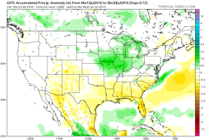 4.) This is also a continued “transient” pattern through the end of the month, meaning we really don’t see any sort of sustained dry, hot weather in the foreseeable future…