Extended Dry Period; Spring-Like Weekend Ahead…
 Highlights:
- Chilly today
- Spring-like weekend
- Extended dry period
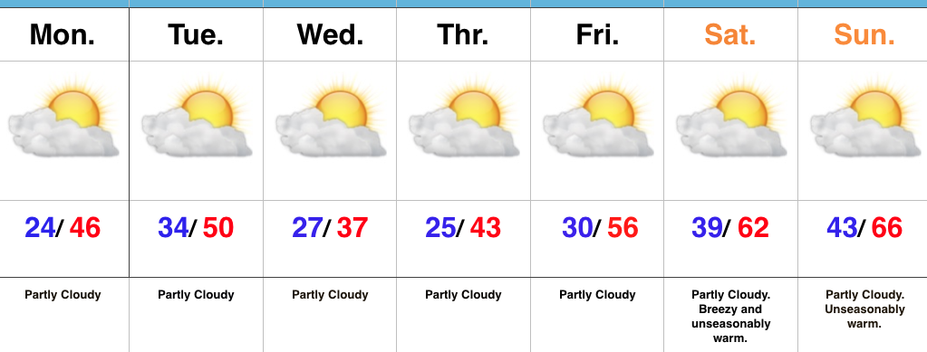
Beautiful Weather…There’s no reason to waste many pixels on this forecast. Despite a slight “speed bump” today (temperatures will top out a few degrees below normal), the balance of this 7-day forecast period is one that will feature unseasonably pleasant (and quiet) weather. We’ll note periods of clouds today as weak cold air advection kicks in, along with a gusty northerly breeze this afternoon.
After Thursday morning, it’s off to the races as an extended period of sunshine will be with us as we wrap up the work week and head into the weekend. Temperatures will reach 60 Friday, mid/ upper 60s this weekend, and near 70 Monday.
The next weather item of note will be increasing clouds late Tuesday, followed by showers Wednesday.
Upcoming 7-Day Precipitation Forecast:
- Snowfall: 0.00″
- Rainfall: 0.00″
 Highlights:


 Highlights: