Falling Temperatures Today; Dry Weather Returns…
 Highlights:
- Temperatures fall through the day
- Sunshine returns this week
- Pleasant stretch of weather ahead
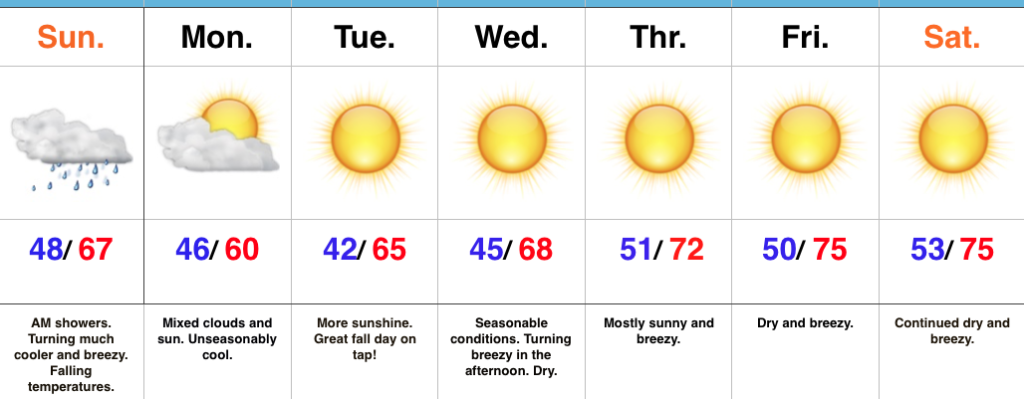
Jackets And Sweaters Required By This Afternoon…A cold front will continue to march east this morning and this will push a broken band of showers east through the state. Rainfall amounts won’t be significant, but will be enough to be a nuisance on the way to church or brunch this morning. This afternoon, we’ll notice an increasingly gusty breeze and falling temperatures. While it’s mild this morning, it’ll feel much cooler as we progress through the afternoon and evening hours. Jackets and sweaters will be required!
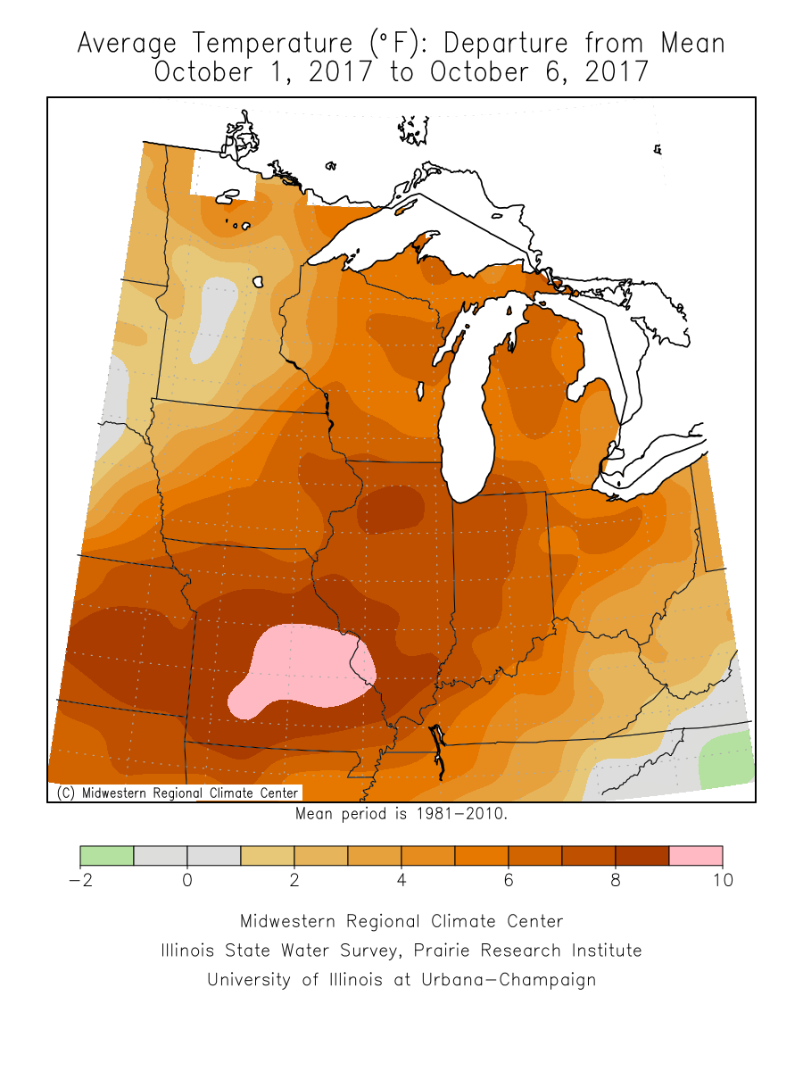
High pressure will settle overhead for the upcoming week and this will lead to an extended period of dry, pleasant weather. Temperatures will moderate from seasonably cool early-week to unseasonably mild by late-week. As expected, the late September and early October warmth (particularly warm overnight lows) really stunted our fall foliage this year. That said, the cool, calm nights ahead this week will be sufficient enough to at least ignite some of the remaining leaves on trees for what should be a couple weeks of “decent” color ahead.
Longer term, there are big goings on behind the scenes that will help drive a dramatically different weather pattern to wrap up the month of October and head into November. Heads up to the parents out there, you may want to nudge the kiddos into picking a warm costume this Halloween…
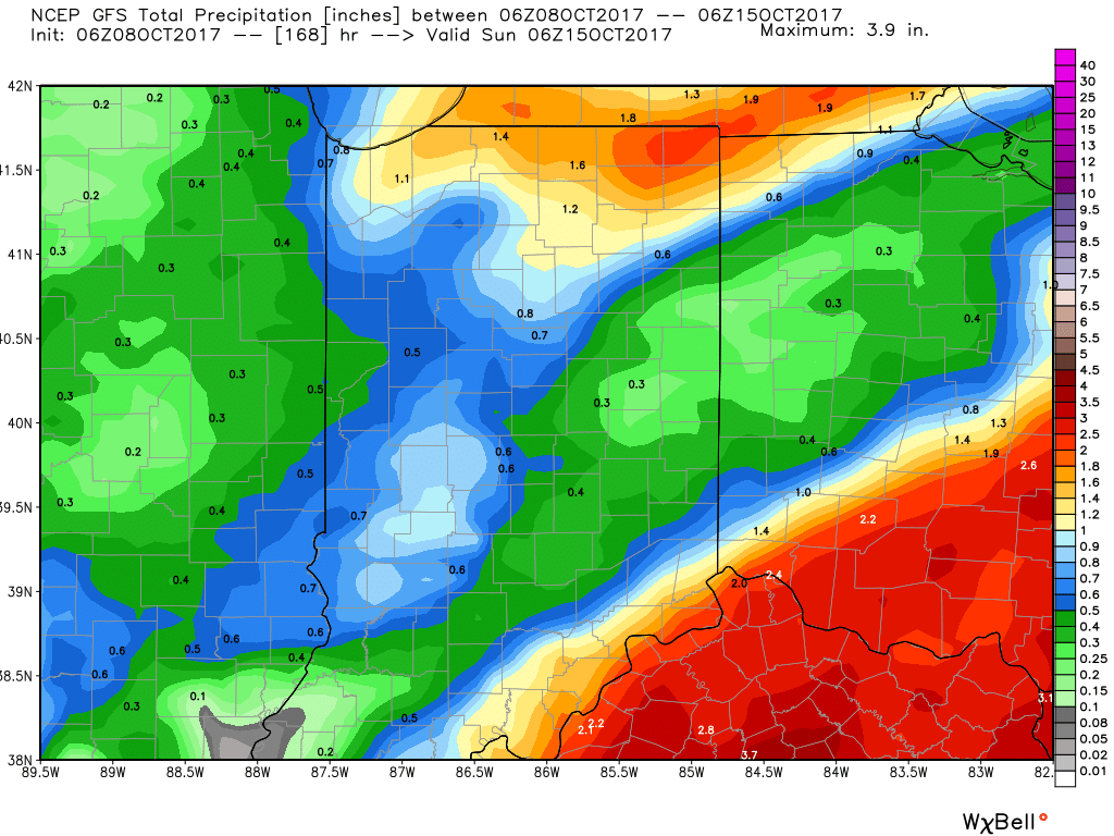
Upcoming 7-Day Precipitation Forecast:
- Snowfall: 0.00″
- Rainfall: 0.10″ – 0.25″
 Highlights:
 Highlights:
 Highlights:
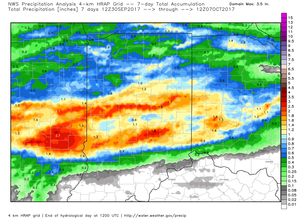
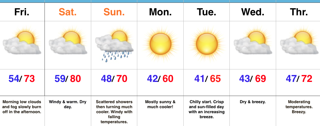
 An all-too-familiar pattern engulfs the country late week. This will showcase more “bonus” summer-like conditions, locally, that will include highs approaching 80° next weekend with a strong southerly flow in place. Additionally, early winter-like conditions will continue to impact the western high ground. The pattern definitely represents a Nina look.
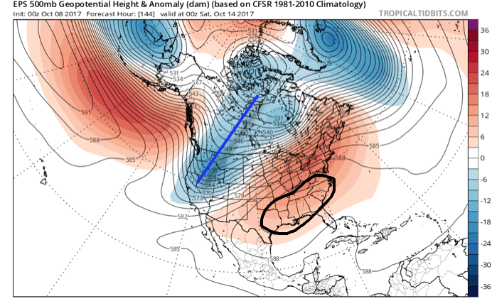
 Thereafter, dry times will settle in along with slightly cooler temperatures. Let’s remember it was only a few days ago where modeling suggested a “pop” of the season’s coldest air thus far. No longer is that the case, and while it will turn briefly cooler, temperatures will still remain above average.