Category: 7-Day Outlook
|
Thr.
|
Fri.
|
Sat.
|
Sun.
|
Mon.
|
Tue.
|
Wed.
|
|

|

|

|

|

|

|

|
|
55/ 75
|
54/ 77
|
55/ 79
|
60/ 80
|
60/ 76
|
55/ 75
|
55/ 79
|
|
– – –
|
– – –
|
– – –
|
Moderate
|
Heavy
|
– – –
|
– – –
|
This time of the year, weather conditions simply don’t get any better than what we’ll enjoy over the next 72 hours. Expect bright sunshine, pleasantly cool temperatures, and unseasonably low humidity levels. Our next storm system is gearing up for the back half of the weekend and we’ll promise a wet and stormy time of things Sunday afternoon into Monday. Rainfall totals continue to look impressive (not what we need after a rainy week), as widespread 1-2″ totals look common in the Sunday-Monday time period. Another pop of dry, cooler air will blow into town Monday night into Tuesday.
Permanent link to this article: https://indywx.com/doesnt-get-any-better-this-time-of-year/
-
Filed under 7-Day Outlook, Canadian Model, Flooding, Forecast, Forecast Discussion, Forecast Models, GFS, Heavy Rain, Rain, Severe Weather, T-storms, Weather Videos
-
June 4, 2014
Good evening, friends. Here’s a video update as we get set to welcome a cooler, drier regime into central Indiana to wrap up the work week. Additionally, we’re also tracking another potential heavy rain maker for the second half of the weekend (not that we need more heavy rain)….
PS: The IndyWx.com mascots have attempted more times than not to interrupt my video updates, so I only thought it was time to give them a little face time. Meet Cameron (left) and Newton (right).

Permanent link to this article: https://indywx.com/wednesday-evening-video-update-drier-cooler-air-coming/
Wed. Thr. Fri. Sat. Sun. Mon. Tue. 64/ 77 57/ 75 53/ 75 52/ 80 63/ 78 60/ 74 52/ 78 Moderate –…
You must be logged in to view this content. Click Here to become a member of IndyWX.com for full access. Already a member of IndyWx.com All-Access? Log-in here.
Permanent link to this article: https://indywx.com/severe-storms-south-today-breath-of-fresh-air-coming/
|
Tue.
|
Wed.
|
Thr.
|
Fri.
|
Sat.
|
Sun.
|
Mon.
|
|

|

|

|

|

|

|

|
|
67/ 84
|
62/ 78
|
52/ 75
|
51/ 75
|
56/ 82
|
66/ 80
|
54/ 75
|
|
– – –
|
Heavy
|
– – –
|
– – –
|
Light
|
Light
|
– – –
|
After a heavy dose of rain across central Indiana Monday, today will be much quieter, AND increasingly sunny! A boundary will slip south through the afternoon hours and could ignite a shower or thunderstorm, but these will primarily be south and east of the city, itself. We’re going with a more optimistic approach to our forecast today for the greater Indianapolis region and points north. All eyes will then shift northwest to a blossoming complex of rain and severe thunderstorms this afternoon. We’ll watch this complex track south and east with time tonight and rumble into the region, especially from IND and points north, early Wednesday morning. Most of these storms will be below severe levels, but the storms are likely to be quite noisy and pack heavy rain, gusty winds, and small hail. A second round of thunderstorms will develop Wednesday afternoon and likely turn severe for some. You can read our thoughts from last night here and this continues to sum up our thinking for now. Widespread additional rainfall Wednesday will fall in the 1″-2″ range.
Get set to open the windows and welcome in a breath of fresh air as we wrap up the work week. Gone will be the warm and sticky air that we’ve dealt with through the early week and in return we’ll enjoy temperatures several degrees cooler along with unseasonably comfortable humidity levels.
Our next rain and storm threat will blow into town Sunday!
Permanent link to this article: https://indywx.com/watching-wednesday-closely/
-
Filed under 7-Day Outlook, Flooding, Forecast, Forecast Discussion, Forecast Models, GFS, Hail, Heavy Rain, Rain, Severe Weather, Summer, T-storms, Weather Videos
-
June 2, 2014
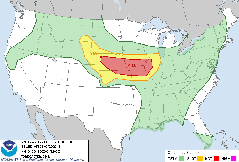
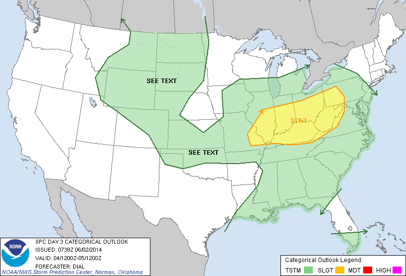
An active few days lie ahead though it won’t rain and storm the entire time, and many dry hours can be expected over the course of the next few days. The video covers the details below!

Tuesday is shaping up to be a very active severe weather day to our west.

Wednesday will feature severe weather chances across the Ohio Valley.
Permanent link to this article: https://indywx.com/monday-morning-video-update-severe-weather-potential-and-heavy-rain/


