Category: 7-Day Outlook

Gorgeous Fall Weather…

Sun.

Mon.

Tue.

Wed.

Thr.

Fri.

Sat.

 Status-weather-clouds-icon

 Status-weather-showers-day-icon

 Status-weather-clouds-icon

 Status-weather-clouds-icon

 Status-weather-clouds-icon

 Status-weather-clouds-icon

 Status-weather-clouds-icon

46/ 68

46/ 69

48/ 67

46/ 68

46/ 71

49/ 75

54/ 82 

Fantastic Fall Day…Chilly Canadian high pressure will remain in control of our weather today and help supply lots of sunshine.  High temperatures will rebound into the upper 60s after the chilly start, but this is still (11) degrees below the average high of 79.

Weak Frontal Boundary Moves In…A weak and moisture-starved frontal boundary will slip into the region Monday afternoon and evening (about 12 hours earlier than we thought yesterday).  We’ll notice an increase in cloudiness tomorrow along with the chance of a few light showers through the afternoon and evening.  We’re not looking at significant rainfall totals, but plan to pack the umbrella as you may need it heading out of the office tomorrow evening.

Back To Dry And Cool…With the exception of Monday, the rest of the work week will be dominated by more ideal fall weather.  Temperatures will remain below average, though slowly begin to moderate towards week’s end.  Sunshine will continue and the combination between dry sunny days and clear, chilly nights will likely begin getting the color season underway a bit earlier than normal this year.  BTW- in the coming weeks ahead, please send in your fall foliage shots to bill@indywx.com!

Quick Warm-Up Ahead Of Next Storm System…While we think we’ll stay dry Saturday, the second half of next weekend may be wet and unsettled as our next storm system moves through.  We’re siding with the European forecast model in regards to rainfall/ storm timing and another chilly Canadian high moving in for now.  Stay tuned.

7-Day Precipitation Forecast:

  • 7-Day Rainfall Forecast: 0.10-0.25″
  • 7-Day Snowfall Forecast: 0.00″
A weak frontal boundary will slip through the region Monday evening with light rain.

A weak frontal boundary will slip through the region Monday evening with light rain.


Permanent link to this article: https://indywx.com/gorgeous-fall-weather/

Weekly Outlook: Cool And Overall Dry

We’re going to begin writing an overview on the weekends (Saturday or Sunday depending on what time allows) of the upcoming week ahead. This won’t serve as a substitute for…

You must be logged in to view this content. Click Here to become a member of IndyWX.com for full access.  Already a member of IndyWx.com All-Access?  Log-in here.

Permanent link to this article: https://indywx.com/weekly-outlook-cool-and-overall-dry/

Feeling Like October!

Sat.

Sun.

Mon.

Tue.

Wed.

Thr.

Fri.

 Status-weather-clouds-icon

 Status-weather-clouds-icon

 Status-weather-clouds-icon

 Status-weather-showers-day-icon

 Status-weather-clouds-icon

 Status-weather-clouds-icon

 Status-weather-clouds-icon

47/ 60

42/ 68

42/ 69

51/ 70

46/ 69

47/ 69

48/ 74 

Reinforcing Chilly Air…A second push of chilly air blew in overnight and you can feel it this morning. North winds are gusting between 15-20 MPH and helping to usher in reinforcing October-like chill!  Certainly pack the jacket or sweat shirt for those football games or fall festivals today!  Cold air advection will keep a good deal of clouds in our forecast through the day before we begin to introduce much more in the way of sunshine into your Sunday picture.  Temperatures will remain unseasonably cool through the forecast period really, but slow moderation will occur by late next week.

Tuesday Showers…A few showers will be possible Tuesday as a weak boundary moves through the region.  This system will be moisture starved so don’t look for much in the way of rainfall Tuesday (perhaps a tenth of an inch).

7-Day Precipitation Forecast:

  • 7-Day Rainfall Forecast: 0.10″
  • 7-Day Snowfall Forecast: 0.00″
Temperatures will remain in the 50s for the better part of the afternoon (and all day just north of the city).  We'll make a push for 60 in the city, but it'll be close.

Temperatures will remain in the 50s for the better part of the afternoon (and all day just north of the city). We’ll make a push for 60 in the city, but it’ll be close.

Permanent link to this article: https://indywx.com/feeling-like-october/

Ready For A True Fall Feel?!

Thr.

Fri.

Sat.

Sun.

Mon.

Tue.

Wed.

 Status-weather-clouds-icon

 Status-weather-showers-day-icon

 Status-weather-showers-day-icon

 Status-weather-clouds-icon

 Status-weather-clouds-icon

 Status-weather-showers-day-icon

 Status-weather-clouds-icon

54/ 67

50/ 67

51/ 63

44/ 69

50/ 75

54/ 69

48/ 69 

Cooler Breezes Blowing…A strong cold front moved through the region last night.  You’ll notice a huge change in the air mass upon stepping out the door this morning with north winds blowing!  This will really be looked at as the first true fall cold front of the season with the coolest air in months blowing in for late week into the weekend.  Today will feature some breaks in the clouds late morning into the afternoon, but cold air advection will lead to continued mostly cloudy skies for the better part of the day.

Reinforcing Chilly Air…A reinforcing push of unseasonably chilly air will blow in Friday night into early Saturday.  A couple of light showers will be possible as the cold front passes and even cooler air will pour into the area Saturday (temperatures will remain in the 50s for a large portion of the day Saturday).

We’ll dry things out and introduce sunshine into your Sunday forecast.

Mid Week Cold Front…Another cold front will target a Tuesday evening/ Wednesday arrival (and departure :-)).  We think moisture will come at a premium with this next front so we don’t forecast any sort of heavy rain at this juncture.  Another push of cool air will move in behind the boundary.

7-Day Precipitation Forecast:

  • 7-Day Rainfall Forecast: 0.25″ – 0.50″
  • 7-Day Snowfall Forecast: 0.00″
Get ready for a MUCH cooler day!  Highs today have already occurred shortly after mid night, and will struggle to top 67 later this afternoon in the city, itself. This is only the beginning of an extended stretch of cool air.

Get ready for a MUCH cooler day! Highs today have already occurred shortly after mid night, and will struggle to top 67 later this afternoon in the city, itself. This is only the beginning of an extended stretch of cool air.

Permanent link to this article: https://indywx.com/2563/

Increasing Storm Chances Mid Week; Turning Cool Late Week…

Tue.

Wed.

Thr.

Fri.

Sat.

Sun.

Mon.

 Status-weather-showers-day-icon

 Status-weather-storm-night-icon

 Status-weather-showers-day-icon

 Status-weather-clouds-icon

 Status-weather-showers-day-icon

 Status-weather-clouds-icon

 Status-weather-clouds-icon

56/ 80

65/ 85

54/ 69

52/ 69

52/ 62

44/ 64

43/ 67 

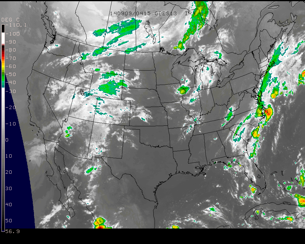
Storms To Our Northwest This Morning…A complex of showers and embedded thunderstorms is moving into extreme northwest portions of the state this morning.  We have a very dry and stable air mass in place locally and these storms will weaken as they continue to sag southeast.  Most will remain rain-free today, but some light rain will be possible across northwestern and north-central portions of the state later this morning. (NOT a big deal).

Severe; Heavy Rain Threat Wednesday…A strong cold front will push into central Indiana Wednesday night. A warm and humid air mass will be in place and as the front moves through the region, widespread showers and thunderstorms will move over the area.  Locally heavy rainfall will be likely and embedded strong to severe thunderstorms will be possible.  Damaging wind and hail is our biggest concern, but a quick spin-up tornado can’t be ruled out.  We target Wednesday evening and nighttime for greatest chances of thunderstorms across our immediate area.

MUCH Cooler…An October-like air mass will filter into the region late week and as we go into the weekend.  A reinforcing shot of cool air will arrive Saturday with a passing shower possible.  Hope you’re ready for some true fall-like weather!

7-Day Precipitation Forecast:

  • 7-Day Rainfall Forecast: 1.50″ – 2″
  • 7-Day Snowfall Forecast: 0.00″

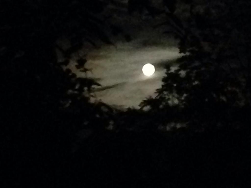
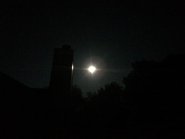
Hopefully you had a chance to see the last ‘super moon’ of the year last night.  John Salewicz and Brian Jessen caught the super moon in Zionsville (top) and Brownsburg (bottom).  Thanks, guys!

BxFeLeoCIAAfrk8.jpg-large

BxDquNcIQAAZpGm


Blow off clouds will move into central and northern portions of the state this morning as a weakening area of showers and thunderstorms pushes closer.

Blow off clouds will move into central and northern portions of the state this morning as a weakening area of showers and thunderstorms pushes closer.

Permanent link to this article: https://indywx.com/increasing-storm-chances-mid-week-turning-cool-late-week/