Category: 7-Day Outlook

“Dirty” High In Control…

Wed.

Thr.

Fri.

Sat.

Sun.

Mon.

Tue.

 Status-weather-snow-scattered-day-icon

 Status-weather-clouds-icon

 Status-weather-clouds-icon

 Status-weather-clouds-icon

 Status-weather-showers-day-icon

 Status-weather-showers-day-icon

 Status-weather-showers-scattered-icon

29/ 36

28/ 38

28/ 43

32/ 45

39/ 48

42/ 51

33/ 44 

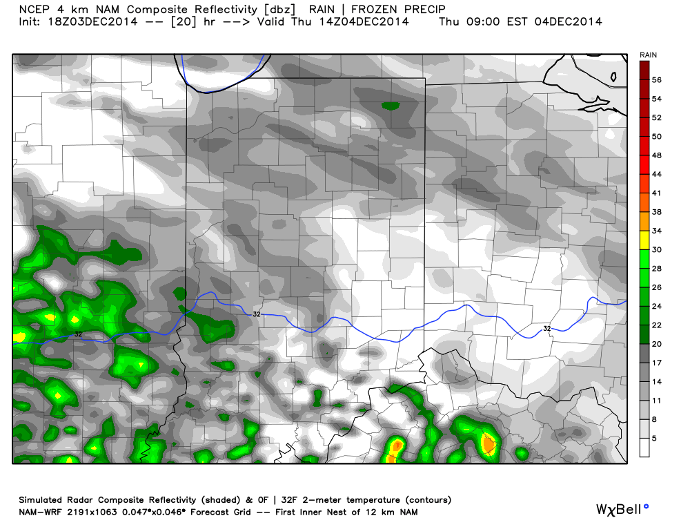
Dirty High…High pressure is in control of our weather, but this is what we call a “dirty high” as low clouds will remain today along with a couple light flurries, particularly across western parts of the state.  Temperatures will remain colder than average.

Sunshine will finally begin to increase as we go into the latter portion of the work week along with slowly moderating temperatures closer to seasonal levels.

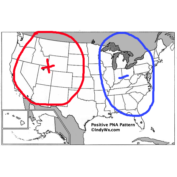
Tricky Weekend…The upper air pattern this weekend will feature a building ridge across the Mid West and Ohio Valley and signal milder days ahead.  Taken at face value one would anticipate temperatures well into the 50s and flirting with 60, but there will likely be an “inversion” that develops over the weekend which will lead to lots of clouds, drizzle, and cooler temperatures that what we’d expect without this inversion.  As such, we’re forecasting increasing clouds Saturday and considerable cloudiness with areas of drizzle Sunday.  Temperatures, though milder than normal, won’t reach levels they could in this type pattern without the inversion.

Early Week Storm System…Our next storm system will arrive late Monday into Tuesday with light rain and colder air returning for the middle of next week.

Upcoming 7-Day Precipitation Forecast:

  • 7-Day Rainfall Forecast: 0.25″ – 0.50″
  • 7-Day Snowfall Forecast: 0.00″

Permanent link to this article: https://indywx.com/dirty-high-in-control/

A Look At Where We’ve Been And Where We’re Going…

December so far has been a battle between the cold northern tier and warmth south. The so-called “battle zone” has been located over our neck of the woods and lead…

You must be logged in to view this content. Click Here to become a member of IndyWX.com for full access.  Already a member of IndyWx.com All-Access?  Log-in here.

Permanent link to this article: https://indywx.com/a-look-at-where-weve-been-and-where-were-going-4/

Colder Air Moving In…

Tue.

Wed.

Thr.

Fri.

Sat.

Sun.

Mon.

 Status-weather-snow-scattered-day-icon

 Status-weather-clouds-icon

 Status-weather-clouds-icon

 Status-weather-clouds-icon

 Status-weather-clouds-icon

 Status-weather-clouds-icon

 Status-weather-clouds-icon

33/ 39

29/ 35

28/ 38

28/ 42

32/ 49

34/ 52

40/ 54 

Mixed Rain/ Snow Showers…Colder air will pour into the region on gusty north and northeast winds through the early week stretch.  Left over moisture will produce scattered mixed rain and snow showers Tuesday, particularly during the morning.

Cold Mid Week…Dry, but cold conditions can be expected through the middle and latter portion of the work week.  Temperatures will run below average, but at least we’ll enjoy a little vitamin D!

Milder Air Coming…Our air flow will shift around to the southwest over the weekend into early next week and this will help promote much milder times- at least for a brief period of time.  We caution though that a much different look (and feel) awaits by the middle and latter part of next week and this will likely set the stage for a cold end to December, including Christmas.

Upcoming 7-Day Precipitation Forecast:

  • 7-Day Snowfall Forecast: 0.00″
  • 7-Day Rainfall Forecast: 0.20″

Permanent link to this article: https://indywx.com/colder-air-moving-in/

Blustery And Cold Day…

Sat.

Sun.

Mon.

Tue.

Wed.

Thr.

Fri.

 Status-weather-showers-scattered-icon

 Status-weather-clouds-icon

 Status-weather-showers-day-icon

 Status-weather-snow-scattered-day-icon

 Status-weather-clouds-icon

 Status-weather-clouds-icon

 Status-weather-clouds-icon

31/ 42

27/ 39

31/ 42

28/ 37

27/ 35

28/ 38

30/ 45 

Half & Half Weekend…After a wet Friday today will begin a drier theme that will continue through the weekend.  Despite the overall drier regime, don’t expect much in the way of sunshine today.  Instead we’ll deal with considerable cloudiness, patchy drizzle, and blustery winds shifting around to the northwest.  We’ll introduce more in the way of sunshine into your Sunday forecast with high temperatures a few degrees below the average high of 42.

Early Week Cold Front…A frontal boundary will move through the region Monday and could have a couple showers as it blows through the state.  Colder air will move in behind the front for mid week and may be accompanied by a few flurries or a scattered snow shower Tuesday.

Dry Ending…Indications at this point are that we’ll enjoy dry conditions to wrap up the work week along with slowly moderating temperatures.

Upcoming 7-Day Precipitation Forecast:

  • 7-Day Rainfall Forecast: 0.10″ – 0.25″
  • 7-Day Snowfall Forecast: 0.00″

Permanent link to this article: https://indywx.com/blustery-and-cold-day/

Another Bout Of Rush Hour Wintry Mix; Longer Range Talk…

We think we’re dealing with another round of light freezing drizzle and a wintry mix for the Thursday morning commute.  Plan to allow extra travel time.

Forecast radar Thursday morning suggests freezing drizzle and a light wintry mix is in play across central Indiana.

Forecast radar Thursday morning suggests freezing drizzle and a light wintry mix is in play across central Indiana.

There’s some longer term data that’s in stark contrast from what a positive PNA should produce (yet alone a strong positive PNA).  Typical positive PNA pattern should promote an eastern trough and associated colder than normal pattern as drawn below:

PositivePNA

Needless to say, we disagree strongly with the NAEFS and GFS ensembles:

2014120312_054@007_E1_north@america_I_NAEFS@TEMPERATURE_anomaly@probability@combined@week2_186

Regardless, the future will tell!  

Permanent link to this article: https://indywx.com/another-bout-of-rush-hour-wintry-mix-longer-range-talk/