Category: 7-Day Outlook

Watching For Afternoon Snow…

Screen Shot 2015-03-04 at 7.56.01 AM
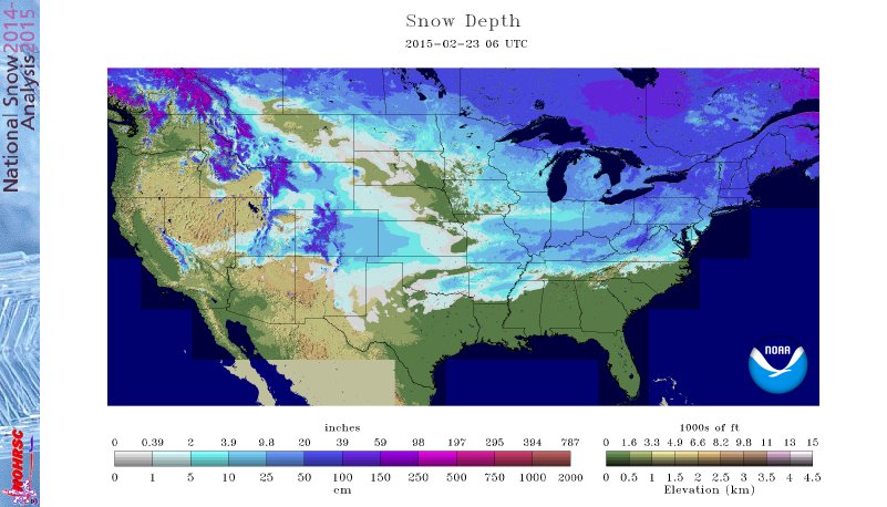
Light Snow Moves In This Afternoon…While heavy snow will remain to our south, we do forecast light snow to overspread portions of central Indiana later this afternoon into the evening hours. This won’t be a huge deal, but a dusting to 1″ of accumulation will be possible around the city, itself.  Heavier snow will fall downstate.  Heads up if you’re traveling south.

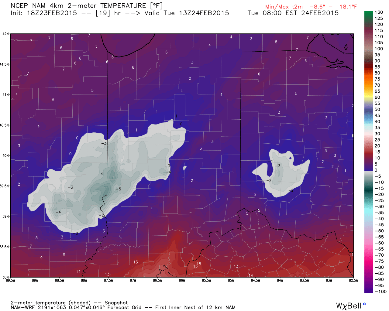
The bigger story will be a MUCH colder air mass that arrives tonight and sets up a frigid Thursday.  We’ll be on record watch Thursday to potentially set a new record cold max.  It’ll be close.  Cold air remains with us to wrap up the work week.

A weak weather system will scoot north of the area Saturday night into Sunday morning, but may be close enough to provide a quick rain or snow shower.

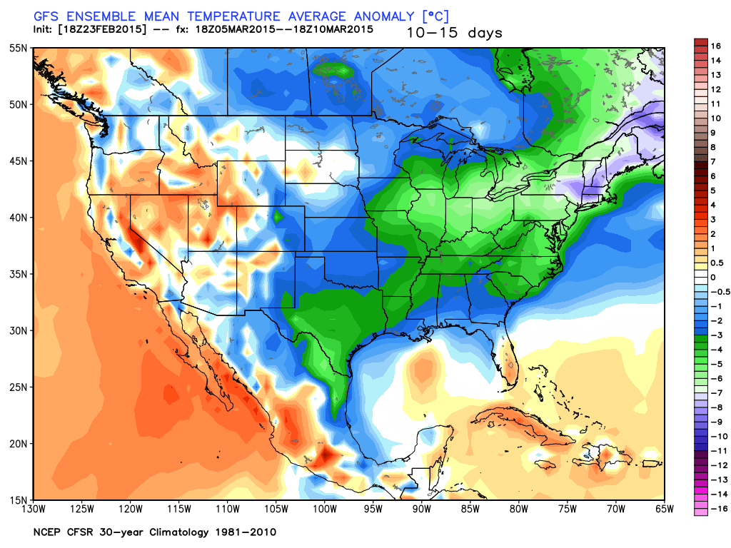
Early next week looks dry with a moderating trend.  We’re expecting a more pronounced warm up for the second half of next week…60s, anyone?!

Upcoming 7-Day Precipitation Forecast:

  • 7-Day Rainfall Forecast: 0.10″
  • 7-Day Snowfall Forecast: Dusting to 1″

Permanent link to this article: https://indywx.com/watching-for-afternoon-snow/

Icy Morning…

Screen Shot 2015-03-03 at 7.58.16 AMRough Travel Conditions This Morning…Freezing rain and freezing drizzle is making a mess of the morning commute.  Thankfully, eventually we’ll climb above freezing around, or just after, noon.  Before then, icy travel conditions can be expected.  Take it slow or postpone travel until the afternoon if possible.  By this afternoon, temperatures will climb above freezing and plain ole rain can be expected into tonight.  We don’t anticipate flooding issues locally as rain won’t be heavy enough and temperatures won’t be warm enough to result in significant melting.

Much colder air will blow into town late tonight and Wednesday morning and as a second area of low pressure tracks along the front, widespread accumulating snow is a good bet across the southern half of the state Wednesday afternoon into Thursday morning.  As of now, we still target areas along and south of I-70 most at risk for snow accumulation Wednesday afternoon.

A much drier, but cold, pattern will be with us to wrap up the work week, including more record cold a good bet.  Dry and slightly milder conditions are ahead over the weekend before a weak system may deliver a light snow or rain shower early next week.

Looking ahead, it appears as if we finally may deal with a much milder, spring-like pattern around mid March.  60s for highs anyone?!  That said, concerns remain that we reverse this and go colder than normal late March.

Upcoming 7-Day Precipitation Forecast:

  • 7-Day Snowfall Forecast: 1″ – 3″ (south)
  • 7-Day Rainfall Forecast: 0.50″

In case you missed it this morning, we posted an article on meteorological winter and you can find it by clicking here.

Permanent link to this article: https://indywx.com/icy-morning/

Busy Weather Week Ahead…

Screen Shot 2015-03-01 at 10.09.08 AMImpressive Snowstorm…Heavy snowfall rates are occurring within localized bands through central and north-central Indiana as we type this.  Within those bands, expect an additional 1″-2″ today.  That’s on top of widespread 6″ to 7″ reports throughout the region.  (By the way- thank you so much for your snowfall reports and photos)!  We love to see them!

Outside of the heavy snow bands, a general light snow will begin to diminish by late afternoon/ early evening as drier air moves in behind a cold front.  Colder air will also roll into town tonight and Monday.

Our next storm will provide a wintry mix of sleet, snow, and freezing rain Tuesday morning before transitioning to rain.  That said, data that suggested we would see 50 degree+ highs Tuesday are finally coming to the realization we have quite the snowpack across the area.  We’ll rise into the lower 40s, but cold air will rush right back in here Tuesday night and Wednesday and potentially set us up for a very interesting mid week period.

For now model data ranges between a significant winter storm to simply dry and bitterly cold.  We’ll split the difference for now and maintain mention of snow in our Wednesday forecast as secondary energy develops a wave of low pressure along the pressing front.  Does that winter storm impact the Ohio Valley or areas of the Deep South?  We’ll continue to sort through the details.  I will say the UKMET has been most consistent of our forecast models over the past several weeks, and it’s quite bullish on the Ohio Valley winter storm scenario.  Never a dull moment around these parts…

Regardless of what happens Wednesday, fresh bitter cold air will pour in here to wrap up the work week.

Upcoming 7-Day Precipitation Forecast:

  • 7-Day Snowfall Forecast: 8″ – 11″
  • 7-Day Rainfall Forecast: 0.50″ – 1″

Permanent link to this article: https://indywx.com/busy-weather-week-ahead/

Busy AND Wintry Forecast…

Screen Shot 2015-02-25 at 7.27.09 AMBrief Break From The Severe Cold, But Not For Long…Today will be the “pick of the week” as milder air and some sunshine lead to a decent Wednesday. (It’s funny we say “milder” with highs that barely rise above our average low, but we’ll take what we can get).

A clipper system will impact the region tonight through Thursday and spread light snow across the area.  This won’t be a big deal, but accumulations around 1″ will be possible (perhaps an isolated 2″ report here or there).  The bigger deal?  Fresh bitterly cold arctic air pushing in here to wrap up the work week and head into the weekend.  Record-smashing cold and dangerous wind chills will be with us.

The next storm system will spread snow and a wintry mix through central Indiana Saturday night into Monday morning.  As we mentioned last night, this is a fluid situation and it’s still far too early for specifics.  That said, central Indiana is very much in play for another accumulating wintry event this weekend.

A final piece of energy will deliver more precipitation early next week.  As of now we forecast a wintry mix of snow and sleet to transition to rain as milder air pushes in from the southwest Tuesday.  Again- much can still change.

Upcoming 7-Day Precipitation Forecast:

  • 7-Day Rainfall Forecast:  0.50″ – 0.75″
  • 7-Day Snowfall Forecast: 3″ – 6″

Permanent link to this article: https://indywx.com/busy-and-wintry-forecast/

Busy Winter Weather…

February has been a brutally cold month and there’s no let-up in sight during the upcoming 7-10 days.

ncep_cfsr_noram_t2m_anomThe snowpack has expanded over the past few days.

nsm_depth_2015022305_NationalThe arctic air is very hard to move and forecast models can struggle mightily in the mid range when arctic air is involved.  Add in a vast snowpack over the TN Valley and Ohio Valley and I wouldn’t buy full force into the warm, mostly liquid precipitation solutions as depicted by some European and GFS runs as of late.  More on that later.

Arctic air is the story in the short-term along with a gusty wind that will precede very light snow Tuesday afternoon/ evening.

hires_t2m_indy_20


hires_ref_indy_29More bitterly cold, arctic air will be with us as we wrap up the work week and head into the weekend.  Additional records will fall.

Snow may also be with us.  We’re keeping a close eye on a clipper system that could deliver accumulating snow prospects around these parts Wednesday night/ Thursday.  The latest RGEM solution (below) depicts a more easterly track.  We also note the latest GFS delivers light snow in here Wednesday night and Thursday, as well.  We’ll keep a close eye on things.

rgem_precip_mslp_mw_17Late weekend into early next week features another complicated and very complex event.  We believe it’s far too early to buy into any one particular solution provided by the various forecast models, but certainly have to “raise an eyebrow” to the mostly wet, warmer solutions.  There’s an awful lot of dense arctic air around and with a widespread snowpack we have to wonder if modeling may be overdoing the warming (where have we seen this before ;-)).

A wavy front may lead to more wintry “mischief” Sunday into early next week.  Again- far too early for specifics, but additional wintry weather is certainly possible.

gfs_ptype_slp_conus2_29In the longer term, there’s just no let up in sight from the colder than normal conditions.  Sure we may see a couple of days of milder air (we are heading into March, after all), but, as a whole, the majority of the upcoming couple weeks look MUCH colder than normal.

gefs_t2m_mean_conus_d0_7


gefs_t2m_mean_conus_d10_15

Permanent link to this article: https://indywx.com/busy-winter-weather/