 Highlights:
- Scattered showers and storms continue
- Big cool blast looms
- Renewed wet stretch next week?
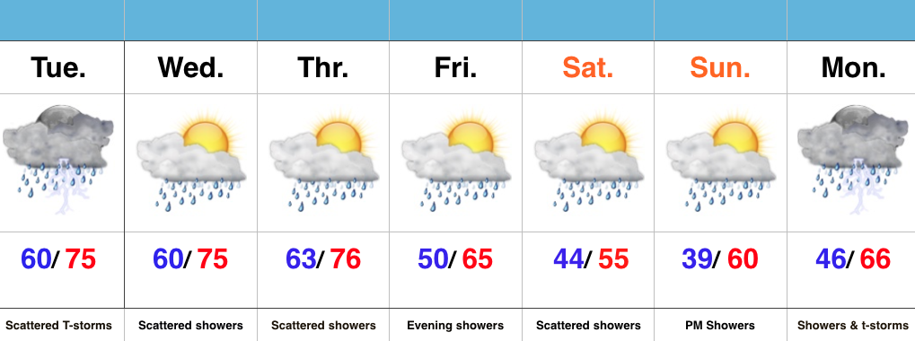
Active Times…It’s not so much the amount of rain that we’re seeing, but the overall duration of the gloomy, wet times. A stalled frontal boundary will remain draped over central parts of the state over the next 72 hours and this will help create periods of showers and thunderstorms through mid week. Localized heavy rain is possible, but the heavy rain totals certainly won’t fall in a “uniform” fashion. Tuesday afternoon and evening appears to still offer up a strong to severe thunderstorm chance.
Eventually a cold front will sweep the state Thursday and help usher in a much cooler air mass to wrap up the work week. An upper level disturbance will follow and provide a period of showers and light rain Friday evening. A spotty shower may continue Saturday with the much cooler air, but more widespread rains look to build in Sunday into Monday. There remains a great deal of disagreement on the forecast late in the weekend into early next week, so stay tuned as we fine tune things in the days ahead.
It’s a busy pattern, indeed, friends…
