Updated 09.16.26 @ 7:33a
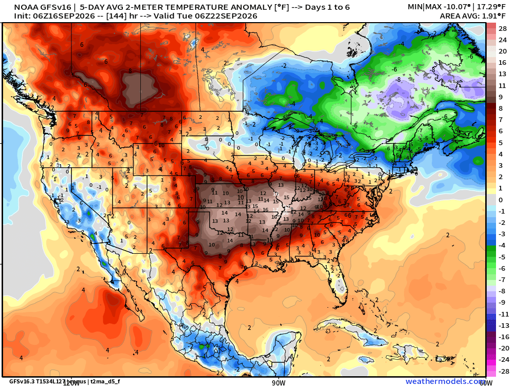
A stationary front will remain draped across the region over the next 24 to 36 hours before briefly pushing south Friday. Just as soon as the boundary gets shoved south, it’ll come back north as a warm front this weekend. This will result in hot, humid conditions today and Thursday, “less hot” but still above normal Friday, and make to the steam bath this weekend. Expect lower 90s for highs today, Thursday, and Saturday, with middle 80s Friday. Unusually high dew points will result in higher heat indices and overnight lows only falling into the upper 60s to lower 70s.
Thunderstorms will be most numerous across areas just north of our immediate region today before shifting south tonight.
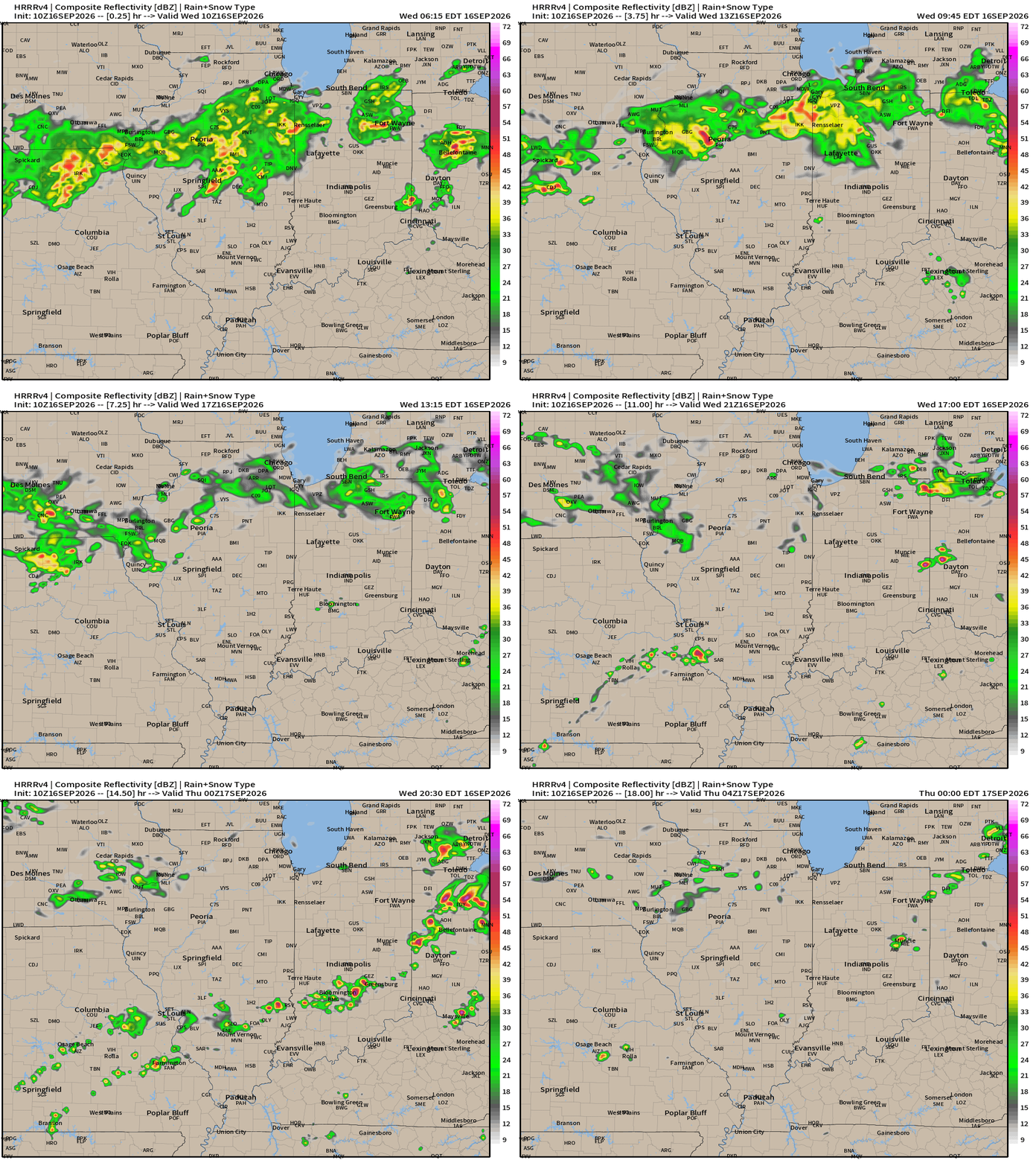
We’ll remain in an unseasonably warm (hot) and humid pattern through the weekend and into the 1st half of next week. Periods of storms will be more numerous than others, but overall activity is anticipated to remain scattered in nature. Given the nature of the pattern, a passing storm is very possible for any one particular neighborhood really at any time, but especially during the afternoon and evening hours.
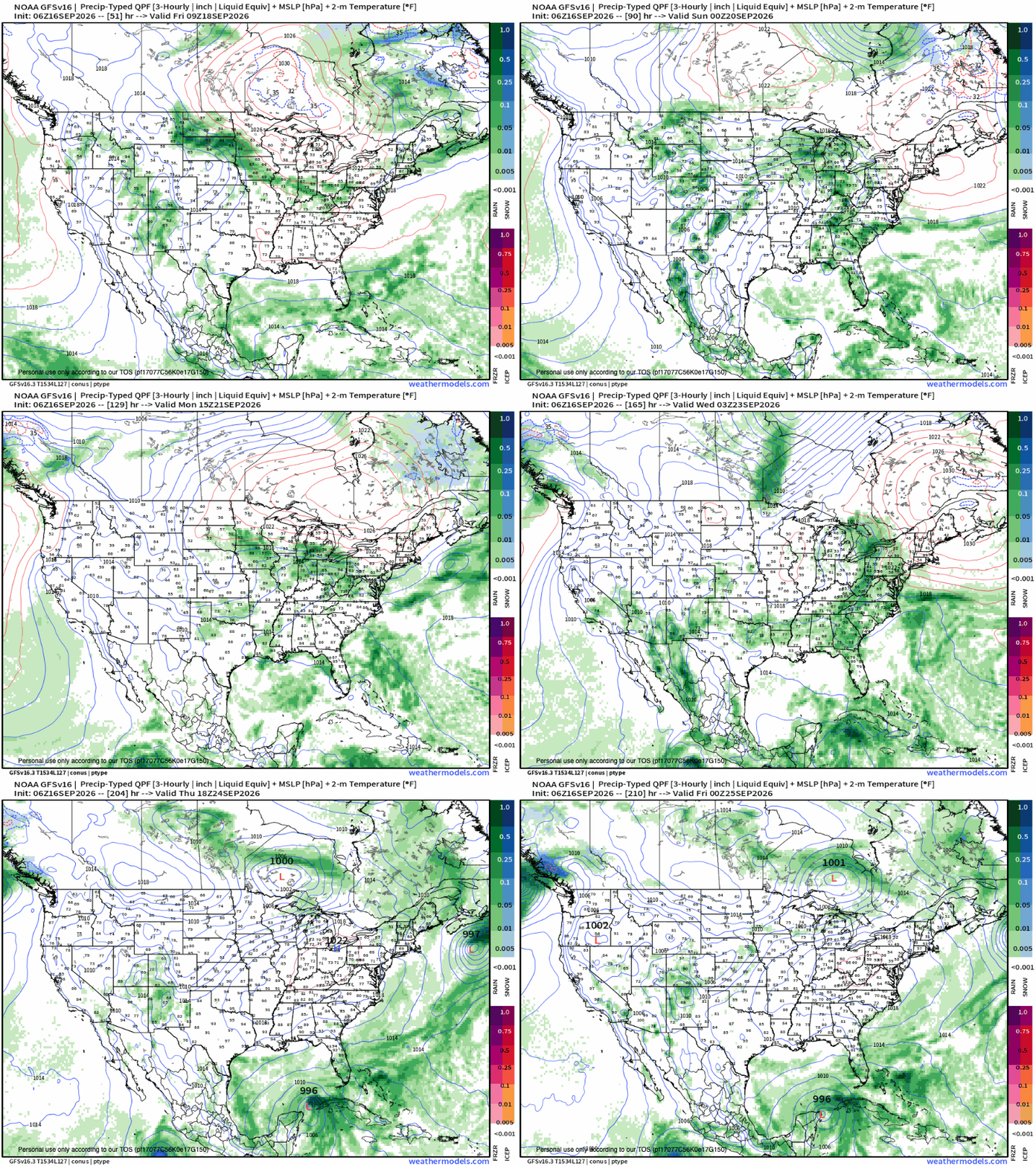
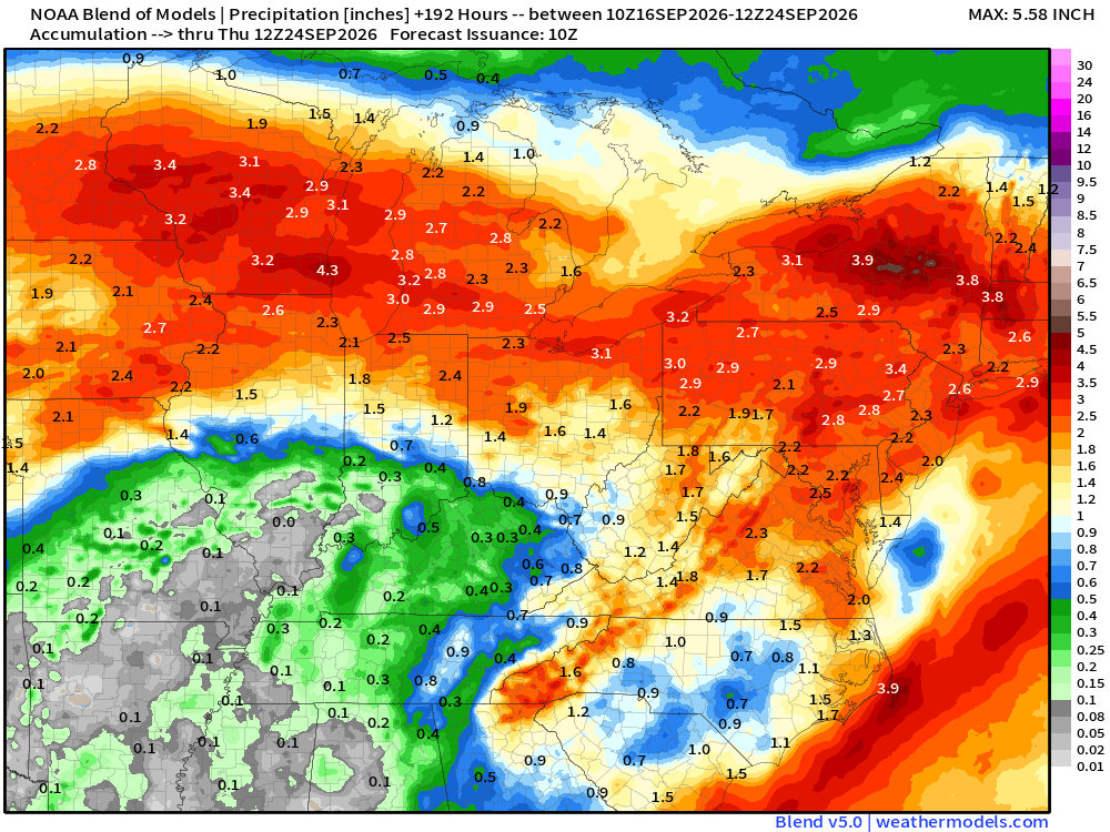
Finally, guidance is giving a “clean sweep” of the frontal boundary as we get to the 2nd half of next week. This would result in significantly less humid air returning and temperatures falling to levels closer to average. Before hand, rainfall amounts of 0.50″ to 1″ can be expected with locally heavier totals, especially across northern regions.
Leave a Reply