A rapidly strengthening surface low will track out of the Plains today into the Great Lakes by Sunday.

On the warm side of the storm, a severe weather outbreak will develop across the MS River Valley and western TN Valley today. A few strong, long-track, tornadoes are likely, unfortunately. To the northwest of the low’s track, an out and out blizzard will develop across the upper Midwest.
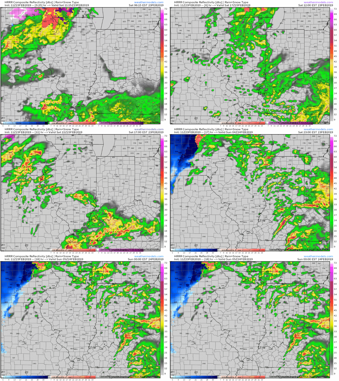
Here on the home front, an unsettled Saturday awaits. While late morning and afternoon showers are possible, better chances of more organized and heavier downpours and embedded thunder will arrive this evening into tonight.

In general, we anticipate between 0.25″ to 0.50″ of rain with this storm system. A few gusty storms are possible across southern Indiana, but widespread severe weather isn’t expected.

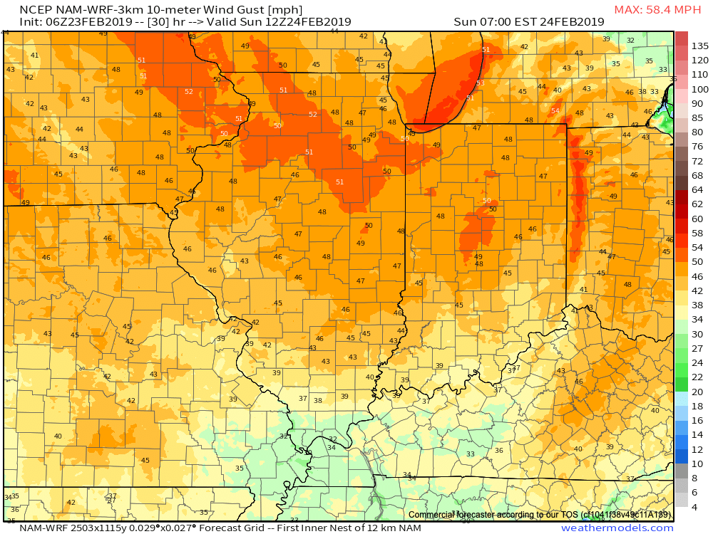
The cold front will pass Sunday morning and you’ll know it. Winds will increase overnight, but turn particularly gusty Sunday.

Sustained 25-30 MPH winds can be expected Sunday with gusts of 50 to 60 MPH. These kind of speeds will be plenty capable of downing trees and power lines and we’d recommend having your storm-ready kit handy in the event you lose power Sunday.

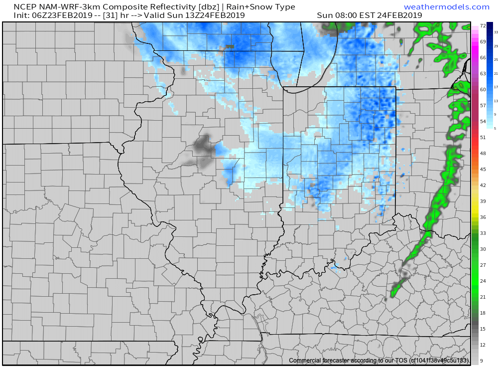
Light snow will be blown about by the strong winds Sunday morning into the afternoon, but we’re not expecting much in the way of accumulating (trace to a dusting in some areas).

We’ll have an updated video posted a bit later this afternoon! Make it a great Saturday!
