Thursday Morning Weather Rambles…

1.) We’re running 15°-20° colder this morning than this time yesterday. Wind chills in the upper 20s-lower 30s are being felt as winds remain gusty this morning.         2.)…

You must be logged in to view this content. Click Here to become a member of IndyWX.com for full access.  Already a member of IndyWx.com All-Access?  Log-in here.

Turning Windy And Cooler…

Screen Shot 2015-10-28 at 7.22.22 AMHighlights:

  • Increasing winds
  • Turning much cooler
  • Showers possible for Trick-Or-Treat

Low pressure is tracking into the Great Lakes this morning and the steady rain is ending from west to east.  Showers will remain in our forecast today until a cold front sweeps the region later this evening, but the all day, steady rains are coming to an end.  The other big story today will be strengthening northwest winds late.  Those northwest winds (gusts of 30-40 MPH) will help drive much cooler air southbound to wrap up the work week!

Our next weather maker will, unfortunately, arrive over the weekend and we must maintain shower chances during the all important Saturday evening Trick-Or-Treat forecast.  While heavy rain isn’t anticipated, it could be just enough to require rain gear when you’re out and about.

Ridging will develop over the eastern US early next week and be responsible for a nice stretch of “Indian Summer” weather.

Upcoming 7-Day Rainfall Forecast: 0.25″ – 0.50″

Contradiction In Model World…

After the wet, windy, and chilly spell of weather this week, we have contradicting signals in model world for what lies ahead as we flip the page into November. With so much “noise,” we don’t think it’s wise buying whole-heartedly into any paticular idea for November just yet.

Here’s the plot line…

The PNA trends negative in the mid range and would argue for eastern ridging, and associated warmth.

NegativePNA

Sure enough, we see model data (GFS ensembles shown here, courtesy of Weatherbell) going towards what a negative PNA should promote- eastern ridging and an associated warmer than normal time.


BUT…not so fast, as the latest MJO forecast keeps things in Phase 2 for a while and doesn’t show near the amplitude it did only a week ago in moving into Phase 3.


As shown above, Phase 2 argues for chill across our neck of the woods, with Phase 3 being much milder.

Let’s watch things unfold this week and revisit this post a bit later as a follow-up with what lies ahead. There’s never a dull moment in this business.

Heavy Rain Then Colder…

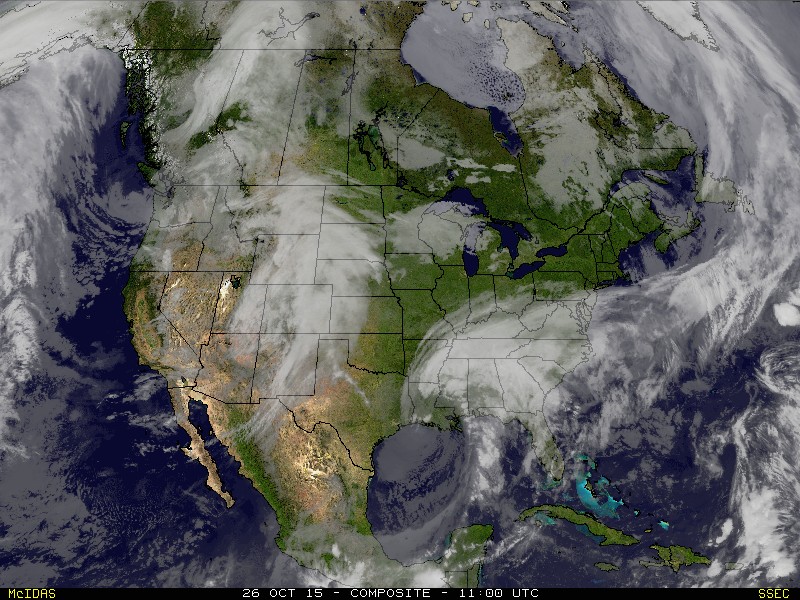
Today can be labeled as the so called “calm before the storm,” as sunny skies greet us out the door.  It’ll be a very pleasant Monday with highs in the middle 60s.  Sunny skies this morning will turn increasingly cloudy later in the day as moisture continues to stream north associated with Patricia’s remnants.

This morning’s satellite picture:

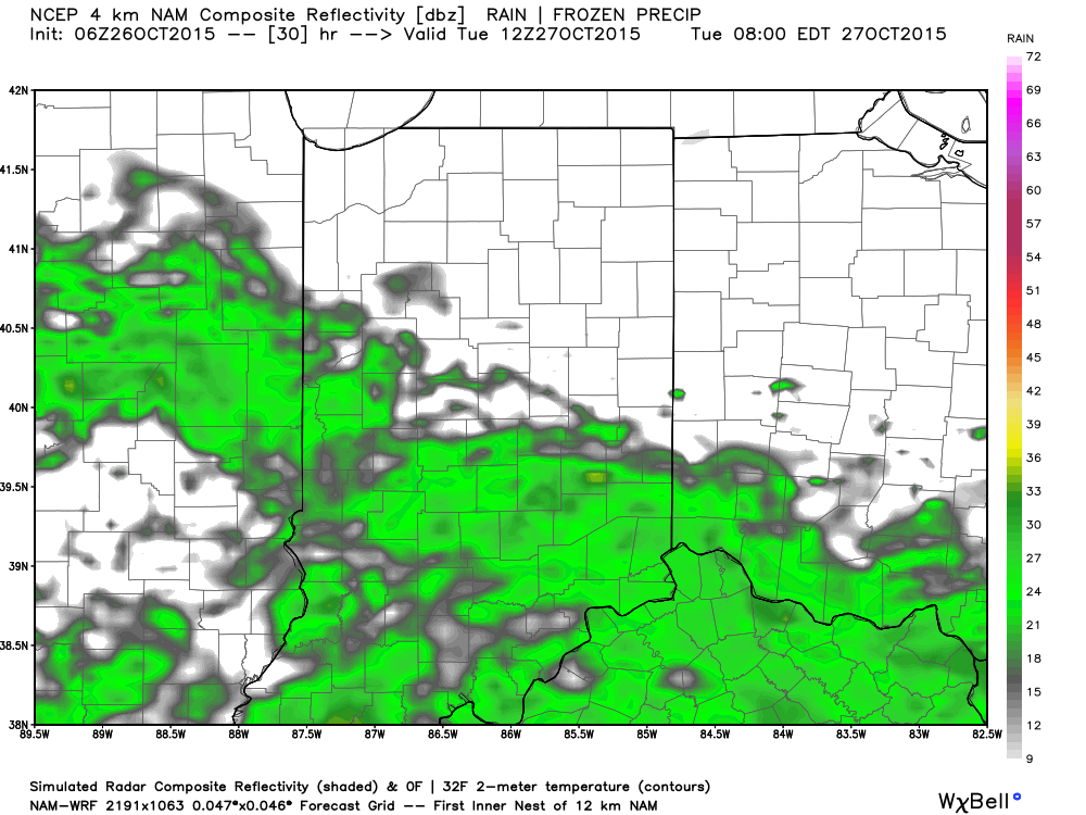
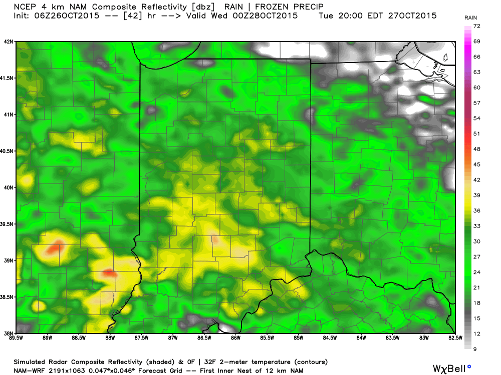
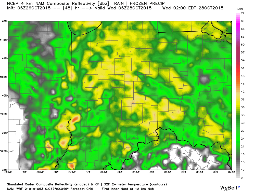
image7When we look at the weather picture tomorrow we note the remnant moisture of Patricia continuing to lift north while a cold front approaches from the west.  The “squeeze play” that will ensue over the region will be just what the doctor ordered as widespread rain develops during the daytime Tuesday before growing heavy Tuesday night.

8a Tuesday Futurecast

8am

8p Tuesday Futurecast

8pOvernight Tuesday-Wednesday morning Futurecast

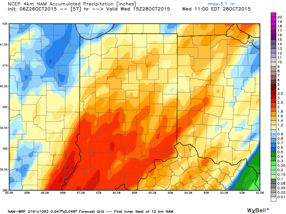
overnightLocally heavy rainfall can be expected.  When you average (5) computer models at this point then you get the idea rainfall totals will be somewhere in the range of 1.5″-2″ inches, with locally heavier totals.

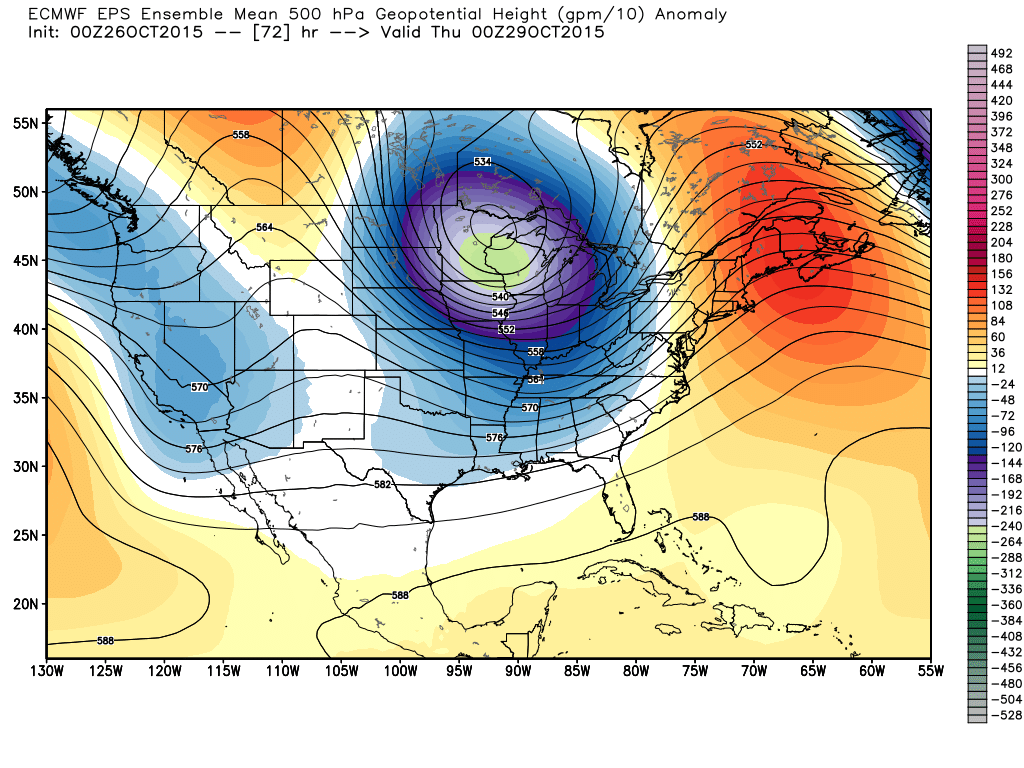
Modeled rainfall totals by Wednesday morning3The story after the big rain storm moves away?  A very windy and much cooler feel as a strong trough moves into the eastern portion of the country.  This will keep temperatures significantly below normal for the 2nd half of the week on into the weekend.

500mb