Thanksgiving Week Opens Cold…
 Highlights:
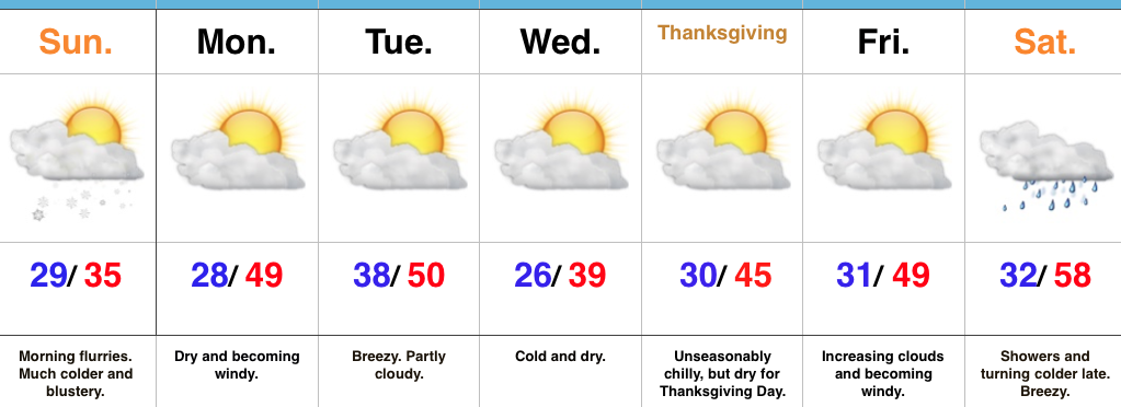
- Scattered flurries and snow showers Sunday morning
- Dry for Thanksgiving travels
- Rather boring week of weather ahead
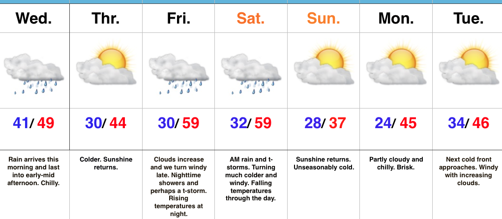
November Or December?! A strong cold front is slipping southeast as we type this forecast Saturday afternoon. This will result in a much colder close to the day, along with wrap around moisture transitioning to wet snow later this evening across central and northern portions of the state. Sunday will start off with scattered flurries and snow showers before dry conditions quickly return. It’ll be an unseasonably cold and blustery day.
As folks begin to travel for the upcoming Thanksgiving Day holiday, high pressure will provide an extended period of dry and rather uneventful conditions. A dry cold front will pass through the state Tuesday and help reinforce the chill for Thanksgiving, itself. While we’ll notice gusty breezes at times this upcoming week, precipitation will be hard to come by.
Our next threat of precipitation will arrive this time next week as a cold front moves south. Expect showers Saturday, followed by a wind shift and coldest air of the season by the second half of next weekend.
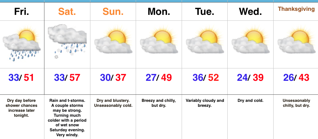
Upcoming 7-Day Precipitation Forecast:
- Snowfall: Trace – Dusting
- Rainfall: 0.10″ – 0.25″
 Highlights:
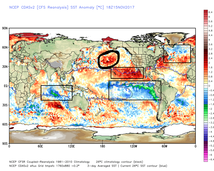
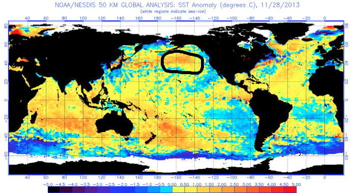
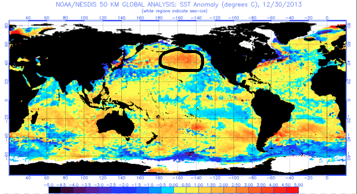
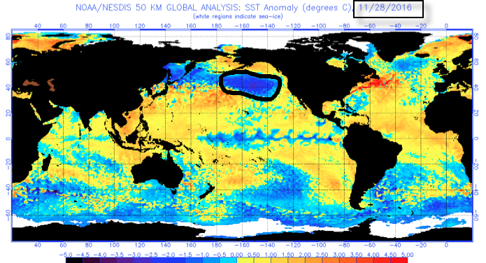 What makes seasonal forecasting so challenging (and fun :-)) are the multiple features that can impact a forecast. We’ve talked about the importance of ENSO (various types of Nino and Nina events) in past updates, as well as low solar and QBO. All of these moving parts and pieces are coming together in a manner that seems to be favoring more of a cold, wintry regime, locally, this year. Is that us saying another blockbuster 2013-2014 winter awaits? Absolutely not (there are other differences noted above with the SST configuration). However, it is suggesting that this winter will be absolutely nothing like the past couple…
 Highlights: