VIDEO: Heavy Wet Snow Arrives Before Sunset…
You must be logged in to view this content. Click Here to become a member of IndyWX.com for full access. Already a member of IndyWx.com All-Access? Log-in here.
You must be logged in to view this content. Click Here to become a member of IndyWX.com for full access. Already a member of IndyWx.com All-Access? Log-in here.
A cold front will blow through central Indiana this evening and colder air will spill into the region overnight. We’ll wake up with temperatures in the upper 20s to lower 30s Easter morning with dry conditions in place.
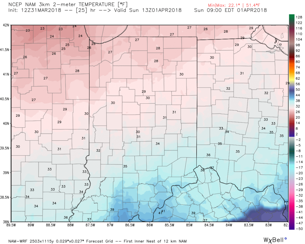 Most of the daytime Easter Sunday will feature dry conditions. Clouds will increase, lower, and thicken through the afternoon ahead of an area of low pressure that will track through the lower Ohio Valley Easter night. This will spread precipitation into central Indiana towards 5p-6p. Initially, precipitation is likely to begin as a cold rain, but we expect a rather quick transition to wet snow shortly after the onset. Periods of moderate to heavy snow will fall into the nighttime across the I-70 corridor. This will lead to reduced visibility and slick travel as snowfall rates will (once again) overcome marginally cold surface and pavement temperatures. If you must travel tomorrow night and early Monday, expect roadways to be slick at times- including being slush and snow covered.
Here’s an idea of what the radar may look like tomorrow night, courtesy of weatherbell.com:
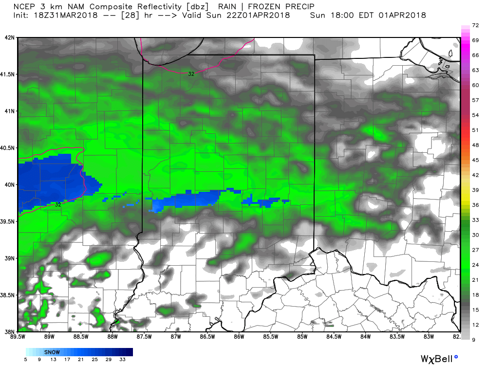
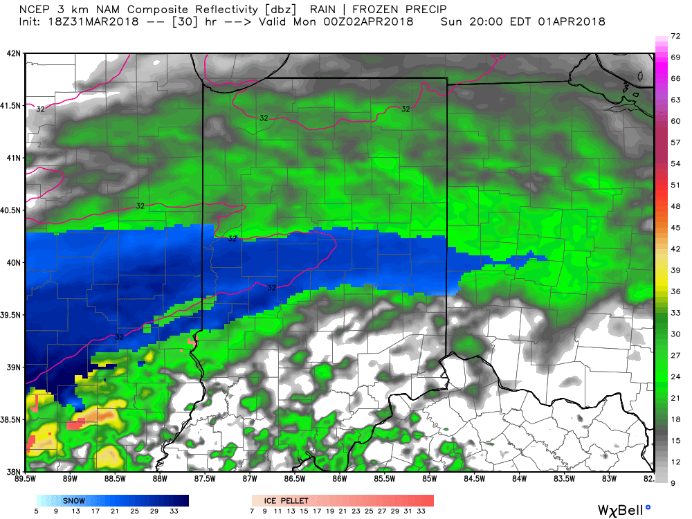
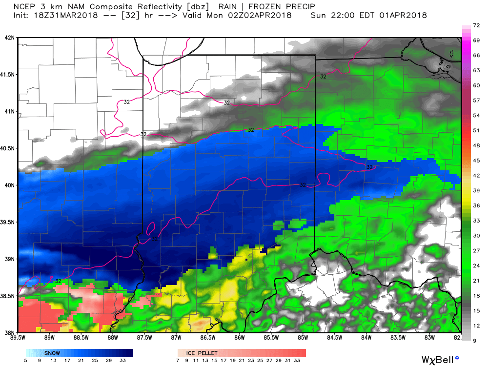
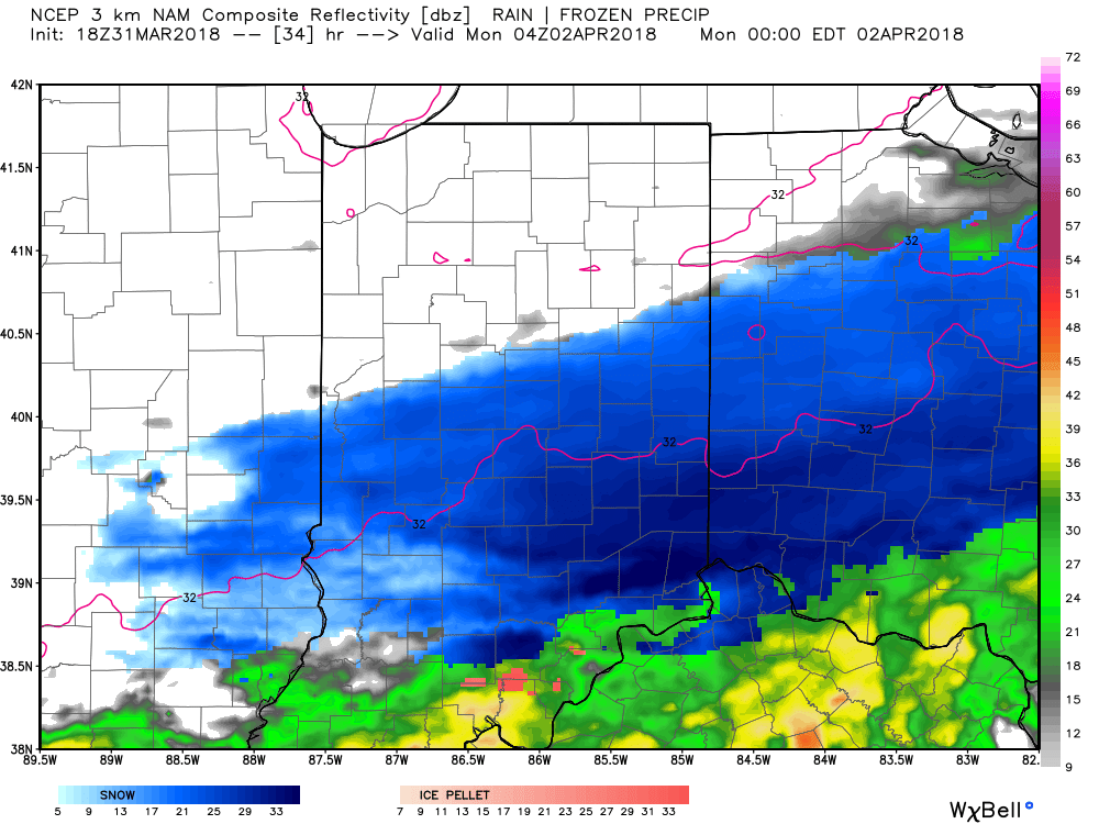
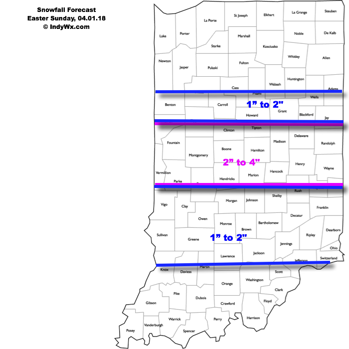
This will be a rather quick-hitting event, but “thump” potential is written all over it, including localized intense banding. These localized bands could result in a couple of reports of 4″+ in spots. We think heaviest snow falls in the 6p-midnight window.
Our current snowfall forecast:
 Another winter event is possible next weekend, including the potential of additional accumulating snow. Should we get snow down, the possibility of near-record cold is present with the late season blast of arctic air next weekend. Lows in the 10s aren’t out of the question at least one night next weekend- likely Sunday.
You must be logged in to view this content. Click Here to become a member of IndyWX.com for full access. Already a member of IndyWx.com All-Access? Log-in here.
A cold front will blow through the state Saturday evening (accompanied by showers and gusty winds) before becoming stationary across the Tennessee Valley region on Easter Sunday. At the same time, a relatively flat wave will scoot east out of the Plains and across the southern Ohio Valley Sunday afternoon and night. This will spread moisture across the southern half of Indiana Sunday evening. With unseasonably cold air in place, most, if not all, of the precipitation will fall in the form of snow Sunday evening into the wee morning hours Monday.
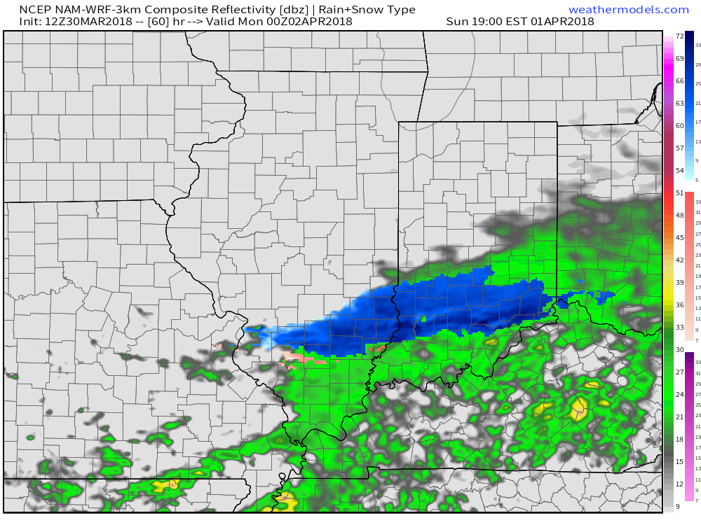
While we still have another 24-36 hours to monitor the modeling, confidence is rather high from this distance that the southern half of the state (especially south of the I-70 corridor) will experience at least a light accumulation of snow Sunday evening and night- potentially a 1″ to 3″ type event. This won’t be anything like central parts of the state dealt with last weekend, but considering the time of the year, this will serve as a reminder that winter isn’t giving up without a fight this year.
Speaking of that, don’t look now, but another attempt at an accumulating snow event may be on the table next weekend. Sigh…
You must be logged in to view this content. Click Here to become a member of IndyWX.com for full access. Already a member of IndyWx.com All-Access? Log-in here.